Enon Valley, Pennsylvania

Last updated
Enon Valley, Pennsylvania
Enon Valley Post Office.jpg
Enon Valley Post Office
Etymology: "Valley of Many Waters"
Lawrence County Pennsylvania Incorporated and Unincorporated areas Enon Valley Highlighted.svg
Location in Lawrence County, Pennsylvania
Coordinates: 40°51′23″N80°27′22″W / 40.85639°N 80.45611°W / 40.85639; -80.45611
CountryUnited States
State Pennsylvania
Counties Lawrence
Established1899
Government
  MayorFlorence R. Braden
Area
[1]
  Total0.50 sq mi (1.28 km2)
  Land0.49 sq mi (1.27 km2)
  Water0.01 sq mi (0.02 km2)
Elevation
[2] (center of borough)
995 ft (303 m)
Highest elevation
[2] (two locations at southeast and western border)
1,140 ft (350 m)
Lowest elevation
[2] (North Fork Little Beaver Creek)
785 ft (239 m)
Population
 (2020) [3]
  Total301
  Density615.54/sq mi (237.68/km2)
Time zone UTC-4 (EST)
  Summer (DST) UTC-5 (EDT)
Zip code
16120
Area codes 724, 878

Enon Valley is a borough in southern Lawrence County, Pennsylvania, United States. The population was 297 at the 2020 census. [4] It is part of the Pittsburgh metropolitan area.

Contents

Geography

Enon Valley is located at 40°51′23″N80°27′22″W / 40.85639°N 80.45611°W / 40.85639; -80.45611 (40.856310, -80.456192). [5]

According to the United States Census Bureau, the borough has a total area of 0.5 square miles (1.3 km2), all land.

Demographics

Historical population
CensusPop.Note
1880 471
1900 395
1910 354−10.4%
1920 3591.4%
1930 3600.3%
1940 3682.2%
1950 3926.5%
1960 45516.1%
1970 427−6.2%
1980 408−4.4%
1990 355−13.0%
2000 3879.0%
2010 306−20.9%
2020 297−2.9%
2021 (est.)294 [4] −1.0%
Sources: [6] [7] [8] [3]

As of the census [7] of 2000, there were 387 people, 138 households, and 105 families residing in the borough. The population density was 746.5 inhabitants per square mile (288.2/km2). There were 149 housing units at an average density of 287.4 per square mile (111.0/km2). The racial makeup of the borough was 98.71% White, 0.52% African American, 0.52% Asian, and 0.26% from two or more races. Hispanic or Latino of any race were 0.78% of the population.

There were 138 households, out of which 36.2% had children under the age of 18 living with them, 63.8% were married couples living together, 6.5% had a female householder with no husband present, and 23.9% were non-families. 20.3% of all households were made up of individuals, and 6.5% had someone living alone who was 65 years of age or older. The average household size was 2.80 and the average family size was 3.23.

In the borough the population was spread out, with 25.6% under the age of 18, 9.0% from 18 to 24, 29.5% from 25 to 44, 22.5% from 45 to 64, and 13.4% who were 65 years of age or older. The median age was 36 years. For every 100 females there were 97.4 males. For every 100 females age 18 and over, there were 104.3 males.

The median income for a household in the borough was $38,417, and the median income for a family was $39,167. Males had a median income of $32,083 versus $14,375 for females. The per capita income for the borough was $23,161. None of the families and 2.9% of the population were living below the poverty line, including no under eighteens and none of those over 64.

Related Research Articles

<span class="mw-page-title-main">Darlington Township, Beaver County, Pennsylvania</span> Township in Pennsylvania, United States

Darlington Township is a township in Beaver County, Pennsylvania, United States. The population was 1,813 at the 2020 census. It is part of the Pittsburgh metropolitan area.

<span class="mw-page-title-main">Blooming Valley, Pennsylvania</span> Borough in Pennsylvania, United States

Blooming Valley is a borough in Crawford County, Pennsylvania, United States. The population was 344 at the 2020 census, up from 337 at the 2010 census.

<span class="mw-page-title-main">Conneaut Lake, Pennsylvania</span> Borough in Pennsylvania, United States

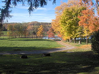
Conneaut Lake is a borough in Crawford County, Pennsylvania, located at the southern end of the lake of the same name. The population was 626 at the 2020 census, down from 653 at the 2010 census.

<span class="mw-page-title-main">Springboro, Pennsylvania</span> Borough in Pennsylvania, United States

Springboro is a borough in Crawford County, Pennsylvania, United States, located 35 miles southwest of Erie. The population was 377 at the 2020 census, down from 477 at the 2010 census.

<span class="mw-page-title-main">Townville, Pennsylvania</span> Borough in Pennsylvania, United States

Townville is a borough in Crawford County, Pennsylvania, United States. The population was 328 at the 2020 census, up from 323 at the 2010 census.

<span class="mw-page-title-main">Woodcock, Pennsylvania</span> Borough in Pennsylvania, United States

Woodcock is a borough in Crawford County, Pennsylvania, United States. The population was 139 at the 2020 census, down from 157 at the 2010 census.

<span class="mw-page-title-main">Woodcock Township, Crawford County, Pennsylvania</span> Township in Pennsylvania, United States

Woodcock Township is a township in Crawford County, Pennsylvania, United States. The population was 2,754 at the 2020 census, down from 2,856 at the 2010 census.

<span class="mw-page-title-main">Bessemer, Lawrence County, Pennsylvania</span> Borough in Pennsylvania, United States

Bessemer is a borough in western Lawrence County, Pennsylvania, United States. The population was 1,073 at the 2020 census. It is part of the Pittsburgh metropolitan area.

<span class="mw-page-title-main">Ellport, Pennsylvania</span> Borough in Pennsylvania, United States

Ellport is a borough in Lawrence County, Pennsylvania, United States. The population was 1,081 at the 2020 census. It is part of the Pittsburgh metropolitan area. The name is a portmanteau of Ellwood City and Portersville, the boroughs that lie to its west and east.

<span class="mw-page-title-main">New Beaver, Pennsylvania</span> Borough in Pennsylvania, United States

New Beaver is a borough in southern Lawrence County, Pennsylvania, United States. The population was 1,370 at the 2020 census. It is part of the Pittsburgh metropolitan area.

<span class="mw-page-title-main">South New Castle, Pennsylvania</span> Borough in Pennsylvania, United States

South New Castle is a borough in central Lawrence County, Pennsylvania, United States. The population was 649 at the 2020 census. It is primarily a residential community which lies south of the city of New Castle, and is part of the Pittsburgh metropolitan area.

<span class="mw-page-title-main">Wampum, Pennsylvania</span> Borough in Pennsylvania, United States

Wampum is a borough in southern Lawrence County, Pennsylvania, United States. The population was 557 at the 2020 census. It is part of the Pittsburgh metropolitan area.

<span class="mw-page-title-main">Clark, Pennsylvania</span> Borough in Pennsylvania, United States

Clark is a borough in western Mercer County, Pennsylvania, United States, along the southern shore of the Shenango River Reservoir. The population was 576 at the 2020 census. It is part of the Hermitage micropolitan area.

<span class="mw-page-title-main">Sandy Lake, Pennsylvania</span> Borough in Pennsylvania, United States

Sandy Lake is a borough in eastern Mercer County, Pennsylvania, United States. It was established in 1849. The population was 649 at the 2020 census. It is part of the Hermitage micropolitan area.

<span class="mw-page-title-main">Sharpsville, Pennsylvania</span> Borough in Pennsylvania, United States

Sharpsville is a borough that is located in western Mercer County, Pennsylvania, United States, along the Shenango River. The population was 4,253 as of the 2020 census. It is part of the Hermitage micropolitan area.

<span class="mw-page-title-main">Sheakleyville, Pennsylvania</span> Borough in Pennsylvania, United States

Sheakleyville is a borough in northern Mercer County, Pennsylvania, United States. The population was 142 at the 2010 census, a figure which increased to 150 tabulated residents in 2020. It is part of the Hermitage micropolitan area.

<span class="mw-page-title-main">Blain, Pennsylvania</span> Borough in Pennsylvania, United States

Blain is a borough in Perry County, Pennsylvania, United States. The population was 227 at the 2020 census. It is part of the Harrisburg metropolitan area. Blain is located in a valley region known as Sherman's Valley.

<span class="mw-page-title-main">Landisburg, Pennsylvania</span> Borough in Pennsylvania, United States

Landisburg is a borough in Perry County, Pennsylvania, United States. The population was 220 at the 2010 census. It is part of the Harrisburg–Carlisle Metropolitan Statistical Area.

<span class="mw-page-title-main">Marysville, Pennsylvania</span> Borough in Pennsylvania, United States

Marysville is a borough in Perry County, Pennsylvania, United States. The population was 2,652 at the 2020 census. It is part of the Harrisburg–Carlisle Metropolitan Statistical Area.

<span class="mw-page-title-main">Shinglehouse, Pennsylvania</span> Borough in Pennsylvania, United States

Shinglehouse is a borough in Potter County, Pennsylvania, United States. The population was 1,108 at the time of the 2020 census.

References

  1. "ArcGIS REST Services Directory". United States Census Bureau. Retrieved October 15, 2022.
  2. 1 2 3 "Cannelton Topo Map, Beaver County PA (New Galilee Area)". TopoZone. Locality, LLC. Retrieved 5 September 2019.
  3. 1 2 "Census Population API". United States Census Bureau. Retrieved Oct 12, 2022.
  4. 1 2 Bureau, US Census. "City and Town Population Totals: 2020-2021". Census.gov. US Census Bureau. Retrieved 18 July 2022.
  5. "US Gazetteer files: 2010, 2000, and 1990". United States Census Bureau. 2011-02-12. Retrieved 2011-04-23.
  6. "Census of Population and Housing". U.S. Census Bureau. Retrieved 11 December 2013.
  7. 1 2 "U.S. Census website". United States Census Bureau . Retrieved 2008-01-31.
  8. "Incorporated Places and Minor Civil Divisions Datasets: Subcounty Resident Population Estimates: April 1, 2010 to July 1, 2012". Population Estimates. U.S. Census Bureau. Archived from the original on 11 June 2013. Retrieved 11 December 2013.