Slippery Rock Township, Lawrence County, Pennsylvania

Last updated

Slippery Rock Township
McConnells Mill Bridge and Creek.jpg
Map of Slippery Rock Township, Lawrence County, Pennsylvania Highlighted.png
Location of Slippery Rock Township in Lawrence County
Map of Pennsylvania highlighting Lawrence County.svg
Location of Lawrence County in Pennsylvania
CountryUnited States
State Pennsylvania
County Lawrence
Established1837
Area
[1]
  Total30.07 sq mi (77.87 km2)
  Land29.85 sq mi (77.32 km2)
  Water0.21 sq mi (0.55 km2)
Highest elevation
[2] (Shaffer Road)
1,440 ft (440 m)
  Rankhighest point in Lawrence County
Lowest elevation880 ft (270 m)
Population
 (2020) [3]
  Total2,913
  Estimate 
(2022) [3]
2,886
  Density105.59/sq mi (40.77/km2)
Time zone UTC-4 (EST)
  Summer (DST) UTC-5 (EDT)
Area code 724
Website slipperyrocktownship.org
Historical population
CensusPop.Note
2000 3,179
2010 3,2833.3%
2020 2,913−11.3%
2022 (est.)2,886 [3] −0.9%
U.S. Decennial Census [4]

Slippery Rock Township is a township in Lawrence County, Pennsylvania, United States. As of the 2020 census, [5] the population was 2,913, a decline from the figure of 3,283 tabulated in 2010. [6]

Contents

History

The township was linked to New Castle, Ellwood City and Pittsburgh in 1908 by the Pittsburgh, Harmony, Butler and New Castle Railway, an interurban trolley line. The line closed on June 15, 1931, and the trolleys were replaced by buses.

McConnell's Mill Covered Bridge was listed on the National Register of Historic Places in 1980. [7]

Geography

According to the United States Census Bureau, the township has a total area of 30.2 square miles (78.2 km2), of which 30.1 square miles (78.0 km2) is land and 0.1 square miles (0.3 km2), or 0.26%, is water. [8] Unincorporated communities in the township include Princeton, Princeton Station, Kennedy Mill, Grant City, Rose Point, McConnells Mill, and part of Energy.

Located within Slippery Rock Township is McConnells Mill State Park along the Slippery Rock Creek Gorge.

Demographics

As of the census [9] of 2000, there were 3,179 people, 1,203 households, and 916 families residing in the township. The population density was 105.5 inhabitants per square mile (40.7/km2). There were 1,285 housing units at an average density of 42.7 per square mile (16.5/km2). The racial makeup of the township was 99.18% White, 0.06% African American, 0.19% Native American, 0.13% Asian, 0.13% from other races, and 0.31% from two or more races. Hispanic or Latino of any race were 0.38% of the population.

There were 1,203 households, out of which 34.2% had children under the age of 18 living with them, 66.6% were married couples living together, 6.7% had a female householder with no husband present, and 23.8% were non-families. 20.5% of all households were made up of individuals, and 9.4% had someone living alone who was 65 years of age or older. The average household size was 2.64 and the average family size was 3.06.

In the township the population was spread out, with 25.2% under the age of 18, 7.1% from 18 to 24, 27.8% from 25 to 44, 26.5% from 45 to 64, and 13.4% who were 65 years of age or older. The median age was 39 years. For every 100 females, there were 98.7 males. For every 100 females age 18 and over, there were 99.7 males.

The median income for a household in the township was $38,651, and the median income for a family was $43,382. Males had a median income of $35,192 versus $21,458 for females. The per capita income for the township was $16,160. About 4.5% of families and 5.8% of the population were below the poverty line, including 5.2% of those under age 18 and 9.4% of those age 65 or over.

Related Research Articles

<span class="mw-page-title-main">Lima Township, Michigan</span> Civil township in Michigan, United States

Lima Township is a civil township of Washtenaw County in the U.S. state of Michigan. The population was 4,024 at the 2020 census.

<span class="mw-page-title-main">Cumberland Township, Adams County, Pennsylvania</span> Township in Pennsylvania, United States

Cumberland Township is a township in Adams County, Pennsylvania, United States. The population was 7,033 at the 2020 census. In 1863, the American Civil War Battle of Gettysburg took place mainly in Cumberland Township, which surrounds the borough of Gettysburg on three sides.

<span class="mw-page-title-main">Brady Township, Butler County, Pennsylvania</span> Township in Pennsylvania, United States

Brady Township is a township in Butler County, Pennsylvania, United States. The population was 1,216 at the 2020 census.

<span class="mw-page-title-main">Muddy Creek Township, Pennsylvania</span> Township in Pennsylvania, United States

Muddy Creek Township is a township in Butler County, Pennsylvania, United States. The population was 2,210 at the 2020 census.

<span class="mw-page-title-main">Portersville, Pennsylvania</span> Village in Pennsylvania, United States

Portersville is a borough in Butler County, Pennsylvania, United States. The population was 235 at the 2010 census.

<span class="mw-page-title-main">Slippery Rock Township, Butler County, Pennsylvania</span> Township in Pennsylvania, United States

Slippery Rock Township is a township in Butler County, Pennsylvania, United States. The population was 6,719 at the 2020 census.

<span class="mw-page-title-main">Waterford Township, Pennsylvania</span> Township in Pennsylvania, United States

Waterford Township is a township in Erie County, Pennsylvania, United States. The population was 3,910 at the 2020 census, down from 3,920 at the 2010 census.

<span class="mw-page-title-main">Pequea Township, Pennsylvania</span> Township in Pennsylvania, United States

Pequea Township is a township that is located in central Lancaster County, Pennsylvania, United States. The population was 5,493 at the time of the 2020 census.

<span class="mw-page-title-main">Perry Township, Lawrence County, Pennsylvania</span> Township in Pennsylvania, United States

Perry Township is a township in Lawrence County, Pennsylvania, United States. The population was 1,854 at the time of the 2020 census, a decline from the figure of 1,938 tabulated in 2010.

<span class="mw-page-title-main">Scott Township, Lawrence County, Pennsylvania</span> Township in Pennsylvania, United States

Scott Township is a township in Lawrence County, Pennsylvania, United States. The population was 2,174 at the 2020 census, a decline from the figure of 2,347 as of the 2010 census.

<span class="mw-page-title-main">Shenango Township, Lawrence County, Pennsylvania</span> Township in Pennsylvania, United States

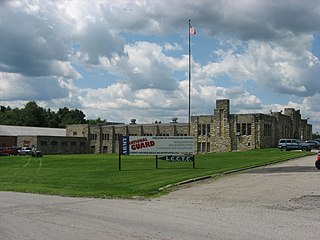
Shenango Township is a township in Lawrence County, Pennsylvania, United States. The population was 7,133 at the 2020 census, a decline from the figure of 7,479 tabulated in 2010. Shenango Township is situated between the city of New Castle to the north and the borough of Ellwood City to the south.

<span class="mw-page-title-main">Wayne Township, Lawrence County, Pennsylvania</span> Township in Pennsylvania, United States

Wayne Township is a township in Lawrence County, Pennsylvania, United States. The population was 2,468 at the 2020 census, a decline from the figure of 2,606 tabulated in 2010.

<span class="mw-page-title-main">Coolspring Township, Mercer County, Pennsylvania</span> Township in Pennsylvania, United States

Coolspring Township is a township in Mercer County, Pennsylvania, United States. The population was 2,112 at the 2020 census, a decline from the figure of 2,278 in 2010.

<span class="mw-page-title-main">Perry Township, Mercer County, Pennsylvania</span> Township in Pennsylvania, United States

Perry Township is a township in Mercer County, Pennsylvania, United States. The population was 1,332 at the 2020 census, down from 1,453 in 2010.

<span class="mw-page-title-main">New Castle Township, Pennsylvania</span> Township in Pennsylvania, United States

New Castle Township is a township that is located in Schuylkill County, Pennsylvania, United States, in the state's Coal Region. The population was 348 at the time of the 2020 census.

<span class="mw-page-title-main">North Union Township, Schuylkill County, Pennsylvania</span> Township in Pennsylvania, United States

North Union Township is a township that is located in Schuylkill County, Pennsylvania, United States. The population was 1,417 at the time of the 2020 census.

<span class="mw-page-title-main">Charleston Township, Tioga County, Pennsylvania</span> Township in Pennsylvania, United States

Charleston Township is a township in Tioga County, Pennsylvania, United States. The population was 3,562 at the 2020 census. Hills Creek State Park, one of 120 Pennsylvania state parks, is in Charleston Township.

<span class="mw-page-title-main">Lawrence Township, Tioga County, Pennsylvania</span> Township in Pennsylvania, United States

Lawrence Township is a township in Tioga County, Pennsylvania, United States. The population was 1,613 at the 2020 census.

<span class="mw-page-title-main">Freehold Township, Warren County, Pennsylvania</span> Township in Pennsylvania, United States

Freehold Township is a township in Warren County, Pennsylvania, United States. The population was 1,214 at the 2020 census, down from 1,510 at the 2010 census.

<span class="mw-page-title-main">Dover Township, Pennsylvania</span> Township in Pennsylvania, United States

Dover Township is a township in York County, Pennsylvania, United States. The population was 22,366 at the 2020 census.

References

  1. "2016 U.S. Gazetteer Files". United States Census Bureau. Archived from the original on August 24, 2017. Retrieved August 14, 2017.
  2. 1 2 "Slippery Rock Creek Gorge Topo Map, Lawrence County PA (Portersville Area)". TopoZone. Locality, LLC. Archived from the original on September 5, 2019. Retrieved September 5, 2019.
  3. 1 2 3 Bureau, US Census. "City and Town Population Totals: 2020-2022". Census.gov. US Census Bureau. Archived from the original on July 11, 2022. Retrieved June 13, 2023.
  4. "Census of Population and Housing". Census.gov. Archived from the original on July 1, 2021. Retrieved June 4, 2016.
  5. Bureau, US Census. "City and Town Population Totals: 2020-2021". Census.gov. US Census Bureau. Archived from the original on July 11, 2022. Retrieved June 26, 2022.
  6. "Profile of General Population and Housing Characteristics: 2010 Demographic Profile Data (DP-1): Slippery Rock township, Lawrence County, Pennsylvania". United States Census Bureau. Archived from the original on July 9, 2021. Retrieved March 28, 2012.
  7. "National Register Information System". National Register of Historic Places . National Park Service. July 9, 2010.
  8. "US Gazetteer files: 2010, 2000, and 1990". United States Census Bureau. February 12, 2011. Archived from the original on August 24, 2019. Retrieved April 23, 2011.
  9. "U.S. Census website". United States Census Bureau. Archived from the original on July 9, 2021. Retrieved January 31, 2008.

40°58′00″N80°15′29″W / 40.96667°N 80.25806°W / 40.96667; -80.25806