New Wilmington, Pennsylvania

Last updated
New Wilmington, Pennsylvania
New Wilmington, Pennsylvania (4883403535).jpg
Lawrence County Pennsylvania Incorporated and Unincorporated areas New Wilmington Highlighted.svg
Location in Lawrence County, Pennsylvania
Coordinates: 41°7′15″N80°19′58″W / 41.12083°N 80.33278°W / 41.12083; -80.33278
CountryUnited States
State Pennsylvania
County Lawrence
EstablishedApril 9, 1873
Government
  MayorSherie E. Babb [1]
Area
[2]
  Total1.09 sq mi (2.82 km2)
  Land1.05 sq mi (2.73 km2)
  Water0.04 sq mi (0.10 km2)
Elevation
[3] (middle of downtown)
1,050 ft (320 m)
Highest elevation
[3] (southeast corner)
1,190 ft (360 m)
Lowest elevation
[3] (Little Neshannock Creek)
940 ft (290 m)
Population
 (2020) [4]
  Total2,092
  Density1,984.82/sq mi (766.68/km2)
Time zone UTC-4 (EST)
  Summer (DST) UTC-5 (EDT)
Area codes 724, 878
Website nwboro.com

New Wilmington is a borough in northern Lawrence County, Pennsylvania, United States, first platted in 1824 and established as a borough on April 9, 1863. The population was 2,097 at the 2020 census. [5] It is home to Westminster College and serves the Old Order Amish community in the surrounding Wilmington Township. It is part of the Pittsburgh metropolitan area.

Contents

History

The town of New Wilmington was established in 1797–1798. In 1824, the first house was built and other buildings were soon erected. In 1847 an Amish settlement was established between New Wilmington and Volant. [6] On April 4, 1863, New Wilmington was established as a half-Borough, and on April 9, 1873, it was made a full borough. The population in 1874 was 500. As of the 2000 census, the population has grown to 2,452, which includes 1,315 residents and 1,137 college students.

A book on the complete history of New Wilmington was penned in 1999, which may be viewed at the Westminster College Library. The book includes 12 chapters of history, starting in 1797 and has over 100 photographs.

In the fall of 2014, community members led by mayor Sherie Babb, formed the New Wilmington Economic Development Committee. This group was established to encourage not only economic health, but a variety of betterment initiatives around the town.

In January 2016, LIVE New Wilmington, a promotional campaign developed and supported by the New Wilmington Economic Development Committee (EDCOM), was officially launched. The goal of this project is to promote connection and celebration as the residents join in a community that is a hub for artists and quality education, picturesque environment, and caring neighbors. Because of this, the group has chosen to focus on these areas (arts, education, environment, people) as the pillars for nurturing and fostering growth. It is believed that these qualities are unique to the community, deserve to be recognized, and should be given a larger platform for actualization. [7]

Geography

New Wilmington is located at 41°7′15″N80°19′58″W / 41.12083°N 80.33278°W / 41.12083; -80.33278 (41.120713, -80.332807). [8]

According to the United States Census Bureau, the borough has a total area of 1.1 square miles (2.8 km2), of which 1.1 square miles (2.8 km2) is land and 0.04 square miles (0.10 km2), or 1.85%, is water.

New Wilmington's ZIP code is 16142.

Demographics

Historical population
CensusPop.Note
1880 628
1890 6848.9%
1900 79115.6%
1910 758−4.2%
1920 88616.9%
1930 9072.4%
1940 1,01812.2%
1950 1,94891.4%
1960 2,20313.1%
1970 2,72123.5%
1980 2,7741.9%
1990 2,706−2.5%
2000 2,452−9.4%
2010 2,4660.6%
2020 2,097−15.0%
2021 (est.)2,091 [5] −0.3%
Sources: [9] [10] [11] [4]

As of the census [10] of 2000, there were 2,452 people, 577 households, and 324 families residing in the borough. The population density was 2,313.2 inhabitants per square mile (893.1/km2). There were 611 housing units at an average density of 576.4 per square mile (222.5/km2). The racial makeup of the borough was 98.21% White, 0.57% African American, 0.20% Native American, 0.45% Asian, 0.24% from other races, and 0.33% from two or more races. Hispanic or Latino of any race were 0.45% of the population. 26.0% were of German, 12.6% Italian, 11.8% Irish, 9.1% English and 7.3% Scotch-Irish ancestry according to Census 2000. 97.9% spoke English and 1.2% Spanish as their first language.

There were 577 households, out of which 23.1% had children under the age of 18 living with them, 45.4% were married couples living together, 9.0% had a female householder with no husband present, and 43.8% were non-families. 35.2% of all households were made up of individuals, and 15.1% had someone living alone who was 65 years of age or older. The average household size was 2.28 and the average family size was 2.90.

In the borough the population was spread out, with 10.4% under the age of 18, 48.5% from 18 to 24, 12.1% from 25 to 44, 12.1% from 45 to 64, and 16.9% who were 65 years of age or older. The median age was 22 years. For every 100 females there were 61.8 males. For every 100 females age 18 and over, there were 58.1 males.

The median income for a household in the borough was $36,734, and the median income for a family was $56,736. Males had a median income of $36,250 versus $26,125 for females. The per capita income for the borough was $12,749. About 4.2% of families and 15.6% of the population were below the poverty line, including 7.8% of those under age 18 and 7.0% of those age 65 or over.

New Wilmington is surrounded by farms of an Amish settlement which had 19 congregations i.e. about 2,500 people in 2013. [6]

Related Research Articles

<span class="mw-page-title-main">Port Byron, Illinois</span> Village in Illinois, United States

Port Byron is a village in Rock Island County, Illinois, United States and part of the Quad Cities Metropolitan Area. The population was 1,647 at the 2010 census.

<span class="mw-page-title-main">Kalona, Iowa</span> City in Iowa, United States

Kalona is a city in Washington County, Iowa. It is part of the Iowa City metropolitan area. The population was 2,630 at the time of the 2020 census. Kalona is the second-largest city in Washington County.

<span class="mw-page-title-main">Munfordville, Kentucky</span> City in Kentucky, United States

Munfordville is a home rule-class city in, and the county seat of, Hart County, Kentucky, United States. The population was 1,615 at the 2010 U.S. census.

<span class="mw-page-title-main">Lincoln, Missouri</span> City in Benton County, Missouri, United States

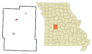
Lincoln is a city in Benton County, Missouri, United States. The population was 1,144 at the 2020 census.

<span class="mw-page-title-main">Athens, Pennsylvania</span> Borough in Pennsylvania, United States

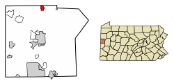
Athens is a borough in Bradford County, Pennsylvania, United States. It is part of Northeastern Pennsylvania and is located 2 miles (3 km) south of the New York state line on the Susquehanna and Chemung rivers. The population was 3,749 in 1900 and 3,796 in 1910. The population was 3,265 at the 2020 census. Athens is in a small area locally known as "The Valley", a group of four contiguous communities in Pennsylvania and New York: Waverly, New York; South Waverly, Pennsylvania; Sayre, Pennsylvania; and Athens. The Valley has a population near 30,000.

<span class="mw-page-title-main">New Albany, Pennsylvania</span> Borough in Pennsylvania, United States

New Albany is a borough in Bradford County, Pennsylvania, United States. It is part of Northeastern Pennsylvania. The population was 254 at the 2020 census.

<span class="mw-page-title-main">South Waverly, Pennsylvania</span> Borough in Pennsylvania, United States

South Waverly is a borough in Bradford County, Pennsylvania, United States. It is part of Northeastern Pennsylvania. The population was 1,070 at the 2020 census. South Waverly is part of the Penn-York Valley, a group of four contiguous communities in New York and Pennsylvania: Waverly, New York, South Waverly, Sayre, and Athens, with a combined population near 30,000.

<span class="mw-page-title-main">Hawthorn, Pennsylvania</span> Borough in Pennsylvania, United States

Hawthorn is a borough in Clarion County, Pennsylvania, United States. The population was 482 at the 2020 census.

<span class="mw-page-title-main">Brady Township, Clearfield County, Pennsylvania</span> Township in Pennsylvania, United States

Brady Township is a township in Clearfield County, Pennsylvania, United States. The population was 1,942 at the 2020 census.

<span class="mw-page-title-main">Loganton, Pennsylvania</span> Borough in Pennsylvania, United States

Loganton, officially the Borough of Loganton, is a borough in Clinton County, Pennsylvania, United States. The population was 469 at the 2020 census.

<span class="mw-page-title-main">Norwood, Pennsylvania</span> Borough in Pennsylvania, United States

Norwood is a borough that is located in Delaware County, Pennsylvania, United States. The population was 5,890 at the time of the 2010 census.

<span class="mw-page-title-main">Smicksburg, Pennsylvania</span> Borough in Pennsylvania, United States

Smicksburg is a borough in Indiana County, Pennsylvania, United States. The population was 57 at the 2020 census, and it is one of the smallest incorporated boroughs in Pennsylvania. It was founded by the Reverend J. George Schmick.

<span class="mw-page-title-main">Volant, Pennsylvania</span> Borough in Pennsylvania, United States

Volant is a borough in northern Lawrence County, Pennsylvania, United States. The population was 127 at the 2020 census. Volant is surrounded by Old Order Amish farms of the New Wilmington settlement. It is part of the Pittsburgh metropolitan area.

<span class="mw-page-title-main">Wilmington Township, Lawrence County, Pennsylvania</span> Township in Pennsylvania, United States

Wilmington Township is a township in Lawrence County, Pennsylvania, United States. The population was 2,662 at the 2020 census, a decline from the figure of 2,715 tabulated in 2010.

<span class="mw-page-title-main">Edwardsville, Pennsylvania</span> Borough in Pennsylvania, United States

Edwardsville is a borough in Luzerne County, Pennsylvania, United States. The population was 4,918 at the 2020 census.

<span class="mw-page-title-main">New Lebanon, Pennsylvania</span> Borough in Pennsylvania, United States

New Lebanon is a borough in northeastern Mercer County, Pennsylvania, United States. The population was 186 at the 2020 census. It is part of the Hermitage micropolitan area.

<span class="mw-page-title-main">Sandy Lake, Pennsylvania</span> Borough in Pennsylvania, United States

Sandy Lake is a borough in eastern Mercer County, Pennsylvania, United States. It was established in 1849. The population was 649 at the 2020 census. It is part of the Hermitage micropolitan area.

<span class="mw-page-title-main">Prompton, Pennsylvania</span> Borough in Pennsylvania, United States

Prompton is a borough that is located in Wayne County, Pennsylvania, United States. The population was 250 at the time of the 2010 census.

<span class="mw-page-title-main">Lakeland North, Washington</span> Census-designated place in Washington, United States

Lakeland North is a census-designated place (CDP) in King County, Washington, United States. The population was 12,942 at the 2010 census. Part of the community was annexed into neighboring Auburn in 2008.

Unity is a town in Waldo County, Maine, United States. The population was 2,292 at the 2020 census. The town is the service center for the northern portion of Waldo County. Outside of Waldo County, it is best known as the home of the Maine Organic Farmers and Gardeners Association, its Common Ground Country Fair and Unity College. Unity College was founded in 1965 to offset the economic effects of the declining chicken farming industry. As of 2007, the college is the town's largest employer.

References

  1. http://nwboro.com/borough-council/ New Wilmington Borough Website. retrieved March 31, 2017
  2. "ArcGIS REST Services Directory". United States Census Bureau. Retrieved October 12, 2022.
  3. 1 2 3 "Neshannock Falls Topo Map, Lawrence County PA (New Castle North Area)". TopoZone. Locality, LLC. Retrieved 5 September 2019.
  4. 1 2 "Census Population API". United States Census Bureau. Retrieved Oct 12, 2022.
  5. 1 2 Bureau, US Census. "City and Town Population Totals: 2020-2021". Census.gov. US Census Bureau. Retrieved 18 July 2022.
  6. 1 2 Donnermeyer, Joe; Luthy, David (2019-10-21). "Amish Settlements across America: 2013". Journal of Amish and Plain Anabaptist Studies. 1 (2): 107–129. ISSN   2471-6383.
  7. "Home - LIVE New Wilmington - New Wilmington PA". LIVE New Wilmington. Retrieved 2016-02-17.
  8. "US Gazetteer files: 2010, 2000, and 1990". United States Census Bureau. 2011-02-12. Retrieved 2011-04-23.
  9. "Census of Population and Housing". U.S. Census Bureau. Retrieved 11 December 2013.
  10. 1 2 "U.S. Census website". United States Census Bureau . Retrieved 2008-01-31.
  11. "Incorporated Places and Minor Civil Divisions Datasets: Subcounty Resident Population Estimates: April 1, 2010 to July 1, 2012". Population Estimates. U.S. Census Bureau. Archived from the original on 11 June 2013. Retrieved 11 December 2013.