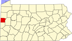
Neshannock Township, Pennsylvania

Last updated
Neshannock Township
Beaver from Worthington, New Castle NW.jpg
Residential neighborhood in New Castle Northwest
Etymology: Neshannock, Native American for "Land between two waters"
Nickname: 
Lancers
Map of Neshannock Township, Lawrence County, Pennsylvania Highlighted.png
Location of Neshannock Township in Lawrence County
Map of Pennsylvania highlighting Lawrence County.svg
Location of Lawrence County in Pennsylvania
CountryUnited States
State Pennsylvania
County Lawrence County
Established1799
Area
[1]
  Total17.42 sq mi (45.12 km2)
  Land17.23 sq mi (44.64 km2)
  Water0.19 sq mi (0.48 km2)
Highest elevation
[2] (north of Fording Road)
1,250 ft (380 m)
Lowest elevation795 ft (242 m)
Population
 (2020) [3]
  Total9,843
  Density570.93/sq mi (218.15/km2)
Time zone UTC-4 (EST)
  Summer (DST) UTC-5 (EDT)
United States Postal Code
16105
Area code 724
FIPS code 42-073-53064
Website www.neshannock.org
Historical population
CensusPop.Note
2000 9,216
2010 9,6094.3%
2020 9,8432.4%
2022 (est.)9,714 [3] −1.3%
U.S. Decennial Census [4]

Neshannock Township is a township in Lawrence County, Pennsylvania, United States. The population was 9,609 at the 2010 census. [5]

Contents

The township derives its name from Neshannock Creek, a Native American name purported to mean "double stream". [6]

Geography

According to the United States Census Bureau, the township has a total area of 17.4 square miles (45.0 km2), of which 17.3 square miles (44.9 km2) is land and 0.1 square miles (0.2 km2), or 0.34%, is water. The word Neshannock means "land between two waters".

The township includes the New Castle Northwest census-designated place, as well as the communities of Walmo, Coaltown, Painter Hill, Kings Chapel, and Sunset Valley.

Demographics

As of the census [7] of 2020, there were 9,843 people, 4,180 households residing in the township. The population density was 570.9 inhabitants per square mile (220.4/km2). There were 3,978 housing units at an average density of 229.6 per square mile (88.6/km2). The racial makeup of the township was 96.3% White, 1.6% African American, 0.11% Native American, 1.2% Asian, 0.01% Pacific Islander, 0.01% from other races, and 0.9% from two or more races. Hispanic or Latino of any race were 1.5% of the population.

There were 4,180 households, out of which 25.5% had children under the age of 18 living with them, 62.6% were married couples living together, 6.9% had a female householder with no husband present, and 28.5% were non-families. 27.0% of all households were made up of individuals, and 17.9% had someone living alone who was 65 years of age or older. The average household size was 2.36 and the average family size was 2.86.

In the township the population was spread out, with 16.1% under the age of 18, 4.8% from 18 to 24, 22.1% from 25 to 44, 26.7% from 45 to 64, and 27.5% who were 65 years of age or older. The median age was 47 years. For every 100 females there were 86.0 males. For every 100 females age 18 and over, there were 81.9 males.

The median income for a household in the township was $74,755, and the median income for a family was $54,036.The per capita income for the township was $46,852. About 1.7% of families and 3.8% of the population were below the poverty line, including 2.4% of those under age 18 and 7.1% of those age 65 or over.

Homes in Neshannock range from city street living on the edge of New Castle to larger country-style houses with several acres.

Weather

MonthAv. HighAv. LowAv. Precip.
January,35 F16 F2.29 Inches
February39 F17 F2.08 Inches
March50 F25 F2.94 Inches
April61 F34 F3.28 Inches
May72 F45 F3.48 Inches
June80 F54 F4.30 Inches
July85 F59 F4.19 Inches
August83 F57 F3.56 Inches
September76 F50 F3.74 Inches
October65 F38 F2.60 Inches
November52 F31 F3.16 Inches
December40 F23 F2.81 Inches

Records

The highest recorded temperature was 102 °F in 1935. The lowest recorded temperature was -29 °F in 1930.

Facts

July is usually the warmest month. Most of the time, the coolest month is January.

[8]

Schools

Neshannock Township's only school district is Neshannock Township School District. The school is one building divided into two parts by a set of doors. Neshannock Memorial School serves grades K-6, and Neshannock Junior/Senior High School serves 7th-12th graders.

Public transportation

Neshannock's public transportation is served by the New Castle Transit Authority. They make many stops in Neshannock and go as far away as Pittsburgh.

Roadways

Neshannock's main roadway is Pennsylvania State Route 18 which runs through downtown New Castle and the center of Neshannock. Locals know it as simply "18" or "Wilmington Road". Interstate 376 is about 1 mile (1.6 km) from the corner of Wilmington Road and Mitchell Road. Mitchell Road has a leg that goes from Wilmington Road and merges into I-376. I-376 then leads to I-80, I-76 and other major Western Pennsylvania roads.

Air travel

The closest airport to Neshannock is New Castle Municipal Airport in nearby Union Township. The closest airport with commercial service is Youngstown-Warren Regional Airport in Ohio. Most residents use Pittsburgh International Airport, about 40 minutes away, because of the much wider variety of destinations in the US, the Caribbean, Canada, Europe, and Mexico.

Recreation and sports

Neshannock Towhship's main recreation center is Pearson Park, which includes a members-only community pool, a playground, two Little League baseball fields, a party center (the Hutchison Center), a 1-mile walking trail, six tennis courts, a basketball court, and a volleyball court. Neshannock High School’s tennis team's home court is at the park's tennis courts.

Also part of Neshannock Township’s Pearson Park is Hess Ice Rink and Baseball Field. Hess Ice Rink is where ice hockey is played, figure skating is taught, and has public skating when the facility is open. Hess Ice Rink is the home ice of Hess Figure Skating Club. The rink is home of the Dallas Stars defenseman, Stephen Johns.

The New Castle Country Club is in Neshannock Township. The club has a golf course, tennis courts, putting green, and a driving range. They also have a restaurant and an area for parties.

Related Research Articles

<span class="mw-page-title-main">Mt. Lebanon, Pennsylvania</span> Home rule municipality in Pennsylvania, United States

Mt. Lebanon is a Home rule municipality in Allegheny County, Pennsylvania, United States. The population was 34,075 at the 2020 census. It is a suburb of Pittsburgh. Established in 1912 as Mount Lebanon, the township was a farming community. With the arrival of the first streetcar lines and the development of the first real estate subdivision, both in 1901, it became a streetcar suburb, offering residents the ability to commute to Downtown Pittsburgh. Furthermore, the opening of the Liberty Tunnel in 1924 allowed easy automobile access to Pittsburgh. In 1975, the renamed Mt. Lebanon adopted one of the first home rule charters in Pennsylvania.

<span class="mw-page-title-main">Butler Township, Butler County, Pennsylvania</span> Township in Pennsylvania, United States

Butler Township is a township in Butler County, Pennsylvania, United States. The population was 17,230 at the 2020 census. The township was first settled by Europeans in 1795. It was established as a township in 1804 and as a first class township in 1922.

<span class="mw-page-title-main">East Goshen Township, Pennsylvania</span> Township in Pennsylvania, United States

East Goshen Township is a township in Chester County, Pennsylvania, United States. The population was 18,026 at the 2010 census.
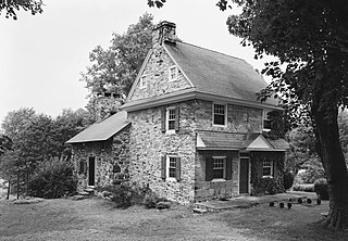
<span class="mw-page-title-main">West Goshen Township, Pennsylvania</span> Township in Pennsylvania, United States

West Goshen Township is a township in Chester County, Pennsylvania, United States. The population was 23,040 at the 2020 census. In 2013, Money Magazine voted West Goshen as the 10th best place to live in America. West Goshen has also been ranked in the top 15 places to live in America from 2014 to 2017 and is also at the top of best neighborhoods to raise a family in Pennsylvania every year.

<span class="mw-page-title-main">Summerhill Township, Crawford County, Pennsylvania</span> Township in Pennsylvania, United States

Summerhill Township is a township in Crawford County, Pennsylvania, United States. The population was 1,197 at the 2020 census, down from 1,236 at the 2010 census.
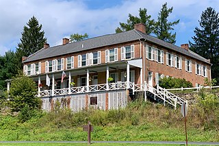
<span class="mw-page-title-main">Cooke Township, Cumberland County, Pennsylvania</span> Township in Pennsylvania, United States

Cooke Township is a township in Cumberland County, Pennsylvania, United States. The population was 179 at the 2010 census, up from 117 at the 2000 census.
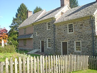
<span class="mw-page-title-main">Marple Township, Pennsylvania</span> Township in Pennsylvania, United States

Marple Township is a township in Delaware County, Pennsylvania, United States. It contains the census designated place of Broomall. The population was estimated at 23,743 as of 2015. ZIP codes include mainly 19008, as well as 19064 and 19063. The township is run by Marple Township board of commissioners.

<span class="mw-page-title-main">Hickory Township, Lawrence County, Pennsylvania</span> Township in Pennsylvania, United States

Hickory Township is a township in Lawrence County, Pennsylvania, United States. The population was 2,320 at the 2020 census, a decline from the figure of 2,470 tabulated in 2010.

<span class="mw-page-title-main">New Castle Northwest, Pennsylvania</span> Census-designated place in Pennsylvania, United States

New Castle Northwest is an unincorporated area and census-designated place (CDP) in Lawrence County, Pennsylvania, United States. The population was 1,413 at the 2010 census.

<span class="mw-page-title-main">New Wilmington, Pennsylvania</span> Borough in Pennsylvania, United States

New Wilmington is a borough in northern Lawrence County, Pennsylvania, United States, first platted in 1824 and established as a borough on April 9, 1863. The population was 2,097 at the 2020 census. It is home to Westminster College and serves the Old Order Amish community in the surrounding Wilmington Township. It is part of the Pittsburgh metropolitan area.

<span class="mw-page-title-main">Oakwood, Pennsylvania</span> Census-designated place in Pennsylvania, United States

Oakwood is an unincorporated area and census-designated place (CDP) in Lawrence County, Pennsylvania, United States. The population was 2,270 at the 2010 census.

<span class="mw-page-title-main">Scott Township, Lawrence County, Pennsylvania</span> Township in Pennsylvania, United States

Scott Township is a township in Lawrence County, Pennsylvania, United States. The population was 2,174 at the 2020 census, a decline from the figure of 2,347 as of the 2010 census.

<span class="mw-page-title-main">Volant, Pennsylvania</span> Borough in Pennsylvania, United States

Volant is a borough in northern Lawrence County, Pennsylvania, United States. The population was 127 at the 2020 census. Volant is surrounded by Old Order Amish farms of the New Wilmington settlement. It is part of the Pittsburgh metropolitan area.

<span class="mw-page-title-main">Wilmington Township, Lawrence County, Pennsylvania</span> Township in Pennsylvania, United States

Wilmington Township is a township in Lawrence County, Pennsylvania, United States. The population was 2,662 at the 2020 census, a decline from the figure of 2,715 tabulated in 2010.

<span class="mw-page-title-main">Hollenback Township, Pennsylvania</span> Township in Pennsylvania, United States

Hollenback Township is a township which is located in Luzerne County, Pennsylvania, United States. The population was 1,125 at the time of the 2020 census.

<span class="mw-page-title-main">Wright Township, Pennsylvania</span> Township in Pennsylvania, United States

Wright Township is a township in Luzerne County, Pennsylvania, United States. The population was 5,726 at the 2020 census.
<span class="mw-page-title-main">Delaware Township, Mercer County, Pennsylvania</span> Township in Pennsylvania, United States

Delaware Township is a township in Mercer County, Pennsylvania, United States. The population was 2,088 at the 2020 census, a decline from the figure of 2,291 in 2010.

<span class="mw-page-title-main">Lackawannock Township, Mercer County, Pennsylvania</span> Township in Pennsylvania, United States

Lackawannock Township is a township in Mercer County, Pennsylvania, United States. The population was 2,469 at the 2020 census, a decline from the figure of 2,662 in 2010. The origin of its name is disputed. One source contends that it was named for the Lackawanna River in eastern Pennsylvania, while another claims that it comes from the French word for "lake" (lac) and the name of a Native American chief (Wannock) who lived in the area.

<span class="mw-page-title-main">Wilmington Township, Mercer County, Pennsylvania</span> Township in Pennsylvania, United States

Wilmington Township is a township in Mercer County, Pennsylvania, United States. The population was 1,416 at the 2020 census, an increase from 1,415 in 2010.

<span class="mw-page-title-main">Lawrence County, Pennsylvania</span> County in Pennsylvania, United States

Lawrence County is a county in the Commonwealth of Pennsylvania. As of the 2020 census, the population was 86,070. The county seat and largest city is New Castle.

References

  1. "2016 U.S. Gazetteer Files". United States Census Bureau. Retrieved Aug 14, 2017.
  2. 1 2 "New Castle Topo Map, Lawrence County PA (New Castle North Area)". TopoZone. Locality, LLC. Retrieved 5 September 2019.
  3. 1 2 Bureau, US Census. "City and Town Population Totals: 2020-2022". Census.gov. US Census Bureau. Retrieved June 13, 2023.
  4. "Census of Population and Housing". Census.gov. Retrieved June 4, 2016.
  5. "Profile of General Population and Housing Characteristics: 2010 Demographic Profile Data (DP-1): Neshannock township, Lawrence County, Pennsylvania". United States Census Bureau . Retrieved March 28, 2012.
  6. Espenshade, Abraham Howry (1925). Pennsylvania Place Names. Evangelical Press. p. 286. ISBN   978-0-8063-0416-8.
  7. "U.S. Census website". United States Census Bureau . Retrieved 2008-01-31.
  8. "Ashburn, VA Monthly Weather Forecast - weather.com". The Weather Channel.

41°03′00″N80°19′59″W / 41.05000°N 80.33306°W / 41.05000; -80.33306