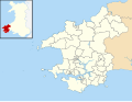
Fishguard and Goodwick

Last updated

Fishguard and Goodwick
  • Welsh: Abergwaun ac Wdig
Goodwick and Fishguard from air.jpg
Goodwick and Fishguard from the air
Population5,407  [1]
OS grid reference SM949376
Community
  • Fishguard and Goodwick
Principal area
Preserved county
Country Wales
Sovereign state United Kingdom
Post town GOODWICK
Postcode district SA64
Post townFISHGUARD
Postcode district SA65
Dialling code 01348
Police Dyfed-Powys
Fire Mid and West Wales
Ambulance Welsh
UK Parliament
Senedd Cymru – Welsh Parliament
Website fishguardgoodwick-tc.gov.wales
List of places
UK
Wales
Pembrokeshire
51°59′57″N4°59′19″W / 51.9993°N 4.9886°W / 51.9993; -4.9886 Coordinates: 51°59′57″N4°59′19″W / 51.9993°N 4.9886°W / 51.9993; -4.9886
Fishguard and Goodwick
This is a stopgap mapping solution, while attempts are made to resolve technical difficulties with {{ OSM Location map }}

Fishguard and Goodwick is the name of a community that wraps around Fishguard Bay, on the northern coast of Pembrokeshire, Wales. It comprises the two towns of Fishguard and Goodwick, with their neighbourhoods of Dyffryn, Harbour Village, Penyraber, Lower Town, and Stop-and-Call. Within the community are two railway stations and Goodwick Ferry Terminal, which is the terminus of the A40 London to Fishguard Trunk Road.

Contents

History

The two towns of Goodwick and Fishguard were administered separately until 1934. In that year the Fishguard Urban District and Goodwick Urban District were merged to become Fishguard and Goodwick Urban District. [2] Fishguard and Goodwick Urban District was abolished under the Local Government Act 1972, with the area becoming part of the district of Preseli Pembrokeshire on 1 April 1974. A community covering the former urban district was established at the same time, with its council taking the name Fishguard and Goodwick Town Council. [3] [4]

Governance

Fishguard Town Hall Fishguard - Town Hall (geograph 7003892).jpg
Fishguard Town Hall

The community has a council called Fishguard and Goodwick Town Council. [5] Three wards elect a total of 14 council members: Goodwick (5), Fishguard North West (4) and Fishguard North East (5). [6] The council elects a mayor on an annual basis from among the elected councillors. The council is based at Fishguard Town Hall in Market Square, Fishguard. [7]

Topography

The three wards take in three areas of habitation, each fronting onto a section Fishguard Bay, a sheltered bay on the north coast of Pembrokeshire, South Wales. The coastline of the bay is entirely within the community boundary. Much of the shoreline has substantial cliffs although the section between the two towns, known as the Parrog, has a wide beach and leads to an area of flat marshland, [8] and the River Gwaun at Lower Town harbour flows from the wooded valley of Cwm Gwaun.

Goodwick ward includes the town of Goodwick on the north-east corner of the bay and Harbour Village alongside the ferry terminal. The north-west side of the bay is dominated by the major Ferry terminal at which the railway and the A40 terminate and from which two ships a day sail to Rosslare Europort, Ireland. [9] Inland from Goodwick are the two settlements of Stop-and Call and Dyfryn. Within the bay itself are two 1 km long breakwaters ensuring safe port moorings, and between the ferry terminal and the outer breakwater is the Fishguard Lifeboat Station. North of the outer breakwater the community boundary takes in the east coast of Strumble Head including the rocky headland of Pen Anglas. [6] The Parrog is a stretch of seafront and beach facing Fishguard bay, [10] including the 'Ocean Lab' visitor centre, [11] Projecting north-east from the Parrog is the inner breakwater, whilst on the inland side is Goodwick Moor Nature Reserve, 15.6 hectares (39 acres) of reed-bed and mire, home to otters and water voles, and managed by the Wildlife Trust of South and West Wales. [12]

Fishguard North West ward has no coastline, occupying the western part of the town of Fishguard south of the A487 and west of Wallis Street. The area includes the south-western half of the historic centre of Fishguard upper town, with significant areas of housing and the Ysgol Bro Gwaun senior school, for which major rebuilding plans were announced at the end of 2015. [13]

Fishguard North East ward includes the other half of the historic upper town core, and an area of 20th-century housing known as Penyraber, beside the cliffs of Saddle Point. It also includes the steep slopes of the Lower Town area and the quayside of the picturesque old harbour. The harbour and Lower Town were the location used by Richard Burton and Elizabeth Taylor for the 1972 film of Dylan Thomas's Under Milk Wood. [14] The ward also includes the headland east of the town, where the A487 Fishguard to Bangor Trunk Road runs north-east out of Fishguard with sharp bends and steep gradients as it climbs up to the cliff top near Castle Point.

Protected sites

Within Fishguard and Goodwick community there are a wide variety of protected sites from rocky cliffs and ancient monuments to listed buildings and three conservation areas.

Geology SSSI

Fishguard Cliffs
Site of Special Scientific Interest
Pembrokeshire UK location map.svg
Red pog.svg
Location within Pembrokeshire
Location Pembrokeshire
Grid reference SM 958375
Coordinates 51°59′54″N4°58′34″W / 51.9983°N 4.9760°W / 51.9983; -4.9760
InterestGeological
Area6.7 hectares (17 acres)
Notification 1954
The cliffs below Castle Point Low tide below the fort - geograph.org.uk - 620722.jpg
The cliffs below Castle Point

The cliffs either side of Fishguard Lower Town harbour are an SSSI notable for its geology. From Saddle Point on the western side, round to Castle Point on the eastern headland, [15] the geology has legal protection because of its notable Ordovician pillow lava, in which the Llanvirn series is well demonstrated. Many of the rocks of Pembrokeshire have their origins some 460 million years ago in vast volcanic outpourings of ash and tuff, and more rarely flows of lava, which, as here, cooled into a number of pillow formations. [16]

National Park

Although the Pembrokeshire Coast National Park includes almost all of the coastline, it has three gaps, of which one is Fishguard and Goodwick. Most of the Community is excluded from National Park jurisdiction. Several lengths of the Community boundary are also the boundary to the National Park, both to east and west. Only two small areas of the Community are within the National Park, these being: the Castle point headland north of the A487 to the east; and the northwest end of the community along the Pen Anglas headland of Strumble Head. For these areas, the Park is the legal Planning Authority, unlike the rest of the Community, for which Pembrokeshire County Council has that responsibility. [17]

Scheduled Monuments

Garn Wen Cromlechs Garn Wen Cromlechs, Goodwick, Pembrokeshire.jpg
Garn Wen Cromlechs
Pen Rhiw Cromlech: a broad, low-lying cromlech in a field north of Pen-rhiw farm, Goodwick. Pen Rhiw Cromlech, Goodwick, Pembrokeshire.jpg
Pen Rhiw Cromlech: a broad, low-lying cromlech in a field north of Pen-rhiw farm, Goodwick.
Old fort, Castle Point, Fishguard Old fort, Castle Point Fishguard - geograph.org.uk - 537590.jpg
Old fort, Castle Point, Fishguard

There are three scheduled monuments in the community. Two chambered tomb sites are prehistoric, and the Old Castle is a post-medieval site:-

Listed buildings

Hermon Baptist Church, Fishguard Hermon, Fishguard DSC00522c.jpg
Hermon Baptist Church, Fishguard

Two buildings within the community are listed grade II*.

There are also 161 grade II listed buildings across the two towns, including shops, houses, Churches, inns and public buildings. The largest density of these is in Fishguard town centre, which has 112, particularly along the Market Square and Main Street, Hill Terrace, Tower Hill and Hamilton Street, with another heavy cluster along High Street and West Street. It includes several terraces on Park Street and Nottipass Street. The Lime kilns on The Slade and farm buildings at Maesgwynne are also listed. In Fishguard Lower Town there are a further 35 grade II buildings, mostly harbour-side cottages, clustered around Quay Street, Bridge Street, Newport Road and Glyn-y-mel Road. In Goodwick there are 14 listed buildings, particularly in the centre, including the Lifeboat memorial, Institute, two churches and several houses and cottages. [23]

Conservation Areas

This community has 3 of Pembrokeshire's 24 Conservation areas. These afford a wide-area protection for the special character of an area, regulating the building construction and alterations within the protected area and influencing the landscaping of outdoor spaces. [24] The three areas match closely to the three historic settlement cores, and to the clusterings of the listed buildings. All three conservation areas were first drawn up in 1976, had a revision in 1992 and an appraisal in 2016.

Lower Town Fishguard Conservation Area: Lower Town is thought to be oldest of the three settlements, growing up around the old harbour. The 2016 conservation area appraisal affirms the maritime history and coastal landscape as key significant features, and the resulting narrow streets, quayside buildings, constrained building plots and separation from the rest of Fishguard give it the picturesque value that the conservation area management plan seeks to protect and enhance. The conservation area is 19.23 hectares (47.5 acres) and covers the quay and hillside to the north, along the Gwaun valley, and adjoins the Fishguard Conservation Area where the main road climbs up from lower to upper town [25]

Fishguard Conservation Area (upper town): The special characteristics identified in the 2016 appraisal included the dramatic coastal setting, the mix of buildings from the 17th, 18th and 19th centuries, the marketplace with radial streets, historic shop fronts, narrow streets and alleyways and the extreme topography separating the upper and lower towns. The town had a medieval origin and Norman castle, but its prosperity increased as fishing and coastal trade increased through the 17th and 18th centuries. The sheltered harbour served both trading vessels and those travelling to Ireland, and allowed ancillary industries such as boatbuilding and rope-making to thrive, and the townscape retains many elements from that period of prosperity. 18.35 hectares (45.3 acres) of the historic core of the town and the former industrial area of The Slade, leading down to the shoreline, are included in the conservation area. [26]

Goodwick Conservation Area: Goodwick as a settlement saw its period of growth into a town later than Fishguard. Although a maritime history and coastal setting are noted as significant in defining its special character, it is the period of late 19th- and early-20th-century growth that defines the town's character. With the 1906 arrival of the railway, and the use of Goodwick Harbour for trans-Atlantic liners, Goodwick had a fashionable heyday in the Edwardian period, and the Victorian and Edwardian shops are identified as being key parts of Goodwick's character. The Conservation Area covers 29.53 hectares (73.0 acres) including the town centre and the residential streets on the hillside northwest of the railway and ferry terminal. [27]

See also

Related Research Articles

<span class="mw-page-title-main">Fishguard</span> Town in Pembrokeshire, Wales

Fishguard is a coastal town in Pembrokeshire, Wales, with a population of 3,419 in 2011; the community of Fishguard and Goodwick had a population of 5,407. Modern Fishguard consists of two parts, Lower Fishguard and the "Main Town". Fishguard and Goodwick are twin towns with a joint Town Council.

<span class="mw-page-title-main">Goodwick</span> Town on Fishguard Harbour, Wales

Goodwick is a coastal town in Pembrokeshire, Wales, immediately west of its twin town of Fishguard.

<span class="mw-page-title-main">Neyland</span> Human settlement in Wales

Neyland is a town and community in Pembrokeshire, Wales, lying on the River Cleddau and the upstream end of the Milford Haven estuary. The Cleddau Bridge carrying the A477 links Pembroke Dock with Neyland.

<span class="mw-page-title-main">Strumble Head</span>

Strumble Head is a rocky headland in the community of Pencaer in Pembrokeshire, Wales, within the Pembrokeshire Coast National Park. It marks the southern limit of Cardigan Bay. Three islands lie off the head: Ynys Meicel – 112 feet (34 m) – Ynys Onnen and Carreg Onnen.

<span class="mw-page-title-main">Wolf's Castle</span> Human settlement in Wales

Wolfscastle, also spelt Wolf's Castle, is a village and community in Pembrokeshire, between Haverfordwest and Fishguard, in southwest Wales. It was historically in the parish of St Dogwells.

<span class="mw-page-title-main">Fishguard Harbour railway station</span> Railway station that serves the port of Fishguard Harbour, Wales

Fishguard Harbour railway station serves the port of Fishguard Harbour, Wales. It is the terminus of one of the branches of the West Wales Line from Swansea. The area is also now served by Fishguard and Goodwick railway station.

<span class="mw-page-title-main">Dinas Cross</span> Human settlement in Wales

Dinas Cross is both a village, a community and a former parish in Pembrokeshire, Wales. Located between Fishguard and Newport in the Pembrokeshire Coast National Park, it is a popular holiday destination on the A487 road. The two hamlets, Cwm-yr-Eglwys and Pwllgwaelod, are in the community. The community has an elected community council and until 2022 gave its name to an electoral ward of Pembrokeshire County Council which covered the communities of Dinas Cross, Cwm Gwaun and Puncheston.

<span class="mw-page-title-main">River Gwaun</span> River in Wales

The River Gwaun is a river in Pembrokeshire, West Wales, which flows west to the sea at Fishguard.

<span class="mw-page-title-main">Fishguard and Goodwick railway station</span> Railway station in Pembrokeshire, Wales

Fishguard and Goodwick railway station is a railway station sited 1 mile from Fishguard in the neighbouring town of Goodwick, Pembrokeshire, Wales. It is owned by Pembrokeshire County Council and just over 12 mile (0.80 km) from the larger Fishguard Harbour station. Following its closure in 1964, it reopened on 14 May 2012 following investment from Network Rail and Pembrokeshire County Council.

<span class="mw-page-title-main">North Pembrokeshire and Fishguard Railway</span>

The North Pembrokeshire and Fishguard Railway was a railway company in south-west Wales, incorporated to extend the moribund Narberth Road and Maenclochog Railway, with a view to developing a port on Fishguard Bay and ferry services to Rosslare in Ireland.

<span class="mw-page-title-main">Ysgol Bro Gwaun</span> Comprehensive school in Fishguard, Pembrokeshire, Wales

Ysgol Bro Gwaun is a secondary comprehensive school in the town of Fishguard in north Pembrokeshire. It is a predominantly English-medium school with significant use of Welsh, and has a catchment area covering the towns of Fishguard and Goodwick, the villages of Scleddau, Letterston and Newport and the surrounding areas including the Gwaun valley.

<span class="mw-page-title-main">Dinas Island</span>

Dinas Island is a peninsula, partially detached from the mainland, in the community of Dinas Cross between Fishguard and Newport, Pembrokeshire, in southwest Wales. A triangulation point shows 466 feet (142 m) above sea level at Pen-y-fan. Although Dinas Head is the northernmost part of the promontory where the cliffs meet the sea, the name is sometimes loosely used to refer to this highest point. Dinas Island is contained within the Pembrokeshire Coast National Park and the headland is under the care of the National Trust.

<span class="mw-page-title-main">Fishguard & Goodwick Marina</span>

The Fishguard & Goodwick Marina is a planned development within the harbour of the Welsh towns of Fishguard and Goodwick in Pembrokeshire, south-west Wales. In April 2012 Pembrokeshire County Council revealed that they had given outline planning permission for the development of a marina to be located in the small town of Goodwick within Fishguard Harbour. The initial planning application was submitted to Pembrokeshire County Council in October 2011 by Conygar who wish to invest £100 million into the project.

Fishguard Bay is a bay on the north Pembrokeshire coast, Wales. Much of the bay's coastline is within the Pembrokeshire Coast National Park though the developed areas of Fishguard and Goodwick are excluded. Fronting onto the much larger Cardigan Bay, it stretches from Dinas Island to Crincoed Point, three miles to the west. Several smaller inlets pierce its southern shore whilst in the southwest it has been developed as Fishguard Harbour. The small sandy bay of Pwllgwaelod is located at its eastern extremity. The Pembrokeshire Coast Path, itself a part of the longer Wales Coast Path runs around the bay, taking a slight detour inland along its western side.

<span class="mw-page-title-main">Coastline of Wales</span> Sea-bounded areas of Wales

The coastline of Wales extends from the English border at Chepstow westwards to Pembrokeshire then north to Anglesey and back eastwards to the English border once again near Flint. Its character is determined by multiple factors, including the local geology and geological processes active during and subsequent to the last ice age, its relative exposure to or shelter from waves, tidal variation and the history of human settlement and development which varies considerably from one place to another. The majority of the coast east of Cardiff in the south, and of Llandudno in the north, is flat whilst that to the west is more typically backed by cliffs. The cliffs are a mix of sandstones, shales and limestones, the erosion of which provides material for beach deposits. Of the twenty-two principal areas which deliver local government in Wales, sixteen have a coastline, though that of Powys consists only of a short section of tidal river some distance from the open sea. Its length has been estimated at 1,680 miles (2,700 km).

The geology of Pembrokeshire in Wales inevitably includes the geology of the Pembrokeshire Coast National Park which extends around the larger part of the county’s coastline and where the majority of rock outcrops are to be seen. Pembrokeshire’s bedrock geology is largely formed from a sequence of sedimentary and igneous rocks originating during the late Precambrian and the Palaeozoic era, namely the Ediacaran, Cambrian, Ordovician, Silurian, Devonian and Carboniferous periods, i.e. between 635 and 299 Ma. The older rocks in the north of the county display patterns of faulting and folding associated with the Caledonian Orogeny. On the other hand, the late Palaeozoic rocks to the south owe their fold patterns and deformation to the later Variscan Orogeny.

<span class="mw-page-title-main">Fishguard Town Hall</span> Municipal Building in Fishguard, Wales

Fishguard Town Hall is a municipal building in the Market Square, Fishguard, Pembrokeshire, Wales. The structure, which is the meeting place of Fishguard and Goodwick Town Council, is a Grade II listed building.

References

  1. Fishguard and Goodwick Community, 2011 census
  2. "Fishguard and Goodwick Urban District". A Vision of Britain through Time. GB Historical GIS / University of Portsmouth. Retrieved 4 August 2022.
  3. "Local Government Act 1972", legislation.gov.uk , The National Archives, 1972 c. 70, retrieved 31 July 2022
  4. "The Districts in Wales (Names) Order 1973", legislation.gov.uk , The National Archives, SI 1973/1, retrieved 31 July 2022
  5. "Fishguard and Goodwick". Fishguard and Goodwick Town Council. Retrieved 26 December 2016.
  6. 1 2 "Fishguard and Goodwick Electoral Divisions". Fishguard and Goodwick Town Council. Retrieved 26 December 2016.
  7. "Contact us". Fishguard and Goodwick Town Council. Retrieved 4 August 2022.
  8. "Goodwick Moor & Parrog". Sea View Hotel, Fishguard. Retrieved 8 January 2016.
  9. "Stena's Fishguard to Rosslare fast ferry service cut". bbc.co.uk. 21 November 2011.
  10. Pembrokeshire Coast National Park (2013). "Fishguard and Goodwick Harbours: SCA7 - Seascape Character Assessment" . Retrieved 27 December 2016.
  11. Ocean Lab website.
  12. "Goodwick Moor". Wildlife Trust of South and West Wales. Retrieved 27 December 2016.
  13. "Fishguard to get £10.5 million to build modern school". Western Telegraph. Haverfordwest. 24 December 2015.
  14. Paul Whitfield, Mike Parker and Catherine le Nevez (2012). The Rough Guide to Wales. Rough Guides.
  15. Natural Resources Wales (1988). "SSSI 0576 Map, first notified 1954" (PDF).
  16. Natural Resources Wales (1988). "SSSI 0576 Citation sheet, first notified 1954" (PDF).
  17. Pembrokeshire Coast National Park Authority. "Planning". pembrokeshirecoast.org.uk. Retrieved 6 January 2017.
  18. Garn Wen neolithic cemetery (ID PRN2908) . in the ' SMR ' for Dyfed Archaeological Trust (DAT)
  19. Pen-rhiw (ID PRN2499) . in the ' SMR ' for Dyfed Archaeological Trust (DAT)
  20. "Plas Gwyn-y-Mel (Cadw ID 12256, listed Nov 1978)". /www.britishlistedbuildings.co.uk.
  21. Richard Davies (8 May 2010). Local Information Leaflet 37: Fishguard (PDF) (Report). Capeli: The Chapels Heritage Society. p. 3.
  22. "Herman Baptist Church (Cadw ID 12273, listed Jan 1978)". britishlistedbuildings.co.uk.
  23. "Cadw listed building database". historicwales.gov.uk. Retrieved 5 January 2017.
  24. Links to the designating maps can be found at "Conservation Areas". pembrokeshire.gov.uk. Pembrokeshire County Council.
  25. Dr Steven Jones (February 2016). Lower Town Fishguard Conservation Area Character Appraisal and Management Plan (Report). Pembrokeshire County Council.
  26. Dr Steven Jones (February 2016). Fishguard Conservation Area Character Appraisal and Management Plan (Report). Pembrokeshire County Council. p. 15.
  27. Dr Steven Jones (February 2016). Goodwick Conservation Area Character Appraisal and Management Plan (Report). Pembrokeshire County Council.