Related Research Articles

In earth science, erosion is the action of surface processes that removes soil, rock, or dissolved material from one location on the Earth's crust, and then transports it to another location. This natural process is caused by the dynamic activity of erosive agents, that is, water, ice (glaciers), snow, air (wind), plants, animals, and humans. In accordance with these agents, erosion is sometimes divided into water erosion, glacial erosion, snow erosion, wind (aeolic) erosion, zoogenic erosion, and anthropogenic erosion. The particulate breakdown of rock or soil into clastic sediment is referred to as physical or mechanical erosion; this contrasts with chemical erosion, where soil or rock material is removed from an area by its dissolving into a solvent, followed by the flow away of that solution. Eroded sediment or solutes may be transported just a few millimetres, or for thousands of kilometres.

Soil erosion is the displacement of the upper layer of soil, it is one form of soil degradation. This natural process is caused by the dynamic activity of erosive agents, that is, water, ice (glaciers), snow, air (wind), plants, animals, and humans. In accordance with these agents, erosion is sometimes divided into water erosion, glacial erosion, snow erosion, wind (aeolean) erosion, zoogenic erosion and anthropogenic erosion. Soil erosion may be a slow process that continues relatively unnoticed, or it may occur at an alarming rate causing a serious loss of topsoil. The loss of soil from farmland may be reflected in reduced crop production potential, lower surface water quality and damaged drainage networks.Soil erosion could also cause sinkholes.

Geomorphology is the scientific study of the origin and evolution of topographic and bathymetric features created by physical, chemical or biological processes operating at or near the Earth's surface. Geomorphologists seek to understand why landscapes look the way they do, to understand landform history and dynamics and to predict changes through a combination of field observations, physical experiments and numerical modeling. Geomorphologists work within disciplines such as physical geography, geology, geodesy, engineering geology, archaeology, climatology and geotechnical engineering. This broad base of interests contributes to many research styles and interests within the field.

Permafrost is ground that continuously remains frozen for two or more years, located on land or under the ocean. Permafrost does not have to be the first layer that is on the ground. It can be an inch to over miles deep into the Earth’s surface. Some of the most common permafrost locations are located in the Northern Hemisphere. 85% of Alaska, Greenland, Canada, and Siberia is sitting on top of a layer of permafrost, that is almost a quarter of the Northern Hemisphere. It can also be located in the Southern Hemisphere, just on mountain tops. Permafrost frequently occurs in ground ice, but it also can be presented in non-porous bedrock. Permafrost is formed from ice holding all different sorts of soil, sand, and rock combination together.

In geography and geology, fluvial processes are associated with rivers and streams and the deposits and landforms created by them. When the stream or rivers are associated with glaciers, ice sheets, or ice caps, the term glaciofluvial or fluvioglacial is used.

The Kobuk River is a river located in the Arctic region of northwestern Alaska in the United States. It is approximately 280 miles (451 km) long. Draining a basin with an area of 12,300 square miles (32,000 km2), the Kobuk River is among the largest rivers in northwest Alaska with widths of up to 1500 feet and flow at a speed of 3–5 miles per hour in its lower and middle reaches. The average elevation for the Kobuk River Basin is 1,300 feet (400 m) above sea level, ranging from near sea level to 11,400 feet. Topography includes low, rolling mountains, plains and lowlands, moderately high rugged mountainous land, and some gently sloped plateaus and highlands. The river contains an exceptional population of sheefish, a large predatory whitefish within the salmon family, found throughout the Arctic that spawns in the river's upper reaches during the autumn. A portion of the vast Western Arctic Caribou Herd utilize the Kobuk river valley as winter range.

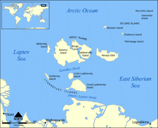
Bolshoy Lyakhovsky Island, or Great Lyakhovsky, is the largest of the Lyakhovsky Islands belonging to the New Siberian Islands archipelago between the Laptev Sea and the East Siberian Sea in northern Russia. It has an area of 4,600 km², and a maximum altitude of 270 m.

Solifluction is a collective name for gradual processes in which a mass moves down a slope related to freeze-thaw activity. This is the standard modern meaning of solifluction, which differs from the original meaning given to it by Johan Gunnar Andersson in 1906.

An ice wedge is a crack in the ground formed by a narrow or thin piece of ice that measures up to 3–4 meters in length at ground level and extends downwards into the ground up to several meters. During the winter months, the water in the ground freezes and expands. Once temperatures reach −17 degrees Celsius or lower, the ice that has already formed acts like a solid and expands to form cracks in the surface known as ice wedges. As this process continues over many years ice wedges can grow, up to the size of a swimming pool. Ice wedges usually appear in a polygonal pattern known as ice wedge polygons. The cracks can also be filled with materials other than ice, especially sand, and then they're called sand wedges.

Thermokarst is a land surface characterised by very irregular surfaces of marshy hollows and small hummocks formed as ice-rich permafrost thaws, that occurs in Arctic areas, and on a smaller scale in mountainous areas such as the Himalayas and the Swiss Alps. These pitted surfaces resemble those formed by solution in some karst areas of limestone, which is how they came to have karst attached to their name without the presence of any limestone. Small domes that form on the surface due to frost heaving with the onset of winter are only temporary features. They then collapse with the arrival of next summer's thaw and leave a small surface depression. Some ice lenses grow and form larger surface hummocks, which last many years and sometimes become covered with grasses and sedges, until they begin to thaw. These domed surfaces eventually collapse either annually or after longer periods and form depressions which contribute to uneven surfaces. These are included within the general label of thermokarst.

Pingos are intrapermafrost ice-cored hills, ranging in height from 3m to 70m and 30m to 1000m in diameter . They are typically conical in shape and grow and persist only in permafrost environments, such as the Arctic and subarctic. A pingo is a periglacial landform, which is defined as a non-glacial landform or process linked to colder climates. It is estimated that there are more than 11 000 pingos on Earth. The Tuktoyaktuk peninsula area has the greatest concentration of pingos in the world with a total of 1350 pingos. There is currently remarkably limited data on pingos.

In geology, a terrace is a step-like landform. A terrace consists of a flat or gently sloping geomorphic surface, called a tread, that is typically bounded on one side by a steeper ascending slope, which is called a "riser" or "scarp". The tread and the steeper descending slope together constitute the terrace. Terraces can also consist of a tread bounded on all sides by a descending riser or scarp. A narrow terrace is often called a bench.
Paraglacial means unstable conditions caused by a significant relaxation time in processes and geomorphic patterns following glacial climates. Rates of landscape change and sediment output from the system are typically elevated during paraglacial landscape response.
Aufeis,, is a sheet-like mass of layered ice that forms from successive flows of ground water during freezing temperatures. This form of ice is also called overflow, icings, or the Russian term, naled. The term was first used in 1859 by A. T. von Middendorff following his observations of the phenomenon in northern Siberia.

Palsas are peat mounds with a permanently frozen peat and mineral soil core. They are a typical phenomena in the polar and subpolar zone of discontinuous permafrost. One of their characteristics is having steep slopes that rises above the mire surface. This leads to the accumulation of large amounts of snow around them. The summits of the palsas are free of snow even in winter, because the wind carries the snow and deposits on the slopes and elsewhere on the flat mire surface. Palsas can be up to 150 m in diameter and can reach a height of 12 m.

A frost boil, also known as mud boils, a stony earth circles, frost scars, or mud circles, are small circular mounds of fresh soil material formed by frost action and cryoturbation. They are found typically found in periglacial or alpine environments where permafrost is present, and may damage roads and other man-made structures. They are typically 1 to 3 metres in diameter.

Frost weathering is a collective term for several mechanical weathering processes induced by stresses created by the freezing of water into ice. The term serves as an umbrella term for a variety of processes such as frost shattering, frost wedging and cryofracturing. The process may act on a wide range of spatial and temporal scales, from minutes to years and from dislodging mineral grains to fracturing boulders. It is most pronounced in high-altitude and high-latitude areas and is especially associated with alpine, periglacial, subpolar maritime and polar climates, but may occur anywhere at sub-freezing temperatures if water is present.

Periglaciation describes geomorphic processes that result from seasonal thawing of snow in areas of permafrost, the runoff from which refreezes in ice wedges and other structures. "Periglacial" suggests an environment located on the margin of past glaciers. However, freeze and thaw cycles influence landscapes outside areas of past glaciation. Therefore, periglacial environments are anywhere that freezing and thawing modify the landscape in a significant manner.
In geography azonal is an adjective that refers to processes or things that are not restricted to any climate zone. It can be used to describe soils, landforms, geomorphic processes or vegetation. In some climatic environments azonal geomorphologic processes may take distinct characteristics. For example, river activity is common across the globe, but in periglacial environments it causes spring floods from snowmelt, freezing and break-up cycles, and sometimes fluvio-thermal erosion.
Syngenetic permafrost growth is a mode of the growth of permafrost whereby additional material is deposited to a permafrost site during freezing conditions, causing the permafrost layer to build upwards. It is cited as an efficient mode of permafrost growth, compared with heterogenetic permafrost growth, which occurs when freezing temperatures penetrate into previously unfrozen ground of uniform composition. Lunardini gives the basic formulas for permafrost generation under both modes.
References
- Costard, Francois, E. Gautier, A. Fedorov, P. Konstantinov and L. Dupeyrat. (2014). An Assessment of the Erosion Potential of the Fluvial Thermal Process during Ice Breakups of the Lena River (Siberia). John Wiley & Sons Ltd. p. 162-171.
- Costard, F., E. Gautier, D. Brunstein, J. Hammadi, A. Fedorov, D. Yang, and L. Dupeyat. (2007). Impact of the global warming on the flvial thermal erosion over the Lena River in Central Siberia. The American Geophysical Union.
- Costard, F., L. Dupeyrat, E. Gautier and E. Carey-Gailhardis. (2003). Fluvial Thermal Erosion Investigations Along a Rapidly Eroding River Bank: Application to the Lena River (Central Siberia). Wiley InterScience.
- Dupeyrat, L., F. Costard, R. Randriamazaoro, E, Gailhardis, E. Gautier, A. Fedorov .(2011). Effects of Ice Content on the Thermal Erosion of Permafrost: Implications of Coastal and Fluvial Erosion. Wiley Online Library.
- Randriamazaoro, R., L. Dupeyat, F. Costard and E. Carey Gailhardis. (2007). Fluvial Thermal Erosion: heat balance integral method. Wiley InterScience.
- Notes
- ↑ Dupeyrat, L (2011). "Effects of Ice Content on the Thermal Erosion of Permafrost: Implications for Coastal and Fluvial Erosion". Permafrost and Periglacial Processes. 22 (2): 179–187. doi:10.1002/ppp.722.
- 1 2 French, Hugh M. (2007). The Periglacial Environment (3rd ed.). John Wiley & Sons Ltd. p. 260. ISBN 978-0-470-86588-0.
- ↑ Costard, Francois (2014). "An Assessment of the Erosion Potential of the Fluvial Thermal Process during Ice Breakups of the Lena River (Siberia)". Permafrost and Periglacial Processes. 25 (3): 162–171. doi:10.1002/ppp.1812.
- ↑ Randriamazaoro, R (2007). "Fluvial thermal erosion: heat balance integral method". Earth Surface Processes and Landforms. 32 (12): 1828–1840. Bibcode:2007ESPL...32.1828R. doi:10.1002/esp.1489.