Related Research Articles

In earth science, erosion is the action of surface processes that removes soil, rock, or dissolved material from one location on the Earth's crust, and then transports it to another location where it is deposited. Erosion is distinct from weathering which involves no movement. Removal of rock or soil as clastic sediment is referred to as physical or mechanical erosion; this contrasts with chemical erosion, where soil or rock material is removed from an area by dissolution. Eroded sediment or solutes may be transported just a few millimetres, or for thousands of kilometres.

A glacier is a persistent body of dense ice that is constantly moving under its own weight. A glacier forms where the accumulation of snow exceeds its ablation over many years, often centuries. Glaciers slowly deform and flow under stresses induced by their weight, creating crevasses, seracs, and other distinguishing features. They also abrade rock and debris from their substrate to create landforms such as cirques, moraines, or fjords. Glaciers form only on land and are distinct from the much thinner sea ice and lake ice that forms on the surface of bodies of water.

A moraine is any accumulation of unconsolidated debris, sometimes referred to as glacial till, that occurs in both currently and formerly glaciated regions, and that has been previously carried along by a glacier or ice sheet. It may consist of partly rounded particles ranging in size from boulders down to gravel and sand, in a groundmass of finely-divided clayey material sometimes called glacial flour. Lateral moraines are those formed at the side of the ice flow, and terminal moraines were formed at the foot, marking the maximum advance of the glacier. Other types of moraine include ground moraines and medial moraines.

Till or glacial till is unsorted glacial sediment.

Glaciology is the scientific study of glaciers, or more generally ice and natural phenomena that involve ice.
Landforms are categorized by characteristic physical attributes such as their creating process, shape, elevation, slope, orientation, rock exposure, and soil type.

Scree is a collection of broken rock fragments at the base of a cliff or other steep rocky mass that has accumulated through periodic rockfall. Landforms associated with these materials are often called talus deposits. Talus deposits typically have a concave upwards form, where the maximum inclination corresponds to the angle of repose of the mean debris particle size. The exact definition of scree in the primary literature is somewhat relaxed, and it often overlaps with both talus and colluvium.

A cirque is an amphitheatre-like valley formed by glacial erosion. Alternative names for this landform are corrie and cwm. A cirque may also be a similarly shaped landform arising from fluvial erosion.

Glacial motion is the motion of glaciers, which can be likened to of rivers of ice. It has played an important role in sculpting many landscapes. Most lakes in the world occupy basins scoured out by glaciers. Glacial motion can be fast or slow, but is typically around 25 centimetres per day (9.8 in/d).

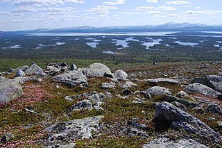
Glacial landforms are landforms created by the action of glaciers. Most of today's glacial landforms were created by the movement of large ice sheets during the Quaternary glaciations. Some areas, like Fennoscandia and the southern Andes, have extensive occurrences of glacial landforms; other areas, such as the Sahara, display rare and very old fossil glacial landforms.

Craig Cerrig-gleisiad is a subsidiary summit of Fan Fawr in the Fforest Fawr section of the Brecon Beacons National Park, South Wales. It makes up half of the Craig Cerrig-gleisiad and Fan Frynych National Nature Reserve with its sister peak Fan Frynych.

A terminal moraine, also called end moraine, is a type of moraine that forms at the terminal (edge) of a glacier, marking its maximum advance. At this point, debris that has accumulated by plucking and abrasion, has been pushed by the front edge of the ice, is driven no further and instead is deposited in an unsorted pile of sediment. Because the glacier acts very much like a conveyor belt, the longer it stays in one place, the greater the amount of material that will be deposited. The moraine is left as the marking point of the terminal extent of the ice.

Rock glaciers are distinctive geomorphological landforms, consisting either of angular rock debris frozen in interstitial ice, former "true" glaciers overlain by a layer of talus, or something in-between. Rock glaciers are normally found at high latitudes and/or elevations, and may extend outward and downslope from talus cones, glaciers or terminal moraines of glaciers.
A Rogen moraine is a subglacially formed type of moraine landform, that mainly occurs in Fennoscandia, Scotland, Ireland and Canada. It is one of the three main types of hummocky moraines. They cover large areas that have been covered by ice, and occur mostly in what is believed to have been the central areas of the ice sheets. Rogen moraines are named after Lake Rogen in Härjedalen, Sweden, the landform's type locality. Rogen Nature Reserve serves to protect the unusual area.

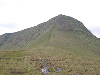
Corn Du is a summit of the twin topped Pen y Fan and the second highest peak in South Wales at 873 m, situated in the Brecon Beacons National Park. The summit itself is marked by a well structured Bronze Age cairn with a central burial cist like that on nearby Pen y Fan. The two summits are visible from great distances owing to their height above the surrounding moorland, and are famous landmarks. The views from the peaks are also panoramic and very extensive, the Black Mountain and Fforest Fawr being especially obvious to the west. Mynydd Epynt is visible to the north behind the county town of Brecon, and other parts of the escarpment to the east.
Fluvioglacial landforms are those that result from the associated erosion and deposition of sediments caused by glacial meltwater. These landforms may also be referred to as glaciofluvial in nature. Glaciers contain suspended sediment loads, much of which is initially picked up from the underlying landmass. Landforms are shaped by glacial erosion through processes such as glacial quarrying, abrasion, and meltwater. Glacial meltwater contributes to the erosion of bedrock through both mechanical and chemical processes.
Cribyn is a mountain in the Brecon Beacons with an elevation of 2608 feet about 300 feet lower than the neighbouring peaks of Pen y Fan and Corn Du. It is a prominent peak in the long and impressive escarpment facing north and running roughly east–west of the central section of the Brecon Beacons.

Picws Du is the second highest peak of the Carmarthen Fans in the Carmarthenshire section of the Black Mountain in the west of the Brecon Beacons National Park in south Wales. The highest peak is Fan Foel immediately next along the ridge and it is a subsidiary summit of Fan Brycheiniog. Picws Du falls within Fforest Fawr Geopark and its prominent summit is marked by a large Bronze Age round barrow at a height of 2457 feet above sea level. Waun Lefrith is the other, lower summit of the Bannau Sir Gâr / Carmarthen Fans situated to the west. The peak overlooks the glacial lake of Llyn y Fan Fach in the cwm below. As the peak sits on the edge of the escarpment on a ridge which juts out into the valley below, the views from the summit are panoramic and extensive. The views to the north are especially impressive when the weather is clear, looking towards the Cambrian Mountains, Mynydd Epynt and Brecon. Swansea and the Bristol Channel can just be seen on the horizon to the south, across the gently falling dip slope. Pen y Fan and Corn Du are distinctive landmarks seen directly to the east across Fforest Fawr.
Discrete debris accumulation (DDA) is a non-genetic term in mountain glacial geology to aid identification of non-lithified sediments on a valley or mountain slope or floor. It is intended that the debris accumulation is discrete such that it can be mapped, in the field and/or from aerial or satellite imagery. The origin or formative process may well not be known clearly or be changed by subsequent investigators it is advisable to have a non-genetic field reference so that discussion can then be used to ascertain, if possible, the origin. Mountain areas may currently have glaciers (glacierized) or have had glaciers (glaciated) or be subject to forms of periglacial activity. A moraine would be an easily identified DDA as would an esker. Although scree (talus) is generally easily identified and mapped, these deposits may be modified by ice, avalanches or downlope movement to create essentially new landforms. Many small slope failures and landslides can give the appearance of moraines or protalus ramparts on slopes. After mapping as a DDA, further investigation might draw light on the origin of the feature.
This article describes the geology of the Brecon Beacons National Park in mid/south Wales. The area gained national park status in 1957 with the designated area of 1,344 km2 (519 sq mi) including mountain massifs to both the east and west of the Brecon Beacons proper. The geology of the national park consists of a thick succession of sedimentary rocks laid down from the late Ordovician through the Silurian and Devonian to the late Carboniferous period. The rock sequence most closely associated with the park is the Old Red Sandstone from which most of its mountains are formed. The older parts of the succession, in the northwest, were folded and faulted during the Caledonian orogeny. Further faulting and folding, particularly in the south of the park is associated with the Variscan orogeny.
References
- ↑ Shakesby, R. 2002 Classic Landforms of the Brecon Beacons, Geographical Association pp14-15 ISBN 1843770164
- ↑ "Protalus rampart Cairngorm". www.landforms.eu. Retrieved 2018-07-17.
- ↑ Price, R.J. 1983 Scotland's Environment during the last 30,000 years, Scottish Academic Press, Edinburgh p140 ISBN 0707303257
- ↑ Ballantyne, C.K. & Harris, C. 1994 The Periglaciation of Great Britain, Cambridge University Press, pp240-241 ISBN 0521310164
- ↑ Shakesby, R. 2002 Classic Landforms of the Brecon Beacons, Geographical Association p24, 27-28, 30-37 ISBN 1843770164
| | This glaciology article is a stub. You can help Wikipedia by expanding it. |