Fort Edward, New York

Last updated

Fort Edward
Houses in Fort Edward, New York.jpg
Houses at the edge of Fort Edward, near its border with Hudson Falls
Washington County New York incorporated and unincorporated areas Fort Edward (town) highlighted.svg
Location in Washington County and the state of New York.
Coordinates: 43°13′35″N73°33′33″W / 43.22639°N 73.55917°W / 43.22639; -73.55917
CountryUnited States
State New York
County Washington
Established1818
Area
[1]
  Total27.41 sq mi (70.99 km2)
  Land26.62 sq mi (68.93 km2)
  Water0.80 sq mi (2.06 km2)
Population
 (2020) [2] [3]
  Total5,991
  Density220/sq mi (84/km2)
ZIP code
12828
Area code 518
FIPS code 36-115-26781
Website https://fortedward.net/

Fort Edward is a town and the county seat of Washington County, New York, United States. The population was 5,991 at the 2020 census. [2] [4] [5] [6] The municipal center complex is on U.S. Route 4 between the villages of Hudson Falls and Fort Edward. [7] [8] When construction of the complex was completed in 1994, most of the administrative offices were moved from the original county seat of Hudson Falls to this location. [9] The town of Fort Edward is part of the Glens Falls Metropolitan Statistical Area. [10]

Contents

The town contains a village also named Fort Edward. Both are located on the western border of the county.

History

The town is located at the "Great Carrying Place", a portage around the falls on the Hudson, which had been used by Native Americans for thousands of years before European colonization. It was located on the Native American "Great War Path", later used by French and English colonists during their own warfare, during the colonial years, especially during the eighteenth century.

During the French and Indian War (1754-1763), General Phineas Lyman constructed Fort Lyman here in 1755. In that year, Ephraim Williams, founder of Williams College, was killed in an ambush by French and Native American fighters on the road from Lake George. [11] It was renamed Fort Edward in 1756 by Sir William Johnson, the British Superintendent for Indian Affairs in the region, in honor of Prince Edward, [12] the grandson of King George II. Edward was a younger brother of the later King George III.

The town of Fort Edward was established in 1818 from Argyle and Greenwich. In 1849, the community of Fort Edward set itself off from the town by incorporating as a village.

The Fort Edward D&H Train Station, Fort Miller Reformed Church Complex, St. James Episcopal Church, Rogers Island, Old Fort House, and Wing-Northup House are listed on the National Register of Historic Places. [13]

Notable people

Geography

According to the United States Census Bureau, the town has a total area of 27.4 square miles (71.0 km2), of which 26.8 square miles (69.4 km2) is land and 0.6 square mile (1.6 km2) (2.19%) is water.

The western town line is defined by the Hudson River and is the border of Saratoga County, New York.

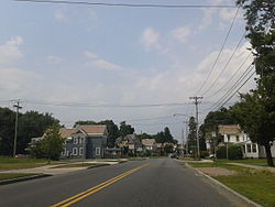
U.S. Route 4 follows the course of the Hudson River along the western side of the town and joins New York Route 197 at Fort Edward village. The Hudson River passes through the northern part of the town.

The site of the actual fort can be found off Old Fort Street, just off Rte. 4 heading south.

Demographics

Historical population
CensusPop.Note
1820 1,631
1830 1,81611.3%
1840 1,726−5.0%
1850 2,32834.9%
1860 3,54452.2%
1870 5,12544.6%
1880 4,680−8.7%
1890 4,424−5.5%
1900 5,21617.9%
1910 5,74010.0%
1920 5,8451.8%
1930 5,841−0.1%
1940 5,716−2.1%
1950 6,2138.7%
1960 6,5235.0%
1970 6,7193.0%
1980 6,479−3.6%
1990 6,330−2.3%
2000 5,888−7.0%
2010 6,3718.2%
2020 5,991−6.0%
U.S. Decennial Census [14] [15]

At the 2000 census, there were 5,892 people, 2,248 households and 1,571 families residing in the town. The population density was 219.9 inhabitants per square mile (84.9/km2). There were 2,487 housing units at an average density of 92.8 per square mile (35.8/km2). The racial makeup of the town was 98.59% White, 0.34% Black or African American, 0.24% Native American, 0.22% Asian, 0.10% from other races, and 0.51% from two or more races. Hispanic or Latino of any race were 0.53% of the population. [2]

There were 2,248 households, of which 32.8% had children under the age of 18 living with them, 50.2% were married couples living together, 14.2% had a female householder with no husband present, and 30.1% were non-families. 24.5% of all households were made up of individuals, and 9.7% had someone living alone who was 65 years of age or older. The average household size was 2.52 and the average family size was 2.95. [2]

Age distribution was 24.4% under the age of 18, 7.6% from 18 to 24, 28.8% from 25 to 44, 22.9% from 45 to 64, and 16.3% who were 65 years of age or older. The median age was 38 years. For every 100 females, there were 93.6 males. For every 100 females age 18 and over, there were 90.7 males. [2]

The median household income was $34,973, and the median family income was $41,630. Males had a median income of $31,875 versus $23,429 for females. The per capita income for the town was $17,201. About 6.5% of families and 9.9% of the population were below the poverty line, including 16.8% of those under age 18 and 3.0% of those age 65 or over. [2]

Rail transportation

Fort Edward - Glens Falls Amtrak station Fort Edward-Glens Falls (Amtrak station) in 2008.jpg
Fort Edward - Glens Falls Amtrak station

Amtrak, the national passenger rail system, provides service to Fort Edward. Its Adirondack route operates daily in both directions between Montreal and New York City. The Ethan Allen Express operates daily in both directions between Burlington, Vermont, and New York City. The Amtrak stop is designated Fort Edward-Glens Falls; it also serves Hudson Falls and Fernwood.

Communities and locations in the town

Street scene in Fort Edward Fort Edward, New York.jpg
Street scene in Fort Edward

Related Research Articles

Harpersfield is a town in Delaware County, New York, United States. The population was 1,442 at the 2020 census. The town is on the northern border of the county.

Kortright is a town in Delaware County, New York, United States. The population was 1,544 at the 2020 census. The town is in the northern part of the county.

Masonville is a town in Delaware County, New York, United States. The population was 1,239 at the 2020 census. The town is in the western part of the county.

<span class="mw-page-title-main">Tompkins, New York</span> Town in Delaware County, New York, US

Tompkins is a town in Delaware County, New York, United States. The population was 1,290 at the 2020 census. The town is named after Daniel D. Tompkins, the fourth governor of New York and sixth vice president of the United States.

<span class="mw-page-title-main">Jewett, New York</span> Town in New York, United States

Jewett is a town centrally located in Greene County, New York, United States. The population was 879 at the 2020 census. The town is named for Freeborn G. Jewett, justice of the New York Supreme Court.

<span class="mw-page-title-main">Prattsville (town), New York</span> Town in New York, United States

Prattsville is a town in Greene County, New York, United States. The town is in the northwestern part of the county. As of the 2020 census, the population was 774.

Wilna is a town in Jefferson County, New York, United States. The population was 5,732 at the 2020 census. The town is on the eastern side of the county and is east of Watertown.

<span class="mw-page-title-main">Petersburgh, New York</span> Town in New York, United States

Petersburgh is a town located in the northeast section of Rensselaer County, New York, United States. The population was 1,372 at the 2020 census. The town was named after an early settler named Peter Simmons.

<span class="mw-page-title-main">Pittstown, New York</span> Town in New York, United States

Pittstown is a town in Rensselaer County, New York, United States. The population was 5,540 at the 2020 census. It is in the northern part of the county.

<span class="mw-page-title-main">Denning, New York</span> Town in New York, United States

Denning is an isolated town in Ulster County, New York, United States. The population was 493 at the 2020 census. The town is named after an early landowner, William Denning. Denning is located in the western part of the county, deep inside the Catskill Mountains. The location of the town in the Catskill State Park accounts in part for its low population.

<span class="mw-page-title-main">Olive, New York</span> Town in New York, United States

Olive is a town in Ulster County, New York, United States. The town is west of Kingston, New York, and is inside the Catskill Park. The population was 4,226 at the 2020 census.

<span class="mw-page-title-main">Johnsburg, New York</span> Town in New York, United States

Johnsburg is a town in the northwestern corner of Warren County, New York, United States. It is part of the Glens Falls Metropolitan Statistical Area. The town population was 2,143 at the 2020 census. The town is named after John Thurman, an early settler and founder. Johnsburg is the largest town in Warren County by area.

<span class="mw-page-title-main">Easton, New York</span> Town in New York, United States

Easton is a town in southwestern Washington County, New York, United States along the county's western boundary. It is part of the Glens Falls Metropolitan Statistical Area. The town population was 2,279 at the 2020 census. The town adopted English as its official language on July 6, 2010.

<span class="mw-page-title-main">Hartford, New York</span> Town in New York, United States

Hartford is a town centrally located in Washington County, New York, United States. It is part of the Glens Falls Metropolitan Statistical Area. The town population was 2,193 at the 2020 census.

<span class="mw-page-title-main">White Creek, New York</span> Town in New York, United States

White Creek is a town in Washington County, New York, United States. It is part of the Glens Falls Metropolitan Statistical Area. The town population was 3,275 at the 2020 census. The town contains the White Creek Historic District, which was listed on the National Register of Historic Places in 1979.

Greenville is a hamlet and census-designated place (CDP) in the town of Greenville, in Greene County, New York, United States. The population of the CDP was 688 at the 2020 census, out of a total 3,741 people in the town as a whole.

Cape Vincent is a town in Jefferson County, New York, United States. The population was 2,765 at the 2020 census.

<span class="mw-page-title-main">Schaghticoke, New York</span> Town in New York, United States

SchaghticokeSKAT-ih-kohk is a town in Rensselaer County, New York, United States. The population was 7,445 at the 2020 census. It was named for the Schaghticoke, a Native American tribe formed in the seventeenth century from an amalgamation of remnant peoples of eastern New York and New England. The tribe has one of the oldest reservations in the United States, located in what is now Litchfield County, Connecticut. It has been recognized by the state of Connecticut but has not yet achieved federal recognition.

<span class="mw-page-title-main">Salem, New York</span> Town in New York, United States

Salem is a town in eastern Washington County, New York, United States. It is part of the Glens Falls Metropolitan Statistical Area. The town population was 2,612 at the 2020 census. The town of Salem contains a hamlet also named Salem, formerly an incorporated village.

<span class="mw-page-title-main">Greenwich (town), New York</span> Town in New York, United States

Greenwich is a town in the southwestern part of Washington County, New York, United States. The town is located on the western border of the county. The population was 4,868 at the 2020 census. It is part of the Glens Falls Metropolitan Statistical Area. Greenwich features several homes that were a part of the Underground Railroad.

References

  1. "2016 U.S. Gazetteer Files". United States Census Bureau. Retrieved July 5, 2017.
  2. 1 2 3 4 5 6 "U.S. Census website". United States Census Bureau . Retrieved January 31, 2008.
  3. US Census 2020 Report, Fort Edward town, Washington County, New York https://www.census.gov/search-results.html?searchType=web&cssp=SERP&q=Fort%20Edward%20town,%20Washington%20County,%20New%20York
  4. "About Fort Edward". Archived from the original on November 15, 2009. Retrieved July 7, 2009. The Town is also home to the Washington County Office Building housing nearly all the county offices and support groups.
  5. "Board of Supervisors". Washington County. Archived from the original on June 30, 2009. Retrieved July 13, 2009. 383 Broadway
  6. US Census 2020 Report, Fort Edward town, Washington County, New York https://www.census.gov/search-results.html?searchType=web&cssp=SERP&q=Fort%20Edward%20town,%20Washington%20County,%20New%20York
  7. Google Maps (383 Broadway, Fort Edward, New York), Retrieved January 14, 2015.
  8. New York State Unified Court System (Washington County), Retrieved January 14, 2015.
  9. Town of Kingsbury, New York, Retrieved January 14, 2015.
  10. "Metropolitan Areas and Components, 1999, with FIPS Codes". US Census Bureau. Retrieved July 7, 2009.
  11. "Williams, Ephraim, Jr".
  12. Gannett, Henry (1905). The Origin of Certain Place Names in the United States. Govt. Print. Off. pp.  129.
  13. "National Register Information System". National Register of Historic Places . National Park Service. March 13, 2009.
  14. "Census of Population and Housing". Census.gov. Retrieved June 4, 2015.
  15. US Census 2020 Report, Fort Edward town, Washington County, New York https://www.census.gov/search-results.html?searchType=web&cssp=SERP&q=Fort%20Edward%20town,%20Washington%20County,%20New%20York