Related Research Articles

The Warrego Highway is located in southern Queensland, Australia. It connects coastal centres to the south western areas of the state, and is approximately 715 km in length. It takes its name from the Warrego River, which is the endpoint of the highway. The entire highway is part of the National Highway system linking Darwin and Brisbane: formerly National Highway 54, Queensland began to convert to the alphanumeric system much of Australia had adopted in the early-2000s and this road is now designated as National Highway A2.

Yarraman is a rural town and locality in the Toowoomba Region, Queensland, Australia. In the 2021 census, the locality of Yarraman had a population of 1,127 people.

Meringandan is a rural locality in the Toowoomba Region, Queensland, Australia. In the 2016 census, Meringandan had a population of 487 people.

The Shire of Rosalie was a local government area in the Darling Downs region of Queensland, Australia, immediately northwest of the regional city of Toowoomba. The shire, administered from the town of Goombungee, covered an area of 2,200.7 square kilometres (849.7 sq mi), and existed as a local government entity from 1879 until 2008. In 2008, it amalgamated with several other councils in the Toowoomba area to form the Toowoomba Region.
Gowrie Junction is a rural locality in the Toowoomba Region, Queensland, Australia. It is north-west of Toowoomba. In the 2021 census, Gowrie Junction had a population of 2,030 people. The town of Gowrie is in the eastern part of the locality.
Peranga is a rural town and locality in the Toowoomba Region, Queensland, Australia. In the 2016 census the locality of Peranga had a population of 85 people.
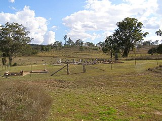
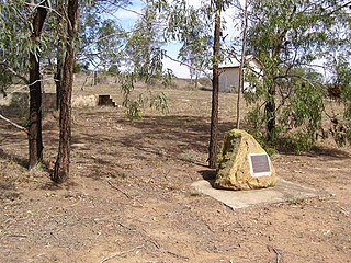
The Cooyar railway line was a branch line in the Darling Downs region of Queensland, Australia. The small town of Cooyar is about halfway to Kingaroy in the South Burnett Region. A plan to connect Kingaroy to the south via Cooyar did not eventuate and left Cooyar at the terminus of a branch line running from Oakey west of Toowoomba. It was opened on 28 April 1913 after previous stages to Kulpi and Peranga opened on 29 April 1912 and 4 November 1912 respectively. The line was partially closed beyond Acland on 1 May 1964, with the last segment closed on 8 December 1969.

Kingsthorpe is a rural town and locality in the Toowoomba Region, Queensland, Australia. In the 2021 census, the locality of Kingsthorpe had a population of 2,159 people.
The Maryvale railway line was a branch railway in the Southern Downs region of Queensland, Australia.

Goombungee is a rural town and locality in the Toowoomba Region, Queensland, Australia. In the 2016 census the locality of Goombungee had a population of 1,026 people.
Haden is a rural town and locality in the Toowoomba Region, Queensland, Australia. In the 2016 census, the locality of Haden had a population of 195 people.

The Western railway line is a narrow gauge railway, connecting the south-east and south-west regions of Queensland, Australia. It commences at Toowoomba, at the end of the Main Line railway from Brisbane, and extends west 810 km to Cunnamulla, passing through the major towns of Dalby, Roma and Charleville, although services on the 184 km section from Westgate to Cunnamulla have been suspended since 2011. The Queensland Government was the first railway operator in the world to adopt narrow gauge for a main line, and this remains the system-wide gauge.

Boodua is a rural locality in the Toowoomba Region, Queensland, Australia. In the 2016 census Boodua had a population of 93 people.
Bergen is a rural locality in the Toowoomba Region, Queensland, Australia. In the 2016 census, Bergen had a population of 68 people.
Douglas is a rural locality in the Toowoomba Region, Queensland, Australia. In the 2016 census, Douglas had a population of 112 people.
Cutella is a rural locality in the Toowoomba Region, Queensland, Australia. In the 2021 census, Cutella had a population of 45 people.
Kings Siding is a rural locality in the Toowoomba Region, Queensland, Australia. In the 2021 census, Kings Siding had a population of 15 people.
Doctor Creek is a rural locality in the Toowoomba Region, Queensland, Australia. In the 2016 census, Doctor Creek had a population of 37 people.
Oakey–Cooyar Road is a continuous 58.8 kilometres (36.5 mi) road route in the Darling Downs and Toowoomba regions of Queensland, Australia. The entire route is signed as State Route 68. It is a state-controlled part regional and part district road. It provides an alternate route between the Warrego Highway and the New England Highway, bypassing Toowoomba.
The roads that join the towns of Dalby, Toowoomba and Cooyar form a triangle that encloses some of the most fertile land on the Darling Downs in Queensland, Australia. These roads are the Warrego Highway, New England Highway and Dalby–Cooyar Road. Pechey–Maclagan Road forms a large part of a group of roads that bisect the triangle from east to west, and is also part of one of the groups of roads that bisect from south to north.
References
- 1 2 "NEW RAILWAYS.: Drayton Deviation". The Telegraph . No. 11869. Queensland, Australia. 1 December 1910. p. 8 (SECOND EDITION). Retrieved 30 March 2017– via National Library of Australia.
- ↑ "OFFICIAL NOTIFICATIONS". The Telegraph . No. 11, 697. Queensland, Australia. 14 May 1910. p. 2 (SECOND EDITION). Retrieved 2 September 2023– via National Library of Australia.
- ↑ "Haden – population centre in Toowoomba Region (entry 15176)". Queensland Place Names. Queensland Government . Retrieved 2 September 2023.
- ↑ Kerr, J. 'Triumph of Narrow Gauge' Boolarong Press 1990
- ↑ "GOOMBUNGEE LINE". The Telegraph . No. 11890. Queensland, Australia. 26 December 1910. p. 2. Retrieved 2 September 2023– via National Library of Australia.
- ↑ "Goombungee Line". The Telegraph . No. 11, 905. Queensland, Australia. 12 January 1911. p. 6. Retrieved 2 September 2023– via National Library of Australia.
- ↑ "GOOMBUNGEE LINE". The Telegraph . No. 11906. Queensland, Australia. 13 January 1911. p. 9. Retrieved 2 September 2023– via National Library of Australia.