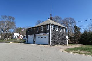
Monument Beach is a census-designated place (CDP) in the town of Bourne in Barnstable County, Massachusetts, United States. The population was 2,790 at the 2010 census.
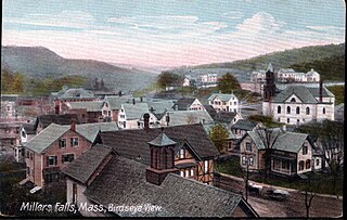
Millers Falls is a census-designated place (CDP) in the towns of Montague and Erving in Franklin County, Massachusetts, United States. The population was 1,139 at the 2010 census. It is part of the Springfield, Massachusetts metropolitan statistical area.
Monson Center is a census-designated place (CDP) in the town of Monson in Hampden County, Massachusetts, United States. The population was 2,107 at the 2010 census, out of a total 8,560 people in the town. It is part of the Springfield, Massachusetts Metropolitan Statistical Area.

Amherst Center is a census-designated place (CDP) in the City of Amherst in Hampshire County, Massachusetts, United States. The CDP covers the primary village in town. The population was 19,065 at the 2010 census, out of a total city population of 37,819. It is part of the Springfield, Massachusetts Metropolitan Statistical Area.

South Amherst is a census-designated place (CDP) in the town of Amherst in Hampshire County, Massachusetts, United States. The population was 4,994 at the 2010 census. The CDP includes the village of South Amherst and residential subdivisions south of the Amherst town center.

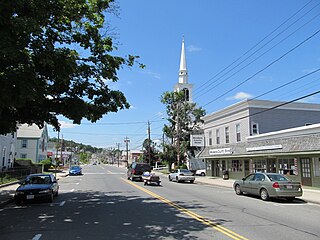
East Pepperell is a village and census-designated place (CDP) in the town of Pepperell in Middlesex County, Massachusetts, United States. The population was 2,120 at the 2020 census.

North Pembroke is a census-designated place (CDP) in the town of Pembroke in Plymouth County, Massachusetts, United States. The population was 3,292 at the 2010 census.

Baldwinville is an unincorporated village and census-designated place (CDP) in the town of Templeton in Worcester County, Massachusetts, United States. The population was 2,028 at the 2010 census. The name also refers to the local post office or railroad station.
Guilford is a census-designated place (CDP) in Franklin County, Pennsylvania, United States. The population was 2,923 at the 2020 census.

Holland is a census-designated place (CDP) in the town of Holland in Hampden County, Massachusetts, United States, comprising the town center and other populated areas in the eastern part of the town. The population was 1,464 at the 2010 census, out of a total 2,481 people in the town. It is part of the Springfield, Massachusetts Metropolitan Statistical Area.
Belchertown is a census-designated place (CDP) comprising the central village in the town of Belchertown in Hampshire County, Massachusetts, United States. The population was 2,899 at the 2010 census, out of a total town population of 14,649. It is part of the Springfield, Massachusetts Metropolitan Statistical Area.

Granby is a census-designated place (CDP) comprising the main village in the town of Granby in Hampshire County, Massachusetts, United States. The population of the CDP was 1,368 at the 2010 census, out of a total town population of 6,240. It is part of the Springfield, Massachusetts Metropolitan Statistical Area.

Ware is a census-designated place (CDP) comprising the main village in the town of Ware in Hampshire County, Massachusetts, United States. The population of the CDP was 6,170 at the 2010 census, out of a total town population of 9,872. It is part of the Springfield, Massachusetts Metropolitan Statistical Area.

Ayer is a census-designated place (CDP) and the primary settlement in the town of Ayer in Middlesex County, Massachusetts, United States. The population of the CDP was 2,986 at the 2020 census, out of 8,479 in the entire town.

Athol is a census-designated place (CDP) in the town of Athol in Worcester County, Massachusetts, United States. The population was 8,265 at the 2010 census.

Warren is a census-designated place (CDP) in the town of Warren in Worcester County, Massachusetts, United States. The population was 1,405 at the 2010 census.

Winchendon is a census-designated place (CDP) in the town of Winchendon in Worcester County, Massachusetts, United States. The population was 4,160 at the 2020 census.

Groton is a census-designated place (CDP) comprising the main village in the town of Groton in Middlesex County, Massachusetts, United States. The population of the CDP was 1,353 at the 2020 census, out of 11,315 in the entire town of Groton.

Pepperell is a census-designated place (CDP) comprising the main village in the town of Pepperell in Middlesex County, Massachusetts, United States. The population was 2,390 at the 2020 census, out of 11,604 in the entire town of Pepperell.

Townsend is a census-designated place (CDP) comprising the main village in the town of Townsend in Middlesex County, Massachusetts, United States. The population was 1,213 at the 2020 census, out of 9,127 in the entire town.


