Huntington (CDP), Massachusetts

Last updated
Huntington, Massachusetts
Hampshire County Massachusetts incorporated and unincorporated areas Huntington (CDP) highlighted.svg
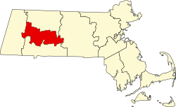
Location in Hampshire County in Massachusetts
Coordinates: 42°14′0″N72°52′46″W / 42.23333°N 72.87944°W / 42.23333; -72.87944 Coordinates: 42°14′0″N72°52′46″W / 42.23333°N 72.87944°W / 42.23333; -72.87944
Country United States
State Massachusetts
County Hampshire
Town Huntington
Area
[1]
  Total4.74 sq mi (12.28 km2)
  Land4.63 sq mi (11.99 km2)
  Water0.11 sq mi (0.29 km2)
Elevation
377 ft (115 m)
Population
 (2020)
  Total857
  Density185.14/sq mi (71.48/km2)
Time zone UTC-5 (Eastern (EST))
  Summer (DST) UTC-4 (EDT)
ZIP code
01050
Area code(s) 413
FIPS code 25-31750
GNIS feature ID0608324

Huntington is a census-designated place (CDP) comprising the main village in the town of Huntington in Hampshire County, Massachusetts, United States. The population of the CDP was 936 at the 2010 census, [2] out of a total town population of 2,180. It is part of the Springfield, Massachusetts Metropolitan Statistical Area.

Contents

Geography

The Huntington CDP is located in the southwest corner of the town of Huntington. It is bordered to the northwest by the town of Chester, to the southwest by the town of Blandford, to the southeast by the towns of Russell and Montgomery, and to the northeast by the remainder of the town of Huntington. Montgomery Road, the Westfield River, and the Middle Branch of the Westfield former the boundary between the CDP and the rest of the town. [3]

The village of Huntington is in the center of the CDP, at the juncture of the Westfield River with its West Branch. U.S. Route 20 passes through the village, leading southeast down the Westfield River valley 11 miles (18 km) to the city of Westfield, and northwest up the valley of the West Branch 7 miles (11 km) to Chester and eventually 23 miles (37 km) to Lee. Massachusetts Route 112 leads north from Huntington up the Westfield River valley 22 miles (35 km) to Cummington.

The village of Norwich Bridge is in the northern part of the CDP, where Route 112 crosses the Westfield River.

According to the United States Census Bureau, the Huntington CDP has a total area of 4.7 square miles (12.2 km2), of which 4.6 square miles (12.0 km2) are land and 0.1 square miles (0.2 km2), or 2.22%, are water. [2]

Demographics

Historical population
CensusPop.
2020 857
U.S. Decennial Census [4]

Related Research Articles

Hampden County, Massachusetts County in Massachusetts, United States

Hampden County is a non-governmental county located in the Pioneer Valley of the state of Massachusetts, in the United States. As of the 2020 census, Hampden County's population was 465,825. Its traditional county seat is Springfield, the Connecticut River Valley's largest city, and economic and cultural capital; with an estimated population of 154,758, approximately 1 in 3 residents of Hampden County live in Springfield. Hampden County was split from Hampshire County in 1812, because Northampton, Massachusetts, was made Hampshire County's "shire town" in 1794; however, Springfield—theretofore Hampshire County's traditional shire town, dating back to its founding in 1636—grew at a pace far quicker than Northampton and was granted shire town-status over its own, southerly jurisdiction. It was named for parliamentarian John Hampden. To the north of Hampden County is modern-day Hampshire County; to the west is Berkshire County; to the east is Worcester County; to the south are Litchfield County, Hartford County, and Tolland County in Connecticut. Hampden County is part of the Springfield, MA Metropolitan Statistical Area. It is the most urban county in Western Massachusetts. The Knowledge Corridor surrounding Springfield-Hartford is New England's second most populous urban area with 1.9 million people.

Chester, Massachusetts Town in Massachusetts, United States

Chester is a town in Hampden County, Massachusetts, United States, situated in Western Massachusetts. It is part of the Springfield metropolitan statistical area. The town includes the Chester Factory Village Historic District. The total population was 1,228 in the 2020 census.

Montgomery, Massachusetts Town in Massachusetts, United States

Montgomery is a town in Hampden County, Massachusetts, United States. The population was 819 at the 2020 census. It is part of the Springfield, Massachusetts Metropolitan Statistical Area.

Russell, Massachusetts Town in Massachusetts, United States

Russell is a town in Hampden County, Massachusetts, United States. The population was 1,643 at the 2020 census. It is part of the Springfield, Massachusetts Metropolitan Statistical Area.

Huntington, Massachusetts Town in Massachusetts, United States

Huntington is a town in Hampshire County, Massachusetts, United States. The population was 2,094 at the 2020 census. It is part of the Springfield, Massachusetts Metropolitan Statistical Area.

Worthington, Massachusetts Town in Massachusetts, United States

Worthington is a town in Hampshire County, Massachusetts, United States. The population was 1,193 at the 2020 census, up from 1,156 at the 2010 census. It is part of the Springfield, Massachusetts Metropolitan Statistical Area.

Chesterland, Ohio Census-designated place in Ohio, United States

Chesterland is a census-designated place (CDP) in Geauga County, Ohio, United States. As of the 2010 census, the CDP had a population of 2,521.

Ware (CDP), Massachusetts Census-designated place in Massachusetts, United States

Ware is a census-designated place (CDP) comprising the main village in the town of Ware in Hampshire County, Massachusetts, United States. The population of the CDP was 6,170 at the 2010 census, out of a total town population of 9,872. It is part of the Springfield, Massachusetts Metropolitan Statistical Area.

Derry is a census-designated place (CDP) in the town of Derry in Rockingham County, New Hampshire, United States. The CDP comprises the urban center of the town, as well as the village of East Derry and connected suburban areas. The population of the CDP was 22,879 at the 2020 census, out of 34,317 in the entire town.

Trexlertown, Pennsylvania Census-designated place in Pennsylvania, United States

Trexlertown is an unincorporated community and census-designated place (CDP) in Upper Macungie Township, Lehigh County, Pennsylvania, United States. It is part of the Lehigh Valley metropolitan area of the United States.

New Tripoli, Pennsylvania Census-designated place in Pennsylvania, United States

New Tripoli is an unincorporated community and census-designated place (CDP) in Lynn Township, Lehigh County, Pennsylvania, in the United States. As of the 2010 census the population was 898.

Ilchester, Maryland Census-designated place in Maryland

Ilchester is an unincorporated community and census-designated place in Howard County, Maryland, United States. The population was 23,476 at the 2010 census. It was named after the village of Ilchester in the English county of Somerset.

New Hartford Center, Connecticut Census-designated place in Connecticut, United States

New Hartford Center is a census-designated place (CDP) in Litchfield County, Connecticut, United States. It comprises the village of New Hartford, the adjacent Pine Meadow Historic District, and some surrounding forest land, all within the town of New Hartford. As of the 2010 census, the population of New Hartford Center was 1,385, out of 6,970 in the entire town of New Hartford.

Salmon Brook is the name of a census-designated place (CDP) corresponding to the village of Granby, the primary settlement of the town of Granby, Connecticut, in Hartford County. The population of the CDP was 2,324 as of the 2010 census.

Lowell is the primary village and a census-designated place (CDP) in the town of Lowell, Orleans County, Vermont, United States. As of the 2020 census, it had a population of 254, out of 887 in the entire town of Lowell.

Chester (CDP), Massachusetts Census-designated place in Massachusetts, United States

Chester is a census-designated place that comprises the populated center of the town of Chester in Hampden County, Massachusetts, United States. The population of the CDP was 627 at the 2010 census, out of 1,337 in the entire town of Chester. It is part of the Springfield, Massachusetts Metropolitan Statistical Area.

Russell (CDP), Massachusetts Census-designated place in Massachusetts, United States

Russell is a census-designated place that comprises the populated center of the town of Russell in Hampden County, Massachusetts, United States. The population of the CDP was 786 at the 2010 census, out of 1,775 in the entire town of Russell. It is part of the Springfield, Massachusetts Metropolitan Statistical Area.

Sharon (CDP), Connecticut Census-designated place in Connecticut, United States

Sharon is a census-designated place (CDP) in Litchfield County, Connecticut, United States. It is the primary village within the town of Sharon. As of the 2010 census, the population of the CDP was 729, out of 2,782 in the entire town.

Francestown (CDP), New Hampshire Census-designated place in New Hampshire, United States

Francestown is a census-designated place (CDP) and the main village in the town of Francestown, Hillsborough County, New Hampshire, United States. As of the 2020 census, the population of the CDP was 201, out of 1,610 in the entire town.

Grafton is the central village and a census-designated place (CDP) in the town of Grafton, Windham County, Vermont, United States. As of the 2020 census, it had a population of 49, compared to 645 in the entire town.

References

  1. "2020 U.S. Gazetteer Files". United States Census Bureau. Retrieved May 21, 2022.
  2. 1 2 "Geographic Identifiers: 2010 Census Summary File 1 (G001): Huntington CDP, Massachusetts". American Factfinder. U.S. Census Bureau. Archived from the original on February 13, 2020. Retrieved August 10, 2017.
  3. "TIGERweb: Hatfield CDP, Massachusetts". Geography Division, U.S. Census Bureau. Retrieved August 10, 2017.
  4. "Census of Population and Housing". Census.gov. Retrieved June 4, 2016.