South Amherst, Massachusetts

Last updated

South Amherst, Massachusetts
South Amherst Common, South Amherst MA.jpg
South Amherst Common
USA Massachusetts location map.svg
Red pog.svg
South Amherst
Usa edcp location map.svg
Red pog.svg
South Amherst
Coordinates: 42°20′23″N72°31′21″W / 42.33972°N 72.52250°W / 42.33972; -72.52250
Country United States
State Massachusetts
County Hampshire
Town Amherst
Area
  Total4.25 sq mi (11.00 km2)
  Land4.22 sq mi (10.94 km2)
  Water0.02 sq mi (0.06 km2)
Elevation
230 ft (70 m)
Population
 (2010)
  Total4,994
  Density1,182/sq mi (456.5/km2)
Time zone UTC-5 (Eastern (EST))
  Summer (DST) UTC-4 (EDT)
ZIP code
01002
Area code 413
FIPS code 25-62675
GNIS feature ID0609086

South Amherst is a census-designated place (CDP) in the town of Amherst in Hampshire County, Massachusetts, United States. The population was 4,994 at the 2010 census. [1] The CDP includes the village of South Amherst and residential subdivisions south of the Amherst town center.

Contents

South Amherst is part of the Springfield, Massachusetts Metropolitan Statistical Area.

Geography

South Amherst is located in the southwest part of the town of Amherst at 42°20′23″N72°31′21″W / 42.33972°N 72.52250°W / 42.33972; -72.52250 (42.339586, -72.522426). [2] It is bordered to the north by Amherst Center and to the west by the Hadley town line. The CDP extends south to Bay Road. [3]

According to the United States Census Bureau, the CDP has a total area of 4.2 square miles (11.0 km2), of which 0.02 square miles (0.06 km2), or 0.58%, are water. [1]

The original village of South Amherst is near the eastern edge of the CDP, at the junction of Shays Street, South East Street, and Station Road. The village has a town common area between South East and Middle streets, known as the South Amherst Common or Fiddlers Green, [4] which, together with several of the surrounding houses, constitutes the South Amherst Common Historic District.

Demographics

At the 2000 census, [5] there were 5,039 people, 1,500 households and 870 families residing in the CDP. The population density was 458.9/km2 (1,187.2/mi2). There were 1,530 housing units at an average density of 139.3/km2 (360.5/mi2). The racial makeup of the CDP was 71.66% White, 7.01% African American, 0.22% Native American, 10.82% Asian, 0.12% Pacific Islander, 5.40% from other races, and 4.78% from two or more races. Hispanic or Latino were 9.82% of the population.

There were 1,500 households, of which 34.5% had children under the age of 18 living with them, 37.5% were married couples living together, 17.0% had a female householder with no husband present, and 42.0% were non-families. 18.3% of all households were made up of individuals, and 4.3% had someone living alone who was 65 years of age or older. The average household size was 2.68 and the average family size was 3.12.

19.8% of the population were under the age of 18, 37.4% from 18 to 24, 21.6% from 25 to 44, 15.4% from 45 to 64, and 5.7% who were 65 years of age or older. The median age was 23 years. For every 100 females, there were 90.8 males. For every 100 females age 18 and over, there were 88.1 males.

The median household income was $44,628 and the median family income was $58,438. Males had a median income of $43,793 compared with $35,288 for females. The per capita income for the CDP was $17,191. About 8.3% of families and 17.4% of the population were below the poverty line, including 3.1% of those under age 18 and none of those age 65 or over.

Related Research Articles

<span class="mw-page-title-main">Homewood Canyon-Valley Wells, California</span> Unincorporated community in California, United States

Homewood Canyon-Valley Wells is a former census-designated place (CDP) in Inyo County, California, United States. The population was 75 at the 2000 census.

<span class="mw-page-title-main">Monument Beach, Massachusetts</span> Census-designated place in Massachusetts, United States

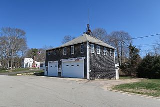
Monument Beach is a census-designated place (CDP) in the town of Bourne in Barnstable County, Massachusetts, United States. The population was 2,790 at the 2010 census.

<span class="mw-page-title-main">Millers Falls, Massachusetts</span> Census-designated place in Massachusetts, United States

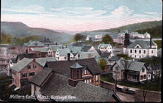
Millers Falls is a census-designated place (CDP) in the towns of Montague and Erving in Franklin County, Massachusetts, United States. The population was 1,139 at the 2010 census. It is part of the Springfield, Massachusetts metropolitan statistical area.

<span class="mw-page-title-main">Monson Center, Massachusetts</span> Census-designated place in Massachusetts, United States

Monson Center is a census-designated place (CDP) in the town of Monson in Hampden County, Massachusetts, United States. The population was 2,107 at the 2010 census, out of a total 8,560 people in the town. It is part of the Springfield, Massachusetts Metropolitan Statistical Area.

<span class="mw-page-title-main">Amherst Center, Massachusetts</span> Census-designated place in Massachusetts, United States

Amherst Center is a census-designated place (CDP) in the town of Amherst in Hampshire County, Massachusetts, United States. The CDP covers the primary village in town. The population was 19,065 at the 2010 census, out of a total town population of 37,819. It is part of the Springfield, Massachusetts Metropolitan Statistical Area.

<span class="mw-page-title-main">North Amherst, Massachusetts</span> Census-designated place in Massachusetts, United States

North Amherst is a census-designated place (CDP) in the city of Amherst in Hampshire County, Massachusetts, United States. The population was 6,819 at the 2010 census, up from 6,019 at the 2000 census. It is part of the Springfield, Massachusetts Metropolitan Statistical Area.

<span class="mw-page-title-main">Baldwinville, Massachusetts</span> CDP in Massachusetts, United States

Baldwinville is an unincorporated village and census-designated place (CDP) in the town of Templeton in Worcester County, Massachusetts, United States. The population was 2,028 at the 2010 census. The name also refers to the local post office or railroad station.

<span class="mw-page-title-main">Fiskdale, Massachusetts</span> CDP in Sturbridge, Massachusetts, United States

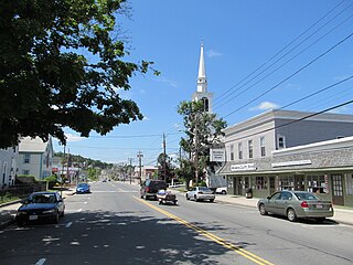
Fiskdale is a census-designated place (CDP) in the town of Sturbridge in Worcester County, Massachusetts, United States. The population was 2,583 at the 2010 census.

<span class="mw-page-title-main">Centerville, South Carolina</span> CDP in South Carolina, United States

Centerville is a census-designated place (CDP) in Anderson County, South Carolina. The population was 7,185 at the 2020 census.

Hollins is a census-designated place (CDP) in Botetourt and Roanoke counties in the U.S. state of Virginia. Hollins covers much of the area known locally as "North County". The population was 15,574 at the 2020 census. It is part of the Roanoke Metropolitan Statistical Area. The area is also the home of Hollins University in addition to four properties listed on the National Register of Historic Places: the Black Horse Tavern-Bellvue Hotel and Office, Harshbarger House, the Hollins College Quadrangle, and Old Tombstone.

<span class="mw-page-title-main">Adams (CDP), Massachusetts</span> Census-designated place in Massachusetts, United States

Adams is a census-designated place (CDP) located in the town of Adams in Berkshire County, Massachusetts, United States. The population was 5,515 at the 2010 census, out of 8,485 in the entire town of Adams.

<span class="mw-page-title-main">Orange (CDP), Massachusetts</span> Census-designated place in Massachusetts, United States

Orange is a census-designated place (CDP) in the town of Orange in Franklin County, Massachusetts, United States. The population was 4,018 at the 2010 census. It is part of the Springfield, Massachusetts Metropolitan Statistical Area.

<span class="mw-page-title-main">Belchertown (CDP), Massachusetts</span> Census-designated place in Massachusetts, United States

Belchertown is a census-designated place (CDP) comprising the central village in the town of Belchertown in Hampshire County, Massachusetts, United States. The population was 2,899 at the 2010 census, out of a total town population of 14,649. It is part of the Springfield, Massachusetts Metropolitan Statistical Area.

<span class="mw-page-title-main">Granby (CDP), Massachusetts</span> Census-designated place in Massachusetts, United States

Granby is a census-designated place (CDP) comprising the main village in the town of Granby in Hampshire County, Massachusetts, United States. The population of the CDP was 1,368 at the 2010 census, out of a total town population of 6,240. It is part of the Springfield, Massachusetts Metropolitan Statistical Area.

<span class="mw-page-title-main">Ware (CDP), Massachusetts</span> Census-designated place in Massachusetts, United States

Ware is a census-designated place (CDP) comprising the main village in the town of Ware in Hampshire County, Massachusetts, United States. The population of the CDP was 6,170 at the 2010 census, out of a total town population of 9,872. It is part of the Springfield, Massachusetts Metropolitan Statistical Area.

<span class="mw-page-title-main">Ayer (CDP), Massachusetts</span> Census-designated place in Massachusetts, United States

Ayer is a census-designated place (CDP) and the primary settlement in the town of Ayer in Middlesex County, Massachusetts, United States. The population of the CDP was 2,986 at the 2020 census, out of 8,479 in the entire town.

<span class="mw-page-title-main">East Brookfield (CDP), Massachusetts</span> CDP in Massachusetts, United States

East Brookfield is a census-designated place (CDP) in the town of East Brookfield in Worcester County, Massachusetts, United States. The population was 1,323 at the 2010 census.

<span class="mw-page-title-main">Hudson (CDP), Massachusetts</span> Census-designated place in Massachusetts, United States

Hudson is a census-designated place (CDP) comprising the densely developed central part of the town of Hudson in Middlesex County, Massachusetts, United States. The population of the CDP was 15,749 at the 2020 census, out of 20,092 in the entire town.

<span class="mw-page-title-main">Pepperell (CDP), Massachusetts</span> Census-designated place in Massachusetts, United States

Pepperell is a census-designated place (CDP) comprising the main village in the town of Pepperell in Middlesex County, Massachusetts, United States. The population was 2,390 at the 2020 census, out of 11,604 in the entire town of Pepperell.

<span class="mw-page-title-main">Townsend (CDP), Massachusetts</span> Census-designated place in Massachusetts, United States

Townsend is a census-designated place (CDP) comprising the main village in the town of Townsend in Middlesex County, Massachusetts, United States. The population was 1,213 at the 2020 census, out of 9,127 in the entire town.

References

  1. 1 2 "Geographic Identifiers: 2010 Census Summary File 1 (G001): South Amherst CDP, Massachusetts". American Factfinder. U.S. Census Bureau. Archived from the original on February 13, 2020. Retrieved August 10, 2017.
  2. "US Gazetteer files: 2010, 2000, and 1990". United States Census Bureau. February 12, 2011. Retrieved April 23, 2011.
  3. "TIGERweb: South Amherst CDP, Massachusetts". Geography Division, U.S. Census Bureau. Retrieved August 10, 2017.
  4. Scott Merzbach "Independence Day Celebrations to Light the Sky Across the Pioneer Valley", Hampshire Gazette, June 30, 2017.
  5. "U.S. Census website". United States Census Bureau . Retrieved January 31, 2008.