Hurricane Gabrielle (2001)

Last updated

Map key
  Tropical depression (≤38 mph, ≤62 km/h)
  Tropical storm (39–73 mph, 63–118 km/h)
  Category 1 (74–95 mph, 119–153 km/h)
  Category 2 (96–110 mph, 154–177 km/h)
  Category 3 (111–129 mph, 178–208 km/h)
  Category 4 (130–156 mph, 209–251 km/h)
  Category 5 (≥157 mph, ≥252 km/h)
  Unknown
Storm type
Disc Plain black.svg Tropical cyclone
Solid black.svg Subtropical cyclone
ArrowUp.svg Extratropical cyclone, remnant low, tropical disturbance, or monsoon depression

On September 5, a weak low- to mid-level trough was nearly stationary a short distance off the southeastern coastline of the United States. It remained stationary for several days, before developing a low-level circulation over Florida by September 9. The system moved into the Gulf of Mexico, [1] and by September 11, the low and its associated convection were well-organized enough for the National Hurricane Center (NHC) to classify it as Tropical Depression Eight. [2] By that time, the system was located about 170 mi (270 km) west-northwest of Key West, Florida. [1] Located in an environment of weak steering currents, the depression drifted to the west-southwest after forming. Northerly wind shear and the presence of a nearby upper-level low initially prevented further organization, [2] leaving the center of the depression poorlydefined with minimal convection. [3] The depression gradually became better organized while it slowly executed a small counter-clockwise loop. [1] Early on September 12, the system developed increased banding features over the eastern half of its circulation. [4] By early on September 13, the upper level outflow over the depression became much more conducive for intensification, although the circulation remained broad and weak. [5] Shortly thereafter, deep convection developed and persisted near the center, [6] and at 1200  UTC on September 13, the depression intensified into Tropical Storm Gabrielle while located about 200 miles (320 km) southwest of Venice, Florida. [1]

Under the influence of a mid-level trough, Gabrielle accelerated northeastward and quickly intensified, despite increasing amounts of westerly wind shear. [1] Its center reformed several times under the deep convection, and on September 14 Gabrielle made landfall near Venice with winds of 70 mph (110 km/h). At the time, Hurricane Hunters reported gusts to hurricane force, [7] [8] and the National Hurricane Center indicated the possibility that Gabrielle made landfall as a hurricane. [1] Land interaction and vertical wind shear quickly weakened Gabrielle over land; its convection decreased markedly with the strongest remaining convection remaining well to the northeast of the center. [9] The storm reached the Atlantic Ocean with winds of 45 mph (72 km/h) about 18 hours after it made landfall; [1] by that time, one forecaster at the National Hurricane Center remarked that the storm resembled an occluded frontal low, with a large circulation devoid of convection in a non-symmetric wind field. [10] Another forecaster likened the storm to a subtropical cyclone, due to dry air continuing to limit organization. [11]

Tropical Storm Gabrielle over Florida on September 14 TS Gabrielle 14 sept 2001 1832Z.jpg
Tropical Storm Gabrielle over Florida on September 14

On September 15, convection gradually developed closer to the center, though operationally forecasters were unsure whether the convection was in association with Gabrielle or to a cold front to its west. [12] A Hurricane Hunters flight into the system reported the center of Gabrielle became elongated, resembling a trough, and one forecaster considered the storm on the verge of becoming an extratropical cyclone. [13] Shortly thereafter, convection increased near the center as the storm became stronger and better organized. [14] Despite strong amounts of wind shear, Gabrielle intensified to attain hurricane status early on September 17 while located about 350 mi (560 km) to the west of Bermuda. Continuing northeastward, the hurricane strengthened slightly further to reach peak winds of 80 mph (130 km/h) about 230 miles (370 km) northwest of Bermuda. [1] Shortly thereafter, a banding eye briefly developed in the center of the convection. [15] Increased wind shear eventually diminished the convection, and Gabrielle weakened to tropical storm status September 18. [16] By early on September 19, wind shear dissipated nearly all of the associated deep convection, and Gabrielle transitioned into an extratropical cyclone about 350 miles (560 km) south of Newfoundland. The extratropical remnant continued to the northeast, passing a short distance southeast of Newfoundland before restrengthening to reach winds of 75 mph (121 km/h). The storm weakened, and on September 21 the extratropical remnant of Gabrielle merged with another extratropical storm over the far northern Atlantic Ocean. [1]

Preparations

Shortly after Gabrielle became a tropical storm, the National Hurricane Center issued a tropical storm warning from Craig Key through the Dry Tortugas in the Florida Keys and along the Florida west coast from Flamingo to the mouth of the Suwannee River. Additionally, a hurricane watch was issued from Chokoloskee to Tarpon Springs. On September 14, a tropical storm warning was issued for Lake Okeechobee and the Florida east coast from Jupiter to Saint Augustine. [1] Due to the storm, schools in six counties along the west coast were closed. All aircraft from MacDill Air Force Base were evacuated to Kansas as a precaution. [17] Gabrielle struck Florida three days after the September 11 attacks, after which all flights nationwide were canceled for two days. Flights resumed the day Gabrielle moved ashore, with the exception of Sarasota-Bradenton International Airport which closed due to the inclement weather. [18] In the Tampa area, two major bridges closed due to the storm. Disney World closed three water parks and several rides. [19]

The government of Bermuda issued a gale warning for the island before changing it to a tropical storm warning on September 16. [20]

The Newfoundland Weather Center issued severe weather warnings for portions of Atlantic Canada prior to the arrival of the extratropical remnant of Gabrielle. [21] Rough sea warnings were issued for waters off of the Avalon Peninsula of eastern Newfoundland, and fishermen were recommended to remain away from the sea. [22]

Impact

United States

Daytona Beach during Gabrielle Daytona Beach Hurricane Gabrielle.jpg
Daytona Beach during Gabrielle

While the storm was moving east across the Gulf of Mexico, Gabrielle produced rip currents along the coast of Alabama, killing one man in Orange Beach. High surf along the Florida Panhandle destroyed a retaining wall in Pensacola Beach. In the Florida Keys, there was an indirect drowning death of a man who fell off his boat; this was due to a combination of high seas, engine failure, and intoxication. [23] Upon making landfall, Gabrielle produced moderate winds along coastal areas of western Florida, with sustained winds of 58 mph (93 km/h) at Venice. [1] The same station reported a wind gust of 73 mph (117 km/h). High tides from rough waves and the storm surge reached 6.2 feet (1.9 m), the highest tide since 1926. The tide flooded the northern shoreline of Charlotte Harbor and at the entrance to the Peace River, while further to the south a surge of greater than 3 feet (0.91 m) inundated the barrier island at Fort Myers Beach and flooded some cars. Beach erosion was common in the areas where the storm surge was greatest. [24]

Total rainfall from Gabrielle in the United States Gabrielle 2001 rainfall.gif
Total rainfall from Gabrielle in the United States

In Lee County, tropical storm-force winds damaged many roofs, although damage was primarily due to flooding. Along the coast, high storm tides severely damaged about 100 homes and lightly damaged 500 other homes. In nearby Charlotte County, several homes were flooded along Gasparilla Island. Strong winds in Sarasota and Manatee counties downed trees and power lines, [23] and across western Florida, 570,000 electric customers lost power. [25] In Bradenton, high winds damaged the roof of a motel, forcing 100 people to evacuate. [19] High rainfall in Pasco County flooded a portion of U.S. Route 301. Along the west coast of Florida, Gabrielle spawned four weak tornadoes. In Everglades City, sustained winds reached 51 mph (82 km/h), with gusts to 70 mph (110 km/h). [23]

While crossing the state, Gabrielle interacted with a decaying cold front, which produced intense rainfall. The highest total was 15.1 in (380 mm) in Parrish along the west coast. Jacksonville reported 6.32 in (161 mm) in a 24‑hour period. [26] In Winter Springs, a boy drowned after being swept away by a flooded stream. In Volusia, the rains flooded about 30 homes or apartments, and roads in several counties were closed. [23] After moving across the state, the storm produced locally strong winds along the Atlantic Florida coastline, peaking at 59 mph (95 km/h) at Saint Augustine. [1] High wind gusts left about 126,000 homes and businesses without power in eastern Florida. Rainbands spawned five tornadoes, one of which damaged six mobile homes in Cocoa. Along the coast in Brevard and Volusia, high storm tides and waves produced significant beach erosion. [23]

Overall, Gabrielle caused an estimated $230 million in damage in Florida. There were 18 tornadoes in the state, and three deaths related to the storm. [1] Heavy rainfall extended into Georgia; a station in Brunswick reported a total of 3.84 in (98 mm). [27] In South Carolina, high winds and tides produced coastal flooding in Garden City. [23]

Bermuda and Canada

In Bermuda, the combination of Gabrielle and the cold front to its west dropped about 1.8 in (46 mm) of precipitation in a four-day period. Wind gusts peaked at 55 mph (89 km/h) in an outer rainband. [28]

While extratropical, the remnants of Gabrielle passed a short distance south of Newfoundland, the second cyclone in less than a week to affect the area. The storm produced moderately strong wind gusts of over 60 mph (100 km) across the southern portion of the island, including a peak gust of 80 mph (130 km/h) at Cape Race. Seas reached 36 ft (11 m) in height. [21] The remnant of Gabrielle dropped heavy rainfall in a short amount of time across Newfoundland, with one station at Cape Race recording 1.9 in (48 mm) in just one hour. [1] This set the all time 6hour precipitation record at St. John's, with a total of 3.54 in (90 mm). [29] In a 24‑hour period, the St. John's airport recorded 4.67 in (118.6 mm), which was only 0.1 in (2.6 mm) less than the existing record. [30] Rainfall peaked at 6.9 in (175 mm) at the Memorial University of Newfoundland in St. John's. [21]

In St. John's, the rainfall caused severe flooding, and the mayor of the city considered Gabrielle "the worst storm in 100 years". [21] The flooding washed out two roads and flooded 20 others, forcing several closures. [30] The rains flooded the basements of houses with several feet of water, affecting at least four homes. [22] [30] Flooding damage closed 15 schools and affected 45 businesses. [30] There were multiple reports of sewers unable to accompany the excess of water. Hurricane-force wind gusts forced the cancellation of flights [22] and left thousands without power, telephone, or heat. [31] Dangerous conditions caused Canada Post to cancel delivery on the day of the storm. [30] Hundreds of homes and buildings were damaged by the passage of Gabrielle, resulting in several million Canadian dollars in damage. [32]

Aftermath

Despite the flooding in Florida, the heavy rainfall proved beneficial in alleviating drought conditions. By late September, water levels in 18 counties in southwestern Florida were within the normal range for the first time in 18 months. [33] On September 28, the head of the Federal Emergency Management Agency declared seven Florida counties as disaster areas; this allocated federal funding for debris removal and repairing damaged public facilities. [34] After the storm's passage, there were more than 32,000 insurance claims for homes, and 10,000 claims for damaged cars. [35]

In response to the flooding in St. John's, Newfoundland, the city mayor activated the city's Emergency Preparedness Program. [21] On September 27, about a week after the passage of the storm, the Emergency Measures Organization began accepting applications for flood-related damage. [36] By about a month after the storm, 169 applications were processed, with an additional 1,762 received by the Emergency Measures Organization. Eligibility for the disaster assistance included restoration to property or household items of an essential nature. [37] A few days after the passage of the storm, the government of Newfoundland appealed to the federal government for federal disaster relief fund; [32] the government later approved. [38] Ultimately, disaster relief assistance totaled $6.3 million (2001 CAD), primarily to individual assistance. [39]

See also

Related Research Articles

<span class="mw-page-title-main">1995 Atlantic hurricane season</span> Hurricane season in the Atlantic Ocean

The 1995 Atlantic hurricane season was a very active Atlantic hurricane season, and is considered to be the start of an ongoing era of high-activity tropical cyclone formation. The season produced twenty-one tropical cyclones, nineteen named storms, as well as eleven hurricanes and five major hurricanes. The season officially began on June 1 and ended on November 30, dates which conventionally delimit the period of each year when most tropical cyclones develop in the Atlantic basin. The first tropical cyclone, Hurricane Allison, developed on June 2, while the season's final storm, Hurricane Tanya, transitioned into an extratropical cyclone on November 1. The very active Atlantic hurricane activity in 1995 was caused by La Niña conditions, which also influenced an inactive Pacific hurricane season. It was tied with 1887 Atlantic hurricane season with 19 named storms, which was later equalled by the 2010, 2011, and 2012 seasons.

<span class="mw-page-title-main">2003 Atlantic hurricane season</span> Hurricane season in the Atlantic Ocean

The 2003 Atlantic hurricane season was a very active season with tropical cyclogenesis occurring before and after the official bounds of the season—the first such occurrence since the 1970 season. The season produced 21 tropical cyclones, of which 16 developed into named storms; seven of those attained hurricane status, of which three reached major hurricane status. The strongest hurricane of the season was Hurricane Isabel, which reached Category 5 status on the Saffir–Simpson hurricane scale northeast of the Lesser Antilles; Isabel later struck North Carolina as a Category 2 hurricane, causing $3.6 billion in damage and a total of 51 deaths across the Mid-Atlantic region of the United States.

<span class="mw-page-title-main">2002 Atlantic hurricane season</span> Hurricane season in the Atlantic Ocean

The 2002 Atlantic hurricane season was a near-average Atlantic hurricane season. It officially started on June 1, 2002, and ended on November 30, dates which conventionally limit the period of each year when most tropical cyclones develop in the Atlantic Ocean. The season produced fourteen tropical cyclones, of which twelve developed into named storms; four became hurricanes, and two attained major hurricane status. While the season's first cyclone did not develop until July 14, activity quickly picked up: eight storms developed in the month of September. It ended early however, with no tropical storms forming after October 6—a rare occurrence caused partly by El Niño conditions. The most intense hurricane of the season was Hurricane Isidore with a minimum central pressure of 934 mbar, although Hurricane Lili attained higher winds and peaked at Category 4 whereas Isidore only reached Category 3. However, Lili had a minimum central pressure of 938 mbar.

<span class="mw-page-title-main">2001 Atlantic hurricane season</span> Hurricane season in the Atlantic Ocean

The 2001 Atlantic hurricane season was a fairly active Atlantic hurricane season that produced 17 tropical cyclones, 15 named storms, nine hurricanes, and four major hurricanes. The season officially lasted from June 1, 2001, to November 30, 2001, dates which by convention limit the period of each year when tropical cyclones tend to form in the Atlantic Ocean basin. The season began with Tropical Storm Allison on June 4, and ended with Hurricane Olga, which dissipated on December 6.
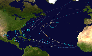
<span class="mw-page-title-main">2000 Atlantic hurricane season</span> Hurricane season in the Atlantic Ocean

The 2000 Atlantic hurricane season was a fairly active hurricane season, but featured the latest first named storm in a hurricane season since 1992. The hurricane season officially began on June 1, and ended on November 30. It was slightly above average due to a La Niña weather pattern although most of the storms were weak. It was also the only season to have two of the storms affect Ireland. The first cyclone, Tropical Depression One, developed in the southern Gulf of Mexico on June 7 and dissipated after an uneventful duration. However, it would be almost two months before the first named storm, Alberto, formed near Cape Verde; Alberto also dissipated with no effects on land. Several other tropical cyclones—Tropical Depression Two, Tropical Depression Four, Chris, Ernesto, Nadine, and an unnamed subtropical storm—did not impact land. Five additional storms—Tropical Depression Nine, Florence, Isaac, Joyce, and Leslie—minimally affected land areas.

<span class="mw-page-title-main">1962 Atlantic hurricane season</span> Hurricane season in the Atlantic Ocean

The 1962 Atlantic hurricane season featured Hurricanes Daisy and Ella – two tropical cyclones that showed the latest dates for the fourth and fifth named storms on record since tropical cyclones were first named in the North Atlantic ocean, starting in 1950, when they both formed on September 29 and October 14. On the same hand, it was the least active since 1939, with only five named storms. Although the season officially began on June 15, the first named storm did not form until August 26, the third-latest date. Hurricane Alma brushed the Outer Banks before becoming extratropical southeast of New England, destroying hundreds of boats and producing beneficial rainfall. In late August, Tropical Storm Becky developed unusually far east in the Atlantic Ocean, becoming the easternmost storm on record to recurve to the northeast. Celia followed in the September, forming east of the Lesser Antilles and executing a loop near Bermuda before dissipating. Hurricane Daisy, the latest fourth named storm, was the costliest of the season, leaving about $1.1 million in damage in New England (1962 USD). The storm dropped the highest rainfall total on record in Maine, and its precipitation caused 22 traffic fatalities. The final hurricane – Ella – the latest fifth named storm – was also the strongest, remaining offshore of the eastern United States but causing two deaths.

<span class="mw-page-title-main">1992 Atlantic hurricane season</span> Hurricane season in the Atlantic Ocean

The 1992 Atlantic hurricane season was a significantly below average season for overall tropical or subtropical cyclones as only ten formed. Six of them became named tropical storms, and four of those became hurricanes; one hurricane became a major hurricane. The season was also near-average in terms of accumulated cyclone energy. The season officially started on June 1 and officially ended on November 30. However, tropical cyclogenesis is possible at any time of the year, as demonstrated by formation in April of an unnamed subtropical storm in the central Atlantic.

<span class="mw-page-title-main">1991 Atlantic hurricane season</span> Hurricane season in the Atlantic Ocean

The 1991 Atlantic hurricane season was the first season since 1984 in which no hurricanes developed from tropical waves, which are the source for most North Atlantic tropical cyclones. The hurricane season officially began on June 1, and ended on November 30. It was the least active in four years due to higher than usual wind shear across the Atlantic Ocean. The first storm, Ana, developed on July 2 off the southeast United States and dissipated without causing significant effects. Two other tropical storms in the season – Danny and Erika – did not significantly affect land. Danny dissipated east of the Lesser Antilles, and Erika passed through the Azores before becoming extratropical. In addition, there were four non-developing tropical depressions. The second depression of the season struck Mexico with significant accompanying rains.

<span class="mw-page-title-main">2006 Atlantic hurricane season</span> Hurricane season in the Atlantic Ocean

The 2006 Atlantic hurricane season was the least active in the basin since 1997, with nine named storms as well as an additional unnamed tropical storm identified by the National Hurricane Center. 2006 was the first season since 2001 in which no hurricanes made landfall in the United States, and was the first since 1994 in which no tropical cyclones formed during October. Following the intense activity of 2003, 2004, and 2005, forecasters predicted that the 2006 season would be only slightly less active. Instead, it turned out to be a below average season, as activity was slowed by a rapidly forming moderate El Niño event, the presence of the Saharan Air Layer over the tropical Atlantic, and the steady presence of a robust secondary high-pressure area to the Azores High centered on Bermuda. There were no tropical cyclones after October 2.

<span class="mw-page-title-main">2007 Atlantic hurricane season</span> Hurricane season in the Atlantic Ocean

The 2007 Atlantic hurricane season was the first season since 2003 to feature tropical activity both before and after the official bounds of the season. There were an above-average number of named storms during the season – 15, however many storms were weak and short-lived. Despite the predominance of weak systems, this was the first season on record to feature more than one Category 5 landfalling hurricane. This would not happen again until 2017. It produced 17 tropical cyclones, 15 tropical storms, six hurricanes, and two major hurricanes. It officially started on June 1 and ended on November 30, dates which conventionally delimit the period during which most tropical cyclones form in the Atlantic Ocean, although as shown by Subtropical Storm Andrea and Tropical Storm Olga in early May and early December, respectively, the formation of tropical cyclones is possible at any time of the year. The first system, Subtropical Storm Andrea, developed on May 9, while the last storm, Tropical Storm Olga, dissipated on December 13. The most intense hurricane, Dean, was, at the time, the third most intense landfalling Atlantic storm on record. It was the second on record in which an Atlantic hurricane, Felix, and an eastern Pacific hurricane, Henriette, made landfall on the same day. September had a then record-tying eight storms, until it was surpassed in 2020. However, the strengths and durations of most of the storms were low.

<span class="mw-page-title-main">Tropical Storm Alberto (2006)</span> Atlantic tropical cyclone

Tropical Storm Alberto was the first tropical storm of the 2006 Atlantic hurricane season. Forming on June 10 in the northwestern Caribbean, the storm moved generally to the north, reaching a maximum intensity of 70 mph (110 km/h) before weakening and moving ashore in the Big Bend area of Florida on June 13. Alberto then moved through eastern Georgia, North Carolina, and Virginia as a tropical depression before becoming extratropical on June 14.
<span class="mw-page-title-main">Tropical Storm Helene (2000)</span> Atlantic tropical storm in 2000

Tropical Storm Helene was a long-lived tropical cyclone that oscillated for ten days between a tropical wave and a 70 mph (110 km/h) tropical storm. It was the twelfth tropical cyclone and eighth tropical storm of the 2000 Atlantic hurricane season, forming on September 15 east of the Windward Islands. After degenerating into a tropical wave, the system produced flooding and mudslides in Puerto Rico. It reformed into a tropical depression on September 19 south of Cuba, and crossed the western portion of the island the next day while on the verge of dissipation. However, it intensified into a tropical storm in the Gulf of Mexico, reaching its peak intensity while approaching the northern Gulf Coast.

<span class="mw-page-title-main">Hurricane Florence (2006)</span> Category 1 Atlantic hurricane in 2006

Hurricane Florence was the first North Atlantic hurricane to produce hurricane-force winds on the island of Bermuda since Hurricane Fabian in September 2003. The seventh tropical storm and second hurricane of the 2006 Atlantic hurricane season, Florence developed from a tropical wave in the eastern Atlantic Ocean on September 3. Due to unfavorable conditions, the system failed to organize initially, and as a result, the storm grew to an unusually large size. After several days, Florence encountered an area of lesser wind shear and intensified into a hurricane on September 10. It passed just west of Bermuda while recurving northeastward, and on September 13 it transitioned into an extratropical cyclone.

<span class="mw-page-title-main">Hurricane Karen (2001)</span> Category 1 Atlantic hurricane in 2001

Hurricane Karen was a hurricane of non-tropical origin that formed in October of the 2001 Atlantic hurricane season. It developed out of the interaction between a cold front and an upper level trough on October 10 located to the south of Bermuda, and quickly strengthened as an extratropical storm. The storm passed near Bermuda on October 12, producing hurricane-force winds on the island. It then organized, becoming a subtropical cyclone on October 12 and a tropical cyclone on October 13. Karen strengthened to reach 80 mph (130 km/h) winds as a Category 1 hurricane on the Saffir-Simpson Hurricane Scale, and after weakening over cooler waters, it made landfall on Nova Scotia as a tropical storm. It quickly became extratropical.

<span class="mw-page-title-main">Tropical Storm Dean (2001)</span> Atlantic tropical storm in 2001

Tropical Storm Dean was a strong tropical storm that affected at least twelve islands along its path from the tropical Atlantic Ocean to east of Atlantic Canada in August 2001. Dean developed from a tropical wave on August 22 over the Lesser Antilles, and was initially predicted to intensify further to reach hurricane status. However, strong wind shear quickly weakened Dean to cause it to dissipate on August 23. The remnants turned northward, and redeveloped on August 26 to the north of Bermuda. Located over warm waters and in an area of favorable conditions, Dean steadily strengthened while moving to the northeast, and peaked just below hurricane status on August 27 about 465 miles (748 km) southwest of Newfoundland. The storm subsequently weakened over cooler waters, and became extratropical on August 28.

<span class="mw-page-title-main">Hurricane Erin (2001)</span> Category 3 Atlantic hurricane

Hurricane Erin was the longest-lived hurricane in the 2001 Atlantic hurricane season. The sixth tropical depression, fifth tropical storm, and first hurricane of the season, Erin developed from a tropical wave on September 1. After strengthening to a 60 mph (97 km/h) tropical storm as it moved to the west-northwest, wind shear weakened Erin and caused it to degenerate into a remnant low on September 5. The remnants re-organized into a tropical depression the next day, and Erin strengthened into a hurricane on September 9 while moving northwestward. This was the latest date for the first hurricane of the season since Hurricane Diana on September 10, 1984. Erin quickly intensified and reached peak winds of 120 mph (190 km/h) later on September 9. At its closest approach, Erin passed 105 miles (169 km) east-northeast of Bermuda near peak intensity, and subsequently weakened as it turned to the east. A trough turned Erin to the northeast, and after passing just east of Cape Race, Newfoundland it became extratropical on September 15. The extratropical remnant continued northeastward and was absorbed into another extratropical storm near Greenland on September 17.
<span class="mw-page-title-main">Tropical Storm Barry (2007)</span> Atlantic tropical cyclone

Tropical Storm Barry was a rapidly forming tropical cyclone that made landfall on Florida, United States, in early June 2007. The second named storm of the 2007 Atlantic hurricane season, Barry developed from a trough of low pressure in the southeastern Gulf of Mexico on June 1. It tracked rapidly northeastward, reaching peak winds of 60 mph (97 km/h) before weakening and making landfall near Tampa Bay as a tropical depression. Barry quickly lost tropical characteristics after wind shear removed much of the convection, and early on June 3, it completed the transition into an extratropical cyclone. The extratropical remnants tracked up the East Coast of the United States, and were absorbed by a larger extratropical cyclone on June 5.

<span class="mw-page-title-main">Tropical Storm Chantal (2007)</span> Atlantic tropical storm in 2007

Tropical Storm Chantal was a short-lived tropical storm that affected Bermuda in its formative stages and caused flooding and gusty winds in Newfoundland while extratropical. The third named storm of the 2007 Atlantic hurricane season, Chantal developed on July 31 from non-tropical origins between Bermuda and Cape Cod, and with favorable conditions, the storm rapidly attained peak winds of 50 mph (80 km/h). The storm accelerated northeastward over an area of progressively colder water temperatures, and after a decrease in convection the National Hurricane Center ceased issuing advisories as Chantal began undergoing extratropical transition early on August 1. Shortly thereafter, the extratropical remnant crossed over southeastern Newfoundland before tracking into the open waters of the north Atlantic Ocean. Prior to forming, the storm dropped moderate rainfall on Bermuda. Subsequent to becoming extratropical, the remnants of Chantal produced gusty winds and heavy precipitation across the Avalon Peninsula of Newfoundland, causing flooding and wind damage; insured damage totaled $25 million.

<span class="mw-page-title-main">Hurricane Humberto (2001)</span> Category 2 Atlantic hurricane in 2001

Hurricane Humberto was a moderately powerful hurricane that briefly affected Bermuda in September 2001. It was the eighth named storm of the season, as well as the fourth hurricane. It formed on September 21 between Puerto Rico and Bermuda, partially related to previous Hurricane Gabrielle. Humberto passed about 140 miles (230 km) west of Bermuda, which spared the island with its strongest winds. After weakening and believed to be on the verge of dissipating, Humberto unexpectedly restrengthened to the southeast of Atlantic Canada. The intensification was short-lived and the storm dissipated on September 27. There were a series of significant observational flights into the hurricane that produced a wealth of data on the structure of hurricanes.

<span class="mw-page-title-main">Tropical Storm Beryl (2012)</span> Atlantic tropical storm in 2012

Tropical Storm Beryl was the strongest off-season Atlantic tropical cyclone on record to make landfall in the United States. The second tropical cyclone of the 2012 Atlantic hurricane season, Beryl developed on May 26 from a low-pressure system offshore North Carolina. Initially subtropical, the storm slowly acquired tropical characteristics as it tracked across warmer sea surface temperatures and within an environment of decreasing vertical wind shear. Late on May 27, Beryl transitioned into a tropical cyclone less than 120 miles (190 km) from North Florida. Early the following day, the storm moved ashore near Jacksonville Beach, Florida, with peak winds of 65 mph (100 km/h). It quickly weakened to a tropical depression, dropping heavy rainfall while moving slowly across the southeastern United States. A cold front turned Beryl to the northeast, and the storm became extratropical on May 30.

References

  1. 1 2 3 4 5 6 7 8 9 10 11 12 13 14 Miles Lawrence and Eric Blake (2001-12-18). Hurricane Gabrielle Tropical Cyclone Report (PDF) (Report). National Hurricane Center. Retrieved 2007-02-27.
  2. 1 2 Richard Pasch (2001-09-11). Tropical Depression Eight Discussion One (Report). National Hurricane Center. Retrieved 2007-02-28.
  3. James Franklin (2001-09-12). Tropical Depression Eight Discussion Two (Report). National Hurricane Center. Retrieved 2007-02-28.
  4. Stacy Stewart (2001-09-12). Tropical Depression Eight Discussion Three (Report). National Hurricane Center. Retrieved 2007-02-28.
  5. James Franklin (2001-09-13). Tropical Depression Eight Discussion Six (Report). National Hurricane Center. Retrieved 2007-02-28.
  6. Stacy Stewart (2001-09-13). Tropical Depression Eight Discussion Seven (Report). National Hurricane Center. Retrieved 2007-02-28.
  7. Lixion Avila (2001-09-14). Tropical Storm Gabrielle Discussion Eleven (Report). National Hurricane Center. Retrieved 2007-02-28.
  8. Jack Beven (2001-09-14). Tropical Storm Gabrielle Discussion Twelve (Report). National Hurricane Center. Retrieved 2007-02-28.
  9. Jack Beven (2001-09-14). Tropical Storm Gabrielle Discussion Thirteen (Report). National Hurricane Center. Retrieved 2007-02-28.
  10. Lixion Avila (2001-09-15). Tropical Storm Gabrielle Discussion Fifteen (Report). National Hurricane Center. Retrieved 2007-02-28.
  11. Jack Beven (2001-09-15). Tropical Storm Gabrielle Discussion Sixteen (Report). National Hurricane Center. Retrieved 2007-02-28.
  12. Jack Beven (2001-09-15). Tropical Storm Gabrielle Discussion Seventeen (Report). National Hurricane Center. Retrieved 2007-02-28.
  13. Richard Pasch (2001-09-16). Tropical Storm Gabrielle Discussion Nineteen (Report). National Hurricane Center. Retrieved 2007-02-28.
  14. Stacy Stewart (2001-09-16). Tropical Storm Gabrielle Discussion Twenty (Report). National Hurricane Center. Retrieved 2007-02-28.
  15. Stacy Stewart (2001-09-17). Hurricane Gabrielle Discussion Twenty-Five (Report). National Hurricane Center. Retrieved 2007-02-28.
  16. Lixion Avila and Hugh Cobb (2001-09-18). Hurricane Gabrielle Discussion Twenty-Six (Report). National Hurricane Center. Retrieved 2007-02-28.
  17. Coralie Carlson (2001-09-14). "Tropical storm hits Florida". Bowling Green, Kentucky Daily News. Associated Press. Retrieved 2012-04-15.
  18. John Hielscher (2001-09-15). "Sarasota-Bradenton International deserted as Gabrielle strikes". Sarasota Herald-Tribune. Retrieved 2012-04-16.
  19. 1 2 Mike Branom (2001-09-15). "Tropical Storm Gabrielle sloshes across Florida; thousands lose power". Sarasota Herald-Journal. Associated Press. Retrieved 2012-04-16.
  20. Miles Lawrence (2001-09-17). Hurricane Gabrielle Discussion Twenty-Two (Report). National Hurricane Center. Retrieved 2007-02-28.
  21. 1 2 3 4 5 Canadian Hurricane Centre (2002). 2001 Tropical Cyclone Season Summary (Report). Retrieved 2007-02-27.
  22. 1 2 3 Staff Writer (2001-09-20). "Hurricane-force Gabrielle smashes Newfoundland". CBC News. Retrieved 2007-02-27.
  23. 1 2 3 4 5 6 "Storm Data and Unusual Weather Phenomena with Late Reports and Corrections" (PDF). 43 (9). September 2001. Retrieved 2012-04-14.{{cite journal}}: Cite journal requires |journal= (help)
  24. Tampa, Florida National Weather Service (2001). Report on Tropical Storm Gabrielle (Report). Archived from the original on November 6, 2008. Retrieved 2007-03-01.
  25. "Tropical storm smacks Florida". The Hour. Associated Press. 2011-09-14. Retrieved 2012-04-16.
  26. David M. Roth (2006-12-24). "Hurricane Gabrielle - September 10-16, 2001". Hydrometeorological Prediction Center. Retrieved 2012-04-14.
  27. Roth, David M (May 12, 2022). "Tropical Cyclone Rainfall in the Southeastern United States". Tropical Cyclone Rainfall. United States Weather Prediction Center. Retrieved January 6, 2023.PD-icon.svg This article incorporates text from this source, which is in the public domain.
  28. Bermuda Weather Service (2001). "September 2001 Tropical Cyclone Summary". Archived from the original on 2012-02-05. Retrieved 2007-02-28.
  29. Canadian Hurricane Centre (2001). "Backgrounder: 2001 Canadian Hurricane Season". Archived from the original on 2007-02-11. Retrieved 2007-02-27.
  30. 1 2 3 4 5 2001-Gabrielle (Report). Environment Canada. 2010-09-14. Retrieved 2012-04-15.
  31. Canadian Hurricane Centre (2009-12-18). "The Top 10 Canadian Weather Stories for 2001" . Retrieved 2007-03-01.
  32. 1 2 Staff Writer (2001-09-21). "Newfoundland seeks federal help for flood damage". CBC News. Retrieved 2007-02-27.
  33. Victor Hull (2001-09-22). "Gabrielle helped, but drought lingers". Sarasota Herald-Tribune. Associated Press. Retrieved 2012-04-16.
  34. Federal Disaster Funds Authorized For Florida To Aid Local Government Recovery From Tropical Storm Gabrielle (Report). Federal Emergency Management Agency. 2001-09-28.
  35. John Hielscher (2001-10-03). "Gabrielle damage claims mounting". Sarasota Herald Tribune. Retrieved 2012-04-16.
  36. Sean Kelly (2001-09-27). "Minister provides update on disaster assistance resulting from Hurricane Gabrielle". Government of Newfoundland and Labrador Municipal and Provincial Affairs. Retrieved 2007-02-27.
  37. Lynn Hammond (2001-10-19). "Questions and answers concerning assistance for damages caused by Tropical Storm Gabrielle". Government of Newfoundland and Labrador Municipal and Provincial Affairs. Retrieved 2007-02-27.
  38. Staff Writer (2001-11-26). "Ottawa offering aid to Gabrielle victims". CBC News. Retrieved 2007-02-27.
  39. Newfoundland and Labrador Fire & Emergency Services (2006). "Recent Disasters in Newfoundland" (PDF). Archived from the original (PDF) on February 27, 2008. Retrieved 2007-02-27.
Hurricane Gabrielle
Gabrielle 2001-09-18 1525Z.jpg
Gabrielle at peak intensity on September 18