Marrero is a census-designated place (CDP) in Jefferson Parish, Louisiana, United States. Marrero is on the south side of the Mississippi River, within the New Orleans–Metairie–Kenner metropolitan statistical area. Marrero is the home of Rob Schneider and John Cena. The population was 32,382 at the 2020 U.S. census.
Arkabutla is a census-designated place and unincorporated community in Tate County, Mississippi, United States. Arkabutla is located approximately 9 miles (14 km) west of Coldwater and approximately 9 miles (14 km) north of Strayhorn. It also lies approximately 4 miles (6.4 km) south of the dam at Arkabutla Lake. Although an unincorporated community, it has a post office and a zip code of 38602.
Bogue Chitto is an unincorporated community and census-designated place (CDP) in Lincoln County, Mississippi, United States. As of the 2020 census, it had a population of 437. Bogue Chitto is the only municipal hamlet in the state of Mississippi.

Lauderdale is an unincorporated community and census-designated place (CDP) in Lauderdale County, Mississippi, United States. The population of Lauderdale was 395 at the 2020 census. It is located along U.S. Highway 45, 16 miles (26 km) northeast of Meridian.

Strayhorn is a census-designated place and unincorporated community along Mississippi Highway 4 in rural western Tate County, Mississippi, United States. Strayhorn is located in the Memphis Metropolitan Area. At the 2000 census, the community had a population of 1,784. Strayhorn has a few businesses, including Hudspeth's Grocery, the Strayhorn Snack Bar, and a Dollar General Store. Strayhorn Baptist Church is located in the community.
Benndale is a census-designated place (CDP) and unincorporated community in George County, Mississippi, near the intersection of State Highways 26 and 57. It is part of the Pascagoula Metropolitan Statistical Area. Prior to the creation of George County, Benndale was located in Jackson County. It became a CDP in the 2020 United States census, with a population of 65.

Rena Lara is a census-designated place and unincorporated community located along Mississippi Highway 1 in southwestern Coahoma County, Mississippi, United States. Rena Lara is located on the former Riverside Division of the Yazoo and Mississippi Valley Railroad. Rena Lara was once home to two general stores, two grocery stores, and the Richardson and May Land & Planting Company.

Eastabuchie is a census-designated place and unincorporated community in southwestern Jones County, Mississippi. It is located along U.S. Route 11, just north of the Forrest County line. the community has a post office with the ZIP code 39436. Eastabuchie is part of the Laurel Micropolitan Statistical Area.
Darling is a census-designated place in Quitman County, Mississippi. Darling is located on Mississippi Highway 3, north of Marks. Per the 2020 Census, the population was 154.
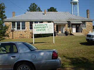
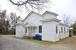
Randolph is a census-designated place and unincorporated community in Pontotoc County, Mississippi. Randolph is located along Mississippi Highway 9. It was first named as a CDP in the 2020 Census.

Scott is a census-designated place and unincorporated community located in Bolivar County, Mississippi, United States on Mississippi Highway 1. Scott is approximately 5 miles (8.0 km) north of Lamont and approximately 7 miles (11 km) south of Benoit.
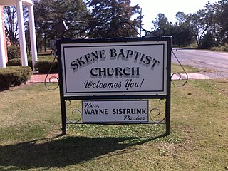
Skene is a census-designated place and unincorporated community located in Bolivar County, Mississippi, United States on Mississippi Highway 446. Skene is approximately 3 miles (4.8 km) west of Boyle and approximately 7 miles (11 km) north of Shaw. Skene was a station on the Boyle and Sunflower branch of the former Yazoo and Mississippi Valley Railroad.
Red Banks is a census-designated place and unincorporated community in Marshall County, Mississippi, United States. It was first listed as a CDP in the 2020 census, which reported a population of 215.
New Site is a census-designated place and unincorporated community in Prentiss County, Mississippi, United States. Its population was 851 at the 2010 U.S. Census. Its ZIP code is 38859.
Kirkville is a census-designated place and unincorporated community in Itawamba County, Mississippi, United States.
Pattison, also known as Martin, is a census-designated place and unincorporated community in Claiborne County, Mississippi, United States. Its ZIP code is 39144.
Mississippi Valley State University is a census-designated place in Leflore County, Mississippi, United States. The population at the 2020 census was 805. It is the location of Mississippi Valley State University and is adjacent to Itta Bena.
Arnold Line is an unincorporated area and census-designated place (CDP) in Lamar County, Mississippi, United States. As of the 2020 census it had a population of 2,333. It is part of the Hattiesburg Metropolitan Statistical Area.

Rawls Springs is an unincorporated community and census-designated place (CDP) located in Forrest County, Mississippi, United States. As of the 2020 census it had a population of 1,202. Rawls Springs is approximately 6.5 miles (10.5 km) northwest of Hattiesburg near U.S. Route 49 and a part of the Hattiesburg, Mississippi Metropolitan Statistical Area.

Glendale is an unincorporated community and census-designated place (CDP) located in Forrest County, Mississippi, United States. Glendale is approximately 3.5 miles (5.6 km) north of Hattiesburg on Mississippi Highway 42 and a part of the Hattiesburg, Mississippi Metropolitan Statistical Area.