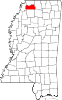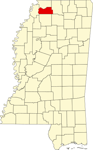
Tate County is a county located in the northwestern portion of the U.S. state of Mississippi. As of the 2020 census, the population was 28,064. Its county seat is Senatobia. Organized in 1873 during the Reconstruction era, from portions of DeSoto, Marshall, and Tunica counties, the county is named for Thomas Simpson Tate, one of the first prominent American settlers of the area.
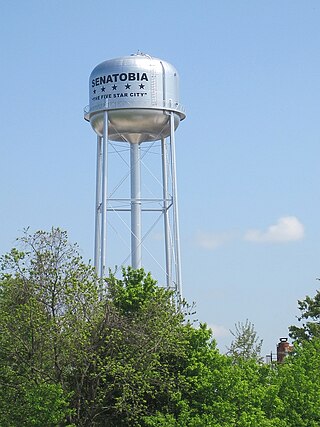
Senatobia is a city in, and the county seat of, Tate County, Mississippi, United States, and is the 16th largest municipality in the Memphis Metropolitan Area. The population was 8,165 at the 2010 census. Senatobia is home to Northwest Mississippi Community College, a state community college providing two-year academic and technical degree programs. Also located in Senatobia is the Baddour Center, a residential care facility for intellectually disabled adults.
Arkabutla is a census-designated place and unincorporated community in Tate County, Mississippi, United States. Arkabutla is located approximately 9 miles (14 km) west of Coldwater and approximately 9 miles (14 km) north of Strayhorn. It also lies approximately 4 miles (6.4 km) south of the dam at Arkabutla Lake. Although an unincorporated community, it has a post office and a zip code of 38602.

Valley Park is a census-designated place and unincorporated community in Issaquena County, Mississippi, United States. Its elevation is 95 feet. Although unincorporated, it has a post office, with the ZIP code of 39177.

Stoneville is a census-designated place and unincorporated community located in northeastern Washington County, Mississippi. Deer Creek flows through Stoneville.

Rena Lara is a census-designated place and unincorporated community located along Mississippi Highway 1 in southwestern Coahoma County, Mississippi, United States. Rena Lara is located on the former Riverside Division of the Yazoo and Mississippi Valley Railroad. Rena Lara was once home to two general stores, two grocery stores, and the Richardson and May Land & Planting Company.
Ovett is a census-designated place and unincorporated community in southeastern Jones County, Mississippi. Ovett is part of the Laurel Micropolitan Statistical Area.

Moselle is a census-designated place and unincorporated community in southern Jones County, Mississippi. The community is part of the Laurel micropolitan area.
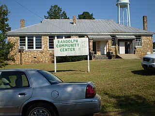
Randolph is a census-designated place and unincorporated community in Pontotoc County, Mississippi. State highway 9 by-passes the center of Randolph, which can be accessed by turning onto Randolph Loop, County Road 188. Mostly an agriculture and timber community, there are many farms, sawmills, and even a cotton gin owned by BHF Farms located there. Also, there is a large Amish community nearby, the only one in the deep south.
Lamar is a census-designated place and unincorporated community in Benton County, Mississippi, United States. It is located along Mississippi Highway 7 in western Benton County. Lamar has a post office with the ZIP code 38642. The nearly abandoned Mississippi Central Railroad runs through Lamar, and is only used rarely for freight trafficking. Lamar shares its ZIP code with the nearby community of Slayden.
Van Vleet is a census-designated place and unincorporated community in Chickasaw County, Mississippi, United States. Van Vleet is located at the junction of Mississippi Highway 32 and Mississippi Highway 385, 8 miles (13 km) northeast of Houston. Van Vleet has a post office with ZIP code 38877.

Scott is a census-designated place and unincorporated community located in Bolivar County, Mississippi, United States on Mississippi Highway 1. Scott is approximately 5 miles (8.0 km) north of Lamont and approximately 7 miles (11 km) south of Benoit.

Skene is a census-designated place and unincorporated community located in Bolivar County, Mississippi, United States on Mississippi Highway 446. Skene is approximately 3 miles (4.8 km) west of Boyle and approximately 7 miles (11 km) north of Shaw. Skene was a station on the Boyle and Sunflower branch of the former Yazoo and Mississippi Valley Railroad.

Dundee is a census-designated place and unincorporated community in Tunica County, Mississippi, United States. Dundee is 12 miles (19 km) south-southwest of Tunica. Dundee has a post office with ZIP code 38626.
Independence is a census-designated place and unincorporated community in Tate County, Mississippi, United States.
Pleasant Hill is a census-designated place and unincorporated community located in DeSoto County, Mississippi, United States, located approximately 9 miles (14 km) southwest of Hernando and 8 miles (13 km) southeast of Eudora, just east of Arkabutla Lake.

Dennis is a census-designated place and unincorporated community located at the intersection of Mississippi Highway 25 and Mississippi Highway 4 in Tishomingo County, Mississippi, United States. Dennis is approximately 6 miles (9.7 km) south of Tishomingo and 3 miles (4.8 km) north of Belmont.
Pheba is a census-designated place and unincorporated community located in Clay County, Mississippi, United States. Pheba is located at the intersection of Mississippi Highway 50 and Mississippi Highway 389 and is approximately 7 miles (11 km) west of Cedarbluff.
Mount Pleasant is a census-designated place and unincorporated community in northeastern Marshall County, Mississippi, United States, located along U.S. Route 72 at State Route 311. Although unincorporated, it has a post office serving the nearby city of Holly Springs. The zip code is 38649. The community also has a volunteer fire department located on Boswell Road, and a K-12 school located off of US Highway 72. Mount Pleasant is bordered by Cayce and Taska to the west, Holly Springs to the south, Slayden to the east, and Collierville, Tennessee to the north.
Paris is a census-designated place and unincorporated community in Lafayette County, Mississippi, United States. Paris is located at the junction of Mississippi Highway 9W and Mississippi Highway 315 10 miles (16 km) east of Water Valley.