Jamaica Beach, Texas

Last updated
City of Jamaica Beach
JamaicaBeachCityHall0.JPG
Jamaica Beach City Hall
JamaicaBeachTexasSeal.gif
Motto(s): 
"A Great Place to Visit, but an even Better Place to Live"
Galveston County JamaicaBeach.svg
Location of Jamaica Beach, Texas
Coordinates: 29°11′31″N94°58′50″W / 29.19194°N 94.98056°W / 29.19194; -94.98056
Country United States
State Texas
County Galveston
Government
  Type General law
  MayorClay Morris
Area
[1]
  Total0.72 sq mi (1.86 km2)
  Land0.58 sq mi (1.50 km2)
  Water0.14 sq mi (0.35 km2)
Elevation
3 ft (1 m)
Population
 (2010)
  Total983
  Estimate 
(2019) [2]
1,079
  Density1,857.14/sq mi (717.23/km2)
Time zone UTC-6 (Central (CST))
  Summer (DST) UTC-5 (CDT)
ZIP codes
77550, 77554
Area code 409
FIPS code 48-37252 [3]
GNIS feature ID1388565 [4]
Website http://www.ci.jamaicabeach.tx.us/

Jamaica Beach is a city in Galveston County, Texas, United States on Galveston Island. As of the 2010 census, the city's population was 983. [5] the city is bordered by Galveston to the east and west, the east bay on the north and the Gulf of Mexico to the south.

Contents

History

Karankawa Indian Historical Marker in Jamaica Beach Karankawa Indian Campsite Marker in Jamaica Beach, Texas.jpg
Karankawa Indian Historical Marker in Jamaica Beach

Prior to its development, Jamaica Beach was a burial ground of the Karankawa people. Johnny Goyen and Earl Galceran of the Jamaica Corporation developed Jamaica Beach as a 2,000-lot resort subdivision in close proximity to a marina. [6] The individuals who were a part of the development effort were Goyen, Galceran, brothers Jack and Welcome Wilson, Bill Sherrill, and Jack Valenti. They acquired an area of 320 acres (130 ha) that was owned by the Moody family. An oil businessperson named R.E. "Bob" Smith decided not to be a partner in the development, but he purchased the Moody land and sold it to the developers. He did not ask for any down payments and he guaranteed a $250,000 bank loan. Initially, the beachfront lots, each 90 feet (27 m), were sold for $3,500 apiece. The "second row" houses sold at a quick pace. As the subsequent rows of houses opened to sale, the sales figures decreased slowly because while wealthy people were easily able to acquire second houses, middle class homebuyers were unable to get a mortgage, and needed to pay for the homebuilding with cash. [7]

In the 1960s, the discovery of a skull and that it was connected to a Karankawa Native American burial ground led to an increase in public exposure and visitors. Welcome Wilson said that no additional sales were generated by the publicity. With the growth of the second house market, almost all of the lots on Jamaica Beach had been sold by the 1970s. Due to a decline in the United States economy, the developer closed its doors. [7] The city incorporated on May 12, 1975. By 1978, 141 residents lived in Jamaica Beach. By 1988, the city had 446 residents and no businesses. By 1990, the city had 624 residents. [6]

Jamaica Beach was affected by Hurricane Alicia in August 1983. In September 2008, the city was affected by Hurricane Ike. [8]

On Saturday August 9, 2008, Jamaica Beach celebrated the 50th anniversary of its groundbreaking. At the ceremony, Welcome Wilson donated boxes of news articles, brochures, and promotional materials in order to build a collection for a museum located at the city hall. In addition, the five children of Welcome Wilson donated $10,000 to the new museum. [7]

Geography

Jamaica Beach is located at 29°11′31″N94°58′50″W / 29.19194°N 94.98056°W / 29.19194; -94.98056 (29.192080, –94.980488). [9]

According to the United States Census Bureau, the city has a total area of 0.77 square miles (2.0 km2), of which0.19 square miles (0.5 km2), or 24.57%, is covered by water. [10]

The city has several pirate-themed street names. They include "Blackbeard", "Buccaneer", "Captain Hook", "Captain Kidd". "Francis Drake", "John Davis", "Jean Lafitte", "Mansvelt", "Henry Morgan", "John Silver", and "Edward Teach". [11]

Parks

Demographics

Historical population
CensusPop.Note
1980 365
1990 62471.0%
2000 1,07572.3%
2010 983−8.6%
2019 (est.)1,079 [2] 9.8%
U.S. Decennial Census [12]
Map of Jamaica Beach JamaicaBeachTXMap.gif
Map of Jamaica Beach

2020 Census data

Jamaica Beach racial composition [13]
(NH = Non-Hispanic) [lower-alpha 1]
RaceNumberPercentage
White (NH)94087.2%
Black or African American (NH)40.37%
Native American or Alaska Native (NH)40.37%
Asian (NH)141.3%
Some Other Race (NH)20.19%
Mixed/Multi-Racial (NH)312.88%
Hispanic or Latino 837.7%
Total1,078

As of the 2020 United States census, there were 1,078 people, 704 households, and 339 families residing in the city.

2000 Census data

As of the census [3] of 2000, there were 1,075 people, 483 households, and 303 families residing in the city. The population density was 1,487.7 inhabitants per square mile (574.4/km2). There were 1,078 housing units at an average density of 1,491.8 per square mile (576.0/km2). The racial makeup of the city was 95.07% White, 0.37% African American, 0.37% Native American, 0.56% Asian, 1.95% from other races, and 1.67% from two or more races. Hispanic or Latino of any race were 8.56% of the population.

There were 483 households, out of which 25.7% had children under the age of 18 living with them, 52.8% were married couples living together, 6.8% had a female householder with no husband present, and 37.1% were non-families. 27.3% of all households were made up of individuals, and 7.7% had someone living alone who was 65 years of age or older. The average household size was 2.23 and the average family size was 2.74.

In the city, the population was 20.3% under the age of 18, 4.9% from 18 to 24, 31.9% from 25 to 44, 28.4% from 45 to 64, and 14.5% who were 65 years of age or older. The median age was 42 years. For every 100 females, there were 99.8 males. For every 100 females age 18 and over, there were 99.8 males. The median income for a household in the city was $52,045, and the median income for a family was $66,250. Males had a median income of $42,411 versus $31,875 for females. The per capita income for the city was $30,943. About 5.7% of families and 7.3% of the population were below the poverty line, including 8.4% of those under age 18 and none of those age 65 or over.

Government and infrastructure

West Galveston Island Contract Post Office in Jamaica Beach Jamaica Beach Texas Post Office CPU 77554.jpg
West Galveston Island Contract Post Office in Jamaica Beach

As of 2008 the City Council includes Mayor Victor Pierson, Mayor Pro Tem Steve Spicer, and four aldermen (Brad South, Eddie Burke, Sherwood Green, and Mary Morse). [16] The city council established the Jamaica Beach Police Department in 1978; as of 2008 the department has one chief, one lieutenant, and five police officers. Jamaica Beach contracted its dispatching to the City of Hitchcock. After a large brush fire, the city created the Jamaica Beach Volunteer Fire Department and EMS in 1976. The city also has a municipal court, a water and sewer department, and a building department. [17]

In November 2007 a United States Postal Service Contract Postal Unit opened inside a local business in Jamaica Beach. [18] The West Galveston Contract Unit (77554-9998) is at Bob Smith Drive near Farm to Market Road 3005.

Education

Pupils in Jamaica Beach are within the Galveston Independent School District. [19] As of 2020 there are no particular attendance boundaries in GISD so parents may apply to any school they wish. [20] Ball High School (9–12) in Galveston is the district's sole comprehensive high school.

Previously students are zoned to Oppe Elementary School (K–4) and Weis Middle School (6–8). [21]

Galveston ISD (and therefore Jamaica Beach) is assigned to Galveston College in Galveston. [22]

Texas A&M University at Galveston is in nearby Galveston.

Related Research Articles

<span class="mw-page-title-main">Guadalupe County, Texas</span> County in Texas, United States

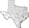
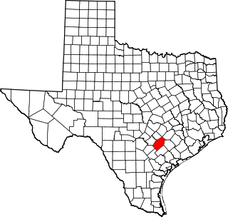
Guadalupe County is a county located in the U.S. state of Texas. As of the 2020 census, its population was 172,706. The county seat is Seguin. The county was founded in 1846 and is named after Guadalupe River.

<span class="mw-page-title-main">Gonzales County, Texas</span> County in Texas, United States

Gonzales County is a county in the U.S. state of Texas, adjacent to Greater Austin-San Antonio. As of the 2020 census, its population was 19,653. The county is named for its county seat, the city of Gonzales. The county was created in 1836 and organized the following year. As of August 2020, under strict budgetary limitations, the County of Gonzales government-body is unique in that it claims to have no commercial paper, regarding it as "the absence of any county debt."

<span class="mw-page-title-main">Galveston County, Texas</span> County in Texas, United States

Galveston County is a county in the U.S. state of Texas, located along the Gulf Coast adjacent to Galveston Bay. As of the 2020 census, its population was 350,682. The county was founded in 1838. The county seat is the City of Galveston, founded the following year, and located on Galveston Island. The most-populous municipality in the county is League City, a suburb of Houston at the northern end of the county, which surpassed Galveston in population during the early 2000s.

<span class="mw-page-title-main">Chambers County, Texas</span> County in Texas, United States

Chambers County is a county in the U.S. state of Texas. As of the 2020 census, its population was 46,571. The county seat is Anahuac.

<span class="mw-page-title-main">Surfside Beach, Texas</span> City in Texas, United States

Surfside Beach, also known locally as Surfside, is a city in Brazoria County, Texas, United States, that is situated on Follet's Island by the Gulf of Mexico near the city of Freeport. The population was 482 at the 2010 census. The city has claimed the "Cradle of Texas Liberty" title due to the fact that the Treaty of Velasco which ended hostilities between Texas and Mexico was signed at Fort Velasco, which was located near the city's current City Hall.

<span class="mw-page-title-main">Stephenville, Texas</span> City in Texas, United States

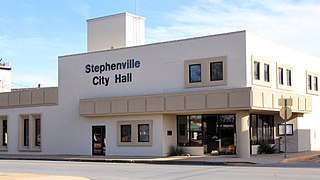
Stephenville is a city in and the county seat of Erath County, Texas, United States. It is on the North Bosque River, which forms nearby. Founded in 1854, it is home to Tarleton State University. As of the 2020 census, the city's population was 20,847, and it is the principal city in the Stephenville Micropolitan Statistical Area. Stephenville is among several communities that call themselves the "Cowboy Capital of the World".

<span class="mw-page-title-main">Rosenberg, Texas</span> City in Texas, United States

Rosenberg is a city in the U.S. state of Texas, within the Houston–The Woodlands–Sugar Land metropolitan area and Fort Bend County. Rosenberg was named for Henry Von Rosenberg who emigrated to Texas from Switzerland in 1843. Von Rosenberg was an important figure in the settlement of Fort Bend County and the Gulf Coast region. The population was 38,282 at the 2020 census, up from 30,618 at the 2010 census. The community holds the Fort Bend County fair in October. Rosenberg is adjacent to the city of Richmond, the Fort Bend County seat.

<span class="mw-page-title-main">Bayou Vista, Texas</span> City in Texas, United States

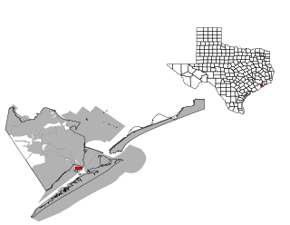
Bayou Vista is a city in Galveston County, Texas, United States. The population was 1,537 at the 2010 census. It received severe damage from Hurricane Ike on September 13, 2008.

<span class="mw-page-title-main">Clear Lake Shores, Texas</span> City in Galveston County, Texas

Clear Lake Shores is a city in Galveston County, Texas, within the Houston–Sugar Land–Baytown metropolitan area. As of the 2010 census, the city population was 1,063.

<span class="mw-page-title-main">Dickinson, Texas</span> City in Texas, United States

Dickinson is a city in Galveston County, Texas, within Houston–The Woodlands–Sugar Land metropolitan area. The population was 20,847 at the 2020 census.

<span class="mw-page-title-main">Hitchcock, Texas</span> City in Texas, United States

Hitchcock is a city in Galveston County, Texas, United States. The population was 6,961 at the 2010 census.

<span class="mw-page-title-main">Kemah, Texas</span> City in Texas, United States

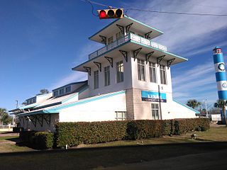
Kemah is a city in the U.S. state of Texas, southeast of Houston along west Galveston Bay. The city's population was 1,773 at the 2010 census, down from 2,330 at the 2000 census. Located in Galveston County, Kemah's main industry is shipping. Originally a small fishing town, the city has become a tourist destination for the area's restaurants and attractions, which are contained within the Kemah Entertainment District. In 2012 Kemah was ranked the top tourism spot in the Greater Houston area.

<span class="mw-page-title-main">La Marque, Texas</span> City in Texas, United States

La Marque is a city in Galveston County, Texas, south of Houston. The city population in 2020 was 18,030. La Marque experienced considerable growth in the 1950s, during which the city provided a general administrative and trades and crafts workforce helping to support the petrochemical complex in adjoining Texas City. It is the hometown of U.S. Senator Kay Bailey Hutchison and Norman Bulaich.

<span class="mw-page-title-main">Tiki Island, Texas</span> Village in Texas, United States

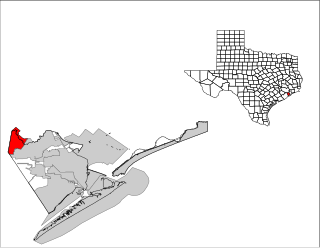
Tiki Island is a village in Galveston County, Texas, United States. The population was 968 at the 2010 census.

<span class="mw-page-title-main">Marion, Texas</span> City in Texas, United States

Marion is a city in Guadalupe County, Texas, United States. The town was incorporated by 1941. The population was 1,034 at the 2020 census. It is part of the San Antonio Metropolitan Statistical Area.

<span class="mw-page-title-main">La Porte, Texas</span> City in Texas, United States

La Porte is a city in Harris County, Texas, United States, within the Bay Area of the Houston–Sugar Land–Baytown metropolitan area. As of the 2020 census, the city population was 35,124. La Porte is the fourth-largest incorporated city in Harris County.

<span class="mw-page-title-main">Stanton, Texas</span> City in Texas, United States

Stanton is a city in and the county seat of Martin County, Texas, United States. Stanton was founded as Marienfeld by German immigrants that were some of the first settlers in this region of Texas. The population was 2,492 at the 2010 census.

<span class="mw-page-title-main">Shoreacres, Texas</span> City in Texas, United States

Shoreacres is a city located in Harris County in the U.S. state of Texas alongside State Highway 146. Established with a mayor-alderman form of city government, it was incorporated in 1949. The population was 1,566 at the 2020 census.

<span class="mw-page-title-main">Friendswood, Texas</span> City in Texas, United States

Friendswood is a city in the U.S. state of Texas. It is part of the Houston–The Woodlands–Sugar Land metropolitan area. The city lies in Galveston and Harris Counties. As of the 2010 census, the population of Friendswood was 35,805.

<span class="mw-page-title-main">League City, Texas</span> City in Texas, United States

League City is a city in the U.S. state of Texas, in Galveston County, within the Greater Houston metropolitan area. As of the 2020 census, the city had a population of 112,129.

References

  1. "2019 U.S. Gazetteer Files". United States Census Bureau. Retrieved August 7, 2020.
  2. 1 2 "Population and Housing Unit Estimates". United States Census Bureau. May 24, 2020. Retrieved May 27, 2020.
  3. 1 2 "U.S. Census website". United States Census Bureau . Retrieved 2008-01-31.
  4. "US Board on Geographic Names". United States Geological Survey. 2007-10-25. Retrieved 2008-01-31.
  5. "Profile of General Population and Housing Characteristics: 2010 Demographic Profile Data (DP-1): Jamaica Beach city, Texas". United States Census Bureau . Retrieved January 6, 2012.
  6. 1 2 Jamaica Beach, Texas from the Handbook of Texas Online
  7. 1 2 3 Elder, Laura. "Wilson put out West End's Welcome mat [ permanent dead link ]." The Galveston Daily News . Sunday August 10, 2008. Vol. 166, No. 118. A1 and A7. Retrieved on January 15, 2012.
  8. Langford, Terri and Dale Lezon. "Jamaica Beach residents allowed to inspect homes." Houston Chronicle . September 20, 2008. Retrieved on January 16, 2012.
  9. "US Gazetteer files: 2010, 2000, and 1990". United States Census Bureau. 2011-02-12. Retrieved 2011-04-23.
  10. "Geographic Identifiers: 2010 Demographic Profile Data (G001): Jamaica Beach city, Texas". United States Census Bureau . Retrieved January 6, 2012.
  11. "A pirate's life for me/Houston's quirkiest street names." (click the picture of the pirate) Houston Chronicle . Retrieved on February 12, 2015.
  12. "Census of Population and Housing". Census.gov. Retrieved June 4, 2015.
  13. "Explore Census Data". data.census.gov. Retrieved 2022-05-22.
  14. https://www.census.gov/ [ not specific enough to verify ]
  15. "About the Hispanic Population and its Origin". www.census.gov. Retrieved 18 May 2022.
  16. "City Council Information Archived 2008-09-13 at the Wayback Machine ." City of Jamaica Beach. Accessed September 15, 2008.
  17. "Departments." City of Jamaica Beach. Accessed September 15, 2008.
  18. "The Galveston County Daily News". Archived from the original on 2008-03-03. Retrieved 2008-10-27.
  19. "2020 CENSUS - SCHOOL DISTRICT REFERENCE MAP: Galveston County, TX" (PDF). U.S. Census Bureau . Retrieved 2021-04-17.
  20. "Schools of Choice". Galveston Independent School District . Retrieved 2021-04-22.
  21. "School Attendance Zones". Galveston Independent School District. Archived from the original on 2004-05-12. Retrieved 2021-04-22.
  22. Texas Education Code, Section 130.179, "Galveston College District Service Area Archived 2009-02-11 at the Wayback Machine ".
  1. Note: the US Census treats Hispanic/Latino as an ethnic category. This table excludes Latinos from the racial categories and assigns them to a separate category. Hispanics/Latinos can be of any race. [14] [15]