
The Athabasca River originates from the Columbia Glacier of the Columbia Icefield in Jasper National Park in Alberta, Canada. The impressive and scenic Athabasca Falls is located upstream about 30 km (19 mi) from the Jasper townsite.

Willmore Wilderness Park, located in Alberta, Canada, is a 4,600 square kilometres (1,800 sq mi) wilderness area adjacent to the world-famous Jasper National Park. It is lesser known and less visited than Jasper National Park. There are no public roads, bridges or buildings. There are, however, several ranger cabins in the park that are available as a courtesy to visitors.

The Peace River is a 1,923-kilometre-long (1,195 mi) river in Canada that originates in the Rocky Mountains of northern British Columbia and flows to the northeast through northern Alberta. The Peace River joins the Athabasca River in the Peace-Athabasca Delta to form the Slave River, a tributary of the Mackenzie River. The Finlay River, the main headwater of the Peace River, is regarded as the ultimate source of the Mackenzie River. The combined Finlay–Peace–Slave–Mackenzie river system is the 13th longest river system in the world.

The Hayes River is a river in Northern Region, Manitoba, Canada that flows from Molson Lake to Hudson Bay at York Factory. It was an historically important river in the development of Canada, and is today a Canadian Heritage River and the longest naturally flowing river in Manitoba.
The Magpie River is a river in Algoma District, northeastern Ontario, Canada, The river empties into Michipicoten Bay on Lake Superior near the town of Wawa. The river drains an area of about 1,900 square kilometres (734 sq mi).

The Elbow River is a river in southern Alberta, Canada. It flows from the Canadian Rockies to the city of Calgary, where it merges into the Bow River.

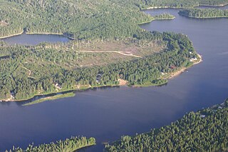
Kakwa Provincial Park and Protected Area is a 170,890 ha provincial park in northeastern British Columbia, Canada. There are significant amounts of fish fossils there. The tallest mountains are Mount Sir Alexander and Mount Ida. Fishing in Kakwa Lake is permitted. Snowmobiling is permitted on trails, meadows, and along mountain sides.

The Great Divide Trail (GDT) is a wilderness hiking trail in the Canadian Rockies. The trail closely follows the Great Divide between Alberta and British Columbia, crossing the divide more than 30 times. Its southern terminus is in Waterton Lakes National Park at the Canada–US border and its northern terminus is at Kakwa Lake in Kakwa Provincial Park, north of Jasper National Park. The trail is 1,130 km (700 mi) long and ranges in elevation from 1,055 m (3,461 ft) at Old Fort Point trailhead near Jasper to 2,590 m (8,500 ft) at an unnamed pass above Michele Lakes just south of the White Goat Wilderness Area.

The Smoky River is a river in western Alberta, Canada. It is a major tributary of the Peace River. The descriptive name refers to the presence of "smouldering beds of coal in the riverbank" noted by the Cree Indians.

The Wapiti River is a river in eastern British Columbia and western Alberta, Canada. It is a major tributary of the Smoky River, located in the southern area of the Peace River Basin.

The Ghost River Wilderness Area is a provincially designated wilderness area in the Canadian Rockies of Alberta. It was established in 1967 and it, as one of the three Wilderness Areas of Alberta, has the strictest form of government protection available in Canada. All development is forbidden and only travel by foot is permitted. Hunting and fishing are not allowed. The other two Wilderness Areas are White Goat Wilderness Area and Siffleur Wilderness Area and together the three areas total 249,548.80 acres (100,988.82 ha).

Northern Alberta is a region located in the Canadian province of Alberta.

Alberta Provincial Highway No. 666, commonly referred to as Highway 666, is a highway in the province of Alberta, Canada. It runs mostly west-east, on mostly existing township and range roads in the Municipal District of Greenview No. 16 in Northern Alberta, for 37 km.
The Northern Rocky Mountains, usually referred to as the Northern Rockies, are a subdivision of the Canadian Rockies comprising the northern half of the Canadian segment of the Rocky Mountains. While their northward limit is easily defined as the Liard River, which is the northward terminus of the whole Rockies, the southward limit is debatable, although the area of Mount Ovington and Monkman Pass is mentioned in some sources, as south from there are the Continental Ranges, which are the main spine of the Rockies forming the boundary between British Columbia and Alberta. Some use the term to mean only the area north of Lake Williston, and in reference to Northern Rocky Mountains Provincial Park, while others consider the term to extend all the way south, beyond the limit of the Hart Ranges at Mount Ovington, to McBride and Mount Robson.

Kiskatinaw is a tributary of the Peace River in northeastern British Columbia, Canada.

Pakowki Lake is an endorheic lake in Alberta, Canada located south of Etzikom, Alberta and not far north is the former town site of Pakowki which may have received its name from the lake.

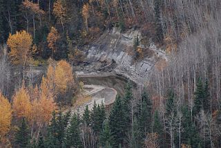
Kakwa Wildland Park is a provincial park in the Rocky Mountain Foothills just east of the northern Canadian Rockies, in Alberta, Canada, immediately east of the border with British Columbia at the 120th meridian west. The park is home to Alberta's tallest waterfall, the Kakwa Falls, which is 30 metres tall.
The Whitesand River is a river in Thunder Bay District, Ontario, Canada, part of the Hewitson River system. Another river in Thunder Bay District with the same name, Whitesand River, lies further northwest and flows into Lake Nipigon.
The Sand River is a major tributary of the Beaver River in Alberta, Canada.
The Heart River is a river in northern Alberta, Canada. It is a major tributary of the Peace River.
