Kingston (town), New York

Last updated
Kingston
Town of Kingston
Ulster County New York incorporated and unincorporated areas Kingston (town) highlighted.svg
Location in Ulster County and the state of New York.
USA New York location map.svg
Red pog.svg
Kingston
Location within the state of New York
Coordinates: 41°59′28″N74°3′26″W / 41.99111°N 74.05722°W / 41.99111; -74.05722
Country United States
State New York
County Ulster
Area
[1]
  Total7.75 sq mi (20.07 km2)
  Land7.70 sq mi (19.95 km2)
  Water0.05 sq mi (0.13 km2)  0.64%
Elevation
476 ft (145 m)
Population
 (2020) [2]
  Total933
  Density121.17/sq mi (46.77/km2)
Time zone UTC-5 (Eastern (EST))
  Summer (DST) UTC-4 (EDT)
ZIP codes
12401-12402
Area code 845
FIPS code 36-39738
GNIS feature ID0979119

Kingston is a town in Ulster County, New York, United States. The Town of Kingston is in the northeastern part of Ulster County, north of the City of Kingston. Kingston is inside the Catskill Park. The population was 933 at the 2020 census. [2]

Contents

History

The original Town of Kingston was settled circa 1611, primarily as a military post, but that part of the town is now the City of Kingston. The town was formed by a patent granted in 1667 and its status as a town was reaffirmed in 1702. The current town does not border the city of Kingston.

In 1811, part of the Town of Kingston was used to form the Towns of Esopus and Saugerties. Additional parts of Kingston were used to set apart the City of Kingston in 1827 and the Town of Woodstock in 1879.

The quarrying industry brought many immigrant laborers to the town, and these new arrivals established themselves in the few communities within this town.

Sawkill

The community takes its name from the sawmills plus “kill”, the Dutch word for creek. [3]

On January 1, 1765, William Legg bought around 100 acres of land lying on both sides of the Saw Kill. This was one of the first purchases to be made in the present town of Kingston. Legg built a sawmill and a house. The Legg family lived there for 88 years. It was reported that they ground wheat in the mill for the Continental Army. Saw mill and grist mill construction were commonplace along the Saw Kill River by the end of the 18th century. Milling died down by the end of the 19th because of decreased profitability. [4]

The next owner was James Gaddis. He continued the milling operations and denied requests of people to use the land for quarrying. However, in the 1880s a fire destroyed both the house and the mill. Gaddis, needing money to rebuild, gave permission for quarrying bluestone on the Saw Mill creek ledge. The extensive quarrying moved the falls that were located by the mill back 300 feet.

Howe's Mill was another mill located on the Saw Kill. It was powered by a dam at Little Falls. The mill was used to make gunpowder and there were frequently explosions. The mill stayed mostly intact, however, and continued operating until the 1860s when it was hit by lightning.

Bluestone quarrying in the area increased in 1828 when the Delaware and Hudson Canal was being built. [5] Bluestone was used to pave sidewalks in New York City, Albany, and Kingston and was shipped all over the world. Entrepreneurs bought up the rocky ground and brought unskilled immigrants, mostly Irish, upriver from Manhattan. Sawkill became a "quarry-town" with company-owned housing.

In the 1900s railroads helped spur tourism in the region. During the summers, many farmers would take in boarders from the city. The scenic beauty and trout fishing in the Saw Kill and other similar creeks is part of what attracted people to the area. [4]

Geography

According to the United States Census Bureau, the town has a total area of 7.8 square miles (20 km2), of which 7.8 square miles (20 km2) is land and 0.1 square miles (0.26 km2) (0.64%) is water.

Demographics

Historical population
CensusPop.Note
1820 2,956
1830 4,17041.1%
1840 5,82439.7%
1850 10,23275.7%
1860 16,64062.6%
1870 21,94331.9%
1880 1,053−95.2%
1890 651−38.2%
1900 524−19.5%
1910 343−34.5%
1920 166−51.6%
1930 19416.9%
1940 1961.0%
1950 22715.8%
1960 490115.9%
1970 74852.7%
1980 92423.5%
1990 864−6.5%
2000 9125.6%
2010 889−2.5%
2020 9334.9%
U.S. Decennial Census [6]

2000 census

As of the census [7] of 2000, there were 908 people, 356 households, and 249 families residing in the town. The population density was 117.1 people per square mile (45.2 people/km2). There were 398 housing units at an average density of 51.3 per square mile (19.8/km2). The racial makeup of the town was 95.59% White, 1.76% Black or African American, 0.22% Native American, 0.44% Asian, 0.11% from other races, and 1.87% from two or more races. Hispanic or Latino of any race were 1.65% of the population.

There were 356 households, out of which 30.9% had children under the age of 18 living with them, 56.7% were married couples living together, 8.4% had a female householder with no husband present, and 29.8% were non-families. 23.3% of all households were made up of individuals, and 6.5% had someone living alone who was 65 years of age or older. The average household size was 2.55 and the average family size was 2.99.

In the town, the population was spread out, with 22.9% under the age of 18, 6.1% from 18 to 24, 29.2% from 25 to 44, 30.3% from 45 to 64, and 11.6% who were 65 years of age or older. The median age was 41 years. For every 100 females, there were 110.7 males. For every 100 females age 18 and over, there were 107.1 males.

The median income for a household in the town was $42,500, and the median income for a family was $48,182. Males had a median income of $32,391 versus $25,956 for females. The per capita income for the town was $18,472. About 6.2% of families and 7.6% of the population were below the poverty line, including 10.9% of those under age 18 and 3.8% of those age 65 or over.

2010 census

As of the 2010 census, the population was 889. The racial makeup of the town was 93.02% White, 3.94% Black or African American, 0.34% Native American, 1.24% Asian, 0.56% from other races, and 0.90% from two or more races. Hispanic or Latino of any race were 3.1% of the population. [8]

2020 census

As of the 2020 census, the population was 933. The racial makeup of the town was 87.67% White, 1.07% Black or African American, 0.21% Native American, 1.29% Asian, 1.39% from other races, and 8.36% from two or more races. Hispanic or Latino of any race were 6.86% of the population. [2]

Communities and locations in the Town of Kingston

Related Research Articles

<span class="mw-page-title-main">Lexington, New York</span> Town in New York, United States

Lexington is a town in Greene County, New York, United States. The population was 770 at the 2020 census. The town is in the southwestern part of Greene County.

<span class="mw-page-title-main">Esopus, New York</span> Town in New York, United States

Esopus is a town in Ulster County, New York, United States. The population was 9,548 at the 2020 census. The town was named after the local indigenous tribe and means "small river" in English. They were one of the Lenape (Delaware) bands, belonging to a people who ranged from western Connecticut through lower New York, western Long Island, and parts of New Jersey and Pennsylvania along the Delaware River. The town is on the west bank of the Hudson River south of the city of Kingston. Its center is in Port Ewen. US Route 9W passes along the eastern side of the town.

<span class="mw-page-title-main">Lake Katrine, New York</span> CDP in New York, United States

Lake Katrine is a hamlet in Ulster County, New York, United States. The population was 2,522 at the 2020 census.

<span class="mw-page-title-main">Marbletown, New York</span> Town in New York, United States

Marbletown is a town in Ulster County, New York, United States. The population was 5,658 at the 2020 census. It is located near the center of Ulster County, southwest of the City of Kingston. US 209 and NY 213 pass through the town. It is at the eastern edge of the Catskill Park.

<span class="mw-page-title-main">Olive, New York</span> Town in New York, United States

Olive is a town in Ulster County, New York, United States. The town is west of Kingston, New York and is inside the Catskill Park. The population was 4.226 at the 2020 census.

<span class="mw-page-title-main">Phoenicia, New York</span> CDP and hamlet in New York, United States

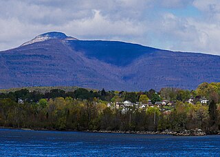
Phoenicia is a hamlet of Shandaken in Ulster County, New York, United States. The population was 268 at the 2020 census, making it the second highest populated community in the town. The village center is located just off Route 28 at its junction with Route 214 and is nestled at the base of three peaks, Mount Tremper, Romer Mountain, and Sheridan Mountain. The community sits at the confluence of the Esopus Creek and Stony Clove Creek. A popular getaway for New Yorkers, the hamlet has frequented many tourism guides as among the best vacation towns in the greater New York City area.

<span class="mw-page-title-main">Port Ewen, New York</span> CDP in New York, United States

Port Ewen is a hamlet in Ulster County, New York, United States. The population was 3,678 at the 2020 census. Port Ewen is in the Town of Esopus, south of Kingston, along U.S. Route 9W.

<span class="mw-page-title-main">Rifton, New York</span> CDP in New York, United States

Rifton is a hamlet in Ulster County, New York, United States. The population was 481 at the 2020 census.

<span class="mw-page-title-main">Rosendale, New York</span> Town in New York, United States

Rosendale is a town in the center of Ulster County, New York, United States. It once contained a village Rosendale, primarily centered around Main Street, but which was dissolved through vote in 1977. The population was 5,782 at the 2020 census.

<span class="mw-page-title-main">Saugerties South, New York</span> CDP in New York, United States

Saugerties South is a hamlet in Ulster County, New York, United States. The population was 2,442 at the 2020 census.

<span class="mw-page-title-main">Shandaken, New York</span> Town in New York, United States

Shandaken is a town on the northern border of Ulster County, New York, United States, northwest of Kingston, New York. As of the 2020 census, the town had a total population of 2,866. The name is believed to be from an Esopus phrase for "land of rapid waters."

<span class="mw-page-title-main">Shawangunk, New York</span> Town in New York, United States

Shawangunk is a town in southwestern Ulster County, New York, United States. The population was 13,563 at the 2020 census. The town takes its name from its largest stream, the Shawangunk Kill. The name Shawangunk is from the language of the Lenape people. Kill is an abbreviation of the Dutch word for creek, Killitje. It is pronounced Shuh-Whan-Gung

<span class="mw-page-title-main">Ulster, New York</span> Town in New York, United States

Ulster is a town in Ulster County, New York, United States. The population was 12,660 at the 2020 census.

<span class="mw-page-title-main">Wallkill, Ulster County, New York</span> CDP in New York, United States

Wallkill is a hamlet, generally identified as coterminous with ZIP code 12589, telephone exchange 895 in the 845 area code and most of the Wallkill Central School District located mostly in the eastern half of the town of Shawangunk, Ulster County, New York, United States, but partly spilling over into adjacent regions of the Orange County towns of Newburgh and Montgomery. The population was 2,166 at the 2020 census.

<span class="mw-page-title-main">Hurley (CDP), New York</span> CDP in New York, United States

Hurley is a hamlet in the Town of Hurley, Ulster County, New York, United States. The population was 3,346 at the 2020 census.

<span class="mw-page-title-main">Hurley, New York</span> Town in New York, United States

Hurley is a town in Ulster County, New York, United States. The population was 6,178 at the 2020 census. The town is in the northeastern part of the county, west of the city of Kingston. Much of the town is inside the Catskill Park. Located within the town is a hamlet and census-designated place, also named Hurley. The Town of Hurley comprises the hamlets of Hurley, West Hurley and Glenford.

<span class="mw-page-title-main">Saugerties (village), New York</span> Village in Ulster County, New York, United States

Saugerties is a village in Ulster County, New York, United States. The population was 3,899 at the 2020 census, showing a slight decline from the 3,971 counted at the 2010 census.

<span class="mw-page-title-main">Saugerties, New York</span> Town in Ulster County, New York, United States

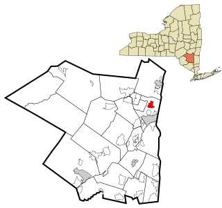
Saugerties is a town in the northeastern corner of Ulster County, New York. The population was 19,038 at the time of the 2020 Census, a decline from 19,482 in 2010. The village of the same name is located entirely within the town.

<span class="mw-page-title-main">Woodstock, New York</span> Town in New York, United States

Woodstock is a town in Ulster County, New York, United States, in the northern part of the county, northwest of Kingston, NY. It lies within the borders of the Catskill Park. The population was 6,287 at the 2020 census, up from 5,884 in 2010.

<span class="mw-page-title-main">Saw Kill (Esopus Creek tributary)</span> River in New York, United States

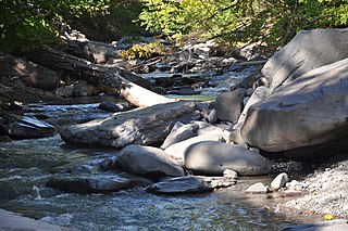
Saw Kill is a 19.7-mile-long (31.7 km) main tributary that drains into Esopus Creek on the Hudson’s west bank.

References

  1. "2016 U.S. Gazetteer Files". United States Census Bureau. Retrieved Jul 5, 2017.
  2. 1 2 3 "2020 Census Redistricting Data: Kingston town, Ulster County, New York". data.census.gov. U.S. Census Bureau. Retrieved February 1, 2023.
  3. "Where the Pastor Once spied on the Pub", The Kingston Daily Freeman, June 7, 1969
  4. 1 2 "A Journey Through Lower Esopus Creek" (PDF). www.loweresopus.org.
  5. "History of Town of Kingston". www.townkingstonny.us. Retrieved 2015-10-17.
  6. "Census of Population and Housing". Census.gov. Retrieved June 4, 2015.
  7. "U.S. Census website". United States Census Bureau . Retrieved 2008-01-31.
  8. American Fact Finder, U.S. Census, 2010, Kingston town, New York, https://factfinder.census.gov/faces/tableservices/jsf/pages/productview.xhtml?src=CF Archived 2011-07-21 at the Wayback Machine Archived 2015-04-11 at the Wayback Machine