
The Landis Mill Covered Bridge is a covered bridge that spans the Little Conestoga Creek in Lancaster County, Pennsylvania, United States. A county-owned and maintained bridge, its official designation is the Little Conestoga #1 Bridge. The bridge, built in 1873 by Elias McMellen, is today surrounded by a development, shopping center, and highways on the boundary of Lancaster, Pennsylvania. At 53 feet (16 m), it is the shortest covered bridge in the county.

The Siegrist's Mill Covered Bridge is an 88-foot (27 m), Burr Arch Truss covered bridge over Chiques Creek between Rapho and West Hempfield townships, Lancaster County in U.S. state of Pennsylvania. Owned and maintained by the county, its official designation is the Big Chiques #6 Bridge.

The Pool Forge Covered Bridge is a covered bridge that spans the Conestoga River in Lancaster County, Pennsylvania, United States. The bridge is now on private property where it was once used as a storage barn before the owner added a road to receive vehicle traffic.
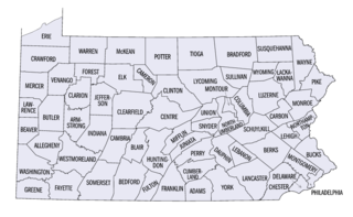
This is a list of properties and districts listed on the National Register of Historic Places in Pennsylvania. As of 2015, there are over 3,000 listed sites in Pennsylvania. All 67 counties in Pennsylvania have listings on the National Register.
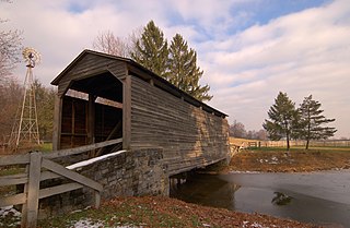
The Buck Hill Covered Bridge, Eichelberger's Covered Bridge, or Abram Hess' Mill Bridge is a burr arch-truss style covered bridge located in Lancaster County, Pennsylvania, United States. It is located on the Buck Hill Farm's pond on private property.

The Mansfield Covered Bridge is a Double Burr Arch double span truss bridge located on Mansfield Road (historic) and Big Raccoon Creek in Mansfield southeast of Rockville in Parke County, Indiana. Built by Joseph J. Daniels in 1867 at a cost of $12,200. At 279 ft (85 m) it is the second longest covered bridge left in Parke County. This Historic Site rest on land provided by Luke Moody, of Parke County, Indiana and is open to the public all year.

The Big Rocky Fork Covered Bridge is located 1 mile (1.6 km) southeast of Mansfield, Indiana, on County Road 720 and about 2 miles (3.2 km) east of State Road 59, in Parke County.

Buskirk Bridge is a wooden covered bridge and is the name of the hamlet in which it is located. It is in the town of Hoosick. The bridge, which crosses the Hoosic River is one of 29 historic covered bridges in New York State. The bridge takes its name from the nearby hamlet of the same name, which was named after the local Van Buskirk family.

The Bowsher Ford Covered Bridge is a single span Burr Arch truss covered bridge structure that was built by J.A. Britton's son, Eugene Britton, in 1915.

The Catlin Covered Bridge is a single span Burr Arch truss covered bridge structure that was built by Clark McDaniel in 1907.

The Thorpe Ford Covered Bridge is northeast of Rosedale, Indiana. The single span Burr Arch Truss covered bridge structure was built by Joseph A. Britton in 1912.
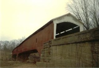
The West Union Covered Bridge formerly carried Tow Path Road over Sugar Creek north-northeast of Montezuma, Indiana. The two-span Burr Arch Truss covered bridge structure was built by Joseph J. Daniels in 1876. It is notable for being the longest standing covered bridge in Parke County, and one of the nation's best-preserved examples of the Burr truss.

The Cogan House Covered Bridge is a Burr arch truss covered bridge over Larrys Creek in Cogan House Township, Lycoming County, in the U.S. state of Pennsylvania. It was built in 1877 and is 94 feet 2 inches (28.7 m) long. The bridge was placed on the National Register of Historic Places in 1980, and had a major restoration in 1998. The Cogan House bridge is named for the township and village of Cogan House, and is also known by at least four other names: Buckhorn, Larrys Creek, Day's, and Plankenhorn.

The Buttonwood Covered Bridge is a covered bridge built in either 1878 or 1898 over Blockhouse Creek in Jackson Township, Lycoming County in the U.S. state of Pennsylvania. It uses a queen post with king post truss and is 74 feet 2 inches (22.6 m) long. The bridge was placed on the National Register of Historic Places in 1980, and had a major restoration in 1998. It is the shortest and most heavily used of the three covered bridges remaining in Lycoming County.
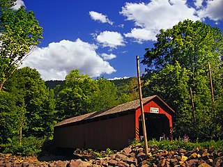
The Sonestown Covered Bridge is a covered bridge over Muncy Creek in Davidson Township, Sullivan County, Pennsylvania built around 1850. It is 110 ft (34 m) long and was placed on the National Register of Historic Places (NRHP) in 1980. It is named for the nearby unincorporated village of Sonestown in Davidson Township, and is also known as the Davidson Covered Bridge. It was built to provide access to a grist mill which operated until the early 20th century.

The Forksville Covered Bridge is a Burr arch truss covered bridge over Loyalsock Creek in the borough of Forksville, Sullivan County, in the U.S. state of Pennsylvania. It was built in 1850 and is 152 feet 11 inches (46.61 m) in length. The bridge was placed on the National Register of Historic Places in 1980. The Forksville bridge is named for the borough it is in, which in turn is named for its location at the confluence or "forks" of the Little Loyalsock and Loyalsock Creeks.
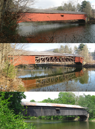
The Hillsgrove Covered Bridge is a Burr arch truss covered bridge over Loyalsock Creek in Hillsgrove Township, Sullivan County, in the U.S. state of Pennsylvania. It was built c. 1850 and is 186 feet (56.7 m) long. In 1973, it became the first covered bridge in the county to be placed on the National Register of Historic Places (NRHP). The bridge is named for the township and nearby unincorporated village of Hillsgrove, and is also known as Rinkers Covered Bridge for an adjoining farm.

The Hill to Hill Bridge is a road crossing of the Lehigh River and linking the south and north sides of Bethlehem, Pennsylvania in the Lehigh Valley region of eastern Pennsylvania.
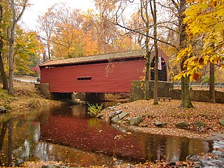
Bartram's Covered Bridge, a historic covered bridge built in 1860, uses a Burr Truss design and carried Goshen Road over Crum Creek on the border between Delaware County and Chester County, Pennsylvania. It is 30 feet (9.1 m) long and 13 feet (4.0 m) wide and is the only covered bridge remaining of the 30 which once stood in Delaware County. The bridge has slanted planks at each entrance and is the only covered bridge in Pennsylvania with this feature. According to an on-site marker from the Newtown Square Historical Preservation Society, the bridge was built to be "hi and wide as a load of hay" It was built by Ferdinand Wood and named for Mordecai Bartram.

Bogert Covered Bridge is a historic wooden covered bridge located at Allentown, Pennsylvania. It is a 145-foot-long (44 m), Burr Truss bridge, constructed in 1841. It has vertical plank siding and a gable roof. It was restored by the Allentown Parks Department.


