List of bridges on the National Register of Historic Places in Connecticut

Last updated

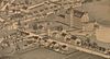
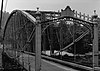
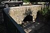
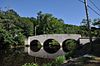
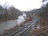
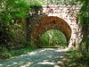
This is a list of bridges and tunnels on the National Register of Historic Places in the U.S. state of Connecticut. [1]

NameImageBuiltListedLocationCountyType
Arrawanna Bridge Arrawanna Bridge on Coginchaug Middletown CT.jpg 19182004-09-29 Middletown
41°33′46″N72°40′0″W / 41.56278°N 72.66667°W / 41.56278; -72.66667 (Arrawanna Bridge)
Middlesex Open-spandrel concrete arch
Ashland Mill Bridge AshlandMill1889.jpg 18861999-04-01, delisted 2016-02-02 Griswold
41°31′31″N71°58′28″W / 41.52528°N 71.97444°W / 41.52528; -71.97444 (Ashland Mill Bridge)
New London Lenticular pony truss; demolished
Blackledge River Railroad Bridge Double Intersection Warren Truss Bridge, Spanning Blackledge River, Colchester (New London County, Connecticut).jpg ca. 19121986-07-31 Colchester
41°35′2″N72°25′21″W / 41.58389°N 72.42250°W / 41.58389; -72.42250 (Blackledge River Railroad Bridge)
New London Warren truss
Boardman's Bridge Boardman's Lenticular Bridge, Spanning Housatonic River on Boardman's Road, New Milford (Litchfield County, Connecticut).jpg 18881976-05-13 New Milford
41°35′36″N73°27′2″W / 41.59333°N 73.45056°W / 41.59333; -73.45056 (Boardman's Bridge)
Litchfield Lenticular truss
Bridge No. 1132 KillingworthCT Bridge1132.jpg 19342004-09-29 Killingworth and Madison
41°21′33″N72°43′15″W / 41.35917°N 72.72083°W / 41.35917; -72.72083 (Bridge No. 1132)
Middlesex and New Haven Open-spandrel concrete arch
Bridge No. 1603 DevilsHopyardSP Bridge1603DownstreamSide.jpg 19371993-07-29 East Haddam
41°29′1.5″N72°20′32.5″W / 41.483750°N 72.342361°W / 41.483750; -72.342361 (Bridge No. 1603)
Middlesex Stone arch; vernacular, rustic
Bridge No. 1604 DevilsHopyardSP Bridge1604DownstreamSide.jpg 19371993-07-29 East Haddam
41°28′38.7″N72°20′31″W / 41.477417°N 72.34194°W / 41.477417; -72.34194 (Bridge No. 1604)
Middlesex Stone arch; vernacular, rustic
Bridge No. 1605 DevilsHopyardSP Bridge1605DownstreamSide.jpg 19371993-07-29 East Haddam
41°28′32″N72°20′30.88″W / 41.47556°N 72.3419111°W / 41.47556; -72.3419111 (Bridge No. 1605)
Middlesex Stone arch; vernacular, rustic
Bridge No. 1860 MontvilleCT Bridge1860.jpg 19361993-07-29 Montville
41°28′48″N72°05′12″W / 41.48°N 72.0867°W / 41.48; -72.0867 (Bridge No. 1860)
New London Stone arch; vernacular, rustic
Bridge No. 2305 LakevilleCT Bridge2305ProfileView.jpg 18732007-03-09 Salisbury
41°58′4″N73°26′22″W / 41.96778°N 73.43944°W / 41.96778; -73.43944 (Bridge No. 2305)
Litchfield Stone arch
Bridge No. 455 SuffieldCT Bridge455.jpg 19292004-09-29 Suffield
41°57′30″N72°37′40″W / 41.95833°N 72.62778°W / 41.95833; -72.62778 (Bridge No. 455)
Hartford Open-spandrel concrete arch
Bridge No. 560 Cornwall Bridge and station 063.JPG 19302004-09-29 Cornwall
41°49′11″N73°22′25″W / 41.81972°N 73.37361°W / 41.81972; -73.37361 (Bridge No. 560)
Litchfield Open spandrel concrete arch
Bulkeley Bridge 215 17 Morgan G. Bulkeley Bridge, middle arch.jpg 19081993-12-10 Hartford
41°46′9″N72°39′58″W / 41.76917°N 72.66611°W / 41.76917; -72.66611 (Bulkeley Bridge)
Hartford Stone arch
Bull's Bridge Bulls Bridge Kent Connecticut.jpg ca. 18701972-04-26 Kent
41°40′32″N73°30′35″W / 41.67556°N 73.50972°W / 41.67556; -73.50972 (Bull's Bridge)
Litchfield Town lattice truss
Butts Bridge Butts Bridge Over Quinebaug River, Canterbury, CT.JPG 19372010-5-24 Canterbury
41°39′05″N71°58′15″W / 41.65139°N 71.97083°W / 41.65139; -71.97083 (Butts Bridge)
Windham Parker Truss
Comstock's Bridge Comstock's Bridge, East Hampton.jpg 1840, 18681976-01-01 East Hampton
41°33′11″N72°26′57″W / 41.55306°N 72.44917°W / 41.55306; -72.44917 (Comstock's Bridge)
Middlesex Howe truss covered bridge
Depot Street Bridge BeaconFallsCT DepotStreetBridge.jpg 19352007-03-09 Beacon Falls
41°26′31″N73°3′48″W / 41.44194°N 73.06333°W / 41.44194; -73.06333 (Depot Street Bridge)
New Haven Parker through truss
Drake Hill Road Bridge Drake Hill Road Bridge.JPG 18921984-07-19 Simsbury
41°52′6″N72°48′1″W / 41.86833°N 72.80028°W / 41.86833; -72.80028 (Drake Hill Road Bridge)
Hartford Parker truss
Farmington River Railroad Bridge Farmington River Railroad Bridge, Windsor CT.jpg 18671972-08-25 Windsor
41°51′28″N72°38′30″W / 41.85778°N 72.64167°W / 41.85778; -72.64167 (Farmington River Railroad Bridge)
Hartford Stone arch
Glen Falls Bridge PlainfieldCT GlenFallsBridge2.jpg 18861999-04-01 Plainfield
41°43′1″N71°51′43″W / 41.71694°N 71.86194°W / 41.71694; -71.86194 (Glen Falls Bridge)
Windham Lenticular through Truss
Hamburg Bridge Historic District LymeCT HamburgBridge.jpg 19361983-03-10 Lyme
41°23′40″N72°21′02″W / 41.394476°N 72.350676°W / 41.394476; -72.350676 (Hamburg Bridge)
New London Concrete arch; Queen Anne
Housatonic River Railroad Bridge Housatonic River Bridge, Stratford, -Fairfield County, Connecticut).jpg 19041987-06-12 Milford-Stratford
41°12′19″N73°6′37″W / 41.20528°N 73.11028°W / 41.20528; -73.11028 (Housatonic River Railroad Bridge)
Fairfield Scherzer Rolling Lift Bascule
Lover's Leap Bridge Lover's Leap Lenticular Bridge, Spanning Housatonic River on Pumpkin Hill Road, New Milford (Litchfield County, Connecticut).jpg 18951976-05-13 New Milford
41°32′39″N73°24′26″W / 41.54417°N 73.40722°W / 41.54417; -73.40722 (Lover's Leap Bridge)
Litchfield Lenticular
Lyman Viaduct Lyman viaduct pacific railway 1876.JPG 18731986-08-21 Colchester
41°33′53″N72°26′46″W / 41.56472°N 72.44611°W / 41.56472; -72.44611 (Lyman Viaduct)
New London Buried wrought iron railroad trestle
Main Street Bridge StamfordCT MainStreetBridge.jpg 18881987-05-21 Stamford
41°3′14″N73°32′44″W / 41.05389°N 73.54556°W / 41.05389; -73.54556 (Main Street Bridge)
Fairfield Lenticular pony truss; closed to vehicular traffic
Melrose Road Bridge EastWindsorCT MelroseRoadBridge.jpg 18881999-08-05 East Windsor
41°56′18″N72°32′51″W / 41.93833°N 72.54750°W / 41.93833; -72.54750 (Melrose Road Bridge)
Hartford Lenticular pony truss
Merritt Parkway Bridges Merritt Parkway, James Farm Road Bridge, Spanning Merritt Parkway, Stratford (Fairfield County, Connecticut).jpg 1930s1991Greenwich, Stamford, New Canaan, Norwalk, Westport, Fairfield, Trumbull, Stratford Fairfield County Sixty-six beam and arched structures of various 1930s styles, including Art Deco, Art Moderne and Neoclassicism.
Mianus River Railroad Bridge Mianus River Bridge, Cos Cob (Fairfield County, Connecticut).jpg 19041987-06-12 Greenwich
41°1′51″N73°35′41″W / 41.03083°N 73.59472°W / 41.03083; -73.59472 (Mianus River Railroad Bridge)
Fairfield Deck Girder, Bascule
Mill Brook Bridge LisbonCT MillBrookBridgeRemnant.jpg ca. 1790s1997-01-02 Lisbon
41°33′30″N72°2′25″W / 41.55833°N 72.04028°W / 41.55833; -72.04028 (Mill Brook Bridge)
New London Masonry arch; partially collapsed
Minortown Road Bridge MinortownBridge.png 18902001-08-17 Woodbury
41°34′36″N73°10′34″W / 41.57667°N 73.17611°W / 41.57667; -73.17611 (Minortown Road Bridge)
Litchfield Lenticular pony truss
Mystic Bridge Historic District Mystic River Bascule Bridge in Mystic, Connecticut.JPG 19221979-08-31 Mystic
41°21′17″N71°58′08″W / 41.354710°N 71.968759°W / 41.354710; -71.968759 (Mystic River Bascule Bridge)
New London Strauss Heel Trunnion Bascule
Norwalk River Railroad Bridge NorwalkCTNorwalkRivRRBridge08122007.JPG 18961987-06-12 South Norwalk
41°6′2″N73°24′57″W / 41.10056°N 73.41583°W / 41.10056; -73.41583 (Norwalk River Railroad Bridge)
Fairfield Rim Bearing, Swing
Packerville Bridge PlainfieldCT PackervilleBridge.jpg 18861992-11-27 Plainfield
41°40′1″N71°56′56″W / 41.66694°N 71.94889°W / 41.66694; -71.94889 (Packerville Bridge)
Windham Masonry arch
Pequabuck Bridge Pequabuck Bridge, August 31, 2008.jpg 1832, 18331984-07-19 Farmington
41°42′59″N72°50′25″W / 41.71639°N 72.84028°W / 41.71639; -72.84028 (Pequabuck Bridge)
Hartford Stone arch
Pequonnock River Railroad Bridge Pequonock River Bridge, Bridgeport (Fairfield County, Connecticut).jpg 19021987-06-12 Bridgeport
41°10′59″N73°11′11″W / 41.18306°N 73.18639°W / 41.18306; -73.18639 (Pequonnock River Railroad Bridge)
Fairfield Through Girder Bascule
Perry Avenue Bridge Perry Avenue Bridge 011.JPG 18992006-10-25 Norwalk
41°9′4″N73°26′45″W / 41.15111°N 73.44583°W / 41.15111; -73.44583 (Perry Avenue Bridge)
Fairfield Single-span arch-deck
Pine Creek Park Bridge Pine creek park bridge.jpg 1872, 1890, 19791992-04-08 Fairfield
41°7′31″N73°15′48″W / 41.12528°N 73.26333°W / 41.12528; -73.26333 (Pine Creek Park Bridge)
Fairfield Pratt pony truss
Rapallo Viaduct EastHamptonCT RapalloViaduct.jpg 18731986-08-21 East Hampton
41°34′19″N72°28′19″W / 41.57194°N 72.47194°W / 41.57194; -72.47194 (Rapallo Viaduct)
Middlesex Filled-over wrought iron railroad viaduct
Red Bridge Red Bridge 2012-09-20 22-07-04.jpg 18911993-12-10 Meriden
41°31′20″N72°50′20″W / 41.52222°N 72.83889°W / 41.52222; -72.83889 (Red Bridge)
New Haven Lenticular truss
Reynolds Bridge ReynoldsBridge ThomastonCT sm.JPG 19282004-09-29 Thomaston
41°39′11″N73°4′39″W / 41.65306°N 73.07750°W / 41.65306; -73.07750 (Reynolds Bridge)
Litchfield Open-spandrel concrete arch
River Road Stone Arch Railroad Bridge River Road Stone RR Bridge 003.jpg 18871986-08-21 Colchester
41°34′49″N72°25′32″W / 41.58028°N 72.42556°W / 41.58028; -72.42556 (River Road Stone Arch Railroad Bridge)
New London Stone arch
Riverside Avenue Bridge GreenwichCTRiversideAvRRbridgeSoEnd09092007.jpg 18711977-08-29 Greenwich
41°1′54″N73°35′18″W / 41.03167°N 73.58833°W / 41.03167; -73.58833 (Riverside Avenue Bridge)
Fairfield Pratt truss
Saugatuck River Bridge Saugatuck River Bridge, Spanning Saugatuck River at Route 136, Westport (Fairfield County, Connecticut).jpg 18841987-02-12 Westport
41°7′22″N73°22′10″W / 41.12278°N 73.36944°W / 41.12278; -73.36944 (Saugatuck River Bridge)
Fairfield Pin-connected swing bridge
Saugatuck River Railroad Bridge Saugatuck River Bridge, Saugatuck (Fairfield County, Connecticut).jpg 19051987-06-12 Westport
41°7′10″N73°22′8″W / 41.11944°N 73.36889°W / 41.11944; -73.36889 (Saugatuck River Railroad Bridge)
Fairfield Deck Girder, Bascule
Sheffield Street Bridge Sheffield Street Bridge spanning Hancock Brook. 9-17-2013.JPG 18842001-04-12 Waterbury
41°35′50″N73°2′52″W / 41.59722°N 73.04778°W / 41.59722; -73.04778 (Sheffield Street Bridge)
New Haven Lenticular pony truss
Skilton Road Bridge SkiltonRoadBridge.jpg ca. 18651991-12-10 Watertown
41°37′45″N73°9′33″W / 41.62917°N 73.15917°W / 41.62917; -73.15917 (Skilton Road Bridge)
Litchfield Masonry-arch
Starr Mill Road Bridge StarrMill05.JPG 19271993-12-10 Middletown
41°32′56″N72°40′38″W / 41.54889°N 72.67722°W / 41.54889; -72.67722 (Starr Mill Road Bridge)
Middlesex Warren through truss
Stone Bridge Stone Bridge, Hartford CT.jpg 18331985-03-28 Hartford
41°45′44″N72°40′36″W / 41.76222°N 72.67667°W / 41.76222; -72.67667 (Stone Bridge)
Hartford Stone arch
Town Bridge Town Bridge over the Farmington River 3.jpg 18951999-08-05 Canton
41°49′28″N72°55′43″W / 41.82444°N 72.92861°W / 41.82444; -72.92861 (Town Bridge)
Hartford Parker through truss
Turn-of-River Bridge StamfordCT TurnOfRiverBridge 1.jpg 1892, 18931987-07-31 Stamford
41°6′54″N73°32′42″W / 41.11500°N 73.54500°W / 41.11500; -73.54500 (Turn-of-River Bridge)
Fairfield Lenticular pony truss; foot traffic only
Washington Avenue Bridge Washington Avenue Lenticular Truss Bridge, Spanning Mad River, Waterbury (New Haven County, Connecticut).jpg 18812001-04-12 Waterbury
41°32′38″N73°2′18″W / 41.54389°N 73.03833°W / 41.54389; -73.03833 (Washington Avenue Bridge)
New Haven Lenticular pony truss
Washington Bridge Washington bridge CT.jpg 19212004-09-29 Milford & Stratford
41°12′1″N73°6′39″W / 41.20028°N 73.11083°W / 41.20028; -73.11083 (Washington Bridge)
Fairfield & New Haven Open-spandrel concrete arch bascule bridge
West Cornwall Covered Bridge Cornwallbridge.jpg 18641975-12-30 West Cornwall
41°52′18″N73°21′52″W / 41.87167°N 73.36444°W / 41.87167; -73.36444 (West Cornwall Covered Bridge)
Litchfield Town lattice truss
Willimantic Footbridge Willimantic pedestrian bridge, middle.JPG 19061979-04-19 Willimantic
41°42′36″N72°12′53″W / 41.71000°N 72.21472°W / 41.71000; -72.21472 (Willimantic Footbridge)
Windham Steel truss footbridge

Related Research Articles

<span class="mw-page-title-main">National Register of Historic Places listings in Cheboygan County, Michigan</span>

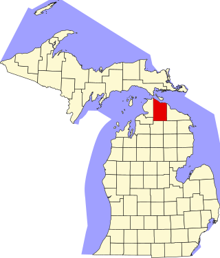
This is a list of the National Register of Historic Places listings in Cheboygan County, Michigan.

The following is a list of Registered Historic Places in Muskegon County, Michigan.
     This National Park Service list is complete through NPS recent listings posted May 10, 2024.

The following is a list of Registered Historic Places in Ottawa County, Michigan.
     This National Park Service list is complete through NPS recent listings posted May 10, 2024.

<span class="mw-page-title-main">National Register of Historic Places listings in Cortland County, New York</span>

List of the National Register of Historic Places listings in Cortland County, New York:

<span class="mw-page-title-main">National Register of Historic Places listings in Greene County, New York</span>

List of the National Register of Historic Places listings in Greene County, New York

<span class="mw-page-title-main">National Register of Historic Places listings in Lewis County, New York</span>

List of the National Register of Historic Places listings in Lewis County, New York

<span class="mw-page-title-main">National Register of Historic Places listings in Livingston County, New York</span>

List of the National Register of Historic Places listings in Livingston County, New York

<span class="mw-page-title-main">National Register of Historic Places listings in Ontario County, New York</span>

List of the National Register of Historic Places listings in Ontario County, New York

<span class="mw-page-title-main">National Register of Historic Places listings in Seneca County, New York</span>

List of Registered Historic Places in Seneca County, New York

<span class="mw-page-title-main">National Register of Historic Places listings in Madison County, New York</span>

List of the National Register of Historic Places listings in Madison County, New York

<span class="mw-page-title-main">National Register of Historic Places listings in Stoneham, Massachusetts</span>

This is a list of properties and historic districts in Stoneham, Massachusetts, that are listed on the National Register of Historic Places.

This is a list of properties and historic districts in Wakefield, Massachusetts, that are listed on the National Register of Historic Places.

This is a list of properties and historic districts in Milton, Massachusetts, that are listed on the National Register of Historic Places.

<span class="mw-page-title-main">National Register of Historic Places listings in Frederick County, Maryland</span>

This is a list of the National Register of Historic Places listings in Frederick County, Maryland.

<span class="mw-page-title-main">National Register of Historic Places listings in Martin County, North Carolina</span>

This list includes properties and districts listed on the National Register of Historic Places in Martin County, North Carolina. Click the "Map of all coordinates" link to the right to view an online map of all properties and districts with latitude and longitude coordinates in the table below.

<span class="mw-page-title-main">National Register of Historic Places listings in Harnett County, North Carolina</span>

This list includes properties and districts listed on the National Register of Historic Places in Harnett County, North Carolina, United States. Click the "Map of all coordinates" link to the right to view a Google map of all properties and districts with latitude and longitude coordinates in the table below.

References

  1. "National Register Information System". National Register of Historic Places . National Park Service. July 9, 2010.