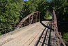
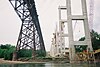
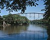
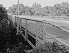
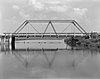
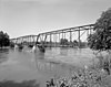
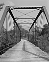
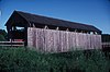
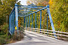
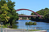
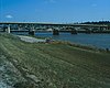
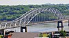
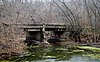
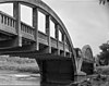
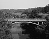
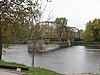
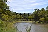
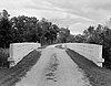
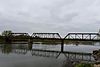
Name Image Built Listed Location County Type 280th Street Bridge 1898 1998-06-25 Independence 42°23′6″N 91°56′34″W / 42.38500°N 91.94278°W / 42.38500; -91.94278 (280th Street Bridge ) Buchanan Pinned kingpost pony truss Adair Viaduct 1923 1998-06-25 Adair 41°29′56″N 94°38′23″W / 41.49889°N 94.63972°W / 41.49889; -94.63972 (Adair Viaduct ) Adair Concrete open spandrel arch Adel Bridge 1882 2002-04-18 Adel 41°36′57″N 94°0′43″W / 41.61583°N 94.01194°W / 41.61583; -94.01194 (Adel Bridge ) Dallas Pratt Through Truss Albright Bridge 1907 1998-06-25 Webster City 42°24′20″N 93°48′36″W / 42.40556°N 93.81000°W / 42.40556; -93.81000 (Albright Bridge ) Hamilton Pinned Pratt through truss Alden Bridge 1936 1998-05-15 Alden 42°31′16″N 93°22′32″W / 42.52111°N 93.37556°W / 42.52111; -93.37556 (Alden Bridge ) Hardin concrete rigid frame Ames Creek Bridge 1912 1998-06-25 De Witt 41°51′1″N 90°30′36″W / 41.85028°N 90.51000°W / 41.85028; -90.51000 (Ames Creek Bridge ) Clinton Concrete through girder Beaver Creek Bridge 1916 1998-06-25 Perry 41°50′47″N 94°2′53″W / 41.84639°N 94.04806°W / 41.84639; -94.04806 (Beaver Creek Bridge ) Dallas Concrete Marsh arch Beaver Creek Bridge 1919 1998-06-25 Ogden 42°2′34″N 94°8′41″W / 42.04278°N 94.14472°W / 42.04278; -94.14472 (Beaver Creek Bridge ) Boone Concrete Marsh arch Bellefountain Bridge 1898 1998-05-15 Tracy 41°19′58″N 92°51′56″W / 41.33278°N 92.86556°W / 41.33278; -92.86556 (Bellefountain Bridge ) Mahaska pinned Pratt through truss Berkhimer Bridge 1899 1998-05-15 Humboldt 42°44′21″N 94°15′11″W / 42.73917°N 94.25306°W / 42.73917; -94.25306 (Berkhimer Bridge ) Humboldt Pennsylvania through truss Bertram Bridge 1891 1998-05-15 Bertram 41°57′23″N 91°31′36″W / 41.95639°N 91.52667°W / 41.95639; -91.52667 (Bertram Bridge ) Linn pinned Pratt through truss Big Creek Bridge 1916 1998-06-25 Madrid 41°53′33″N 93°45′1″W / 41.89250°N 93.75028°W / 41.89250; -93.75028 (Big Creek Bridge ) Boone Concrete Marsh arch Big Creek Bridge 2 1917 1998-06-25 Madrid 41°53′33″N 93°45′2″W / 41.89250°N 93.75056°W / 41.89250; -93.75056 (Big Creek Bridge 2 ) Boone Concrete Marsh arch Big Slough Creek Bridge 1937 1998-05-15 Nichols 41°28′38″N 91°20′53″W / 41.47722°N 91.34806°W / 41.47722; -91.34806 (Big Slough Creek Bridge ) Muscatine concrete rigid frame Boone Bridge 1927, 1928 1998-06-25 Boone 42°2′32″N 93°56′0″W / 42.04222°N 93.93333°W / 42.04222; -93.93333 (Boone Bridge ) Boone Parker/Pratt through truss Boone Bridge 2 1910 1998-06-25 Boone 42°3′47″N 93°58′13″W / 42.06306°N 93.97028°W / 42.06306; -93.97028 (Boone Bridge 2 ) Boone Pennsylvania through truss Boone River Bridge 1912 1998-05-15 Goldfield 42°51′26″N 93°56′46″W / 42.85722°N 93.94611°W / 42.85722; -93.94611 (Boone River Bridge ) Wright riveted Warren pony truss Boone Viaduct 1899–1901 1978-11-17 Boone Boone Pratt deck truss Bridge near West Liberty 1937 1998-05-15 West Liberty 41°34′6″N 91°19′24″W / 41.56833°N 91.32333°W / 41.56833; -91.32333 (Bridge near West Liberty ) Muscatine welded steel rigig frame Bridgeport Bridge 1904 1998-05-15 Denmark 40°47′25″N 91°21′50″W / 40.79028°N 91.36389°W / 40.79028; -91.36389 (Bridgeport Bridge ) Lee Pennsylvania through truss Brooke Creek Bridge 1909 1998-06-25 Sioux Rapids 42°50′11″N 95°17′8″W / 42.83639°N 95.28556°W / 42.83639; -95.28556 (Brooke Creek Bridge ) Buena Vista Concrete spandrel arch Buck Grove Bridge ca. 1945 1998-06-25 Buck Grove 41°54′50″N 95°22′49″W / 41.91389°N 95.38028°W / 41.91389; -95.38028 (Buck Grove Bridge ) Crawford Bowstring pony arch-truss Burlington Railroad Overpass 1937 1998-05-15 Chariton 41°2′27″N 93°21′57″W / 41.04083°N 93.36583°W / 41.04083; -93.36583 (Burlington Railroad Overpass ) Lucas three-hinge deck archtruss Burlington, Cedar Rapids, and Northern Railroad-Rock Rapids Station, Railroad Track and Bridge 1886 1976-11-07 Rock Rapids 43°26′1″N 96°9′59″W / 43.43361°N 96.16639°W / 43.43361; -96.16639 (Burlington, Cedar Rapids, and Northern Railroad-Rock Rapids Station, Railroad Track and Bridge ) Lyon Calamus Creek Bridge 1905 1998-05-15 Maxwell 41°53′4″N 93°22′54″W / 41.88444°N 93.38167°W / 41.88444; -93.38167 (Calamus Creek Bridge ) Story concrete Luten arch Cascade Bridge 1896 1998-06-25 Burlington 40°46′52″N 91°5′54″W / 40.78111°N 91.09833°W / 40.78111; -91.09833 (Cascade Bridge ) Des Moines Baltimore deck truss Chain Lakes Bridge 1884 1998-05-15 Hiawatha 42°2′59″N 91°46′32″W / 42.04972°N 91.77556°W / 42.04972; -91.77556 (Chain Lakes Bridge ) Linn pinned Pratt through truss Chambers Ford Bridge 1890 1998-05-15 Chelsea 41°53′1″N 92°20′9″W / 41.88361°N 92.33583°W / 41.88361; -92.33583 (Chambers Ford Bridge ) Tama pinned Pratt through truss Cherry Street Bridge 1929 1998-06-25 Shell Rock 42°42′28″N 92°35′8″W / 42.70778°N 92.58556°W / 42.70778; -92.58556 (Cherry Street Bridge ) Butler Concrete open-spandrel arch Chicago, Rock Island and Pacific Railroad Stone Arch Viaduct 1868 1998-07-15 Shelby 41°31′26″N 95°26′11″W / 41.52389°N 95.43639°W / 41.52389; -95.43639 (Chicago, Rock Island and Pacific Railroad Stone Arch Viaduct ) Shelby CM and StP Railroad Underpass 1903 1998-05-15 Washington 41°17′36″N 91°43′28″W / 41.29333°N 91.72444°W / 41.29333; -91.72444 (CM and StP Railroad Underpass ) Washington Riveted Warren deck truss Coal Creek Bridge 1889 1998-05-15 Carlisle 41°25′44″N 93°20′46″W / 41.42889°N 93.34611°W / 41.42889; -93.34611 (Coal Creek Bridge ) Warren Pinned Pratt pony truss Corbett's/Eby's Mill Bridge 1871 1985-04-11 Scotch Grove 42°11′59″N 91°3′32″W / 42.19972°N 91.05889°W / 42.19972; -91.05889 (Corbett's/Eby's Mill Bridge ) Jones Arch beam truss Cornelia Lake Bridge 1877 1998-05-15 Clarion 42°47′31″N 93°41′38″W / 42.79194°N 93.69389°W / 42.79194; -93.69389 (Cornelia Lake Bridge ) Wright Pinned Pratt pony truss County Line Bridge 1893 1998-05-15 Columbus Junction 41°16′51″N 91°29′6″W / 41.28083°N 91.48500°W / 41.28083; -91.48500 (County Line Bridge ) Louisa /Washington pinned Pratt through truss Court Avenue Bridge 1918 1998-05-15 Des Moines 41°35′9″N 93°37′3″W / 41.58583°N 93.61750°W / 41.58583; -93.61750 (Court Avenue Bridge ) Polk filled spandral arch Cunningham Bridge 1886 1998-05-15 Bevington 41°24′6″N 93°51′40″W / 41.40167°N 93.86111°W / 41.40167; -93.86111 (Cunningham Bridge ) Madison pinned Pratt through truss Cutler–Donahoe Bridge 1871, 1970 1976-10-08 Winterset 41°19′52″N 94°0′31″W / 41.33111°N 94.00861°W / 41.33111; -94.00861 (Cutler–Donahoe Bridge ) Madison covered bridge Des Moines River Bridge 1916 1998-05-15 Swea City 43°20′42″N 94°26′33″W / 43.34500°N 94.44250°W / 43.34500; -94.44250 (Des Moines River Bridge ) Kossuth Marsh arch Des Moines River Bridge 1939 1998-05-15 Humboldt 42°43′55″N 94°15′30″W / 42.73194°N 94.25833°W / 42.73194; -94.25833 (Des Moines River Bridge ) Humboldt steel plate deck girderuss Dry Run Bridge 1898 1998-06-25 Littleport 42°45′10″N 91°22′8″W / 42.75278°N 91.36889°W / 42.75278; -91.36889 (Dry Run Bridge ) Clayton Steel stringer Dunkerton Bridge 1909 1998-06-25 Dunkerton 42°34′23″N 92°9′38″W / 42.57306°N 92.16056°W / 42.57306; -92.16056 (Dunkerton Bridge ) Black Hawk Concrete spandrelarch Dunleith and Dubuque Bridge 1872 2013-09-11 Dubuque 42°29′21″N 90°46′33″W / 42.48917°N 90.77583°W / 42.48917; -90.77583 (Dunleith and Dubuque Bridge ) Dubuque Pinned Pratt through truss East Indian Creek Bridge 1912 1998-05-15 Nevada 41°58′31″N 93°23′13″W / 41.97528°N 93.38694°W / 41.97528; -93.38694 (East Indian Creek Bridge ) Story concrete Luten arch Eisenhower Bridge 1888 1998-05-15 Milton 40°40′43″N 92°7′2″W / 40.67861°N 92.11722°W / 40.67861; -92.11722 (Eisenhower Bridge ) Van Buren Pinned Pratt through truss Eldorado Bridge 1898, 1899 1998-06-25 Eldorado 43°3′13″N 91°50′5″W / 43.05361°N 91.83472°W / 43.05361; -91.83472 (Eldorado Bridge ) Fayette Pinned Camelback truss Elkader Keystone Bridge 1888, 1889 1976-11-07 Elkader 42°51′17″N 91°24′13″W / 42.85472°N 91.40361°W / 42.85472; -91.40361 (Elkader Keystone Bridge ) Clayton stone arch bridge Ellsworth Ranch Bridge 1895 1998-07-15 Armstrong 43°27′36″N 94°34′49″W / 43.46000°N 94.58028°W / 43.46000; -94.58028 (Ellsworth Ranch Bridge ) Emmet Pratt/Warren through truss Ely's Stone Bridge 1893 1979-03-07 Monticello 42°15′24″N 91°13′31″W / 42.25667°N 91.22528°W / 42.25667; -91.22528 (Ely's Stone Bridge ) Jones Eveland Bridge 1876, 1877 1998-05-15 Oskaloosa 41°14′4″N 92°45′22″W / 41.23444°N 92.75611°W / 41.23444; -92.75611 (Eveland Bridge ) Mahaska pinned Whipple through truss First Avenue Bridge 1920 1998-05-15 Cedar Rapids 41°58′36″N 91°40′20″W / 41.97667°N 91.67222°W / 41.97667; -91.67222 (First Avenue Bridge ) Linn open spandrel arch Fish Creek Bridge 1894 1998-05-15 Salem 40°51′14″N 91°34′51″W / 40.85389°N 91.58083°W / 40.85389; -91.58083 (Fish Creek Bridge ) Henry pinned Pratt bedstead Fort Atkinson Bridge 1892 1998-05-15 Fort Atkinson 43°9′12″N 91°55′43″W / 43.15333°N 91.92861°W / 43.15333; -91.92861 (Fort Atkinson Bridge ) Winneshiek Pinned Pratt through truss Fort Madison Bridge 1925, 1927 1999-08-27 Fort Madison 40°37′16″N 91°17′15″W / 40.62111°N 91.28750°W / 40.62111; -91.28750 (Fort Madison Bridge ) Lee Swing-span through truss Fremont Mill Bridge 1873 1998-05-15 Anamosa 42°6′36″N 91°7′58″W / 42.11000°N 91.13278°W / 42.11000; -91.13278 (Fremont Mill Bridge ) Jones bowstring through arch truss Garnavillo Township Bridge 1902 1998-06-25 Garnavillo 42°51′47″N 91°16′57″W / 42.86306°N 91.28250°W / 42.86306; -91.28250 (Garnavillo Township Bridge ) Clayton Stone arch Garnavillo Township Culvert 1899 1998-06-25 Garnavillo 42°52′4″N 91°16′10″W / 42.86778°N 91.26944°W / 42.86778; -91.26944 (Garnavillo Township Culvert ) Clayton Stone arch culvert Garretson Outlet Bridge 1913 1999-03-12 Whiting 42°12′16″N 96°6′24″W / 42.20444°N 96.10667°W / 42.20444; -96.10667 (Garretson Outlet Bridge ) Monona Warren pony truss Gilliece Bridge 1873, 1874 1998-05-15 Bluffton 43°24′54″N 91°57′32″W / 43.41500°N 91.95889°W / 43.41500; -91.95889 (Gilliece Bridge ) Winneshiek Bowstring through arch-truss Gipple's Quarry Bridge 1893 1998-05-15 Columbus Junction 41°12′17″N 91°24′31″W / 41.20472°N 91.40861°W / 41.20472; -91.40861 (Gipple's Quarry Bridge ) Louisa pinned Pratt through truss Goldfield Bridge 1921 1998-05-15 Goldfield 42°44′14″N 93°55′29″W / 42.73722°N 93.92472°W / 42.73722; -93.92472 (Goldfield Bridge ) Wright Concrete deck girder Grand River Bridge 1885 1998-05-15 Arispe 40°57′48″N 94°2′20″W / 40.96333°N 94.03889°W / 40.96333; -94.03889 (Grand River Bridge ) Union Pinned Pratt through truss Grand River Bridge ca. 1890 1998-06-25 Leon 40°43′18″N 93°52′33″W / 40.72167°N 93.87583°W / 40.72167; -93.87583 (Grand River Bridge ) Decatur Pinned Pratt through truss Green Mill Ford Bridge 1871 1998-06-25 Janesville 42°40′20″N 92°25′44″W / 42.67222°N 92.42889°W / 42.67222; -92.42889 (Green Mill Ford Bridge ) Bremer Bowstring through arch-truss Hale Bridge 1877, 1879 1998-05-15 Oxford Junction 42°0′17″N 91°3′52″W / 42.00472°N 91.06444°W / 42.00472; -91.06444 (Hale Bridge ) Jones bowstring through arch truss Hammond Bridge 1894 1998-05-15 Hamilton 41°10′39″N 93°0′50″W / 41.17750°N 93.01389°W / 41.17750; -93.01389 (Hammond Bridge ) Marion Howe covered truss Harvey Railroad Bridge 1878 1998-05-15 Harvey 41°19′2″N 92°54′36″W / 41.31722°N 92.91000°W / 41.31722; -92.91000 (Harvey Railroad Bridge ) Marion pinned Pratt through truss Hawkeye Creek Bridge 1909, 1910 1998-06-25 Mediapolis 41°2′33″N 91°3′26″W / 41.04250°N 91.05722°W / 41.04250; -91.05722 (Hawkeye Creek Bridge ) Des Moines Riveted Pratt through truss Hawkeye Street Underpass 1889 1998-06-25 Nora Springs 43°8′24″N 93°0′20″W / 43.14000°N 93.00556°W / 43.14000; -93.00556 (Hawkeye Street Underpass ) Floyd Stone masonry arch Herrold Bridge 1921 1998-05-15 Herrold 41°43′19″N 93°44′59″W / 41.72194°N 93.74972°W / 41.72194; -93.74972 (Herrold Bridge ) Polk concrete deck girder Hogback Covered Bridge 1884 1976-08-28 Winterset 41°23′9″N 94°3′0″W / 41.38583°N 94.05000°W / 41.38583; -94.05000 (Hogback Covered Bridge ) Madison Town lattice Holliwell Covered Bridge 1880 1976-08-28 Winterset 41°19′21″N 93°57′33″W / 41.32250°N 93.95917°W / 41.32250; -93.95917 (Holliwell Covered Bridge ) Madison Town lattice IANR Railroad Underpass 1887 1998-05-15 Cedar Rapids 41°56′40″N 91°38′12″W / 41.94444°N 91.63667°W / 41.94444; -91.63667 (IANR Railroad Underpass ) Linn stone masonry arch Imes Covered Bridge 1870, 1887, 1977 1979-02-09 St. Charles 41°17′18″N 93°47′56″W / 41.28833°N 93.79889°W / 41.28833; -93.79889 (Imes Covered Bridge ) Madison covered bridge Indian Creek Bridge ca. 1880 1998-05-15 Cedar Rapids 41°58′2″N 91°34′52″W / 41.96722°N 91.58111°W / 41.96722; -91.58111 (Indian Creek Bridge ) Linn pinned Pratt through truss Iowa Falls Bridge 1928 1998-05-15 Iowa Falls 42°31′6″N 93°15′46″W / 42.51833°N 93.26278°W / 42.51833; -93.26278 (Iowa Falls Bridge ) Hardin open spandrel arch Jefferson Street Viaduct 1935, 1936 1998-05-15 Ottumwa 41°0′39″N 92°24′55″W / 41.01083°N 92.41528°W / 41.01083; -92.41528 (Jefferson Street Viaduct ) Wapello Riveted Warren deck truss Julien Dubuque Bridge 1943 1999-08-27 Dubuque 42°29′30″N 90°39′17″W / 42.49167°N 90.65472°W / 42.49167; -90.65472 (Julien Dubuque Bridge ) Dubuque Cantilevered tied arch Keigley Branch Bridge 1913 1998-05-15 Gilbert 42°8′13″N 93°36′3″W / 42.13694°N 93.60083°W / 42.13694; -93.60083 (Keigley Branch Bridge ) Story filled spandrel arch Kilbourn Bridge 1908, 1909 1998-05-15 Kilbourn 40°47′56″N 91°58′14″W / 40.79889°N 91.97056°W / 40.79889; -91.97056 (Kilbourn Bridge ) Van Buren Pinned Pratt through truss Kittyhawk Avenue Bridge 1913 1998-06-25 Carroll 42°1′47″N 94°53′52″W / 42.02972°N 94.89778°W / 42.02972; -94.89778 (Kittyhawk Avenue Bridge ) Carroll Riveted Warren pony truss Klondike Bridge 1913, 1914 1998-05-15 Larchwood 43°23′16″N 96°31′18″W / 43.38778°N 96.52167°W / 43.38778; -96.52167 (Klondike Bridge ) Lyon Pratt through truss Lawrence Bridge 1880 1998-05-15 Jackson Junction 43°4′58″N 92°3′8″W / 43.08278°N 92.05222°W / 43.08278; -92.05222 (Lawrence Bridge ) Winneshiek Pinned Pratt pony truss Le Grand Bridge (1914) 1914, 1915 1998-05-15 Le Grand 42°1′47″N 92°46′59″W / 42.02972°N 92.78306°W / 42.02972; -92.78306 (Le Grand Bridge ) Marshall concrete deck girder Le Grand Bridge (1896) 1896 1998-05-15 Le Grand 42°1′54″N 92°45′58″W / 42.03167°N 92.76611°W / 42.03167; -92.76611 (Le Grand Bridge ) Tama pinned Pratt through truss Lincoln Highway Bridge 1915 1978-03-30 Tama 41°57′52″N 92°33′47″W / 41.96444°N 92.56306°W / 41.96444; -92.56306 (Lincoln Highway Bridge ) Tama Single-span slab bridge Lincoln Highway-Little Beaver Creek Bridge 1915 1993-03-29 Grand Junction 42°2′57″N 94°10′37″W / 42.04917°N 94.17694°W / 42.04917; -94.17694 (Lincoln Highway-Little Beaver Creek Bridge ) Greene Concrete slab bridge Little Sioux River Bridge 1900, 1901 1998-06-25 Spencer 43°9′47″N 95°10′12″W / 43.16306°N 95.17000°W / 43.16306; -95.17000 (Little Sioux River Bridge ) Clay Pennsylvania through truss Lower Road Bridge 1878 1998-05-15 Anamosa 41°55′49″N 91°18′44″W / 41.93028°N 91.31222°W / 41.93028; -91.31222 (Lower Road Bridge ) Jones bowstring through arch truss Main Street Bridge 1909, 1910 1999-03-12 Charles City 43°3′48″N 92°40′35″W / 43.06333°N 92.67639°W / 43.06333; -92.67639 (Main Street Bridge ) Floyd Concrete spandrel arch Mallory Township Bridge 1890 1998-06-25 Osterdock 42°43′8″N 91°10′42″W / 42.71889°N 91.17833°W / 42.71889; -91.17833 (Mallory Township Bridge ) Clayton Pinned Pratt pony truss Manning Milwaukee Railroad Trestle 1913 2020-08-21 Manning 41°54′50.1″N 91°56′34″W / 41.913917°N 91.94278°W / 41.913917; -91.94278 (280th Street Bridge ) Carroll Pratt through truss Marsh Rainbow Arch Bridge 1914 1989-03-30 Lake City 42°13′46″N 95°3′48.5″W / 42.22944°N 95.063472°W / 42.22944; -95.063472 (Marsh Rainbow Arch Bridge ) Calhoun Triple rainbow arch Matsell Bridge 1938, 1939 1998-05-15 Springville 42°7′51″N 91°22′57″W / 42.13083°N 91.38250°W / 42.13083; -91.38250 (Matsell Bridge ) Linn continuous plate through gir Mederville Bridge 1918 1998-06-25 Mederville 42°45′50″N 91°25′17″W / 42.76389°N 91.42139°W / 42.76389; -91.42139 (Mederville Bridge ) Clayton Concrete open spandrel arch Melan Bridge 1893, 1894 1974-10-18 Rock Rapids 43°25′49″N 96°9′19″W / 43.43028°N 96.15528°W / 43.43028; -96.15528 (Melan Bridge ) Lyon Melan design Mill Creek Bridge 1888, 1889 1998-06-25 Clarence 41°54′15″N 91°3′53″W / 41.90417°N 91.06472°W / 41.90417; -91.06472 (Mill Creek Bridge ) Cedar Pinned Pratt pony truss Mill Creek Bridge 1891 1998-06-25 Cherokee 42°46′38″N 95°31′47″W / 42.77722°N 95.52972°W / 42.77722; -95.52972 (Mill Creek Bridge ) Cherokee Pinned Pratt through truss Mill Race Bridge 1892 1998-06-25 West Union 43°4′38″N 91°53′19″W / 43.07722°N 91.88861°W / 43.07722; -91.88861 (Mill Race Bridge ) Fayette Pinned Warren through truss Miller Bridge 1884 1998-05-15 Winterset 41°24′45″N 93°56′34″W / 41.41250°N 93.94278°W / 41.41250; -93.94278 (Miller Bridge ) Madison pinned Pratt through truss Minerva Creek Bridge 1910 1998-05-15 Clemons 42°8′21″N 93°9′21″W / 42.13917°N 93.15583°W / 42.13917; -93.15583 (Minerva Creek Bridge ) Marshall concrete Luten arch Monona Township Culvert 1899 1998-06-25 Luana 43°2′39″N 91°28′35″W / 43.04417°N 91.47639°W / 43.04417; -91.47639 (Monona Township Culvert ) Clayton Stone arch culvert Moore's Ford Bridge 1884 1998-05-15 Monticello 42°16′47″N 90°55′40″W / 42.27972°N 90.92778°W / 42.27972; -90.92778 (Moore's Ford Bridge ) Jones pinned Pratt through truss Morgan Bridge 1891 1998-05-15 Peru 41°10′16″N 93°55′55″W / 41.17111°N 93.93194°W / 41.17111; -93.93194 (Morgan Bridge ) Madison pinned Pratt through truss Nishnabotna River Bridge 1929, 1930 1998-05-15 Henderson 41°5′21″N 95°28′49″W / 41.08917°N 95.48028°W / 41.08917; -95.48028 (Nishnabotna River Bridge ) Mills riveted Warren pony truss Nishnabotna River Bridge by 1945 1999-03-12 Manilla 41°52′0″N 95°16′0″W / 41.86667°N 95.26667°W / 41.86667; -95.26667 (Nishnabotna River Bridge ) Crawford Bowstring pony arch-truss Nishnabotna River Bridge ca. 1945 1998-06-25 Manilla 41°56′8″N 95°13′8″W / 41.93556°N 95.21889°W / 41.93556; -95.21889 (Nishnabotna River Bridge ) Crawford Bowstring pony arch truss Nodaway River Bridge 1876 1998-05-15 Grant 41°8′52″N 95°2′31″W / 41.14778°N 95.04194°W / 41.14778; -95.04194 (Nodaway River Bridge ) Montgomery Bowstring pony arch-truss North Skunk River Bridge 1920 1998-05-15 New Sharon 41°29′41″N 92°38′0″W / 41.49472°N 92.63333°W / 41.49472; -92.63333 (North Skunk River Bridge ) Mahaska pinned Parker through truss Oakland Mills Bridge 1876 1998-05-15 Mount Pleasant 40°56′7″N 91°37′9″W / 40.93528°N 91.61917°W / 40.93528; -91.61917 (Oakland Mills Bridge ) Henry pinned Pratt through truss Okoboji Bridge 1909 1998-06-25 Milford 43°15′39″N 95°13′46″W / 43.26083°N 95.22944°W / 43.26083; -95.22944 (Okoboji Bridge ) Dickinson Pratt/Warren pony truss Olympic Avenue Bridge 1913 1998-06-25 Carroll 42°6′53″N 94°48′45″W / 42.11472°N 94.81250°W / 42.11472; -94.81250 (Olympic Avenue Bridge ) Carroll Riveted Warren pony truss Otter Creek Bridge 1917 1998-06-25 Oelwein 42°41′10″N 91°56′49″W / 42.68611°N 91.94694°W / 42.68611; -91.94694 (Otter Creek Bridge ) Fayette Concrete through girder Pine Mill Bridge 1878 1998-05-15 Muscatine 41°28′36″N 90°52′56″W / 41.47667°N 90.88222°W / 41.47667; -90.88222 (Pine Mill Bridge ) Muscatine pinned Pratt through truss Plattsmouth Bridge 1929 1993-04-15 Pacific Junction 41°0′2″N 95°51′58″W / 41.00056°N 95.86611°W / 41.00056; -95.86611 (Plattsmouth Bridge ) Mills Cantlevered through truss Quail Avenue Bridge 1913 1998-06-25 Carroll 42°1′50″N 94°47′0″W / 42.03056°N 94.78333°W / 42.03056; -94.78333 (Quail Avenue Bridge ) Carroll Riveted Warren pony truss Quarry Bridge 1885 1998-05-15 Quarry 42°1′35″N 92°48′29″W / 42.02639°N 92.80806°W / 42.02639; -92.80806 (Quarry Bridge ) Marshall pinned Whipple through truss Read Township Culvert 1899 1999-03-12 Elkader 42°50′1″N 91°19′8″W / 42.83361°N 91.31889°W / 42.83361; -91.31889 (Read Township Culvert ) Clayton Stone arch culvert Red Bridge 1892 1998-05-15 Monroe 41°32′28″N 93°1′15″W / 41.54111°N 93.02083°W / 41.54111; -93.02083 (Red Bridge ) Jasper pinned Warren through truss Red Bridge 1920 1998-06-25 Postville 43°7′51″N 91°25′28″W / 43.13083°N 91.42444°W / 43.13083; -91.42444 (Red Bridge ) Allamakee Timber/iron Pratt truss River Street Bridge 1924 1998-05-15 Iowa Falls 42°31′11″N 93°16′5″W / 42.51972°N 93.26806°W / 42.51972; -93.26806 (River Street Bridge ) Hardin open spandrel arch River Street Bridge 1912 1998-06-25 Marble Rock 42°58′2″N 92°52′5″W / 42.96722°N 92.86806°W / 42.96722; -92.86806 (River Street Bridge ) Floyd Concrete deck girder Robin Avenue Bridge 1913 1998-06-25 Carroll 42°5′51″N 94°45′51″W / 42.09750°N 94.76417°W / 42.09750; -94.76417 (Robin Avenue Bridge ) Carroll Steel Warren pony truss Rock Falls Bridge 1929 1998-06-25 Rock Falls 43°12′24″N 93°5′4″W / 43.20667°N 93.08444°W / 43.20667; -93.08444 (Rock Falls Bridge ) Cerro Gordo Open spandrel arch Rockwell City Bridge 1915 1998-06-25 Rockwell City 42°23′57″N 94°36′25″W / 42.39917°N 94.60694°W / 42.39917; -94.60694 (Rockwell City Bridge ) Calhoun Concrete Marsh arch Roseman Covered Bridge 1883 1976-09-01 Winterset 41°17′31″N 94°9′5″W / 41.29194°N 94.15139°W / 41.29194; -94.15139 (Roseman Covered Bridge ) Madison Town lattice Savanna-Sabula Bridge 1931, 1932 1999-08-27 Sabula 42°6′14″N 90°10′1″W / 42.10389°N 90.16694°W / 42.10389; -90.16694 (Savanna-Sabula Bridge ) Jackson Cantilever through truss Shell Rock Bridge 1915 1999-03-12 Shell Rock 42°42′40″N 92°34′53″W / 42.71111°N 92.58139°W / 42.71111; -92.58139 (Shell Rock Bridge ) Butler Concrete spandrel arch Shellsburg Bridge 1915 1998-06-25 Shellsburg 41°54′48″N 91°52′20″W / 41.91333°N 91.87222°W / 41.91333; -91.87222 (Shellsburg Bridge ) Benton Concrete spandrel arch Skunk River Bridge 1876, 1916 1998-05-15 Ames 41°59′12″N 93°35′13″W / 41.98667°N 93.58694°W / 41.98667; -93.58694 (Skunk River Bridge ) Story pinned Warren through truss Snider Bridge 1885 1998-06-25 Corning 40°59′28″N 94°36′38″W / 40.99111°N 94.61056°W / 40.99111; -94.61056 (Snider Bridge ) Adams Pinned Pratt pony truss South Omaha Bridge 1933–1935 1992-06-29 Council Bluffs 41°12′47″N 95°55′57″W / 41.21306°N 95.93250°W / 41.21306; -95.93250 (South Omaha Bridge ) Pottawattamie Warren through truss Southwest Fifth St. Bridge 1898 1998-05-15 Des Moines 41°34′37″N 93°37′10″W / 41.57694°N 93.61944°W / 41.57694; -93.61944 (Southwest Fifth St. Bridge ) Polk pinned Pratt through truss Squaw Creek Bridge 1917 1998-06-25 Ridgeport 42°26′44″N 93°45′39″W / 42.44556°N 93.76083°W / 42.44556; -93.76083 (Squaw Creek Bridge ) Boone Concrete Marsh arch Squaw Creek Bridge 2 1918 1998-06-25 Ridgeport 42°11′44″N 93°46′31″W / 42.19556°N 93.77528°W / 42.19556; -93.77528 (Squaw Creek Bridge 2 ) Boone Concrete Marsh arch State Street Bridge 1903 1998-06-25 Mason City 43°9′7″N 93°11′29″W / 43.15194°N 93.19139°W / 43.15194; -93.19139 (State Street Bridge ) Cerro Gordo Filled spandrel arch Stewart Avenue Bridge 1914 1998-06-25 Mason City 43°9′24″N 93°11′25″W / 43.15667°N 93.19028°W / 43.15667; -93.19028 (Stewart Avenue Bridge ) Cerro Gordo Filled spandrel arch Steyer Bridge 1875 1983-01-04 Decorah 43°17′54″N 91°48′39″W / 43.29833°N 91.81083°W / 43.29833; -91.81083 (Steyer Bridge ) Winneshiek Stoe Creek Bridge 1913 1998-06-25 Oelwein 42°47′30″N 92°0′8″W / 42.79167°N 92.00222°W / 42.79167; -92.00222 (Stoe Creek Bridge ) Fayette Concrete through girder Storm Creek Bridge 1913 1998-06-25 Carroll 42°6′7″N 94°48′11″W / 42.10194°N 94.80306°W / 42.10194; -94.80306 (Storm Creek Bridge ) Carroll Steel Warren pony truss Storm Creek Bridge 2 1913 1998-06-25 Carroll 42°4′42″N 94°46′49″W / 42.07833°N 94.78028°W / 42.07833; -94.78028 (Storm Creek Bridge 2 ) Carroll Steel Warren pony truss Sumner Bridge 1916, 1917 1998-06-25 Sumner 43°4′39″N 91°53′21″W / 43.07750°N 91.88917°W / 43.07750; -91.88917 (Sumner Bridge ) Fayette Concrete deck girder Sutliff Bridge 1897, 1898 1998-05-15 Iowa City 41°50′33″N 91°1′59″W / 41.84250°N 91.03306°W / 41.84250; -91.03306 (Sutliff Bridge ) Johnson pinned Parker through truss Taylor's Ford Bridge 1872 1998-06-25 Independence 42°23′58″N 91°48′46″W / 42.39944°N 91.81278°W / 42.39944; -91.81278 (Taylor's Ford Bridge ) Buchanan Bowstring through arch-truss Third Street Bridge 1917 2018-05-31 Waverly 42°43′15″N 92°28′01″W / 42.72083°N 92.46694°W / 42.72083; -92.46694 (Third Street Bridge (Waverly, Iowa) ) Bremer Riveted Pratt through truss Tremaine Bridge 1902 1998-05-15 Webster City 42°23′12″N 93°48′31″W / 42.38667°N 93.80861°W / 42.38667; -93.80861 (Tremaine Bridge ) Hamilton Camelback through truss Twin Bridge 1910 1998-06-25 Fayette 42°50′4″N 91°51′53″W / 42.83444°N 91.86472°W / 42.83444; -91.86472 (Twin Bridge ) Fayette Concrete Luten arch Upper Bluffton Bridge 1880 1998-05-15 Bluffton 43°24′18″N 91°55′12″W / 43.40500°N 91.92000°W / 43.40500; -91.92000 (Upper Bluffton Bridge ) Winneshiek Pinned Pratt through truss Upper Iowa River Bridge 1913, 1914 1998-06-25 Dorchester 43°25′57″N 91°24′43″W / 43.43250°N 91.41194°W / 43.43250; -91.41194 (Upper Iowa River Bridge ) Allamakee Riveted Pratt through truss Upper Paris Bridge 1879 1998-05-15 Coggon 42°14′40″N 91°35′4″W / 42.24444°N 91.58444°W / 42.24444; -91.58444 (Upper Paris Bridge ) Linn pinned Whipple through truss Vine Street Bridge 1910 1998-06-25 West Union 42°57′33″N 91°49′9″W / 42.95917°N 91.81917°W / 42.95917; -91.81917 (Vine Street Bridge ) Fayette Concrete Luten arch Wabash Railroad Bridge 1882 1998-05-15 Pella 41°20′26″N 92°56′25″W / 41.34056°N 92.94028°W / 41.34056; -92.94028 (Wabash Railroad Bridge ) Marion pinned Pratt through truss Wapsipinicon River Bridge 1926, 1927 1998-06-25 Independence 42°27′31″N 91°53′27″W / 42.45861°N 91.89083°W / 42.45861; -91.89083 (Wapsipinicon River Bridge ) Buchanan Concrete spandrel arch Washington Avenue Bridge 1934 1998-05-15 Iowa Falls 42°31′11″N 93°16′16″W / 42.51972°N 93.27111°W / 42.51972; -93.27111 (Washington Avenue Bridge ) Hardin open spandrel arch Washington Mill Bridge 1877, 1878 1998-06-25 Bernard 42°18′15″N 90°46′49″W / 42.30417°N 90.78028°W / 42.30417; -90.78028 (Washington Mill Bridge ) Dubuque Bowstring through arch-truss West Auburn Bridge 1880, 1881 1998-06-25 West Union 43°0′59″N 91°52′43″W / 43.01639°N 91.87861°W / 43.01639; -91.87861 (West Auburn Bridge ) Fayette Pinned Whipple through truss Winnebago River Bridge 1926 1998-06-25 Mason City 43°11′35″N 93°12′37″W / 43.19306°N 93.21028°W / 43.19306; -93.21028 (Winnebago River Bridge ) Cerro Gordo Concrete deck girder Yellow Smoke Park Bridge ca. 1945 1998-06-25 Denison 42°0′31″N 95°19′38″W / 42.00861°N 95.32722°W / 42.00861; -95.32722 (Yellow Smoke Park Bridge ) Crawford Bowstring pony arch-truss Beaver Creek Bridge 1946 1998-06-25 Schleswig 42°11′48″N 95°30′54″W / 42.19667°N 95.51500°W / 42.19667; -95.51500 (Beaver Creek Bridge ) Crawford Bowstring pony arch-truss Bridge near New Sharon ca. 1900 1998-05-15 New Sharon 41°22′26″N 92°43′51″W / 41.37389°N 92.73083°W / 41.37389; -92.73083 (Bridge near New Sharon ) Mahaska pipe kingpst pony truss Cedar Covered Bridge 1920 1976-08-28 Winterset Madison This covered bridge was destroyed by arson in 2002. It has been rebuilt. Clay Avenue Bridge 1910 Drakesville Davis Riveted Warren beadstead Coon Rapids Bridge 1922, 1923 1998-06-25 Coon Rapids 41°51′54″N 94°40′38″W / 41.86500°N 94.67722°W / 41.86500; -94.67722 (Coon Rapids Bridge ) Carroll Riveted Warren deck truss County Road Bridge 15 1905 Elkader Clayton Stone arch Crane Creek Bridge 1910, 1911 Waterloo Black Hawk Riveted camelback pony-truss Delta Covered Bridge 1867, 1869 Delta Keokuk East Soldier River Bridge ca. 1945 1998-06-25 Charter Oak 42°3′28″N 95°38′1″W / 42.05778°N 95.63361°W / 42.05778; -95.63361 (East Soldier River Bridge ) Crawford Bowstring pony arch-truss Flint River Bridge 1883 1998-06-25 Burlington 40°54′19″N 91°13′22″W / 40.90528°N 91.22278°W / 40.90528; -91.22278 (Flint River Bridge ) Des Moines Pinned Pratt through truss Freeport Bowstring Arch Bridge 1879 1984-04-19 Freeport 43°18′10″N 91°44′22″W / 43.30278°N 91.73944°W / 43.30278; -91.73944 (Freeport Bowstring Arch Bridge ) Winneshiek Hexagonal Plate Channel Arch Indian Creek Bridge II 1888, 1889 Marion Linn pinned Pratt through truss Keosauqua Bridge 1938, 1939 1998-05-15 removed 2008-09-10 Keosauqua 40°43′40″N 91°57′35″W / 40.72778°N 91.95972°W / 40.72778; -91.95972 (Keosauqua Bridge ) Van Buren Riveted Warren through truss McBride Covered Bridge 1871 Winterset Madison Town lattice McDowell Bridge 1883 1998-05-15 Montezuma 41°31′14″N 92°40′32″W / 41.52056°N 92.67556°W / 41.52056; -92.67556 (McDowell Bridge ) Poweshiek bowstring through arch-truss Monsrud Bridge 1887 1998-06-25 Waterville 43°13′9″N 91°19′36″W / 43.21917°N 91.32667°W / 43.21917; -91.32667 (Monsrud Bridge ) Allamakee Bowstring pony arch-truss Otranto Bridge 1899 1998-05-15 St. Ansgar 43°27′29″N 92°58′55″W / 43.45806°N 92.98194°W / 43.45806; -92.98194 (Otranto Bridge ) Mitchell Camelback through truss Otter Creek Bridge 1870 Hazleton Buchanan Bolted Pratt pony truss Otterville Bridge 1875, 1876 Independence Buchanan Pinned Pratt through truss Rubio Bridge 1904 Rubio Washington Pennsylvania through truss Soper's Mill Bridge 1876 Ames Story Pony bowstring truss bridge Suspension Bridge 1906 1989-10-30 Charles City 43°4′15″N 92°41′10″W / 43.07083°N 92.68611°W / 43.07083; -92.68611 (Suspension Bridge ) Floyd Suspension foot bridge Ten Mile Creek Bridge ca. 1895 1998-05-15 Decorah 43°20′17″N 91°53′18″W / 43.33806°N 91.88833°W / 43.33806; -91.88833 (Ten Mile Creek Bridge ) Winneshiek Kingpost pony truss Toledo Bridge 1912 1998-05-15 Toledo 41°59′32″N 92°35′30″W / 41.99222°N 92.59167°W / 41.99222; -92.59167 (Toledo Bridge ) Tama riveted Pratt through truss Turkey River Bridge 1873 1998-05-15 Festina 43°0′17″N 91°54′10″W / 43.00472°N 91.90278°W / 43.00472; -91.90278 (Turkey River Bridge ) Winneshiek Bowstring through arch-truss White Water Creek Bridge 1868 1998-06-25 Bernard 42°18′16″N 90°54′41″W / 42.30444°N 90.91139°W / 42.30444; -90.91139 (White Water Creek Bridge ) Dubuque Pinned Pratt through truss Welsh Bridge 1905 Somers Calhoun Riveted Warren pony truss Yellow Spring Creek Bridge 1916, 1917 Mediapolis Des Moines Concrete Marsh arch