Strzelecki Regional Reserve is a protected area located in the Australian state of South Australia in the gazetted localities of Lindon and Strzelecki Desert about 493 kilometres north-east of Port Augusta. It includes the Strzelecki Desert and the dry Strzelecki Creek bed. The regional reserve can only accessed via the historic Strzelecki Track. It is partly located on land that was included on the List of Wetlands of International Importance under the Ramsar Convention under the name Coongie Lakes in 1987. The regional reserve is classified as an IUCN Category VI protected area.

Barmera is a town in the Riverland region of South Australia. It is on the Sturt Highway A20, 220 kilometres north-east of Adelaide, the capital of the state of South Australia. It is primarily an agricultural and viticultural town and is located on Lake Bonney Riverland, a freshwater lake. The population was 1,914 in 2011.

Lake Bonney Riverland is a freshwater lake located in the Riverland region of South Australia. The lake is fed and drained by the River Murray. The town of Barmera is located on its shores.

Carpenter Rocks is a town and locality located 35 kilometres (22 mi) south-west of Mount Gambier in the south-east of South Australia. The area faces the Southern Ocean and is renowned for its rugged coastline which provides exceptional fishing and diving locations.
Semaphore Park is a suburb in the Australian state of South Australia located in the west of Adelaide on the coastline of Gulf St Vincent. The northern end of the suburb is considered to be located within the Lefevre Peninsula.
Winkie is a locality in South Australia, around 11 km southwest of the Riverland town of Berri, and around the same distance southeast of Barmera. It is close to the Murray River, which passes through Berri. At the 2016 census, Winkie had a population of 341.

Paruna is a town in eastern South Australia. The town is located on the Browns Well Highway, where it crosses the former Barmera railway line, 237 kilometres (147 mi) east of the state capital, Adelaide.
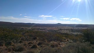
Overland Corner is a locality in the Australian state of South Australia located in the state’s east about 181 kilometres (112 mi) north-east of the state capital of Adelaide and about 30 kilometres (19 mi) west of the municipal seat in Berri.
Mount Benson is a locality in the Australian state of South Australia located on the state's south-east coast overlooking Guichen Bay which is part of the body of water known in Australia as the Southern Ocean and by international authorities as the Great Australian Bight. It is about 269 kilometres south-east of the Adelaide city centre and 112 kilometres north-west of the centre of Mount Gambier.
Gawler Ranges is a locality in the Australian state of South Australia located on Eyre Peninsula about 380 kilometres north-west of the Adelaide city centre and about 48 kilometres north of the town centre of Wudinna and which is associated with the protected area known as the Gawler Ranges National Park.

Katarapko is a locality in the Australian state of South Australia located in the Riverland about 188 kilometres north-east of the state capital of Adelaide and about 6.6 kilometres (4.1 mi) north of Loxton.

Canunda is a locality in the Australian state of South Australia located on the state’s south-east coast overlooking the body of water known in Australia as the Southern Ocean and by international authorities as the Great Australian Bight. It is about 339 kilometres south-east of the state capital of Adelaide and 49 kilometres south of the centre of Mount Gambier.
Spectacle Lake is a locality in the Australian state of South Australia located in the Riverland on the northern side of the Murray River about 180 kilometres north-east of the Adelaide city centre and about 16 kilometres (9.9 mi) northwest of Loxton. Its boundaries were created in August 1999 along with the selection of its name which was derived from the Spectacle Lakes, a lake system which is situated within the locality on the floodplain of the Murray River. In 2014, a portion of Spectacle Lake was removed and added to the adjoining locality of Loveday to ensure the full extent of Nynes Island is within Loveday. As of 2012, the land use within Spectacle Lake was divided between conservation and agriculture with the former being concerned with the floodplain. Spectacle Lake is located within the federal division of Barker, the state electoral district of Chaffey and the unincorporated area of South Australia.
Gerard is a locality in the Australian state of South Australia located in the Riverland on the northern side of the Murray River about 182 kilometres north-east of the state capital of Adelaide and about 12 kilometres (7.5 mi) northwest of Loxton.
Conservation reserves of South Australia is a class of protected area used in the Australian state of South Australia where crown land under the control of the responsible minister has been dedicated for conservation purposes. This class of protected area has been in use as early as 1985. In 2016 there were 15 conservation reserves that covered an area of 194.7 square kilometres. As of March 2022 the number had increased to 16 conservation reserves covering 193.6 square kilometres or less than 1% of South Australia's land area.

County of Le Hunte is a cadastral unit located in the Australian state of South Australia that covers land located in the centre of Eyre Peninsula. It was proclaimed in 1908 and named after George Le Hunte who was the Governor of South Australia from July 1903 to February 1909.

County of Buxton is a cadastral unit located in the Australian state of South Australia that covers land located in the centre of Eyre Peninsula. It was proclaimed in 1896 and named after Thomas Buxton who was the Governor of South Australia from 29 October 1895 to 29 March 1899. It has been divided into thirteen sub-divisions known as hundreds, with the most recent being created in 1928.

The County of Jervois is a cadastral unit in the Australian state of South Australia that covers land on the east coast of the Eyre Peninsula. It was proclaimed on 24 January 1878 and named after William Jervois, the Governor of South Australia from October 1877 to January 1883.
Aroona Dam is a reservoir in the Australian state of South Australia located in the gazetted locality of Leigh Creek about 5 kilometres (3.1 mi) west of the locality’s town centre.
The Hundred of Mayurra is a cadastral division of the County of Grey in southeastern South Australia. It was named on 15 July 1869 for an Aboriginal word meaning fern straws.
