Mount Gambier, also known as Berrin, is the second most populated city in South Australia, with an estimated urban population of 29,940 as of 2021. The city is located on the slopes of Mount Gambier, a volcano in the south east of the state, about 450 kilometres (280 mi) south-east of the capital Adelaide and just 17 kilometres (11 mi) from the Victorian border. The traditional owners of the area are the Bungandidj people. Mount Gambier is the most important settlement in the Limestone Coast region and the seat of government for both the City of Mount Gambier and the District Council of Grant.

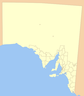
The Limestone Coast is a name used since the early twenty-first century for a South Australian government region located in the south east of South Australia which immediately adjoins the continental coastline and the Victorian border. The name is also used for a tourist region and a wine zone both located in the same part of South Australia.
Tarpeena is a town and a locality on the Riddoch Highway between Penola and Mount Gambier in the Limestone Coast region of South Australia.
Port MacDonnell, originally known as Ngaranga is the southernmost town in South Australia. The small port located in the Limestone Coast region about 477 kilometres (296 mi) southeast of Adelaide and 28 kilometres (17 mi) south of Mount Gambier in the District Council of Grant local government area. The 2016 Australian census which was conducted in August 2016 reports that the locality of Port MacDonnell had a population of 847 of which 671 lived in its town centre. Once a busy shipping port, the town now relies heavily on its fishing and summer tourism industries, particularly rock lobster harvest industry, proclaiming itself "Australia's Southern Rock Lobster Capital".
Donovans is a locality in the Australian state of South Australia located in the state's south-east on the Glenelg River adjoining the border with the state of Victoria. It is about 403 kilometres south-east of the state capital of Adelaide and 26 kilometres south-east of the centre of the city of Mount Gambier.
Wye is a locality in the Australian state of South Australia located on the state's south-east coast adjoining the border with the state of Victoria and overlooking Discovery Bay in the body of water known in Australia as the Southern Ocean and by international authorities as the Great Australian Bight. It is about 399 kilometres south-east of the state capital of Adelaide and 22 kilometres south-east of the city centre of Mount Gambier.

The District Council of Grant is a local government area located in the Limestone Coast region of South Australia, and is the southernmost council in the state.

Kongorong is a locality in the Australian state of South Australia located southwest of Mount Gambier. It has an Australian rules football team and netball team. Kongorong Primary School had 61 students in 2010.

Moorak is a locality in the Australian state of South Australia located in the state's Limestone Coast region.
Yahl is a locality in the Australian state of South Australia, and located in the state's south-east about 7 kilometres (4.3 mi) south-east of Mount Gambier, which is itself about 384 kilometres (239 mi) south east of the state capital of Adelaide.
OB Flat is a rural locality near Mount Gambier in South Australia.
Mount Gambier wine region is a wine region located in the south east of South Australia around the regional city of Mount Gambier. The first planting of vines occurred in 1982. The region received appellation as an Australian Geographical Indication in 2010 and as of 2014, is represented by 20 vineyards and eight wineries.
Glenburnie is a locality in the southeast of the Australian state of South Australia. It adjoins the border with Victoria about 385 kilometres (239 mi) from Adelaide ,the state capital, and 9 kilometres (5.6 mi) east of the municipal seat of Mount Gambier.

Mount Schank is a locality in the Australian state of South Australia located about 385 kilometres south-east of the state capital of Adelaide and 14 kilometres south of the municipal seat of Mount Gambier in the south-east of the state.
Eight Mile Creek is a locality in the Australian state of South Australia located on the state's south-east coast overlooking the body of water known in Australia as the Southern Ocean and by international authorities as the Great Australian Bight. It is about 399 kilometres south-east of the state capital of Adelaide and about 24 kilometres south of the municipal seat of Mount Gambier in the south-east of the state.

German Creek is a rural locality in south-eastern South Australia, situated in the District Council of Grant. The boundaries were formalised in October 1995 for the long established name. The postcode was originally 5280, but was altered to 5291 in 2004. It was reportedly named for a German who was shepherding in the area.
Dismal Swamp is a locality in the Australian state of South Australia located about 361 kilometres (224 mi) south-east of the state capital of Adelaide and about 19 kilometres (12 mi) north-west of the municipal seat of Mount Gambier.
Suttontown is a hamlet located immediately north of Mount Gambier in the south-east of South Australia.
Mingbool is a locality in the Australian state of South Australia located about 372 kilometres (231 mi) south-east of the state capital of Adelaide adjoining the border with the state of Victoria and about 16 kilometres (9.9 mi) north-west of the municipal seat of Mount Gambier.