
The Ngarrindjeri people are the traditional Aboriginal Australian people of the lower Murray River, eastern Fleurieu Peninsula, and the Coorong of the southern-central area of the state of South Australia. The term ngarrindjeri means "belonging to men", and refers to a "tribal constellation". The Ngarrindjeri actually comprised several distinct if closely related tribal groups, including the Jarildekald, Tanganekald, Meintangk and Ramindjeri, who began to form a unified cultural bloc after remnants of each separate community congregated at Raukkan, South Australia.

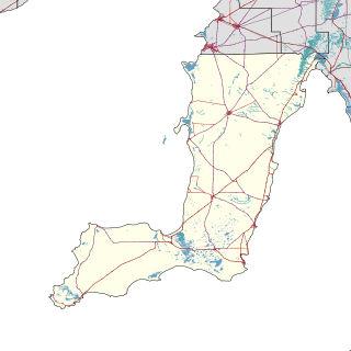
The Riverland is a region of South Australia. It covers an area of 9,386 square kilometres (3,624 sq mi) along the River Murray from where it flows into South Australia from New South Wales and Victoria downstream to Blanchetown. The major town centres are Renmark, Berri, Loxton, Waikerie, Barmera and Monash, and many minor townships. The population is approximately 35,000 people.

Berri Barmera Council is a local government area in the Riverland region of South Australia.

Wujal Wujal is a rural town and locality in the Wujal Wujal Aboriginal Shire, Queensland, Australia. In the 2016 census, Wujal Wujal had a population of 282 people. It is an Aboriginal community.

The Maralinga Tjarutja, or Maralinga Tjarutja Council, is the corporation representing the traditional Anangu owners of the remote western areas of South Australia known as the Maralinga Tjarutja lands. The council was established by the Maralinga Tjarutja Land Rights Act 1984. The area is one of the four regions of South Australia classified as an Aboriginal Council (AC) and not incorporated within a local government area.

Whadjuk, alternatively Witjari, are a Noongar people of the Western Australian region of the Perth bioregion of the Swan Coastal Plain.

Yalata is an Aboriginal community located 200 kilometres (120 mi) west of Ceduna and 140 km (87 mi) south of Ooldea on the edge of the Nullarbor Plain in South Australia. It lies on the traditional lands of the Wirangu people, but the settlement began as Yalata Mission in the early 1950s when Pila Nguru people were moved from Ooldea Mission when that closed, after previously being moved from their land in the Great Victoria Desert owing to nuclear testing by the British Government.

The Renmark Paringa Council is a local government area located adjacent to the Victorian border, in the Riverland, South Australia. The area is known for its various fruit production, and is heavily dependent on the River Murray as a water source. The council seat is at Renmark.

Nepabunna, also spelt Nipapanha, is a small community in the northern Flinders Ranges in north-eastern South Australia, about 600 kilometres (370 mi) north of Adelaide. It is located just west of the Gammon Ranges, and the traditional owners are the Adnyamathanha people.

Aṉangu Pitjantjatjara Yankunytjatjara, also known as APY, APY Lands or the Lands, is a large, sparsely-populated local government area (LGA) for Aboriginal people, located in the remote north west of South Australia. Some of the aṉangu (people) of the Western Desert cultural bloc, in particular Pitjantjatjara, Yankunytjatjara and Ngaanyatjarra peoples, inhabit the Lands.
Pukatja is an Aboriginal community in the Anangu Pitjantjatjara Yankunytjatjara Lands in South Australia, comprising one of the six main communities on "The Lands".
Kaltjiti, formerly and also still known as Fregon, is an Aboriginal community in Anangu Pitjantjatjara Yankunytjatjara in South Australia, comprising one of the six main communities on "The Lands".
A Deed of Grant in Trust (DOGIT) is the name for a system of community-level land trust established in Queensland to administer former Aboriginal reserves and missions. They came about through the enactment by the Queensland Government of the Community Services Act 1984 and Community Services (Aborigines) Act 1984 in 1984, allowing community councils to be created to own and administer former Aboriginal reserves or missions under a Deed of Grant in Trust). The trusts are governed by local representatives who are elected every three years to councils called Incorporated Aboriginal Councils. These councils have the power to pass by-laws, appoint police for the community, and are responsible for maintaining housing and infrastructure, running the Community Development Employment Program and issuing hunting, fishing and camping permits. As such, they work much like a local government, but are different in character as they own the land they administer on behalf of the community.
Point Pearce, also spelt Point Pierce in the past, is a town in the Australian state of South Australia. The town is located in the Yorke Peninsula Council local government area, 194 kilometres (121 mi) north-west of the state capital, Adelaide. At the 2016 census, Point Pearce had a population of 91.

Wardang Island, also known as Waralti is a low-lying 20 km2 island in the Spencer Gulf close to the western coast of the Yorke Peninsula, South Australia. It acts as a natural breakwater, protecting the former grain port of Port Victoria and providing a sheltered anchorage. After European colonisation it was used for the grazing of sheep, for rabbit disease research, was quarried for lime to supply the lead smelter at Port Pirie and is currently leased to the island's traditional owners: the Narungga. The much smaller Goose Island and the other rocks and islets in the Goose Island Conservation Park lie off the northern end. Anyone seeking to visit the island must obtain prior permission from the Point Pearce Community Council.
Indigenous land rights in Australia, also known as Aboriginal land rights in Australia, relate to the rights and interests in land of Aboriginal and Torres Strait Islander people in Australia, and the term may also include the struggle for those rights. Connection to the land and waters is vital in Australian Aboriginal culture and to that of Torres Strait Islander people, and there has been a long battle to gain legal and moral recognition of ownership of the lands and waters occupied by the many peoples prior to colonisation of Australia starting in 1788, and the annexation of the Torres Strait Islands by the colony of Queensland in the 1870s.
Maggea is a town and locality in the Murray Mallee region of South Australia. It is on the Stott Highway between Swan Reach and Loxton and was on the former Waikerie railway line. The town is almost deserted now that the railway line has closed.
Davenport is a suburb in the Australian state of South Australia located about 282 kilometres (175 mi) north of the state capital of Adelaide and about 4 kilometres (2.5 mi) north-east of the municipal seat in Port Augusta.
Gerard is a locality in the Australian state of South Australia located in the Riverland on the northern side of the Murray River about 182 kilometres north-east of the state capital of Adelaide and about 12 kilometres (7.5 mi) northwest of Loxton.

County of Young is a cadastral unit located in the Australian state of South Australia covers land located in the state’s east on the north side of the Murray River. It was proclaimed in 1860 by Governor MacDonnell and named after his predecessor, Governor Young. It has been partially divided in the following sub-units of hundreds – Markaranka, Parcoola, Pooginook and Stuart.
