Padthaway, South Australia

Last updated

Padthaway
South Australia
Padthaway SA.jpg
Main street of Padthaway
Australia South Australia location map.svg
Red pog.svg
Padthaway
Coordinates 36°36′14″S140°29′26″E / 36.603765°S 140.490588°E / -36.603765; 140.490588 Coordinates: 36°36′14″S140°29′26″E / 36.603765°S 140.490588°E / -36.603765; 140.490588 [1]
Population418 (2016 census) [2]
Established10 April 1952 (town)
16 March 2000 (locality) [3] [4]
Postcode(s) 5271 [5]
Elevation37 m (121 ft) [6]
Time zone ACST (UTC+9:30)
 • Summer (DST) ACDT (UTC+10:30)
Location
LGA(s) Tatiara District Council [7]
Region Limestone Coast [8]
County MacDonnell [7]
State electorate(s) MacKillop [9]
Federal division(s) Barker [10]
Mean max temp [6] Mean min temp [6] Annual rainfall [6]
21.4 °C
71 °F
8.5 °C
47 °F
474.2 mm
18.7 in
Localities around Padthaway:
Marcollat Swede Flat
Mundulla West
Western Flat
Marcollat Padthaway Western Flat
The Gap
Woolumbool Keppoch The Gap
Footnotes>Adjoining localities [7]

Padthaway is a small town in the Australian state of South Australia located in the state's south-east within the Limestone Coast region about 253 kilometres (157 miles) south east of the state capital of Adelaide and about 41 kilometres (25 miles) south-east of the municipal seat of Bordertown. [5] [7] The name is derived from the Potawurutj, the Aboriginal name for Good Water. Padthaway is in the Tatiara District Council, the state electorate of MacKillop and the federal Division of Barker.

Contents

The 2016 Australian census which was conducted in August 2016 reports that Padthaway had a population of 418 people. [2]


History

Padthaway was the name of the original pastoral station which was established on Bodaruwitj Aboriginal lands in this area in 1847 by a successful Scottish businessman, Robert Lawson. In 1882 the Padthaway Estate Homestead was built by Eliza and Robert Lawson. [11] The historic Padthaway Estate complex is listed on the South Australian Heritage Register. [12]

In 1952 Padthaway became the centre of a soldier settlement scheme. The first vineyards were planted here in 1964 and quickly transformed marginal grazing land into a top wine-producing region. White wines, especially, from the region are regular winners of major awards. These wines may be purchased at the local cellar door sales and at wine retailers around Australia. Agriculture is also strong in Padthaway with onion, olives and seeds being grown along with sheep and cattle which are reared for sale. [11]

Padthaway has a cluster of businesses located in the heart of town including a deli, general store, two rural service centres, an auto and engineering centre, a caravan park, and a park with a playground in the main street, Memorial Drive.

Other public amenities include netball and tennis courts, football oval, town hall, sports complex, medical clinic, playground, skate park and rotunda. The toilets are right near the playground. In 2010 a new medical clinic was built.

The Padthaway Conservation Park which is situated on a former coastal dune is located about 2.5 kilometres (1.6 mi) north-east of the town centre. [13] The conservation park has stands of yellow gum, ribbon gum, brown stringybark, manna gums, many acacias and banksias. It is also home to a variety of animals including koalas, birds, rabbits, kangaroos and many insects. Sometimes the rare fire orchid may be viewed in flower.

Wine region

Padthaway is also the name of a wine region surrounding the town. It is home to several large commercial vineyards. The oldest vineyard was established in 1964 by Seppelts, with Lindeman's, Hardys and Wynns also establishing vineyards in the 1960s. The wine region is 62 kilometres (39 miles) long and 8 kilometres (5 miles) wide with over 4,000 hectares (9,900 acres) of vineyards. [14] There are only a few cellar doors operating in the region. [15]

Sports

Records for lawn bowls being played in Padthaway go back to 1963. Lawn bowls is played in Padthaway on Saturday during the summer time. Padthaway bowling club plays in the Upper South East association.

The last A grade cricket premiership Padthaway won was in 1993. Padthaway has had a B grade side most years since. Padthaway came fifth in the competition in 2010–2011. In 2011 there was only one competition, an A grade side.

Netball has been played in Padthaway since the mid-late 1960s. In 2011 the Padthaway Netball Club, also called the Lions, has more than seven different teams for netball.

The Padthaway Football Club which commenced in 1967 is known as the Lions and is the main club of the town, competing in the Kowree-Naracoorte-Tatiara Football League. [16] The football club won an A grade premiership grand final in 1993 against Bordertown.

The Padthaway Tennis Club dates back to 1962 and 1972 when the club laid new concrete courts. The Padthaway Tennis club won many premierships between the mid-1970s and into the late 1980s. Tennis is currently played as a social competition on Wednesday nights for a six-eight-week season in the summer before Christmas.

The Padthaway golf course is carved out of scrubland. This tight course is a challenge even for the most professional of golfers. The Padthaway golf club was opened in 1988 and has 9 holes with scrapes.

The community

Apex is a community group which operates in Padthaway composed of men between the ages of 18 and 45 who work together to promote social justice and raise awareness of charity causes by fundraising in interesting and creative ways.

Padthaway has an active Women in Agricultural Business group. WAB is a statewide network with branches throughout SA. It is an organisation for women interested in rural, agricultural and business issues. It provides the opportunity for self-development and friendship.

Schools

The school was built in 1935 and had its 75-year anniversary in 2010. The event was attended by many past, current and future students and staff and a time capsule was buried on the day. In 2011 Padthaway Primary School had 52 students and 12 staff members. Padthaway Primary School caters for years Reception-7 and also has a Child Parent Centre (CPC). At Padthaway Primary School the Student Representative Council (SRC) organises many fundraising activities for students to participate in.

Padthaway Primary School is a school with many activities for students such as the Come out, SAPSASA, Youth Environmental Forum, pancake day, Student Young Leaders Day and school camp. SAPSASA events include football, netball, cricket, tennis, cross country, athletics running events, swimming, diving, golf, hockey and skiing.

Climate

Climate data for Padthaway South
MonthJanFebMarAprMayJunJulAugSepOctNovDecYear
Record high °C (°F)45.1
(113.2)
44.4
(111.9)
40.1
(104.2)
35.1
(95.2)
29.0
(84.2)
23.9
(75.0)
20.3
(68.5)
27.4
(81.3)
29.0
(84.2)
37.1
(98.8)
38.7
(101.7)
43.2
(109.8)
45.1
(113.2)
Average high °C (°F)29.0
(84.2)
28.5
(83.3)
25.9
(78.6)
22.1
(71.8)
17.6
(63.7)
15.0
(59.0)
14.3
(57.7)
15.4
(59.7)
17.7
(63.9)
20.4
(68.7)
24.8
(76.6)
26.5
(79.7)
21.4
(70.5)
Average low °C (°F)12.4
(54.3)
12.3
(54.1)
10.4
(50.7)
8.1
(46.6)
6.8
(44.2)
5.6
(42.1)
5.4
(41.7)
5.9
(42.6)
7.2
(45.0)
7.6
(45.7)
9.9
(49.8)
10.6
(51.1)
8.5
(47.3)
Record low °C (°F)4.0
(39.2)
2.5
(36.5)
1.0
(33.8)
−1.6
(29.1)
−1.8
(28.8)
−4
(25)
−2.1
(28.2)
−2.0
(28.4)
−0.6
(30.9)
−0.5
(31.1)
0.6
(33.1)
2.9
(37.2)
−4
(25)
Average rainfall mm (inches)24.3
(0.96)
17.4
(0.69)
25.4
(1.00)
25.3
(1.00)
40.8
(1.61)
59.4
(2.34)
61.3
(2.41)
73.4
(2.89)
45.7
(1.80)
37.3
(1.47)
29.7
(1.17)
34.2
(1.35)
474.2
(18.69)
Average rainy days (≥ 0.2mm)4.54.47.18.214.517.219.019.616.612.27.78.2139.2
Source: Bureau of Meteorology [6]

Related Research Articles

<span class="mw-page-title-main">Naracoorte, South Australia</span> Town in South Australia

Naracoorte is a town in the Limestone Coast region of South Australia, approximately 336 kilometres south-east of Adelaide and 100 kilometres north of Mount Gambier on the Riddoch Highway (A66).

<span class="mw-page-title-main">Limestone Coast</span> Region in South Australia

The Limestone Coast is a name used since the early twenty-first century for a South Australian government region located in the south east of South Australia which immediately adjoins the continental coastline and the Victorian border. The name is also used for a tourist region and a wine zone both located in the same part of South Australia.

Kaniva is a town in Victoria, Australia. It is located on the Western Highway, north of Little Desert National Park, in the Shire of West Wimmera local government area. It is located roughly 25 kilometres (16 mi) east of the South Australian border and 43 kilometres (27 mi) east of Bordertown. At the 2016 census, Kaniva had a population of 803. The town is commonly used as a rest point for those travelling between Melbourne and Adelaide. The Kaniva region has some rare flora and fauna. The rare south-eastern red-tailed black cockatoo is found in the region. The Shire of West Wimmera prohibits the felling of dead trees to ensure that they have adequate nesting sites.

Padthaway may refer to the following:

<span class="mw-page-title-main">Kingston SE</span> Town in South Australia

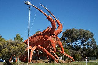
Kingston SE formerly Kingston is a town in the Australian state of South Australia located in the state's south-east coastline on the shores of Lacepede Bay. It is located about 240 kilometres southeast of the state capital of Adelaide and 138 kilometres north-west of the centre of the city of Mount Gambier. At the 2016 census, Kingston SE had a population of 1,648.

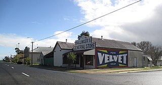
Apsley is a small town in Victoria, Australia. It is on the Wimmera Highway, in the Shire of West Wimmera, 420 kilometres north-west of Melbourne, and 7 kilometres east of the South Australian border. The town is named after Apsley House in London. It was surveyed in 1851 and proclaimed in 1852, a Post Office opening on 1 January 1854 replacing that of Lake Wallace nearer what is now Edenhope serving the grazing population.

Langhorne Creek is a town in South Australia. At the 2016 census, Langhorne Creek had a population of 427.

<span class="mw-page-title-main">Wolseley, South Australia</span> Town in South Australia

Wolseley is a small South Australian town near the Victorian border. It is five kilometres south of the Dukes Highway and 13 kilometres east of Bordertown. It was first proclaimed a town in 1884.

The Kowree-Naracoorte-Tatiara Football League is an Australian rules football competition based in the Limestone Coast region of South Australia, Australia. It is an affiliated member of the South Australian National Football League. One unusual aspect of the league is that it includes clubs from both South Australia and Victoria. The 2018/19/20/21 league medalist was Darcy “Sauce” Boyanton.

<span class="mw-page-title-main">Tatiara District Council</span> Local government area in South Australia

Tatiara District Council is a local government area located in south-eastern South Australia. The name Tatiara is said to mean "the good country", a phrase which dates back to the area's first inhabitants, the Bodaruwitj people. It is one of the largest local government areas in South Australia at 6,476 km2 (2,500 sq mi). The district's economy is based primarily on agriculture, with cereal crops such as wheat, barley and oats and with livestock such as sheep, cattle and pigs prominent.

<span class="mw-page-title-main">Mundulla</span> Town in South Australia

Mundulla is a town and a locality in south eastern South Australia. The town is located in the local government area of Tatiara District Council about 278 kilometres (173 mi) south east of the state capital of Adelaide.

<span class="mw-page-title-main">Goroke, Victoria</span> Town in Victoria, Australia

Goroke is a town in the Wimmera region of Victoria. The town is located in the Shire of West Wimmera local government area, 370 kilometres (230 mi) north west of the state capital, Melbourne. At the 2016 census, Goroke recorded a population of 299.

<span class="mw-page-title-main">Minimay, Victoria</span> Town in Victoria, Australia

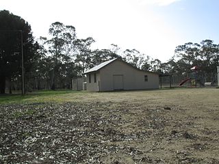
Minimay is a small town located in Victoria, Australia. The town is in the Shire of West Wimmera 25 kilometres (25,000 m) from the South Australian border, about halfway between Melbourne and Adelaide. At the 2016 census, Minimay and the surrounding area recorded a population of 84. A signpost outside the town lists the town's population at 9.

<span class="mw-page-title-main">Limestone Coast zone (wine)</span>

Limestone Coast zone is a wine zone located in the south east of South Australia. It extends south of a line of latitude approximately in line with Cape Willoughby at the east end of Kangaroo Island and it is bounded by the continental coastline and the border with Victoria. It consists of the following wine regions all of which have received appellation as an Australian Geographical Indication (AGI): Coonawarra, Mount Benson, Mount Gambier, Robe, Padthaway, Wrattonbully and a small number of vineyards located outside the above regions. The zone received AGI in 1996.

<span class="mw-page-title-main">County of MacDonnell</span> Cadastral in South Australia

The County of MacDonnell is one of the 49 cadastral counties of South Australia. It was proclaimed in 1857 and named for the South Australian Governor at the time of proclamation, Richard Graves MacDonnell. It is located in the upper south-east of the state from the Limestone Coast at Kingston to the Victorian border. This includes the following contemporary local government areas of the state:

<span class="mw-page-title-main">Bangham, South Australia</span> Town in South Australia

Bangham is a locality in the Australian state of South Australia located in the state's south-east within the Limestone Coast region about 279 kilometres south east of the state capital of Adelaide, about 31.5 kilometres south-east of the municipal seat of Bordertown and adjoining the border with the State of Victoria.

Custon is a locality in the Australian state of South Australia located in the state's south-east within the Limestone Coast region about 267 kilometres south east of the state capital of Adelaide, about 19.5 kilometres south-east of the municipal seat of Bordertown and adjoining the border with the State of Victoria.

Western Flat is a locality in the Australian state of South Australia located in the state's south-east within the Limestone Coast region about 264 kilometres (164 mi) south east of the state capital of Adelaide and about 22 kilometres (14 mi) south of the municipal seat of Bordertown.

Padthaway Conservation Park is a protected area in the Australian state of South Australia located in the state's south-east in the gazetted locality of Padthaway about 253 kilometres (157 mi) south-east of the state capital of Adelaide and about 2.5 kilometres (1.6 mi) north-east of the locality's town centre.

References

  1. "Search results for 'Padthaway, LOCB' with the following datasets being selected - 'Suburbs and Localities', 'Postcode', 'Government Towns', 'Counties', 'Hundreds', 'Local Government Areas', 'SA Government Regions' and 'Gazetteer'". Location SA Map Viewer. Government of South Australia. Retrieved 26 April 2018.
  2. 1 2 Australian Bureau of Statistics (27 June 2017). "Padthaway". 2016 Census QuickStats. Retrieved 26 April 2018. OOjs UI icon edit-ltr-progressive.svg
  3. "TOWN OF PADTHAWAY" (PDF). The South Australian Government Gazette. Government of South Australia: 775. 10 April 1952. Archived (PDF) from the original on 9 October 2022. Retrieved 15 June 2017.
  4. Lawson, Robert (16 March 2000). "GEOGRAPHICAL NAMES ACT 1991 Notice to Assign Names and Boundaries to Places (in the District Council of Tatiara)" (PDF). The South Australian Government Gazette. South Australian Government. p. 1434. Archived (PDF) from the original on 9 October 2022. Retrieved 24 April 2018.
  5. 1 2 "Postcode for Padthway, South Australia". postcodes-australia.com. Retrieved 15 June 2017.
  6. 1 2 3 4 5 "Padthaway South". Climate statistics for Australian locations. Bureau of Meteorology. April 2014. Retrieved 3 April 2014.
  7. 1 2 3 4 "Search result for "Padthaway (Locality Bounded)" (Record no. SA0052922) with the following layers selected - "Suburbs and Localities", "Government Towns", "Development Plan layers" and " Place names (gazetteer)"". Property Location Browser. Government of South Australia. Archived from the original on 12 October 2016. Retrieved 15 January 2017.
  8. "Limestone Coast SA Government region" (PDF). The Government of South Australia. Archived (PDF) from the original on 9 October 2022. Retrieved 10 October 2014.
  9. "District of MacKillop Background Profile". Electoral Commission SA. Retrieved 29 March 2016.
  10. "Federal electoral division of Barker" (PDF). Australian Electoral Commission. Archived (PDF) from the original on 9 October 2022. Retrieved 28 March 2016.
  11. 1 2 Reader's Digest Illustrated Guide to Australian Places. Sydney, NSW: Reader's Digest. 1993. p. 501. ISBN   0-86438-399-1.
  12. "Padthaway Estate, including Homestead, Cottage, former Kitchen, Cellar, former Schoolroom, Shearing Shed, Shearers' Quarters, former Stables and Overseer's cottage". South Australian Heritage Register. Department of Environment, Water and Natural Resources. Retrieved 5 June 2016.
  13. South Australia. National Parks and Wildlife Service. South East District; Sutherland, Andrea; South Australia. National Parks and Wildlife Service (1992), Small parks of the upper South East management plans, South East, South Australia (PDF), Dept. of Environment and Planning, pp. 27–30, ISBN   978-0-7308-2665-1, archived (PDF) from the original on 9 October 2022
  14. "Padthaway Wine Region". Padthaway Grape Growers Association. 2011. Retrieved 2 October 2014.
  15. "Wine Producers". Padthaway Grape Growers Association. 2011. Retrieved 2 October 2014.
  16. Full Points Footy, Kowree-Naracoorte-Tatiara, archived from the original on 13 May 2007, retrieved 25 July 2008