Wolseley, South Australia

Last updated

Wolseley
South Australia
Wolseley shop.jpg
Wolseley historic shop with restored advertising sign on the side
Australia South Australia location map.svg
Red pog.svg
Wolseley
Coordinates 36°22′11″S140°54′15″E / 36.369661°S 140.904151°E / -36.369661; 140.904151 Coordinates: 36°22′11″S140°54′15″E / 36.369661°S 140.904151°E / -36.369661; 140.904151 [1]
Population180 (2016 census) [2]
Established8 May 1884 (town)
16 March 2000 (locality) [3] [4]
Postcode(s) 5269 [5]
Elevation110 m (361 ft) [6]
Time zone ACST (UTC+9:30)
 • Summer (DST) ACST (UTC+10:30)
Location
  • 289 km (180 mi) South East of Adelaide via Australian National Route A8.svg Australian National Route A1.svg
  • 17 km (11 mi) ESE of Bordertown
LGA(s) Tatiara District Council [1]
Region Limestone Coast [1]
County Buckingham [1]
State electorate(s) MacKillop [7]
Federal division(s) Barker [8]
Mean max temp [9] Mean min temp [9] Annual rainfall [9]
21.5 °C
71 °F
8.6 °C
47 °F
463 mm
18.2 in
Localities around Wolseley:
Pine Hill Pine Hill
Bordertown
Pooginagoric
Wolseley Serviceton
Pooginagoric Pooginagoric
Custon
FootnotesAdjoining localities [1]

Wolseley (formerly Tatiara) is a small South Australian town near the Victorian border. It is five kilometres south of the Dukes Highway and 13 kilometres east of Bordertown. It was first proclaimed a town in 1884.

Contents

The 2016 Australian census which was conducted in August 2016 reports that Wolseley had a population of 180 people. [2]

History

The town was surveyed in 1884, and initially named Tatiara, which was described as an "Aboriginal word from the Jackegilbrab Tribe which HC Talbot states is divided into six clans (Kooinkill, Wirriga, Chala, Camiaguigara, Niall & Nunkoora)". The railway station was named after Lord Wolseley, who was the Commander-in-Chief of the British Army. [10] The name of the town was changed to match the name of the station on 20 February 1941. [11]

World War II fuel tanks of No. 12 Inland Aircraft Fuel Depot Wolseley fuel tanks.jpg
World War II fuel tanks of No. 12 Inland Aircraft Fuel Depot

Early in World War II, RAAF No. 12 Inland Aircraft Fuel Depot was established at Wolseley, with an initial capacity of 1.27 megalitres (280,000 imp gal; 340,000 US gal) in three tanks camouflaged to look like farm buildings. The depot started operations in 1942 and three additional tanks were added later. It was disbanded on 14 June 1944. [12] It is listed on the South Australian Heritage Register as the Wolseley Inland Aircraft Fuel Depot. [13]

Railway

The Adelaide–Wolseley railway was opened from Adelaide east to Wolseley railway station in the early 1880s built to 1,600 mm (5 ft 3 in) broad gauge. The Serviceton railway line from Melbourne reached Serviceton in Victoria in 1886, and the three miles from Wolseley to Serviceton was completed by the South Australian Railways in 1887, completing a broad gauge rail link between Adelaide and Melbourne. Around the same time, the Mount Gambier railway line 1,067 mm (3 ft 6 in) narrow gauge railway extended to Wolseley station from the south, creating a break-of-gauge rail junction.

By May 1883, rail construction had not yet been completed, but trains were able to operate regularly from Bordertown on the Adelaide line and from Custon on the Mount Gambier line, continuing through Naracoorte to Kingston SE. [14]

In 1881, the Government of South Australia authorised the construction of a 3 ft 6 in (1,067 mm) railway from "University Block No. 3" near the southern border of the Hundred of Tatiara to Border Town. [15] It had previously authorised the construction from Naracoorte to that point in 1879. [16]

In the 1950s the break-of-gauge was abolished by the conversion of the Mount Gambier line to broad gauge. The line to Mount Gambier has been out of use since the conversion of the Adelaide – Melbourne line to 1,435 mm (4 ft 8+12 in) standard gauge on 12 April 1995, pending possible conversion to standard gauge. If it is converted, it will become the first railway line in Australia to have ever been converted to all 3 gauges.

Railway containers

In 1936, to help overcome some of the inconveniences of the break of gauge, containers were introduced to allow though shipment of goods without the need for transshipment. [17]

Governance

Wolseley is located in the federal division of Barker, the state electoral district of MacKillop and the local government area of Tatiara District Council. [8] [7] [1]

See also

Related Research Articles

<span class="mw-page-title-main">Adelaide railway station</span> Railway station in Adelaide, South Australia

Adelaide Railway Station is the central terminus of the Adelaide Metro railway system. All lines approach the station from the west, and it is a terminal station with no through lines, with most of the traffic on the metropolitan network either departing or terminating here. It has nine platforms, all using broad gauge track. It is located on the north side of North Terrace, west of Parliament House. The Adelaide Casino occupies part of the building that is no longer required for railway use. Until 1984, Adelaide station was also the terminus for regional and interstate passenger trains, but there are no longer any regular regional train services in South Australia, and all interstate services are now handled at Adelaide Parklands Terminal.

<span class="mw-page-title-main">Naracoorte, South Australia</span> Town in South Australia

Naracoorte is a town in the Limestone Coast region of South Australia, approximately 336 kilometres south-east of Adelaide and 100 kilometres north of Mount Gambier on the Riddoch Highway (A66).

<span class="mw-page-title-main">Limestone Coast</span> Region in South Australia

The Limestone Coast is a name used since the early twenty-first century for a South Australian government region located in the south east of South Australia which immediately adjoins the continental coastline and the Victorian border. The name is also used for a tourist region and a wine zone both located in the same part of South Australia.

<span class="mw-page-title-main">Rail transport in South Australia</span>

The first railway in colonial South Australia was a line from the port of Goolwa on the River Murray to an ocean harbour at Port Elliot, which first operated in December 1853, before its completion in May 1854.

<span class="mw-page-title-main">Kingston SE</span> Town in South Australia

Kingston SE formerly Kingston is a town in the Australian state of South Australia located in the state's south-east coastline on the shores of Lacepede Bay. It is located about 240 kilometres southeast of the state capital of Adelaide and 138 kilometres north-west of the centre of the city of Mount Gambier. At the 2016 census, Kingston SE had a population of 1,648.

<span class="mw-page-title-main">Penola, South Australia</span> Town in southern South Australia, Australia

Penola is a town in the Australian state of South Australia located about 388 kilometres (241 mi) southeast of the state capital of Adelaide in the wine growing area known as the Coonawarra. At the 2016 census, town of Penola had a population of 1,312.

<span class="mw-page-title-main">Bordertown, South Australia</span> Town in South Australia

Bordertown, formerly Border Town, is a town and locality in the Australian state of South Australia located in the state's east near the state border with Victoria about 250 kilometres (160 mi) east of the state capital of Adelaide. It is where the Dukes Highway and the railway line cross the Tatiara Creek between Adelaide and Melbourne, the capital of Victoria.

<span class="mw-page-title-main">Kalangadoo, South Australia</span> Town in South Australia

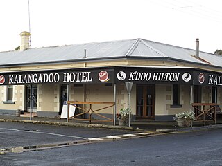
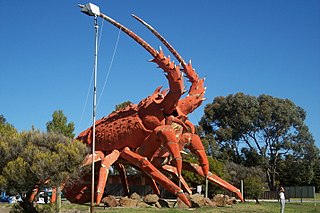
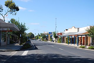
Kalangadoo, formerly Kalangadoo East, is a locality in the Australian state of South Australia located about 348 kilometres (216 mi) south-east of the state capital of Adelaide and about 31 kilometres (19 mi) north of the regional centre of Mount Gambier.

The Kowree-Naracoorte-Tatiara Football League is an Australian rules football competition based in the Limestone Coast region of South Australia, Australia. It is an affiliated member of the South Australian National Football League. One unusual aspect of the league is that it includes clubs from both South Australia and Victoria. The 2018/19/20/21 league medalist was Darcy “Sauce” Boyanton.

The Adelaide–Wolseley railway line is a 313 kilometre line running from Adelaide to Wolseley on the Australian Rail Track Corporation network. It is the South Australian section of the Melbourne–Adelaide railway.

<span class="mw-page-title-main">Frances, South Australia</span> Town in South Australia

Frances is a town in the Australian state of South Australia located about 291 kilometres (181 mi) south-east of the state capital, Adelaide and about 40 kilometres (25 mi) north-east of the municipal seat of Naracoorte in the state's Limestone Coast region and adjoining the border with the State of Victoria.

Hynam is a town and locality in the Australian state of South Australia located in the state's south-east within the Limestone Coast region on the border with the state of Victoria about 302 kilometres south east of the state capital of Adelaide and about 11 kilometres east of the municipal seat of Naracoorte.

Victoria was an electorate in the South Australian House of Assembly from 1857 until 1902 and from 1915 to 1993.

Wandilo is a north-western suburb of Mount Gambier in the Australian state of South Australia. It was named after the railway station on the Mount Gambier railway line, and is recorded to mean "a swamp where native companions resort".

<span class="mw-page-title-main">Mount Gambier railway station</span> Former railway station in South Australia, Australia

Mount Gambier railway station was the junction station for the Naracoorte–Millicent and Mount Gambier-Heywood lines in the South Australian city of Mount Gambier. It was last used in 2006, and has since been transformed into a public community space.

The Mount Gambier railway line was a railway line on the South Australian Railways network. Opened in stages from 1881, it was built to narrow gauge and joined Mount Gambier railway station, which was at that time the eastern terminus of a line to Beachport. It connected at Naracoorte to another isolated narrow gauge line joining Naracoorte to Kingston SE, and to the broad gauge Adelaide-Wolseley line at Wolseley, at around the same time that was extended to Serviceton to become the South Australian part of the interstate Melbourne–Adelaide railway. Since its closure in 1995 following the standardisation of the interstate main line, there have been varying calls for standardisation of the railway between Wolseley and Heywood.

<span class="mw-page-title-main">District Council of Wirrega</span>

The District Council of Wirrega was a short-lived local government area in South Australia in existence from 1884 to 1888.

<span class="mw-page-title-main">Bangham, South Australia</span> Town in South Australia

Bangham is a locality in the Australian state of South Australia located in the state's south-east within the Limestone Coast region about 279 kilometres south east of the state capital of Adelaide, about 31.5 kilometres south-east of the municipal seat of Bordertown and adjoining the border with the State of Victoria.

Custon is a locality in the Australian state of South Australia located in the state's south-east within the Limestone Coast region about 267 kilometres south east of the state capital of Adelaide, about 19.5 kilometres south-east of the municipal seat of Bordertown and adjoining the border with the State of Victoria.

Callington railway station was located in the Adelaide Hills town of Callington, about 72 kilometres from Adelaide station.

References

  1. 1 2 3 4 5 6 "Search results for 'Wolseley, LOCB' with the following datasets being selected – 'Suburbs and Localities', 'Counties', 'Local Government Areas', 'SA Government Regions' and 'Gazetteer'". Location SA Map Viewer. Government of South Australia. Retrieved 24 April 2018.
  2. 1 2 Australian Bureau of Statistics (27 June 2017). "Wolseley". 2016 Census QuickStats. Retrieved 24 April 2018. OOjs UI icon edit-ltr-progressive.svg
  3. "Untitled Proclamation (for the Town of Tatiara)" (PDF). The South Australian Government Gazette. South Australian Government. 8 May 1884. pp. 1740–1741. Retrieved 24 April 2018.
  4. Lawson, Robert (16 March 2000). "GEOGRAPHICAL NAMES ACT 1991 Notice to Assign Names and Boundaries to Places (in the District Council of Tatiara)" (PDF). The South Australian Government Gazette. South Australian Government. p. 1434. Retrieved 24 April 2018.
  5. Wolseley Postcode Australia Post. Retrieved on 2008-05-29
  6. "Search results for 'Wolseley Railway Station' with the following datasets being selected – 'Suburbs and Localities' and 'Gazetteer'". Location SA Map Viewer. Government of South Australia. Retrieved 24 April 2018.
  7. 1 2 "District of Mount Gambier Background Profile". Electoral Commission SA. Retrieved 24 April 2018.
  8. 1 2 "Federal electoral division of Barker" (PDF). Australian Electoral Commission. Retrieved 28 March 2016.
  9. 1 2 3 "Monthly climate statistics: Summary statistics PADTHAWAY SOUTH (nearest weather station)". Commonwealth of Australia , Bureau of Meteorology. Retrieved 24 April 2018.
  10. "Placename Details: Wolseley". Government of South Australia. SA0027361, SA0016322, SA0065544, SA0044004. Retrieved 4 August 2015.
  11. McEwin, A. Lyell (20 February 1941). "ALTERATION OF NAMES OF TOWNS AND PLACES" (PDF). The South Australian Government Gazette. South Australian Government. p. 225. Retrieved 24 April 2018.
  12. Interpretative sign at the site west of Wolseley
  13. "Former Wolseley Inland Aircraft Fuel Depot including pump house, drum filling platform and six fuel tanks". South Australian Heritage Register. Department of Environment, Water and Natural Resources. Retrieved 5 June 2016.
  14. "WOLSELEY". The Border Watch . Mount Gambier, SA. 12 May 1883. p. 2. Retrieved 4 August 2015 via National Library of Australia.
  15. Tatiara and Bordertown Railway 44 Vic., 1881, No. 200, Government Printer, 14 May 2009, retrieved 4 August 2015
  16. Naracoorte and Tatiara Railway 43 Vic., 1879, No. 131, Government Printer, 20 June 2008, retrieved 4 August 2015
  17. "New Freight Containers For S.E. Railway Services". The Advertiser . Adelaide. 23 April 1936. p. 19. Retrieved 26 October 2011 via National Library of Australia.