Lake Forest Park, Washington

Last updated

Lake Forest Park, Washington
Lakeforestparklogo.PNG
King County Washington Incorporated and Unincorporated areas Lake Forest Park Highlighted.svg
Location of Lake Forest Park in
King County and Washington
Coordinates: 47°45′24″N122°17′23″W / 47.75667°N 122.28972°W / 47.75667; -122.28972
CountryUnited States
State Washington
County King
Incorporated 1961
Government
  Type Mayor–council [1]
   Mayor Tom French [1]
Area
[2]
  Total4.15 sq mi (10.74 km2)
  Land3.52 sq mi (9.11 km2)
  Water0.63 sq mi (1.63 km2)
Elevation
69 ft (21 m)
Population
 (2020) [3]
  Total13,630
  Density3,839.64/sq mi (1,482.51/km2)
Time zone UTC-8 (PST)
  Summer (DST) UTC-7 (PDT)
ZIP code
98155
Area code 206
FIPS code 53-37270
GNIS feature ID1512366 [4]
Website cityoflfp.gov
Lake Forest Park Town Center and Farmers' Market Farmer's Market.jpg
Lake Forest Park Town Center and Farmers' Market

Lake Forest Park is a suburban city in King County, Washington, United States, located northeast of Seattle. It was developed in the 20th century as a bedroom community with single-family housing on medium to large-sized lots. Less than 4% of the city's land is zoned commercial, largely concentrated in one location, and there are no industrial areas.

Contents

The city is situated at the northwest end of Lake Washington along State Route 522, which provides connections to Seattle and Bothell. Lake Forest Park includes several parks and nature reserves, access to the Burke–Gilman Trail, and organized summer events. The population of the city was 13,630 at the 2020 census.

History

Lake Forest Park was founded in 1912 by Ole Hanson as one of the Seattle area's first planned communities. Envisioned as a picturesque retreat for professionals, the developers planned roads and lots in strict consideration for natural landmarks. [5] The original prospectus for lot sales declared:

…the strict fiat has gone forth that all the natural beauty must be preserved; that no tree must unwittingly be cut down; that the natural wild flowers must remain; that the streams, the springs, the lake front, the nodding willows, the stately cedar, the majestic fir, the quivering cypress and the homelike maple and all the flora and fauna with which Nature has blessed this lakeshore, must not be defiled by the hand of man. [6]

Until 1914 and completion of the Red Brick Road (now Bothell Way, part of State Route 522) to nearby Kenmore and Bothell, it also marked the literal end of improved roads heading north from Seattle, with the best access to points further north and east being by boat across Lake Washington or the Seattle, Lake Shore and Eastern Railway.

Lake Forest Park officially incorporated on June 20, 1961, in large part to help maintain its specific identity. [7] The town remained small - under 5,000 in population - until the 1990s, when a series of annexations expanded city borders significantly and more than doubled the official population.

The 3/4 acre Lyon Creek Park was created in the late 1990s on land purchased by the city in 1998. For the prior fifty years, the lot had belonged to Marcia and Robert Morris, who had built a modernist home and a horse stable on the property. Both buildings were torn down as part of the park conversion, which also included replanting the park with 5,000 native shrubs and plants. The replanting portion of the project involved the labor of hundreds of citizen volunteers. [8]

Lake Forest Park Town Center, the city's commercial core, was built in 1964 and hugs Bothell Way, not far from the lakeshore. In late 2005, city government began holding public meetings to discuss the future of the town center. The decision was made to renovate Lake Forest Park Town Center and it now spans 18 acres and offers many shopping and dining options along with entertainment. Lake Forest Park Town Center is also home to a branch of the King County Library System, Third Place Books, and Third Place Commons community center. [9] [10]

Geography

Lake Forest Park is situated at the north end of Lake Washington. The city's southern boundary begins at the city limit of Seattle. To the north, Lake Forest Park ends at the Snohomish county line, where the adjacent towns of Mountlake Terrace and Brier border it. To the east, the city is bounded by Lake Washington and at 55th Avenue NE where the city of Kenmore begins; the Burke-Gilman Trail runs in parallel to the lake shore, following the shoreline into Kenmore to the north, and Seattle to the south. The city's western boundary is at the City of Shoreline's city limit, mostly following 25th Avenue NE.

According to the United States Census Bureau, the city has a total area of 3.65 square miles (9.45 km2), of which, 3.53 square miles (9.14 km2) is land and 0.12 square miles (0.31 km2) is water. [11] The two largest streams are Lyon Creek and McAleer Creek, both of which provide habitat for salmon. [12] The shoreline includes two private beach clubs but no public boat access to Lake Washington; however, Lyon Creek Waterfront Preserve offers 100 feet of Lake Washington shoreline and a viewing dock that extends out into the lake. [13]

Lyon Creek Waterfront Preserve provides viewing opportunities of Lake Washington. Lyon-creek-park.jpg
Lyon Creek Waterfront Preserve provides viewing opportunities of Lake Washington.

Parks

Grace Cole Nature Park through the seasons, 2006-2008 GraceColeNaturePark.jpg
Grace Cole Nature Park through the seasons, 2006-2008

Government

Presidential Elections Results [19]
Year Republican Democratic Third Parties
2020 16.38% 1,55080.59%7,6243.02% 286

Lake Forest Park has a mayor–council government with an elected city council composed of seven members. [20] The mayor is a separate elected position with four-year terms. [1]

The City of Lake Forest Park uses strategic partnerships with neighboring cities to provide shared services, including recreational opportunities. A partnership with City of Shoreline's Recreation Department offers residents discounted access to their programs. [21]

The Lake Forest Park Municipal Court was established in 1961 and processes approximately 10,000 filings annually. The presiding judge is appointed by the mayor and confirmed by the city council for a four-year term. The Shoreline/Lake Forest Park Youth Court (SLFPYC) operated under the supervision of the Shoreline District Court and the Lake Forest Park Municipal Court. Lake Forest Park operates its own municipal police agency.

Neighborhoods

Lake Forest Park Town Center forms the city's commercial core. This one complex includes the public library, police department, city hall, and approximately 40 shops, small businesses, and medical/professional offices. [22] Third Place Commons is a large public space that occupies much of the central building's upper level. [23] In the summer, this same complex hosts a large outdoor farmer's market. [24] Until late 2007, the city was also served by a finance unit post office in the same complex, the functions of which have since been moved to nearby Shoreline. The Town Center was also home to Shoreline Community College's Lake Forest Park satellite campus but it is now closed.

Residential neighborhoods include:

Demographics

Historical population
CensusPop.Note
1970 2,530
1980 2,485−1.8%
1990 4,03162.2%
2000 13,142226.0%
2010 12,598−4.1%
2020 13,6308.2%
2021 (est.)13,358 [25] −2.0%
U.S. Decennial Census [26]
2018 Estimate [27]

Based on per capita income, one of the more reliable measures of affluence, Lake Forest Park ranks 26th of 614 areas in the state of Washington to be ranked.

2010 census

As of the 2010 census, [28] there were 12,598 people, 5,024 households, and 3,502 families residing in the city. The population density was 3,568.8 inhabitants per square mile (1,377.9/km2). There were 5,268 housing units at an average density of 1,492.4 per square mile (576.2/km2). The racial makeup of the city was 83.0% White, 1.8% African American, 0.6% Native American, 8.8% Asian, 0.2% Pacific Islander, 1.0% from other races, and 4.7% from two or more races. Hispanic or Latino of any race were 3.6% of the population.

There were 5,024 households, of which 30.2% had children under the age of 18 living with them, 58.6% were married couples living together, 7.8% had a female householder with no husband present, 3.3% had a male householder with no wife present, and 30.3% were non-families. 23.0% of all households were made up of individuals, and 7.9% had someone living alone who was 65 years of age or older. The average household size was 2.49 and the average family size was 2.92.

The median age in the city was 45 years. 20.8% of residents were under the age of 18; 6.4% were between the ages of 18 and 24; 22.8% were from 25 to 44; 34.9% were from 45 to 64; and 15.1% were 65 years of age or older. The gender makeup of the city was 49.7% male and 50.3% female.

2000 census

As of the 2000 census, there were 13,142 people, 5,029 households, and 3,600 families residing in the city. The population density was 3,716.2 people per square mile (1,433.4/km2). There were 5,168 housing units at an average density of 1,461.4 per square mile (563.7/km2). The racial makeup of the city was 85.32% White, 1.64% African American, 0.43% Native American, 7.94% Asian, 0.11% Pacific Islander, 0.92% from other races, and 3.64% from two or more races. Hispanic or Latino of any race were 2.24% of the population.

There were 5,029 households, out of which 31.8% had children under the age of 18 living with them, 61.1% were married couples living together, 7.9% had a female householder with no husband present, and 28.4% were non-families. 21.2% of all households were made up of individuals, and 6.4% had someone living alone who was 65 years of age or older. The average household size was 2.55 and the average family size was 2.97.

In the city the population was spread out, with 22.4% under the age of 18, 6.5% from 18 to 24, 26.6% from 25 to 44, 31.5% from 45 to 64, and 13.0% who were 65 years of age or older. The median age was 42 years. For every 100 females, there were 97.8 males. For every 100 females age 18 and over, there were 93.1 males.

The median income for a household in the city was $74,149, and the median income for a family was $84,316. Males had a median income of $53,164 versus $39,531 for females. The per capita income for the city was $33,419. About 1.3% of families and 3.8% of the population were below the poverty line, including 2.3% of those under age 18 and 2.2% of those age 65 or over.

Notable residents

Education

Of the city's population over the age of 25, 21.1 percent have a graduate or professional degree, 51.1 percent (vs. a national average of 24 percent) hold a bachelor's degree or higher, and 93.2 percent (vs. 80 percent nationally) have a high school diploma or equivalent according to the 2000 census.

The community is in the Shoreline School District. [33] There are two public schools (Brookside Elementary and Lake Forest Park Elementary) which are operated by the district.[ citation needed ]

Related Research Articles

<span class="mw-page-title-main">Redmond, Washington</span> City in Washington, United States

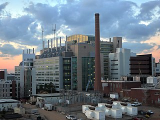
Redmond is a city in King County, Washington, United States, located 15 miles (24 km) east of Seattle. The population was 73,256 at the 2020 census.

<span class="mw-page-title-main">Snohomish County, Washington</span> County in Washington, United States

Snohomish County is a county located in the U.S. state of Washington. With a population of 827,957 as of the 2020 census, it is the third-most populous county in Washington, after nearby King and Pierce counties, and the 72nd-most populous in the United States. The county seat and largest city is Everett. The county forms part of the Seattle metropolitan area, which also includes King and Pierce counties to the south.

<span class="mw-page-title-main">King County, Washington</span> County in Washington, United States

King County is located in the U.S. state of Washington. The population was 2,269,675 in the 2020 census, making it the most populous county in Washington, and the 12th-most populous in the United States. The county seat is Seattle, also the state's most populous city.

<span class="mw-page-title-main">Ontonagon County, Michigan</span> County in Michigan, United States

Ontonagon County is a county in the Upper Peninsula of the U.S. state of Michigan. As of the 2020 census, the population was 5,816, making it Michigan's third-least populous county. The county seat is Ontonagon. The county was set off in 1843, and organized in 1848. Its territory had been organized as part of Chippewa and Mackinac counties. With increasing population in the area, more counties were organized. After Ontonagon was organized, it was split to create Gogebic County. It is also the westernmost county in United States that lies within the Eastern Time Zone.

<span class="mw-page-title-main">Druid Hills, Georgia</span> Neighborhood of Atlanta, Georgia, United States

Druid Hills is a community which includes both a census-designated place (CDP) in unincorporated DeKalb County, Georgia, United States, as well as a neighborhood of the city of Atlanta. The CDP's population was 14,568 at the 2010 census. The CDP formerly contained the main campus of Emory University and the Centers for Disease Control and Prevention (CDC); however, they were annexed by Atlanta in 2018. The Atlanta-city section of Druid Hills is one of Atlanta's most affluent neighborhoods with a mean household income in excess of $238,500.

<span class="mw-page-title-main">Republic, Washington</span> City in Washington, United States

Republic is a city in Ferry County, Washington, United States. The population was 992 at the 2020 census. It is the county seat of Ferry County. It was the largest mining camp in the Republic Mining District, and home to the "Hot Air Line" railway.

<span class="mw-page-title-main">Bellevue, Washington</span> City in Washington, United States

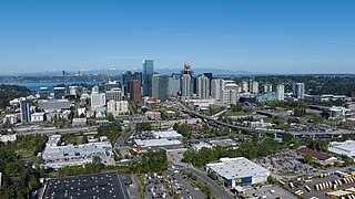
Bellevue is a city in the Eastside region of King County, Washington, United States, located across Lake Washington from Seattle. It is the third-largest city in the Seattle metropolitan area, and the fifth-largest city in Washington. It has variously been characterized as a satellite city, a suburb, a boomburb, or an edge city. The population was 151,854 at the 2020 census. The city's name is derived from the French term belle vue.

<span class="mw-page-title-main">Burien, Washington</span> City in Washington, United States

Burien is a suburban city in King County, Washington, United States, located south of Seattle on Puget Sound. As of the 2020 census, Burien's population was 52,066, which is a 56.3% increase since incorporation in 1993, making it the 25th most populous city in Washington. An annexation in 2010 increased the city's population significantly.

<span class="mw-page-title-main">Des Moines, Washington</span> City in Washington, United States

Des Moines is a city in King County, Washington, United States. The population was 32,888 as of the 2020 census. The city is located on the east shore of Puget Sound, near the center of the Seattle metropolitan area. It is bordered by the suburbs of Federal Way to the south, Kent to the east, SeaTac to the northeast, Burien to the north, and Normandy Park to the northwest.

<span class="mw-page-title-main">Kenmore, Washington</span> City in Washington, United States

Kenmore is a city in King County, Washington, United States, along the northernmost shore of Lake Washington. It is a suburban commuter town at the mouth of the Sammamish River, 12 miles (19 km) northeast of downtown Seattle and 2 miles (3.2 km) west of Bothell. The population was 23,914 at the 2020 census. Kenmore Air Harbor is the largest seaplane-only passenger facility of its kind in the United States.

<span class="mw-page-title-main">Kirkland, Washington</span> City in Washington, United States

Kirkland is a city in King County, Washington, United States. A suburb east of Seattle, its population was 92,175 in the 2020 U.S. census which made it the sixth largest city in King County and the twelfth largest city in the state of Washington.

<span class="mw-page-title-main">Newcastle, Washington</span> City in Washington, United States

Newcastle is an Eastside city in King County, Washington, United States. The population was 13,017 at the 2020 census.

<span class="mw-page-title-main">Sammamish, Washington</span> City in Washington, United States

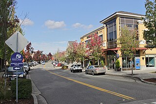
Sammamish is a city in King County, Washington, United States. The population was 67,455 at the 2020 census. Located on a plateau, the city is bordered by Lake Sammamish to the west and the Snoqualmie Valley to the east. Sammamish is situated 20 miles east of Seattle, is a member of the Eastside, and is a part of the Seattle metropolitan area. Sammamish is an affluent community and has been ranked as one of the wealthiest cities in Washington.

<span class="mw-page-title-main">Shoreline, Washington</span> City in Washington, United States

Shoreline is a city in King County, Washington, United States. It is located between the city limits of Seattle and the Snohomish County border, approximately 9 miles (14 km) north of Downtown Seattle. As of the 2020 census, the population of Shoreline was 58,608, making it the 22nd largest city in the state. Based on per capita income, one of the more reliable measures of affluence, Shoreline ranks 91st of 522 areas in the state of Washington to be ranked.

<span class="mw-page-title-main">Woodinville, Washington</span> City in Washington, United States

Woodinville is a city in King County, Washington, United States. The population was 13,069 at the 2020 census. It is a part of the Seattle metropolitan area. There is also a much larger population with Woodinville mailing addresses in adjacent unincorporated areas of King and Snohomish (Maltby) counties. Woodinville has waterfront parks on the Sammamish River, sweeping winery and brewery grounds, and densely wooded areas.

<span class="mw-page-title-main">Brier, Washington</span> City in Washington, United States

Brier is a city in Snohomish County, Washington, United States. It is bordered by Mountlake Terrace to the west, Lynnwood to the north, Bothell to the east, and Lake Forest Park to the south. The population was 6,560 at the 2020 census.

<span class="mw-page-title-main">Mill Creek, Washington</span> City in Washington, United States

Mill Creek is a city in Snohomish County, Washington, United States. It is located between the cities of Everett and Lynnwood, approximately 20 miles (32 km) northeast of Seattle. The city has a population of 20,926 as of the 2020 census. The city lies along State Route 527 and North Creek, a tributary of the Sammamish River, on the east side of Interstate 5.

<span class="mw-page-title-main">Mountlake Terrace, Washington</span> City in Washington, United States

Mountlake Terrace is a suburban city in Snohomish County, Washington, United States. It lies on the southern border of the county, adjacent to Shoreline and Lynnwood, and is 13 miles (21 km) north of Seattle. The city had a population of 19,909 people counted in the 2010 census.

<span class="mw-page-title-main">Bothell, Washington</span> City in Washington, United States

Bothell is a city in King and Snohomish counties in the U.S. state of Washington. It is part of the Seattle metropolitan area, situated near the northeast end of Lake Washington in the Eastside region. Bothell had a population of 48,161 residents as of the 2020 census.

<span class="mw-page-title-main">Washington State Route 522</span> Highway in Washington state

State Route 522 (SR 522) is a state highway in the U.S. state of Washington that serves the Seattle metropolitan area. Approximately 25 miles (40 km) long, it connects the city of Seattle to the northeastern suburbs of Kenmore, Bothell, Woodinville, and Monroe. Its western half is primarily an arterial street, named Lake City Way and Bothell Way, that follows the northern shore of Lake Washington; the eastern half is a grade-separated freeway that runs between Woodinville and Monroe. SR 522 connects several of the metropolitan area's major highways, including Interstate 5 (I-5), I-405, SR 9, and U.S. Route 2 (US 2).

References

  1. 1 2 3 "Mayor". City of Lake Forest Park. Retrieved January 16, 2024.
  2. "2019 U.S. Gazetteer Files". United States Census Bureau. Retrieved August 7, 2020.
  3. "Census Bureau profile: Lake Forest Park, Washington". United States Census Bureau. May 2023. Retrieved March 13, 2024.
  4. "Lake Forest Park". Geographic Names Information System . United States Geological Survey, United States Department of the Interior.
  5. Stein, A., "Lake Forest Park -- Thumbnail History", HistoryLink.org, December 5, 1998. Online as of April 19, 2007.
  6. Alan J. Stein transcribing Ole Hanson, "Lake Forest Park brochure", Seattle, Washington, 1912, held by Shoreline Historical Museum, Shoreline, Washington, 1998.
  7. "Once a refuge from 'disagreeable things'". Seattle Post-Intelligencer. October 31, 2002. Retrieved June 17, 2016.
  8. Informational signs in Lyon Creek Park, City of Lake Forest Park, March 2007.
  9. "City Center". Lake Forest Park Washington. Retrieved June 20, 2016.
  10. Madison Marquette, http://www.madisonmarquette.com/portfolio/property/property:69 Archived July 14, 2011, at the Wayback Machine , Retrieved December 1, 2010.
  11. "US Gazetteer files 2010". United States Census Bureau. Archived from the original on July 2, 2012. Retrieved December 19, 2012.
  12. City of Lake Forest Park (May 2008). "The Legacy 100-Year Vision Final Report" . Retrieved June 17, 2016.
  13. "Lyon Creek Waterfront Preserve". Lake Forest Park Washington. Retrieved June 17, 2016.
  14. "Horizon View Park". Lake Forest Park Washington. Retrieved June 16, 2016.
  15. "Pfingst Animal Acres Park". Lake Forest Park Washington. Retrieved June 16, 2016.
  16. "Grace Cole Nature Park". Lake Forest Park Washington. Retrieved June 16, 2016.
  17. "Lyon Creek Waterfront Preserve". Lake Forest Park Washington. Retrieved June 16, 2016.
  18. "Whispering Willow Park". Lake Forest Park Washington. Retrieved June 16, 2016.
  19. King County Elections
  20. "City Council". City of Lake Forest Park. Retrieved January 16, 2024.
  21. "Recreation Opportunities Outside of Lake Forest Park". Lake Forest Park Washington. Retrieved June 22, 2016.
  22. Lake Forest Park Town Center Store Directory, Madison Marquette Mallfinder Network LLC, online as of August 24, 2008.
  23. Stadler, Anne. "How a Failing Suburban Mall Became a Beloved Indoor Town Square". Project for Public Spaces. Retrieved June 17, 2016.
  24. "Farmer's Market". Third Place Commons. April 4, 2014. Retrieved June 17, 2016.
  25. "City and Town Population Totals: 2020-2021". United States Census Bureau. August 11, 2022. Retrieved August 11, 2022.
  26. United States Census Bureau. "Census of Population and Housing" . Retrieved July 31, 2013.
  27. "Population Estimates". United States Census Bureau . Retrieved June 22, 2019.
  28. "U.S. Census website". United States Census Bureau . Retrieved December 19, 2012.
  29. Fox, Margalit (March 1, 2006). "Octavia E. Butler, Science Fiction Writer, Dies at 58". The New York Times. ISSN   0362-4331 . Retrieved April 26, 2021.
  30. Owen, Rob (November 1, 2022). "Movies, TV shows, stand-up gigs: It's a busy time for Seattle-raised Adam Ray". The Seattle Times. Retrieved September 20, 2023.
  31. Estudillo, Terry (May 22, 2006). "From Shorecrest "loser" to "The Office" poser". The Seattle Times. Retrieved March 8, 2024.
  32. Baker, Geoff (September 11, 2014). "Sounders' DeAndre Yedlin is a goal-oriented star". The Seattle Times. Retrieved September 20, 2023.
  33. U.S. Census Bureau Geography Division (December 21, 2020). 2020 Census – School District Reference Map: King County, WA (PDF) (Map). 1:80,000. U.S. Census Bureau. p. 2. Retrieved August 3, 2022.

Further reading