
Lincoln County is a county in the U.S. state of West Virginia. As of the 2020 census, the population was 20,463. Its county seat is Hamlin. The county was created in 1867 and named for Abraham Lincoln.

The Guyandotte River is a tributary of the Ohio River, approximately 166 mi (267 km) long, in southwestern West Virginia in the United States. It was named after the French term for the Wendat Native Americans. It drains an area of the unglaciated Allegheny Plateau south of the Ohio between the watersheds of the Kanawha River to the northeast and Twelvepole Creek and the Big Sandy River to the southwest. Via the Ohio River, it is part of the Mississippi River watershed.
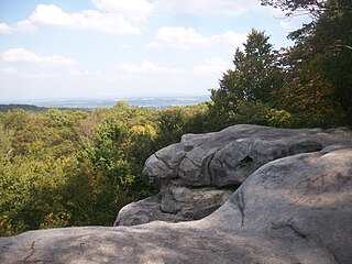
Laurel Hill may refer to:

The South Branch Potomac River has its headwaters in northwestern Highland County, Virginia near Hightown along the eastern edge of the Allegheny Front. After a river distance of 139 miles (224 km), the mouth of the South Branch lies east of Green Spring in Hampshire County, West Virginia where it meets the North Branch Potomac River to form the Potomac.

The Tygart Valley River — also known as the Tygart River — is a principal tributary of the Monongahela River, approximately 135 miles (217 km) long, in east-central West Virginia in the United States. Via the Monongahela and Ohio rivers, it is part of the watershed of the Mississippi River, draining an area of 1,329 square miles (3,440 km2) in the Allegheny Mountains and the unglaciated portion of the Allegheny Plateau.
Back Creek is a 59.5-mile-long (95.8 km) tributary of the Potomac River that flows north from Frederick County, Virginia, to Berkeley County in West Virginia's Eastern Panhandle. Back Creek originates along Frederick County's border with Hampshire County, West Virginia, at Farmer's Gap in the Great North Mountain. Its name reflects its location to the west of North Mountain. The perspective of colonists from the east in the 18th century led them to call it "Back Creek", because it lay to the back of North Mountain.
Knapp Creek is a tributary stream of the Greenbrier River in Pocahontas County, West Virginia. Its source is east of the community of Frost on Allegheny Mountain. From its headwaters, Knapp Creek slowly flows down through farmland until its confluence with Laurel Creek at Minnehaha Springs. Downstream from the confluence of the two streams, Knapp Creek flows through Huntersville. Six miles from Huntersville, Knapp Creek empties into the Greenbrier River outside Marlinton.
Laurel Dale is an unincorporated community on New Creek in Mineral County, West Virginia, United States. Laurel Dale was established in 1878. The community is located along West Virginia Route 93.
Forbes State Forest is a Pennsylvania state forest in Pennsylvania Bureau of Forestry District #4. The main offices are located in Laughlintown in Westmoreland County, Pennsylvania in the United States. Mount Davis, the highest peak in Pennsylvania, is located in the forest.
Abram Creek is a 19.4-mile-long (31.2 km) tributary stream of the North Branch Potomac River in Grant and Mineral counties in West Virginia's Eastern Panhandle.

State Route 91 is a primary state highway in the U.S. state of Virginia. The state highway runs 55.12 miles (88.71 km) from the Tennessee state line near Damascus, where the highway continues as Tennessee State Route 91, north to U.S. Route 19 Business and US 460 Business at Frog Level. SR 91 connects Damascus in southeastern Washington County with the northeastern county town Glade Spring, where the highway has junctions with US 11 and Interstate 81 (I-81). The state highway also indirectly connects Saltville in northwestern Smyth County and Tazewell, the county seat of Tazewell County. SR 91 is the only primary state highway in Virginia with an unpaved section; this gravel section is in southern Tazewell County.

Layland is an unincorporated community in Fayette County, West Virginia, United States. Layland is located on West Virginia Route 41, 6.5 miles (10.5 km) west-northwest of Meadow Bridge. Layland has a post office with ZIP code 25864.
Peach Creek is an unincorporated community and census-designated place (CDP) in Logan County, West Virginia, United States. Peach Creek is located on the east bank of the Guyandotte River across from West Logan. Peach Creek has a post office with ZIP code 25639. The community was first listed as a CDP prior to the 2020 census.
Beckwith is an unincorporated community in Fayette County, West Virginia, United States. Beckwith is located on West Virginia Route 16 and Laurel Creek, 4.1 miles (6.6 km) northwest of Fayetteville. Beckwith had a post office, which closed on October 3, 1998. The community has the name of P. D. Beckwith.
Andrew is an unincorporated community in Boone County, West Virginia, United States.

The Meathouse Fork is a tributary of Middle Island Creek, 19.7 miles (31.7 km) long, in north-central West Virginia in the United States. Via Middle Island Creek and the Ohio River, it is part of the watershed of the Mississippi River, draining an area of 64.6 square miles (167 km2) in a rural region on the unglaciated portion of the Allegheny Plateau.

Washington District, formerly Washington Magisterial District, is one of five historic magisterial districts in Jackson County, West Virginia, United States. The district was originally established as one of five civil townships in Jackson County after West Virginia became a state in 1863; in 1872, all of West Virginia's townships were converted into magisterial districts. When Jackson County was redistricted in the 1990s, Washington District was combined with the eastern portion of Ripley District, including the city of Ripley, to form the new Eastern Magisterial District. However, the county's historic magisterial districts continue to exist in the form of tax districts, serving all of their former administrative functions except for the election of county officials.

The North Branch Potomac River flows from Fairfax Stone in West Virginia to its confluence with the South Branch Potomac River near Green Spring, West Virginia, where it turns into the Potomac River proper.


