
USS Mahan (DDG-72) is an Arleigh Burke-class destroyer currently in service with the United States Navy. This ship is the 22nd destroyer of her class. USS Mahan was the 12th ship of this class to be built at Bath Iron Works in Bath, Maine, and construction began on 17 August 1995. She was launched and christened on 29 June 1996. On 14 February 1998 she was commissioned in Tampa, Florida. Mahan is homeported in Norfolk, Virginia, and as of 2012 was attached to Destroyer Squadron 2. By 2016, the ship was part of Destroyer Squadron 22.
The following is a set–index article, providing a list of lists, for the cities, towns and villages within the jurisdictional United States. It is divided, alphabetically, according to the state, territory, or district name in which they are located.

Burntside is an unincorporated community in Morse Township, Saint Louis County, Minnesota, United States.

Belva is an unincorporated community and census-designated place in west Nicholas County and north Fayette County, West Virginia, United States; while the CDP only includes the Nicholas County portion, the Fayette County portion is considered part of the community. The town is situated at the bottomland surrounding the convergence of Bells Creek with Twentymile Creek and, subsequently, Twenty Mile Creek with the Gauley River. Belva is also the location of the convergence of two state highways: West Virginia Route 16 and West Virginia Route 39.
Russellville is an unincorporated community in Fayette County, West Virginia, United States. Russellville is located along West Virginia Route 41, 14.5 miles (23.3 km) south of Summersville.
Landisburg is an unincorporated community in Fayette County, West Virginia, United States. Landisburg is located along West Virginia Route 41, 11 miles (18 km) east of Oak Hill.
Maplewood is an unincorporated community in Fayette County, West Virginia, United States. Maplewood is located on West Virginia Route 41, 6.5 miles (10.5 km) northwest of Meadow Bridge.
Dothan is an unincorporated community in Fayette County, West Virginia, United States. Dothan is located on West Virginia Route 612 4 miles (6.4 km) west of Oak Hill. Dothan had a post office, which closed on October 5, 1991, when postmaster Lewis "Jackie" Toney retired.
Surveyor is an unincorporated community in Raleigh County, West Virginia, United States. Surveyor is located on West Virginia Route 305, 7 miles (11 km) west of Beckley. Surveyor has a post office with ZIP code 25932.
Redstar is an unincorporated community in Fayette County, West Virginia, United States. Redstar is 2.5 miles (4.0 km) south of Oak Hill. Redstar had a post office with ZIP code 25914, which closed on January 20, 2007.
Carlisle is an unincorporated community in Fayette County, West Virginia, United States. Carlisle is located on West Virginia Route 612 2 miles (3.2 km) southwest of Oak Hill.
Peach Creek is an unincorporated community and census-designated place (CDP) in Logan County, West Virginia, United States. Peach Creek is located on the east bank of the Guyandotte River across from West Logan. Peach Creek has a post office with ZIP code 25639. The community was first listed as a CDP prior to the 2020 census.
Micco is an unincorporated community in Logan County, West Virginia, United States. Micco is located along Island Creek and West Virginia Route 44, 4.5 miles (7.2 km) south of Logan. It is included in the Switzer census-designated place.
Beckwith is an unincorporated community in Fayette County, West Virginia, United States. Beckwith is located on West Virginia Route 16 and Laurel Creek 4.1 miles (6.6 km) northwest of Fayetteville. Beckwith had a post office, which closed on October 3, 1998. The community has the name of P. D. Beckwith.
Harvey is an unincorporated community in Fayette County, West Virginia, United States. Harvey is located on County Route 25, 2.8 miles (4.5 km) south-southeast of Oak Hill.
Long Branch is an unincorporated community in Fayette County, West Virginia, United States. Long Branch is located near the West Virginia Turnpike, 1.1 miles (1.8 km) northwest of Pax. Long Branch had a post office, which closed on October 3, 1998.
Mead is an unincorporated community in Raleigh County, West Virginia, United States. Mead is located on County Route 33 and Stonecoal Creek, 2.7 miles (4.3 km) east-northeast of Rhodell. Mead had a post office, which closed on June 10, 1989. It was also known as Vanwood.
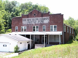
Quinnimont is an unincorporated community in Fayette County, West Virginia, United States. Quinnimont is located on West Virginia Route 41 near the New River, 7.1 miles (11.4 km) east-southeast of Mount Hope. Quinnimont had a post office, which opened on February 23, 1874, and closed on February 1, 1997.
Paint Creek is a 42.1-mile (67.8 km) tributary of the Kanawha River in southern West Virginia. Paint Creek is part of the Mississippi River watershed via the Kanawha and Ohio Rivers and drains an area of 123 square miles (320 km2).


