Oak Ridge or Oakridge may refer to numerous locations in English-speaking countries - the most well-known being Oak Ridge, Tennessee, due to its part in the Manhattan Project. These and other meanings include:

The Appalachian Mountains, often called the Appalachians, are a system of mountains in eastern to northeastern North America. The Appalachians first formed roughly 480 million years ago during the Ordovician Period. They once reached elevations similar to those of the Alps and the Rocky Mountains before experiencing natural erosion. The Appalachian chain is a barrier to east–west travel, as it forms a series of alternating ridgelines and valleys oriented in opposition to most highways and railroads running east–west.

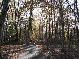
Oak Ridge is a city in Anderson and Roane counties in the eastern part of the U.S. state of Tennessee, about 25 miles (40 km) west of downtown Knoxville. Oak Ridge's population was 31,402 at the 2020 census. It is part of the Knoxville Metropolitan Area. Oak Ridge's nicknames include the Atomic City, the Secret City, and the City Behind the Fence.

The Blue Ridge Mountains are a physiographic province of the larger Appalachian Mountains range. The mountain range is located in the Eastern United States, and extends 550 miles southwest from southern Pennsylvania through Maryland, West Virginia, Virginia, North Carolina, South Carolina, Tennessee, and Georgia. This province consists of northern and southern physiographic regions, which divide near the Roanoke River gap. To the west of the Blue Ridge, between it and the bulk of the Appalachians, lies the Great Appalachian Valley, bordered on the west by the Ridge and Valley province of the Appalachian range.

The Cumberland Mountains are a mountain range in the southeastern section of the Appalachian Mountains. They are located in western Virginia, southwestern West Virginia, the eastern edges of Kentucky, and eastern middle Tennessee, including the Crab Orchard Mountains. Their highest peak, with an elevation of 4,223 feet (1,287 m) above mean sea level, is High Knob, which is located near Norton, Virginia.

The Pin Oak Fountain was built in the U.S. state of West Virginia by the West Virginia State Road Commission and local artisans in 1932 on land given by H.R. Edeburn. The crystal quartz used in construction was quarried from behind nearby Bloomery Iron Furnace on Diamond Ridge, and the stone from the hillside behind the fountain. The fountain's spring water is gravity fed from the hill above and continues to supply area residents and travelers. The fountain is a popular site for picnics, dances, courting, and auctions. Pin Oak Fountain was restored in 1988 and is maintained by the Pin Oak Extension Homemakers Club.
The Fort Mill Ridge Wildlife Management Area is located on 217 acres (0.88 km2) two miles (3 km) southwest of Romney in Hampshire County, West Virginia. Fort Mill Ridge WMA is owned by the West Virginia Division of Natural Resources. The Fort Mill Ridge Civil War Trenches are located at the top of the Fort Mill Ridge access road.

Sleepy Creek Mountain is a mountain ridge in the Ridge-and-Valley Appalachians on the border between Morgan and Berkeley counties in the Eastern Panhandle of West Virginia. The long-distance Tuscarora Trail traverses the southern ridge and northern bench of the mountain.

The Appalachian mixed mesophytic forests is an ecoregion of the temperate broadleaf and mixed forests biome, as defined by the World Wildlife Fund. It consists of mesophytic plants west of the Appalachian Mountains in the Southeastern United States.
Oak Ridge Associated Universities (ORAU) is a consortium of American universities headquartered in Oak Ridge, Tennessee, with offices in Arvada, Colorado, Cincinnati, Ohio, and staff at other locations across the country.
Bearwallow Creek is a 4.3-mile-long (6.9 km) tributary stream of Tearcoat Creek, itself a tributary of the North River, making it a part of the Potomac River and Chesapeake Bay watersheds. Bearwallow Creek is located in Hampshire County, West Virginia. It rises on Chestnut Oak Ridge, from which it flows southwest along the ridge's eastern flanks and then begins its course southeast along Bear Wallow Hollow Road and U.S. Route 50 until its confluence with Tearcoat Creek at Pleasant Dale.

The Appalachian–Blue Ridge forests are an ecoregion in the Temperate broadleaf and mixed forests Biome, in the Eastern United States. The ecoregion is located in the central and southern Appalachian Mountains, including the Ridge-and-Valley Appalachians and the Blue Ridge Mountains. It covers an area of about 61,500 square miles (159,000 km2) in: northeast Alabama and Georgia, northwest South Carolina, eastern Tennessee, western North Carolina, Virginia, Maryland, and central West Virginia and Pennsylvania; and small extensions into Kentucky, New Jersey, and New York.

North Fork Mountain is a quartzite-capped mountain ridge in the Ridge and Valley physiographic province of the Allegheny Mountains, also known as the High Alleghenies or Potomac Highlands, of eastern West Virginia. Kile Knob, at 4,588 feet, is the mountain's highest point, and Panther Knob and Pike Knob are nearly as high.
Chestnut Ridge Natural Area Preserve is a Natural Area Preserve located in Giles County, Virginia. A 821-acre (332 ha) tract of old-growth forest, it is dominated by northern red oak and chestnut oak. The extent of unbroken forest on the property is unusual for southwestern Virginia; many of the trees, including cucumber magnolia and American basswood, are between three and four hundred years old.

Peters Mountain is a 52-mile (84 km) mountain in the U.S. states of Virginia and West Virginia. It is located on the border between Alleghany County, VA, Monroe County, WV, Giles Co.,VA, and Craig Co.,VA. Its elevation ranges from 4,073 feet (1,241 m) on the mountaintop to a low of 2,300 feet (700 m). It produces some of the water supply for Monroe County.

Spruce Mountain, located in eastern West Virginia, is the highest ridge of the Allegheny Mountains. The whale-backed ridge extends for only 16 miles (26 km) from northeast to southwest, but several of its peaks exceed 4,500 feet (1,400 m) in elevation. The summit, Spruce Knob, is the highest Allegheny Mountain point both in the state and the entire range, which spans four states.

The natural environment of Virginia encompasses the physical geography and biology of the U.S. state of Virginia. Virginia has a total area of 42,774.2 square miles (110,784.67 km2), including 3,180.13 square miles (8,236.5 km2) of water, making it the 35th-largest state by area. Forests cover 65% of the state, wetlands and water cover 6% of the land in the state, while 5% of the state is a mixture of commercial, residential, and transitional.

The James River Face Wilderness is an 8,907-acre area located near Natural Bridge, Virginia that is protected by the Eastern Wilderness Act of Congress to maintain its present, natural condition. As part of the National Wilderness Preservation System, it helps to preserve a variety of natural life forms and contributes to a diversity of plant and animal gene pools. Over half of the ecosystems in the United States exist within designated wilderness.


