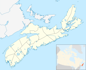
The Annapolis Valley is a valley and region in the Canadian province of Nova Scotia. It is located in the western part of the Nova Scotia peninsula, formed by a trough between two parallel mountain ranges along the shore of the Bay of Fundy. Statistics Canada defines the Annapolis Valley as an economic region, composed of Annapolis County, Kings County, and Hants County.
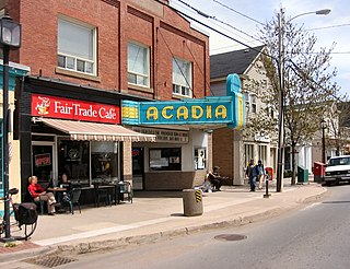
Wolfville is a Canadian town in the Annapolis Valley, Kings County, Nova Scotia, located about 100 kilometres (62 mi) northwest of the provincial capital, Halifax. The town is home to Acadia University and Landmark East School.

Stewiacke is a town located in southern Colchester County, Nova Scotia, Canada. The town was incorporated on August 30, 1906.

Annapolis County is a county in the Canadian province of Nova Scotia located in the western part of the province located on the Bay of Fundy. The county seat is Annapolis Royal.

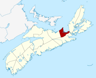
Kings County is a county in the Canadian province of Nova Scotia. With a population of 62,914 in the 2021 Census, Kings County is the third most populous county in the province. It is located in central Nova Scotia on the shore of the Bay of Fundy, with its northeastern part forming the western shore of the Minas Basin.

Truro is a town in central Nova Scotia, Canada. Truro is the shire town of Colchester County and is located on the south side of the Salmon River floodplain, close to the river's mouth at the eastern end of Cobequid Bay.

Kentville is an incorporated town in Nova Scotia. It is the most populous town in the Annapolis Valley. As of 2021, the town's population was 6,630. Its census agglomeration is 26,929.

Middleton is a town in Annapolis County, Nova Scotia, Canada. Situated on the north bank of the Annapolis River, it is located close to the centre of the Annapolis Valley, from which it gets its nickname, "The Heart of the Valley".

Halifax is the capital and largest municipality of the Canadian province of Nova Scotia, and the largest municipality in Atlantic Canada. Halifax is one of Canada's fastest growing municipalities, and as of 2022, it is estimated that the CMA population of Halifax was 480,582,with 348,634 people in its urban area. The regional municipality consists of four former municipalities that were amalgamated in 1996: Halifax, Dartmouth, Bedford, and Halifax County.

Digby is an incorporated town in southwestern Nova Scotia, Canada. It is in the historical county of Digby and a separate municipality from the Municipality of the District of Digby. The town is situated on the western shore of the Annapolis Basin near the entrance to the Digby Gut, which connects the basin to the Bay of Fundy.

Falher is a town in the Peace Country area of Alberta, Canada. It is located in the Municipal District of Smoky River No. 130, along Highway 49. Falher is one of the earliest agricultural communities in the Peace River Country and is notable for its sizable francophone population.
Bridgetown is a Canadian community located in north-central Annapolis County, Nova Scotia.

Pilot Mound is an unincorporated community recognized as a local urban district that also once held town status in the Canadian province of Manitoba. It is located within the Municipality of Louise, approximately 60 km west of the City of Morden.

Berwick is a Canadian town in Kings County, Nova Scotia. The town is located in the eastern part of the Annapolis Valley on the Cornwallis River. The town site stretches south from the river and Exit 15 of Highway 101 to Highway 1. Berwick occupies 6.80 km2 and has an elevation of 43 m (141 ft) above sea level.

The Municipality of the District of Chester is a Nova Scotia district municipality occupying the northeastern half of Lunenburg County, Canada.
Cornwallis Park is a rural community in Annapolis County, Nova Scotia, Canada. As of the 2021 census, the population was 488, an increase of 1.9% from 2016.
Carleton Corner is a community in the Canadian province of Nova Scotia, located in Annapolis County adjacent to Bridgetown. It is a designated place with a population of 99 in 2021. It is on Nova Scotia Route 201.

Granville Ferry is a village in the Canadian province of Nova Scotia, located in Annapolis County. Granville Ferry is located directly across the Annapolis River from Annapolis Royal, Nova Scotia. It was the northern terminus for ferries running across the river. Granville Ferry was a major shipbuilding centre in the Golden Age of Sail. The village was also home to Bessie Hall, a notable female mariner in the 19th century. The community is named after John Carteret, 2nd Earl Granville. Its population at the 2021 census was 152, an increase of 38.2% since 2016.

Lequille is a community in the Canadian province of Nova Scotia, located in Annapolis County. It is on Nova Scotia Trunk 8 at the foot of the South Mountain, midway between Annapolis Royal to the northwest and Highway 101 to the south, approximately 3 km (1.9 mi) distant. As of 2021 its population was 182, a decline of 18.0% since 2016.
Antigonish County is a historical county and census division of Nova Scotia, Canada. Local government is provided by the Municipality of the County of Antigonish, the Town of Antigonish, and by two reserves: Pomquet and Afton 23, and Summerside 38.