Liberta, Antigua and Barbuda

Last updated
Liberta
Village of Liberta
Village
St. Barnabas Anglican Church - panoramio.jpg
Antigua location map.svg
Red pog.svg
Liberta
Antigua and Barbuda location map.svg
Red pog.svg
Liberta
Caribbean location map.svg
Red pog.svg
Liberta
Coordinates: 17°02′N61°47′W / 17.033°N 61.783°W / 17.033; -61.783
Country Antigua and Barbuda
Island Antigua
Parish Saint Paul
Population
 (2011)
  Total2,003
Demonym Libertan
Time zone UTC-4 (AST)
Enumeration Districts (EDS)
  • Liberta-West_2 (70902)
  • Liberta-SouthCen (71100)
  • Liberta (70800)
  • Liberta-West_1 (70901)
  • And others
Note: Enumeration districts with a population less than 30 have not been included.

Liberta is a town located in Saint Paul Parish, on the island of Antigua in Antigua and Barbuda. It had a population of 2,560 in 2001.

Contents

It the third-largest town on Antigua. It is located in the southern island area, north of Falmouth Harbour and the port of Falmouth, to which it is connected by road.

History

Around the time of the 19th century British emancipation of slaves in British Antigua and Barbuda, a colonial plantation owner had financial troubles and was forced to sell off a part of her property in small lots. The ex-slaves in the neighbourhood bought up all the small freeholds, as they desired to own land in perpetuity. "Liberta", meaning liberty and honoring the freed people, became the settlement's name in 1835. By 1842, a painted signboard near its border read: "The Village of Liberta".

The new landowners immediately settled on the lots they had purchased, framed their houses, and cultivated their gardens. Besides working on nearby plantations, income was sometimes also earned working as mechanics at Nelson's Dockyard at Falmouth Harbour. Later on, their descendants also worked in other trades, such as tailors and shop keepers.

Education

Liberta Junior Secondary serves grades 1–9 in the village. There is a small steelpan orchestra there.

Demographics

Liberta has six enumeration districts. [1]

Census data (2011) [1]

Q48 EthnicCounts%
African descendent1,86793.22%
Caucasian/White120.58%
East Indian/India70.37%
Mixed (Black/White)50.26%
Mixed (Other)542.70%
Hispanic301.48%
Other160.79%
Don't know/Not stated120.58%
Total2,003100.00%
Q49 ReligionCounts%
Adventist52026.06%
Anglican1326.60%
Baptist552.77%
Church of God452.23%
Evangelical160.80%
Jehovah Witness472.34%
Methodist1005.00%
Moravian24312.18%
Nazarene130.64%
None/no religion824.10%
Pentecostal24912.50%
Rastafarian241.22%
Roman Catholic984.89%
Weslyan Holiness1527.61%
Other854.26%
Don't know/Not stated1366.81%
Total1,995100.00%
NotApp :8
Q55 Internet UseCounts%
Yes85442.64%
No1,11255.51%
Don't know/Not stated371.85%
Total2,003100.00%
Q58. Country of birthCounts%
Africa30.16%
Other Latin or North American countries40.21%
Antigua and Barbuda1,46773.25%
Other Caribbean countries110.53%
Canada10.05%
Other Asian countries30.16%
Other European countries10.05%
Dominica422.12%
Dominican Republic231.17%
Guyana1437.15%
Jamaica1668.26%
Montserrat60.32%
St. Kitts and Nevis50.26%
St. Lucia120.58%
St. Vincent and the Grenadines130.64%
Trinidad and Tobago40.21%
United Kingdom140.69%
USA572.86%
USVI United States Virgin Islands140.69%
Not Stated130.64%
Total2,003100.00%
Q71 Country of Citizenship 1Counts%
Antigua and Barbuda1,70585.12%
Other Caribbean countries40.21%
Canada10.05%
Other Asian and Middle Eastern countries30.16%
Dominica180.90%
Dominican Republic170.85%
Guyana854.24%
Jamaica1246.20%
Monsterrat10.05%
St. Lucia30.16%
St. Vincent and the Grenadines70.37%
United Kingdom110.53%
USA120.58%
Other countries40.21%
Not Stated70.37%
Total2,003100.00%
Q71 Country of Citizenship 2 (Country of Second Citizenship)Counts%
Other Caribbean countries218.16%
Dominica249.39%
Dominican Republic83.27%
Guyana6725.71%
Jamaica3814.69%
Monsterrat20.82%
St. Lucia72.86%
St. Vincent and the Grenadines114.08%
Trinidad and Tobago41.63%
United Kingdom197.35%
USA5420.82%
Other countries31.22%
Total260100.00%
NotApp :1,743
Q91 Business Earning (Earnings a business made)Counts%
Under $1,000 EC per month2934.62%
1,000 to $1,999 EC per month1416.67%
2,000 to $2,999 EC per month1517.95%
3,000 to $4,999 EC per month1315.38%
$5,000 EC and over per month1315.38%
Total83100.00%
NotApp :1,891
Missing :30
Employment statusCounts%
Employed92562.60%
Unemployed976.53%
Inactive44229.94%
Not stated140.93%
Total1,478100.00%
NotApp :525
Q117 MoneyOverseas (Money from friends and relatives overseas)Counts%
Under 100 EC$1,44797.92%
100 to 499 EC$100.65%
500 to 999 EC$30.22%
1,000 to 1,999 EC$80.57%
2,000 to 4,999 EC$50.36%
5,000 to 99,999 EC$40.29%
Total1,478100.00%
NotApp :525

Enumeration districts

See also

Related Research Articles

<span class="mw-page-title-main">Antigua and Barbuda</span> Country in the Lesser Antilles of the West Indies

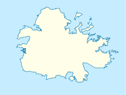
Antigua and Barbuda is a sovereign island country in the Caribbean. It lies at the conjuncture of the Caribbean Sea and the Atlantic Ocean in the Leeward Islands part of the Lesser Antilles.

<span class="mw-page-title-main">History of Antigua and Barbuda</span> Aspect of history

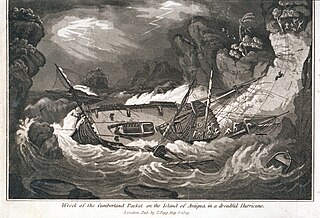
The history of Antigua and Barbuda covers the period from the arrival of the Archaic peoples thousands of years ago to the present day. Prior to European colonization, the lands encompassing present-day Antigua and Barbuda were inhabited by three successive Amerindian societies. The island was claimed by England, who settled the islands in 1632. Under English/British control, the islands witnessed an influx of both Britons and African slaves migrate to the island. In 1981, the islands were granted independence as the modern state of Antigua and Barbuda.

<span class="mw-page-title-main">Saint Mary, Antigua and Barbuda</span> Parish in Antigua and Barbuda

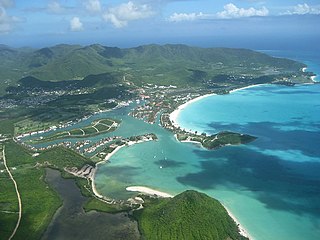
Saint Mary, officially the Parish of Saint Mary, is a parish of Antigua and Barbuda on the island of Antigua. Saint Mary borders Saint John to the north, and Saint Paul to the east. Saint Mary is dominated by the Shekerley Mountains, and its northern border is largely defined by the mountains, and by Cooks Creek. The largest city in the parish is Bolans, home to the Jolly Harbour neighbourhood, and the parish church is located in Old Road. Saint Mary was created with the other five original parishes on 11 January 1692. It had a population of 7,341 in 2011, and 8,141 in 2018.

<span class="mw-page-title-main">Saint Paul, Antigua and Barbuda</span> Parish in Antigua and Barbuda

Saint Paul, officially the Parish of Saint Paul, is a parish of Antigua and Barbuda on the island of Antigua. Saint Paul borders Saint Peter and Saint John to the north, Saint Mary to the west, and Saint Philip to the east. Saint Paul is dominated by farmland in the north, with various creeks and Potworks Dam marking its northern border, and low-lying hills to the south, defining its western border with Saint Mary. The largest city fully within the parish is Liberta, the fourth largest city in the country. The parish capital, and the location of the parish church, is Falmouth. The main economic and tourism hub of the parish is English Harbour. Saint Paul was created with the other five original parishes on 11 January 1692. It had a population of 9,004 in 2018.

<span class="mw-page-title-main">Saint Peter, Antigua and Barbuda</span> Parish in Antigua and Barbuda

Saint Peter, officially the Parish of Saint Peter, is a parish of Antigua and Barbuda on the island of Antigua. Saint Peter borders Saint Paul to the south, Saint Philip to the east, and Saint George and Saint John to the west. Saint Peter is dominated by farmland, savanna, and undeveloped fields, and its borders are not well-defined. The largest city fully within the parish is Parham, which is also the capital. However, the portion of the city of All Saints in Saint Peter is significantly larger than Parham. Saint Peter was created with the other five original parishes on 11 January 1692. It had a population of 5,325 in 2011.

<span class="mw-page-title-main">Antigua</span> Island in Antigua and Barbuda

Antigua, also known as Waladli or Wadadli by the native population, is an island in the Lesser Antilles. It is one of the Leeward Islands in the Caribbean region and the most populous island of the country of Antigua and Barbuda. Antigua and Barbuda became an independent state within the Commonwealth of Nations on 1 November 1981.

<span class="mw-page-title-main">English Harbour</span> Village in Antigua, Antigua and Barbuda

English Harbour is a natural harbour and settlement on the island of Antigua in the Caribbean, in the extreme south of the island. The settlement takes its name from the nearby harbour in which the Royal Navy established its base of operations for the area during the eighteenth century. Its population is 759.

<span class="mw-page-title-main">All Saints, Antigua and Barbuda</span> Village in Antigua, Antigua and Barbuda

All Saints is the second largest town in Antigua and Barbuda, with a population of 3,412. It is located in the middle of Antigua, at 17°3′N61°47′W. Just 5 miles NW of here is the capital, St. John's. It had a population of 3,900 in 2001.

<span class="mw-page-title-main">Parham, Antigua and Barbuda</span> Town in Antigua, Antigua and Barbuda

Parham, officially known as Parham Town, is the capital of Saint Peter, the largest city in Saint Peter, and the fourteenth largest city in Antigua and Barbuda. Parham had a population of 1,307 in 2011, distributed over 1.99 square kilometres. Parham is similar in population to Potters Village, the thirteenth largest city in Antigua and Barbuda, and Bendals, the fifteenth largest city. Parham is situated on the shore of Parham Harbour, one of the most important harbors in the country enclosed by the Parham Peninsula and Long Island. Parham comprises four main neighbourhoods: Lovers Lane, Parham Market, Byam Wharf, and the School neighborhood. If the Saint Peter portion of All Saints, home to 1,954 people extending across three parishes, is considered a separate city, Parham would be considered the second largest city of Saint Peter. The major division of Parham, the town's metropolitan area, stretching over the eastern portion of the parish, had a 2011 population of 3,499 people.

<span class="mw-page-title-main">Willikies</span> Town in Antigua, Antigua and Barbuda

Willikies is a small settlement in Saint Philip Parish, located in the eastern part of Antigua island in Antigua and Barbuda.

Freetown, officially known as FreeTown, is a town in Antigua. It is located in the southeast of the island, on a peninsula between Willoughby Bay to the south and Nonsuch Bay to the north.

<span class="mw-page-title-main">Falmouth, Antigua and Barbuda</span> Village in Antigua, Antigua and Barbuda

Falmouth is a coastal port town located in Saint Paul Parish on the island of Antigua, in Antigua and Barbuda. The town is located in the south of the island, at the end of Falmouth Harbour. A road links Falmouth with the nearby larger town of Liberta inland to the north. In 2018, a proposal was made for squatters who had lived on their land for ten years or more to buy their plots for $1 per 1 sq ft (0.093 m2).

<span class="mw-page-title-main">Swetes</span> Town in Antigua, Antigua and Barbuda

Swetes is located in Saint Paul Parish on the island of Antigua, in Antigua and Barbuda.

Piggotts, also known as St Mark's Village, is a small township in Saint George Parish on Antigua island in Antigua and Barbuda. It had a population of 1,478 in 2001.

<span class="mw-page-title-main">Bethesda, Antigua and Barbuda</span> Village in Antigua, Antigua and Barbuda

Bethesda is a township in Saint Paul Parish on the island of Antigua, in Antigua and Barbuda.

Freemans is a town located in Saint Peter Parish on the island of Antigua, in Antigua and Barbuda.

<span class="mw-page-title-main">Afro-Antiguans and Barbudans</span>

Afro-Antiguans and Afro-Barbudans are Antiguans and Barbudans of entirely or predominantly African ancestry.

<span class="mw-page-title-main">Five Islands, Antigua and Barbuda</span> Village in Antigua, Antigua and Barbuda

Five Islands Village is a village located on the northwest coast of Antigua, within Saint John Parish in Antigua and Barbuda.

Villa is a neighbourhood in St. John's, Antigua and Barbuda.

Golden Grove is a neighbourhood in St. John's, Antigua and Barbuda.

References

  1. 1 2 "Antigua and Barbuda::Statistics Division/Redatam Webserver | Statistical Process and Dissemination Tool". redatam.org. Retrieved 2021-12-08.