List of bridges in Chile

Last updated

This is a list of bridges and viaducts in Chile, including those for pedestrians and vehicular traffic.

Contents

Historical and architectural interest bridges

NameDistinctionLengthTypeCarries
Crosses
OpenedLocationRegionRef.
Puente de Calicanto.jpg 1 Cal y Canto Bridge  [ es ]
demolished in 1888
Historic Monument
(remains of the bridge)
202 m (663 ft) Masonry
9 semi-circular arches
Road bridge
Mapocho River
1782 Santiago
33°25′57.7″S70°39′05.8″W / 33.432694°S 70.651611°W / -33.432694; -70.651611 (Cal y Canto Bridge)
Santiago Metropolitan Region [1]
[2]
Loa Viaduct.jpg 2 Conchi viaduct Second highest railway viaduct in the world when inaugurated
Height : 102 m (335 ft)
Historic Monument
244 m (801 ft) Trestle bridge
Steel
1888 Calama
22°01′55.5″S68°37′15.5″W / 22.032083°S 68.620972°W / -22.032083; -68.620972 (Conchi viaduct)
Antofagasta Region [S 1]
[3]
[4]
[5]
Rio Bio bio (11656087495).jpg 3 Biobío Railway Bridge (Concepción)  [ es ]1,886 m (6,188 ft) Truss
Steel
Concepción-Curanilahue railway
Biobío River
1889 Concepción San Pedro de la Paz
36°49′40.0″S73°04′40.5″W / 36.827778°S 73.077917°W / -36.827778; -73.077917 (Biobío Railway Bridge (Concepción))
Biobío Region [6]
Viaducto del Malleco (Puente Ferroviario).jpg 4 Malleco Viaduct Height : 96 m (315 ft)
Historic Monument
347 m (1,138 ft) Truss
Steel
4x69
Longitudinal Sur
Malleco River
1890 Collipulli
37°57′46.8″S72°26′18.6″W / 37.963000°S 72.438500°W / -37.963000; -72.438500 (Malleco Viaduct)
Araucanía Region [S 2]
[7]
[8]
Puente Ferroviario sobre el Rio Maipo (31690290920).jpg 5 Maipo Bridge Truss
Steel
Railway bridge
Maipo River
San Bernardo Buin
33°41′24.3″S70°43′21.6″W / 33.690083°S 70.722667°W / -33.690083; -70.722667 (Maipo Bridge)
Santiago Metropolitan Region
Puente Pedro de Valdivia, Valdivia 04.jpg 6 Pedro de Valdivia Bridge Withstood the 1960 Valdivia earthquake (9.5 magnitude, the strongest ever recorded)239 m (784 ft) Box girder
Prestressed concrete
49+69+49
1954 Valdivia
39°48′41.4″S73°14′56.5″W / 39.811500°S 73.249028°W / -39.811500; -73.249028 (Pedro de Valdivia Bridge)
Los Ríos Region [9]
[10]
[11]

Major road and railway bridges

This table presents the structures with spans greater than 100 metres (330 ft) (non-exhaustive list).

NameSpanLengthTypeCarries
Crosses
OpenedLocationRegionRef.
1 Chacao Channel bridge
under construction
1,155 m (3,789 ft)2,634 m (8,642 ft) Suspension
Steel box girder deck, 3 concrete pylons
284+1155+1055+43
2025 Chacao (Chiloé Island) Pargua
41°47′43.5″S73°31′22.4″W / 41.795417°S 73.522889°W / -41.795417; -73.522889 (Chacao Channel bridge)
Los Lagos Region [S 3]
[12]
[13]
[14]
Acceso a la Rivera Sur y camino a Puerto Chacabuco.JPG 2 Presidente Ibáñez Bridge 210 m (690 ft)210 m (690 ft) Suspension
Steel truss deck, steel pylons
Chile Route 40
Aysén River
1966 Puerto Aysén
45°24′16.5″S72°41′04.4″W / 45.404583°S 72.684556°W / -45.404583; -72.684556 (Presidente Ibáñez Bridge)
Aysén Region [Note 1]
[S 4]
[15]
[16]
Puente rio yelcho (32955402406).jpg 3 Yelcho Bridge 150 m (490 ft)250 m (820 ft) Cable-stayed
Concrete girder deck, concrete pylons
50+150+50
Chile Route 7
(Carretera Austral)
Yelcho River
Yelcho Lake
1989 Chaitén
43°10′31.5″S72°26′21.0″W / 43.175417°S 72.439167°W / -43.175417; -72.439167 (Yelcho Bridge)
Los Lagos Region [S 5]
[17]
Inauguracion Puente Treng Treng Kay Kay (Srq1776).jpg 4 Treng Treng Kay Kay Bridge  [ es ]140 m (460 ft)240 m (790 ft) Cable-stayed
Concrete box girder deck, 1 inclined concrete pylons
140+27+23
Road bridge
Cautín River
2021 Temuco Padre Las Casas
38°44′59.2″S72°35′22.3″W / 38.749778°S 72.589528°W / -38.749778; -72.589528 (Treng Treng Kay Kay Bridge)
Araucanía Region [S 6]
[18]
Puente carahue1.jpg 5 President Eduardo Frei Montalva Bridge 135 m (443 ft)155 m (509 ft) Suspension
Steel truss deck, concrete pylons
Chile Route S-40
Imperial River
1949 Carahue
38°43′07.0″S73°10′30.9″W / 38.718611°S 73.175250°W / -38.718611; -73.175250 (President Eduardo Frei Montalva Bridge)
Araucanía Region [19]
6 Augusto Grosse Bridge Suspension
Steel truss deck, steel pylons
Chile Route 7
(Carretera Austral)
Mayer River
Villa O'Higgins
48°28′57.7″S72°35′18.8″W / 48.482694°S 72.588556°W / -48.482694; -72.588556 (Augusto Grosse Bridge)
Aysén Region
Puente Lago Gral. Carrera.jpg 7 General Carrera Lake Bridge Suspension
Steel truss deck, steel pylons
Chile Route 7
(Carretera Austral)
General Carrera Lake
1989 Puerto Guadal
46°50′42.7″S72°48′10.0″W / 46.845194°S 72.802778°W / -46.845194; -72.802778 (General Carrera Lake Bridge)
Aysén Region
Puente del rio Rosselot.JPG 8 Sergio Sepúlveda Bridge Suspension
Steel truss deck, steel pylons
Chile Route 7
(Carretera Austral)
Rosselot river
La Junta
43°57′41.3″S72°23′48.2″W / 43.961472°S 72.396722°W / -43.961472; -72.396722 (Sergio Sepúlveda Bridge)
Aysén Region

See also

Map all coordinates using: OpenStreetMap

Notes and references

  1. Historic Monument. [15]
  1. Rosales, Justo Abel (1888). El Puente Cal y Canto [The Cal y Canto Bridge](PDF). pp. 19, 20.{{cite book}}: |website= ignored (help)
  2. "Todos los restos del puente de Cal y Canto de Santiago" [All the remains of the Cal y Canto de Santiago bridge]. Monumentos.gob.cl - Consejo de Monumentos Nacionales de Chile (in Spanish). Retrieved December 17, 2022.
  3. "Viaducto de Conchi sobre el río Loa" [Conchi Viaduct over the Loa River]. Monumentos.gob.cl - Consejo de Monumentos Nacionales de Chile (in Spanish). Retrieved December 17, 2022.
  4. Galeno-Ibaceta, Claudio; Arellano Escudero, Nelson (October 2017). "El viaducto de Conchi: una obra de la Revolución Industrial en el desierto de Atacama, 1887-1888" [The Conchi viaduct: a work of the Industrial Revolution in the Atacama desert, 1887-1888]. Actas del Décimo Congreso Nacional y Segundo Congreso Internacional Hispanoamericano de Historia de la Construcción (in Spanish). Instituto Juan de Herrera. pp. 625–633.
  5. "Loa Viaduct". Highestbridges.com. Retrieved December 17, 2022.
  6. "Plan regulador comunal estudio de patrimonio comunal" [Communal regulatory plan study of communal heritage](PDF). Sanpedrodelapaz.cl - Municipalidad de San Pedro de la Paz (in Spanish). Manuel Duran Iligaray Arquitecto Consultor. Archived from the original (PDF) on December 20, 2010.
  7. "Viaducto del Malleco" [Malleco Viaduct]. Monumentos.gob.cl - Consejo de Monumentos Nacionales de Chile (in Spanish). Retrieved December 17, 2022.
  8. Marin Vicuna, 1901, p.102-103
  9. González, 2013, p.39
  10. "M 9.5 - 1960 Great Chilean Earthquake (Valdivia Earthquake)". Earthquake.usgs.gov. Retrieved December 17, 2022.
  11. Steinbrugge, Karl V.; Clough, Ray W. Chilean Earthquakes of May, 1960: A Brief Trip Report (PDF). p. 634.{{cite book}}: |website= ignored (help)
  12. Pizarro, Diego; Hube, Matias; Valenzuela, Matias (September 2015). "Dynamic Characteristics of a Longitudinally Asymmetrical Multi-Span Suspension Bridge: The Chacao Bridge". IABSE Conference – Structural Engineering: Providing Solutions to Global Challenges. Geneva, Switzerland via Researchgate.net.{{cite book}}: CS1 maint: location missing publisher (link)
  13. "Definitive design approved for Chacao Bridge". Bridgeweb.com - Bridge Design & Engineering. Retrieved December 17, 2022.
  14. "Proyecto Puente Chacao Chiloé" [Chacao Bridge Project - Chiloé]. Puentechacao.cl (in Spanish). Retrieved December 17, 2022.
  15. 1 2 "Puente Presidente Ibáñez" [Ibáñez President Bridge]. Monumentos.gob.cl - Consejo de Monumentos Nacionales de Chile (in Spanish). Retrieved December 17, 2022.
  16. "Puente Presidente Ibáñez es distinguido como ícono bicentenario" [Presidente Ibáñez Bridge is distinguished as a bicentennial icon]. Gobernacionaysen.gov.cl - Gobernación Provincia de Aysén (in Spanish). Archived from the original on 2013-12-03.
  17. "DYWIDAG Multistrand Stay Cable Systems" (PDF). Addbeton.com. p. 20. Retrieved December 17, 2022.
  18. Perales Aravena, Rodrigo (November 2012). Tercer Puente "Treng Treng y Kay Kay" Temuco – Padre Las Casas, Región de la Araucanía [Third Bridge "Treng Treng and Kay Kay" Temuco – Padre Las Casas, Araucanía Region].{{cite book}}: |website= ignored (help)
  19. Manual de Consulta Turístico e Histórico de la Comuna de Carahue [Tourist and Historical Consultation Manual of the Commune of Carahue] (in Spanish). Fondo Regional de Cultura - Gobierno Regional de la Araucanía - Municipalidad de Carahue. 2008. p. 153.

Further reading

Related Research Articles

<span class="mw-page-title-main">Araucanía Region</span> Region of Chile

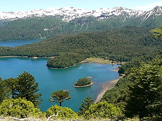
The Araucanía, La Araucanía Region is one of Chile's 16 first-order administrative divisions, and comprises two provinces: Malleco in the north and Cautín in the south. Its capital and largest city is Temuco; other important cities include Angol and Villarrica.

<span class="mw-page-title-main">Biobío River</span> River in Chile

The Biobío River is the second largest river in Chile. It originates from Icalma and Galletué lakes in the Andes and flows 380 km to the Gulf of Arauco on the Pacific Ocean.

<span class="mw-page-title-main">Collipulli</span> City and Commune in Araucanía, Chile

Collipulli is a city and commune forming part of the Malleco Province in the Araucanía Region in southern Chile. Its name means "coloured lands" in the Mapuche language spoken in the area. It has a population of 22,354 (2005) and an area of 1,296 km2 (500 sq mi). Its current mayor is Manuel Macaya Ramírez.

<span class="mw-page-title-main">Loa River</span> River in Chile

The Loa River is a U-shaped river in Chile's northern Antofagasta Region. At 440 km (270 mi) long, it is the country's longest river and the main watercourse in the Atacama Desert.

<span class="mw-page-title-main">Malleco Viaduct</span> Railway bridge over the Malleco River in Araucania Region, Chile

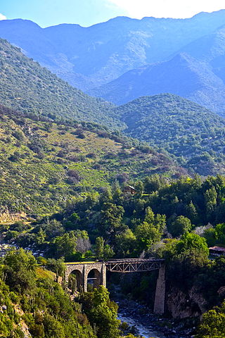
The Malleco Viaduct is a railway bridge located in central Chile, passing over the Malleco River valley, south of Collipulli in the Araucania Region. It was opened by President José Manuel Balmaceda on October 26, 1890. At that time, it was the highest such bridge in the world. The Panamerican Highway passes right next to the viaduct.

<span class="mw-page-title-main">Coordinadora Arauco-Malleco</span> Indigenist organization

Coordinadora Arauco-Malleco (CAM) is a radical, militant indigenous organization engaged in political violence in pursuit of attaining an autonomous Mapuche state in the territory they describe as Wallmapu.

<span class="mw-page-title-main">Chilote School of Religious Imagery</span>

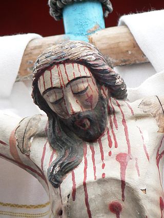
Chilote School of Religious Imagery —Spanish: Escuela chilota de Imaginería Religiosa—, is an artistic and cultural manifestation that was developed during the 17th century on the basis of the circular movement of evangelizing established by the Jesuit missionaries, and reaches its climax in the late 19th century.

<span class="mw-page-title-main">Valdivieso advertising sign</span>

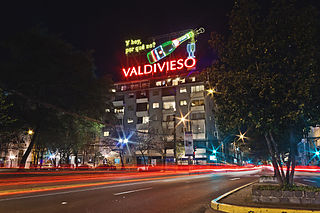
The Valdivieso advertising sign is a rooftop outdoor advertisement at 93 General Bustamante Street, Santiago, Chile. Erected around 1954, it was declared a National Monument of Chile on May 31, 2010.

<span class="mw-page-title-main">Monarch advertising sign</span>

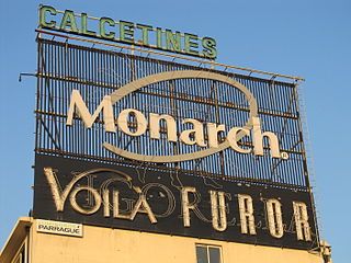
The Monarch advertising sign is a neon billboard located on the roof of a building at 51 Rancagua Street, in the Santiago Metropolitan Region of Santiago, Chile.

The history of Chiloé, an archipelago in Chile's south, has been marked by its geographic and political isolation. The archipelago has been described by Renato Cárdenas, historian at the Chilean National Library, as “a distinct enclave, linked more to the sea than the continent, a fragile society with a strong sense of solidarity and a deep territorial attachment.”

<span class="mw-page-title-main">Santiago Metro Line 2</span>

Santiago Metro Line 2 is one of the seven rapid transit lines that currently make up the Santiago Metro network in Santiago, Chile. It has 22 stations and 20.7 km (12.9 mi) of track. The line intersects with Line 1 at Los Héroes, with the Line 3 at Puente Cal y Canto, with Line 4A at La Cisterna, with Line 5 at Santa Ana, and Line 6 at Franklin. It will also intersect with the future Line 7 and Line 9 at Puente Cal y Canto. Its distinctive colour on the network line map is banana yellow.

Viaducto may refer to:

<span class="mw-page-title-main">Puente Alto-El Volcán Railway</span>

Puente Alto-El Volcán Railway is a small military railway between Puente Alto and El Volcán in Chile. The railway had a narrow gauge of 600 mm, and was constructed in 1906 under Chile's Ministry of Railways. As each section was completed, it was inaugurated: on March 1, 1910 ; in 1911 ; and on June 9, 1914. The railway was built at a cost of $2,335,630 and remained operational until 1985.

<span class="mw-page-title-main">Conchi viaduct</span> Bridge in El Loa province, Antofagasta region

The Conchi viaduct, or Loa viaduct, is located on the Loa River in Chile, 68 kilometres (42 mi) from Calama. It was built to carry part of the Ferrocarril de Antofagasta a Bolivia. It stands 103 metres (338 ft) above the river and is 244 metres (801 ft) long. When opened in 1888 and it was the second highest rail bridge in the world, after the Garabit viaduct.