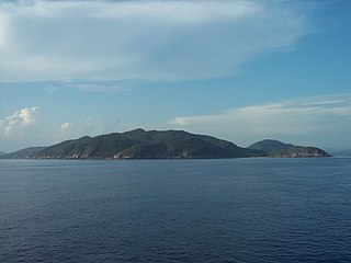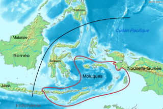
Indonesia is an archipelagic country located in Southeast Asia and Oceania, lying between the Indian Ocean and the Pacific Ocean. It is located in a strategic location astride or along major sea lanes connecting East Asia, South Asia and Oceania. Indonesia is the largest archipelago in the world. Indonesia's various regional cultures have been shaped—although not specifically determined—by centuries of complex interactions with its physical environment.

Alor is the largest island in the Alor Archipelago and is one of the 92 officially listed outlying islands of Indonesia. It is located at the eastern Lesser Sunda Islands that runs through southeastern Indonesia, which from the west include such islands as Bali, Lombok, Sumbawa, Komodo, and Flores.

The Riau Islands is a province of Indonesia - not to be confused with neighbouring Riau Province from which the islands were separated in 2002. The capital of the province is Tanjung Pinang and the largest city is Batam. It shares a maritime border with Riau and Jambi to the east, Bangka Belitung Islands to the south, Singapore to the northeast, Malaysia and West Kalimantan to the west, and Vietnam and Cambodia to the north. It comprises a total of 1,796 islands scattered between Sumatra, Malay Peninsula, and Borneo including the Riau Archipelago. Situated on one of the world's busiest shipping lanes along the Malacca Strait and the Natuna Sea, the province shares water borders with neighboring countries such as Singapore, Malaysia, and Brunei. The Riau Islands also have relatively large potential mineral resources and energy, as well as marine resources.

Natuna Regency is an islands regency located in the northernmost part of the Province of Riau Islands, Indonesia. It contains at least 154 islands, of which 127 of them are reported as uninhabited. This archipelago, with a land area of 1,978.31 km2 out of a total area of 264,198.37 km2 area, contains 15 districts, including the island district of Pulau Laut, Bunguran/Greater Natuna Island, the island district of Pulau Tiga, the island district of Midai, the island district of Subi, and the island district of Serasan.

Anambas Islands Regency is a small archipelago of Indonesia, located 150 nautical miles northeast of Batam Island in the North Natuna Sea between the Malaysian mainland to the west and the island of Borneo to the east. Geographically part of the Tudjuh Archipelago, it is administratively a regency within the Riau Islands Province. It covers a land area of 590.14 square kilometres (227.85 sq mi) and had a population of 37,411 at the 2010 Census and 47,402 at the 2020 Census; the official estimate as at mid 2022 was 50,296. The administrative centre is at Tarempa on Siantan Island.
Selayar or Saleyer, is an archipelago of South Sulawesi province, Indonesia. It lies in the Flores Sea, between Sulawesi and Flores, around 150 km southeast of the major city of Makassar. Kabupaten Selayar is the Regency, covering 1,357 km² with a population of about 139,145 in mid 2022. There are 73 islands, the main one being Selayar Island. To the east lies Pulau (Island) Kalaotoa and Pulau Karompa Lompo, and to the west lies Kepulauan Sabalana. It is a biodiverse diving site.

The Central Malayo-Polynesian languages (CMP) are a proposed branch in the Malayo-Polynesian subgroup of the Austronesian language family. The languages are spoken in the Lesser Sunda and Maluku Islands of the Banda Sea, in an area corresponding closely to the Indonesian provinces of East Nusa Tenggara and Maluku and the nation of East Timor, but with the Bima language extending to the eastern half of Sumbawa Island in the province of West Nusa Tenggara and the Sula languages of the Sula archipelago in the southwest corner of the province of North Maluku. The principal islands in this region are Sumbawa, Sumba, Flores, Timor, Buru, and Seram. The numerically most important languages are Bima, Manggarai of western Flores, Uab Meto of West Timor, and Tetum, the national language of East Timor.

Banggai Island is the second largest of the Banggai Islands, an archipelago located at the far eastern end of Central Sulawesi, Indonesia. The largest and most northerly island is Peleng, which with offshore islets forms the Banggai Islands Regency. Banggai Island itself, together with Labobo and Bangkurung Islands to its southwest, and the group known as the Bokan Islands to the southeast, forms the Banggai Laut Regency, with altogether about 125 islands. Smaller islands of the group are Bowokan, Kebongan, Kotudan, Tropettenando, Timpau, Salue Besar, Salue Kecil, Masepe.
Tambelan archipelago is a group of 68 islands off the west coast of West Kalimantan, (Borneo), Indonesia, just north of the equator. The archipelago is located on the north opening of Karimata Strait which separates Borneo and Belitung island. Geographically it is part of the Tudjuh Archipelago, and administratively forms a district (kecamatan) of Bintan Regency within the Riau Islands Province. It covers a land area of 90.4 km2 and had a population of 4,975 at the 2010 Census. Major islands include Big Tambelan, Mendarik, Uwi, Benua, and Pejantan. The islands are divided into eight administrative villages (kelurahan) - Batu Lepuk, Kampung Hilir, Kampung Melayu, Kukup, Pengikik, Pulau Mentebung, Pulau Pinang and Teluk Sekuni. As a historical side note; It was the first Dutch territory captured by the Japanese in World War 2.
South Natuna is an archipelago off the west coast of the island of Borneo, the southernmost group of the Natuna Islands in the South China Sea. Geographically it is part of the Tudjuh Archipelago, and administratively part of the Riau Islands Province of Indonesia.

The following is an alphabetical list of topics related to the Republic of Indonesia.

North Kayong Regency is a regency of West Kalimantan province in Indonesia. It covers an area of 4,568.26 km2, and had a population of 95,594 at the 2010 Census and 126,571 at the 2020 Census; the official estimate as at mid 2022 was 131,104. The principal town lies in Sukadana. The nearest airport is Ketapang Airport.

The Thousand Islands are a chain of islands to the north of Jakarta's coast. It forms the only regency of Special Capital Region of Jakarta, the metropolitan province of Indonesia. It consists of a string of 342 islands stretching 45 km (28 mi) north into the Java Sea at West Jakarta Bay and in fact are located to the north of Banten Province. Pramuka Island is the regency seat. The islands, along with North Jakarta City, are the only administrative divisions of Jakarta Special Capital Region with a coastline.

The Lesser Sunda Islands, also known as Nusa Tenggara Islands, are an archipelago in Maritime Southeast Asia, most of the Lesser Sunda Islands are located within the Wallacea region, except for the Bali province which is west of the Wallace Line and is within the Sunda Shelf. Together with the Greater Sunda Islands to the west they make up the Sunda Islands. The islands are part of a volcanic arc, the Sunda Arc, formed by subduction along the Sunda Trench in the Java Sea. Slightly over 20 million people live on the islands. Etymologically, Nusa Tenggara means "Southeast Islands" from the words of nusa which means 'island' from Old Javanese language and tenggara means 'southeast'.

The Natuna Sea is an extensive shallow sea located around the Natuna Regency, extending south of the Riau Islands, east of the Lingga Regency and west of Borneo, to the Bangka Belitung Islands. The islands of the Badas and Tambelan Archipelago are located at its center. Mostly located within Indonesian territorial waters, it is the southernmost portion of the South China Sea, and geologically part of Sunda Shelf. It communicates with the Java Sea to its southeast via the Karimata and Gaspar Strait east and west of Belitung, and with the Strait of Malacca to the west via the Berhala and Singapore Strait.

An earthquake occurred 112 km, offshore, north of Maumere in the Flores Sea on December 14. The quake had a moment magnitude of 7.3 according to the United States Geological Survey (USGS). One person was killed and 173 others suffered injuries.


