Related Research Articles

Winnipeg South Centre is a federal electoral district in Manitoba, Canada, that has been represented in the House of Commons of Canada from 1925 to 1979 and since 1988.

Charleswood is a residential community and neighbourhood in Winnipeg, Manitoba, Canada. It is located in the South-West of the city and is bordered by the neighbourhoods Tuxedo to the East, Fort Whyte to the South, and the Rural Municipality of Headingley on the West. It's boundaries are Roblin and the Assiniboine River to the north, Shaftesbury Boulevard on the East, Wilkes Avenue to the South and the Perimeter Highway to the West.
The Winnipeg City Council is the governing body of the city of Winnipeg, Manitoba, Canada. The Council is seated in the Council Building of Winnipeg City Hall.
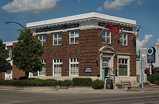
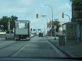
Transcona is a ward and suburb of Winnipeg, Manitoba, located about 10 kilometres (6.2 mi) east of the downtown area.
The Winnipeg Public Library is a public library system in Winnipeg, Manitoba. Branches provide programming for children, teens, and adults. The Library also contains an Outreach Department which works with the community, as well as people who cannot visit the library directly. Outreach also promotes the library to communities that are under represented in the library.

Tuxedo is a residential suburb of Winnipeg, Manitoba. It is located about 7 kilometres southwest of downtown Winnipeg and borders the Assiniboine River and Assiniboine Park on the north, Shaftesbury Boulevard on the west, Route 90 to the East and McGillvary Boulevard to the South. Prior to 1972, the community was incorporated as the Town of Tuxedo.
Old Kildonan is the northernmost city ward of Winnipeg, Manitoba. Before the City of Winnipeg Act of 1972, it was an independent unincorporated municipality called the Municipality of Old Kildonan; prior to that, from 1914, it was a subdivision of the Rural Municipality of Kildonan.

The amalgamation of Winnipeg, Manitoba was the municipal incorporation of the old City of Winnipeg, eleven surrounding municipalities, and the Metropolitan Corporation of Greater Winnipeg (Metro) into one.
Fort Garry is a community area and neighbourhood of Winnipeg, Manitoba, Canada, located in the southwestern part of the city, south of the district of Fort Rouge and east of the Tuxedo area. It comprises parts of the city wards of River Heights - Fort Garry, Fort Rouge - East Fort Garry, Waverley West, and St. Norbert - Seine River.
Metropolitan Corporation of Greater Winnipeg was a governing body that served as part of the leadership for the metropolitan area of Winnipeg. It was established by Premier Douglas Campbell after he was given a commission to do so by the Greater Winnipeg Investigating Commission. It was dissolved when its component municipalities were amalgamated into one "unicity" in 1972. Winnipeg is a city in Manitoba, Canada.

St. James-Assiniboia is a major community area in Winnipeg, Manitoba, Canada. As it encapsulates most of the city ward of St. James, which includes the major St. James Street, the area itself is often simply referred to "St. James."
The Progressive Conservative Party of Manitoba fielded fifty-six candidates in the 2007 Manitoba provincial election, and won 19 seats to remain as the Official Opposition party in the Legislative Assembly of Manitoba. Many of the party's candidates have their own biography pages; information about others may be found here.
The Midget Football League of Manitoba (MFLM) is a league for Canadian football located in the Canadian province of Manitoba for players of ages 15–17 years old. The league currently has eight teams: the Sunrise Coyotes, Southwest Wolves, Greendell Falcons, Interlake Thunder, St. Vital Mustangs, and Transcona Nationals. Most teams are located in Winnipeg; however, Eastman, Interlake, and Pembina Valley are based in Steinbach, Stonewall, and Winkler respectively.
Winnipeg, Manitoba, is subdivided in different ways for different purposes. The suburbs and neighbourhoods of Winnipeg take their names from former administrative districts, parishes, and geographic features.
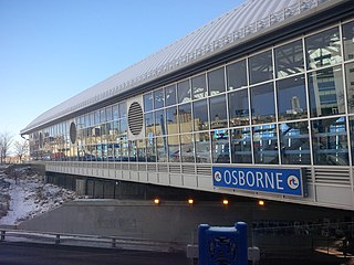
Winnipeg RT is a bus rapid transit system of Winnipeg Transit in Winnipeg, Manitoba, Canada, currently consisting of the Southwest Transitway. Future expansions are in the planning stages, consisting of an Eastern Corridor connecting downtown to Transcona and a West-North Corridor connecting St. James with Downtown and West Kildonan.
The Greater Winnipeg Water District Aqueduct (GWWDA) is an aqueduct that supplies the city of Winnipeg, Manitoba, with water from Shoal Lake, Kenora District, Ontario. Winnipeg has relied on the lake as its source for safe drinking water since the aqueduct was put in service in 1919 at a cost of nearly CDN $16 million.
References
- 1 2 "Alphabetical Neighbourhood Listing | 2016 Census". City of Winnipeg. 2019-02-07. Retrieved 2021-06-10.
- ↑ 2018 Winnipeg Neighbourhoods map, City of Winnipeg. Retrieved 2021-06-09
- ↑ Neighbourhoods of Winnipeg, City of Winnipeg. Archived from the original on 2018-03-26.
- ↑ "Neighbourhoods | Tourism Winnipeg". www.tourismwinnipeg.com. Retrieved 2021-06-10.
- ↑ Sherlock's Map of Winnipeg and Surrounding Areas, Île-des-Chênes, ISBN 978-1-895229-67-7.
- ↑ Winnipeg Architectural Foundation. Tuxedo. http://www.winnipegarchitecture.ca/wp-content/uploads/2016/09/Web-Exhibit-Tuxedo-1.pdf . Accessed June 4, 2023
- 1 2 3 "Concept: Neighbourhood Clusters (NC)." Manitoba Centre for Health Policy . Max Rady College of Medicine. 2008 December 19.
- ↑ City Clerk (February 7, 2019). "Community Area Profiles - 2016 Census". City of Winnipeg. Retrieved 2021-06-10.
- ↑ "Concept: Community Centre Areas (CCAs)." Manitoba Centre for Health Policy . Max Rady College of Medicine. 2012 July 31.
- ↑ City Clerk (February 7, 2019). "Neighbourhood Cluster Profiles - 2016 Census". City of Winnipeg. Retrieved 2021-06-10.
- ↑ City Clerk (November 6, 2018). "Electoral Wards - City of Winnipeg". City of Winnipeg. Retrieved 2021-06-10.
- ↑ "Business Improvement Zones - Planning, Property and Development - City of Winnipeg". winnipeg.ca. Retrieved 2022-08-07.
- 1 2 "BIZ Zone Directory - Planning, Property and Development - City of Winnipeg". winnipeg.ca. Retrieved 2022-08-07.