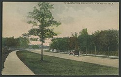
Charleswood is a semi-rural residential community and neighbourhood in Winnipeg, Manitoba, Canada. It is located in the South-West of the city and is bordered by the neighbourhoods Tuxedo to the East, Fort Whyte to the South, and the Rural Municipality of Headingley on the West. It's boundaries are Roblin and the Assiniboine River to the north, Shaftesbury Boulevard on the East, Wilkes Avenue to the South and the Perimeter Highway to the West.
East Kildonan is a primarily residential community in northeast Winnipeg, Manitoba, Canada. Commonly known by its initials EK, the suburb has a population of approximately 35,800 as of the 2016 Census.
River Heights is a suburb and community area in Winnipeg, Manitoba. It is bordered by Route 90 to the west, the Assiniboine River to the north, Cambridge Street to the east, and Taylor Avenue to the south.

Fort Rouge is a district of Winnipeg, Manitoba, in Canada. Located in the south-central part of the city, it is bounded on the north by the Assiniboine River, on the east and south by the Red River, and on the west by Stafford Street and Pembina Highway.
North Kildonan is a city ward in northern Winnipeg, and a former municipality in Manitoba, Canada. Its population was of 2016 was 44,664.

The West End is a mostly residential area of Downtown Winnipeg, Manitoba, Canada. It includes the neighbourhoods of Armstrong's Point, Colony, Daniel McIntyre, Minto, Sargent Park, Spence, St. Matthews, West Broadway, and Wolseley.

Winnipeg's North End is a large urban area located to the north and northwest of Downtown Winnipeg. It is bordered by the Red River on the east, the Canadian Pacific Railway (CPR) mainline on the south, the City of Winnipeg boundary on the west and Jefferson Avenue, Keewatin Street, Carruthers Avenue, McGregor Street and the lane between McAdam and Smithfield Avenues on the north. It is the northern section of the City of Winnipeg as it existed prior to the 1972 municipal amalgamation. Winnipeg's northern suburbs such as West Kildonan and Old Kildonan are not considered part of the North End. The CPR mainline and its Winnipeg yards, which are one of the largest railway yards in the world, act as a physical barrier between the North End and the rest of Winnipeg to the south. This has resulted in the North End remaining a very distinct and unique part of Winnipeg.

Taché is a rural municipality in Manitoba, Canada, incorporated in 1880.
The municipal government of Winnipeg is represented by 15 city councillors and a mayor elected every four years.

Elmwood is a primarily working-class residential area of Winnipeg, Manitoba. It is the only part of the historic city of Winnipeg located east of the Red River. It includes the areas of Glenelm, which is more affluent and lies west of Henderson Highway, most of Chalmers, Talbot-Grey, and East Elmwood, which was developed primarily in the 1950s. Elmwood is mostly composed of single family residential homes, though there are numerous low-rise apartment blocks, townhouses, and two high rise apartment complexes, which are both social housing projects.
Varsity View is one of the original neighbourhoods of the Charleswood community in Winnipeg, Manitoba, Canada, and also a part of the Assiniboine South neighbourhood cluster.
Crescent Heights is a neighbourhood located in Calgary, Alberta. It is located in the inner city, immediately north from Downtown. It is bounded to the north by the Trans-Canada Highway, on the east by Edmonton Trail, on the west by 4th Street NW, and to the south by Memorial Drive and the Bow River.
Valley Ridge is a residential neighbourhood in the northwest quadrant of Calgary, Alberta, Canada. It is located at the western edge of the city, south of the Bow River and north of the Trans-Canada Highway. The Valley Ridge golf course is located in the northern part of the community. The community is located on the former site of the Happy Valley Campground a fun park with slides, which was a major destination for visitors to Calgary until it was closed in the 1980s; the campground was located where the golf course is now situated.
Renfrew is a residential neighbourhood in the northeast quadrant of Calgary, Alberta. It is located south of the Trans-Canada Highway, and north of the inner city community of Bridgeland. To the east it is bordered by the Nose Hill Creek and the Deerfoot Trail and is separated from Crescent Heights to the west by Edmonton Trail.
Woodbine is a residential neighbourhood in the southwest quadrant of Calgary, Alberta. It is located at the western edge of the city, and is bordered on the north by Anderson Road, on the west by Tsuut'ina Trail, on the east by 24th Street West, and to the south by Fish Creek Provincial Park.

St. Andrews Heights is a residential neighbourhood in the northwest quadrant of Calgary, Alberta. It is bounded to the north by the Trans-Canada Highway, to the east by Crowchild Trail, to the south by Toronto Crescent, and to the west by 29 Street. The Foothills Medical Centre occupies the northwestern corner of the community, and McMahon Stadium and the Foothills Athletic Park borders to the northeast. The Bow River flows immediately south of the neighbourhood.

Central Park is a large urban park located in downtown Winnipeg, and forms the heart of the neighbourhood of the same name.

Linden Woods is a neighbourhood in the Fort Garry area of southwest Winnipeg, Manitoba, Canada.

Centennial is an inner-city neighbourhood located Winnipeg, Manitoba, Canada, in the Downtown East Neighbourhood Cluster. The boundaries of Centennial are Sherbrook Street on the west, Logan Avenue on the north, William Avenue on the south and Stanley, Paulin and Adelaide streets on the east.