Fort Rouge, Winnipeg

Last updated
Corydon Avenue arch Corydon Avenue arch in Winnipeg, Manitoba.jpg
Corydon Avenue arch

Fort Rouge is a district of Winnipeg, Manitoba, in Canada. Located in the south-central part of the city, it is bounded on the north by the Assiniboine River, on the east and south by the Red River, and on the west by Stafford Street and Pembina Highway.

Contents

It composes part of the city ward of Fort Rouge-East Fort Garry, [1] as well as belonging to the provincial electoral district of Fort Rouge, [2] and the federal electoral district of Winnipeg South Centre. Fort Rouge is not a discrete census district, so its population cannot be easily obtained through census records; the 2006 combined population of Fort Rouge and the neighbouring district of River Heights was 56,505. [3]

History

The district was named after Fort Rouge, a fort built on the Assiniboine River in approximately 1738 by Sieur Louis Damours de Louvières, a lieutenant of the Canadian explorer Pierre Gaultier de Varennes, sieur de La Vérendrye. [4] It is not known if the neighbourhood is built on the site of the fortification.

The area prior to 1880 consisted of a few small farms and woodlots. In 1880, a bridge was built across the Assiniboine River south from Main Street; the following year, another was constructed south along Pembina Road (later known as Osborne Street). Originally known as St. Boniface West, the area was annexed by the City of Winnipeg in 1882.

With the bridge in place to the city, a middle class residential area developed. Most houses in this area were quite modest in size and cost, although during the 1890s and 1900s mansions could be found on Roslyn Road, Wellington Crescent, and River Avenue. Due to its proximity to central Winnipeg and the presence of the Park Line streetcar, Fort Rouge was attractive to a variety of families of the middle and commercial classes as well as the more prosperous from the skilled trades. Most residents were of British Canadian backgrounds. This sense of community was reflected in the large churches that were constructed in the early 1900s along Nassau Street. Notable residents of the time include three victims of the RMS Titanic disaster: real estate developer Mark Fortune, [5] his son Charles Fortune, [5] and banker Thomson Beattie. [6] Another Titanic victim, John Hugo Ross, [7] gave his name to Hugo Street in Fort Rouge some years before his death, while a fifth victim, Eaton's employee George Graham, is buried in St. Marys Cemetery (in St. Marys, Ontario). [8] Immigration agent and legislator William Hespeler also resided in Fort Rouge.

The Canadian Northern Railway shops and yards were also located in Fort Rouge. Working-class neighbourhoods developed around the yards. Many of the residents were able to walk the short distance to work. A few factories and warehouses appeared alongside the tracks and near the Red River as well. The yards are still in operation under the aegis of the Canadian National Railway and Via Rail, although some of the original yards were closed and the land ceded to the City of Winnipeg, which built a large bus garage on the lands.

From the 1950s to the 1980s dozens of high-rise apartment blocks, many over 25 storeys, were built in and around Osborne Village. This is currently Western Canada's second most densely populated neighbourhood. In the 1990s Corydon Avenue was redeveloped and is now one of Winnipeg's most important cultural and night-life areas.

Fort Rouge includes many neighbourhoods. These include Lord Roberts, Riverview, Ebby-Wentworth, Earl Grey, McMillan, and River-Osborne.

Recreation and living

Public schools in Fort Rouge are administered by the Winnipeg School Division.

The only major health care facility in Fort Rouge is the Riverview Health Centre, located in the Riverview neighbourhood. St. Mary's Cemetery, a Catholic burial ground dating to the 19th century, is located on Osborne Street.

Sports

The Fort Rouge district shares the Fort Garry/Fort Rouge Twins hockey team with the district of Fort Garry. The team plays out of the Century Arena in Fort Garry and are members of the Manitoba Major Junior Hockey League.

The area is the home of the Fort Rouge Curling Club.

TeamFoundedLeagueArenaChampionships
Fort Garry/Fort Rouge Twins 1970 MMJHL Century Arena6

Crime rates

The table below shows the crime rates of various crimes in each of the Fort Rouge neighbourhoods. The crime data spans 5 years from the year 2017 to the year 2021. The rates are crimes per 100,000 residents per year.

Crime Rates per 100,000 people in Fort Rouge Neighbourhoods, 2017-2021 [9]
NeighbourhoodPop. [10] HomicideRate [lower-alpha 1] RobberyRateAgr. Aslt. [lower-alpha 2] RateCmn. Aslt [lower-alpha 3] RateUtt. Threat [lower-alpha 4] RatePropertyRate
Crescentwood2,71500.016117.917125.232235.716117.913129,664.8
Earl Grey4,26014.748225.469323.9105493.023108.016547,765.3
Ebby-Wentworth79500.023578.66150.919478.010251.646911,798.7
Grant Park2,72517.357418.320146.854396.334249.5144810,627.5
Lord Roberts4,96514.033132.956225.6126507.638153.113085,268.9
McMillan3,44515.834197.471412.2105609.631180.0177910,328.0
River-Osborne4,750729.597408.4122513.7235989.555231.623429,861.1
Riverview4,27014.741192.02093.752243.62093.79454,426.2
Rockwood4,24500.02094.21675.424113.1837.711945,625.4
Roslyn4,55000.090395.61983.555241.81357.115947,006.6
Fort Rouge36,720126.5459250.0416226.6807439.5248135.114,0457,649.8
  1. Rate per 100,000 people per year: Figure is calculated by dividing the total incidences of a crime by the neighbourhood population, then multiplying by 100,000, and then dividing by 5, as the data spans 5 years
  2. Aggravated assault: Includes assaults which cause bodily harm or utilize weapons; includes the following categories given on Winnipeg CrimeMaps: aggravated assault, aggravated sexual assault, assault against peace officer, assault with weapon or causing bodily harm, attempted murder, firearms offences, sexual assault with a weapon.
  3. Common assault: Excludes assaults which cause bodily harm or utilize weapons; includes the following categories given on Winnipeg CrimeMaps: assault against peace officer, common assault, other assaults, sexual assault.
  4. Abbreviated from: uttering threats

Related Research Articles

<span class="mw-page-title-main">Fort Garry</span> Historic trading post in present-day downtown Winnipeg, Manitoba, Canada

Fort Garry, also known as Upper Fort Garry, was a Hudson's Bay Company trading post at the confluence of the Red and Assiniboine rivers in what is now downtown Winnipeg. It was established in 1822 on or near the site of the North West Company's Fort Gibraltar established by John Wills in 1810 and destroyed by Governor Semple's men in 1816 during the Pemmican War. Fort Garry was named after Nicholas Garry, deputy governor of the Hudson's Bay Company. It served as the centre of fur trade within the Red River Colony. In 1826, a severe flood destroyed the fort. It was rebuilt in 1835 by the HBC and named Upper Fort Garry to differentiate it from "the Lower Fort," or Lower Fort Garry, 32 km downriver, which was established in 1831. Throughout the mid-to-late 19th century, Upper Fort Garry played a minor role in the actual trading of furs, but was central to the administration of the HBC and the surrounding settlement. The Council of Assiniboia, the administrative and judicial body of the Red River Colony mainly run by Hudson's Bay Company officials, met at Upper Fort Garry.

<span class="mw-page-title-main">Winnipeg South Centre</span> Federal electoral district in Manitoba, Canada

Winnipeg South Centre is a federal electoral district in Manitoba, Canada, that has been represented in the House of Commons of Canada from 1925 to 1979 and since 1988.

<span class="mw-page-title-main">Charleswood, Winnipeg</span> Suburb of Winnipeg

Charleswood is a semi-rural residential community and neighbourhood in the southwest corner of Winnipeg, Manitoba, Canada. Since at least the 1930s, Charleswood has been known as "The Suburb Beautiful." It composes part of the city ward of Charleswood - Tuxedo - Westwood; and is part of the provincial electoral district of Roblin. It is also served by the Pembina Trails School Division.

<span class="mw-page-title-main">East Kildonan, Winnipeg</span> Suburban community in southeast Manitoba.

East Kildonan is a primarily residential community in northeast Winnipeg, Manitoba, Canada. Commonly known by its initials EK, the suburb has a population of approximately 35,800 as of the 2016 Census.

<span class="mw-page-title-main">Tuxedo, Winnipeg</span> Suburb of Winnipeg, Canada

Tuxedo is a residential suburb of Winnipeg, Manitoba. Prior to 1972, the community was incorporated as the Town of Tuxedo. Today, it is the wealthiest area of Winnipeg, with the highest property values.

This article is about the Winnipeg neighbourhood of River Heights.

<span class="mw-page-title-main">Fort Garry, Winnipeg</span> Suburb of Winnipeg, Canada

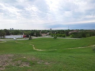
Fort Garry is a community area and neighbourhood of Winnipeg, Manitoba, Canada, located in the southwestern part of the city, south of the district of Fort Rouge and east of the Tuxedo area. It comprises parts of the city wards of River Heights - Fort Garry, Fort Rouge - East Fort Garry, Waverley West, and St. Norbert - Seine River.

<span class="mw-page-title-main">Osborne Village</span> Neighbourhood in Winnipeg, Manitoba, Canada

Osborne Village is a neighbourhood of Winnipeg, Manitoba. The area is bordered by the Assiniboine River on the north and west, Harkness Station on the east, and the Osborne Underpass on the south.

<span class="mw-page-title-main">Crescentwood, Winnipeg</span> Neighbourhood

Crescentwood is a neighbourhood in the River Heights area of Winnipeg, Manitoba, Canada. It is bordered on the north on Academy Road, on the east by the Assiniboine River, on the south by Corydon Avenue, and on the west by Cambridge Street.

<span class="mw-page-title-main">Downtown Winnipeg</span> Neighbourhood in Winnipeg, Manitoba, Canada

Downtown Winnipeg is an area of Winnipeg located near the confluence of the Red and Assiniboine rivers. It is the oldest urban area in Winnipeg, and is home to the city's commercial core, city hall, the seat of Manitoba's provincial government, and a number of major attractions and institutions.

<span class="mw-page-title-main">West End, Winnipeg</span> Urban area in Manitoba, Canada

The West End is a mostly residential area of Downtown Winnipeg, Manitoba, Canada. It includes the neighbourhoods of Armstrong's Point, Colony, Daniel McIntyre, Minto, Sargent Park, Spence, St. Matthews, West Broadway, and Wolseley.

<span class="mw-page-title-main">North End, Winnipeg</span> Neighbourhood in Winnipeg, Manitoba, Canada

Winnipeg's North End is a large urban area located to the north and northwest of Downtown Winnipeg. It is bordered by the Red River on the east, the Canadian Pacific Railway (CPR) mainline on the south, the City of Winnipeg boundary on the west and Jefferson Avenue, Keewatin Street, Carruthers Avenue, McGregor Street and the lane between McAdam and Smithfield Avenues on the north. It is the northern section of the City of Winnipeg as it existed prior to the 1972 municipal amalgamation. Winnipeg's northern suburbs such as West Kildonan and Old Kildonan are not considered part of the North End. The CPR mainline and its Winnipeg yards, which are one of the largest railway yards in the world, act as a physical barrier between the North End and the rest of Winnipeg to the south. This has resulted in the North End remaining a very distinct and unique part of Winnipeg.

Wildwood Park is a suburban, planned community in Winnipeg that has a central green space and no front roads, with communal walkways, playgrounds, and parks.

<span class="mw-page-title-main">Elmwood, Winnipeg</span>

Elmwood is a primarily working-class residential area of Winnipeg, Manitoba. It is the only part of the historic city of Winnipeg located east of the Red River. It includes the areas of Glenelm, which is more affluent and lies west of Henderson Highway, most of Chalmers, Talbot-Grey, and East Elmwood, which was developed primarily in the 1950s. Elmwood is mostly composed of single family residential homes, though there are numerous low-rise apartment blocks, townhouses, and two high rise apartment complexes, which are both social housing projects.

Route 42 is a major arterial road located in Winnipeg, Manitoba.

<span class="mw-page-title-main">Winnipeg Route 62</span>

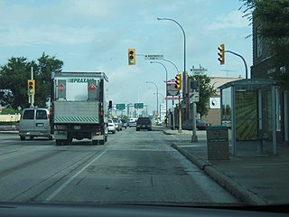
Route 62 is a major north–south arterial route in Winnipeg, Manitoba that has eight different street names.

<span class="mw-page-title-main">Confusion Corner</span>

Osborne Junction, more commonly known as Confusion Corner, is a street intersection in Winnipeg, Manitoba. Located at the junction of City Route 62 and City Route 42 in the city's Fort Rouge neighbourhood, the intersection is a major traffic hub through which most traffic between downtown and the southwest quadrant of the city must pass, but is infamous for being complex and difficult for unfamiliar or distracted drivers to navigate correctly.

The Southwest Transitway is a bus rapid transit dedicated roadway in Winnipeg, Manitoba, Canada, which commenced operation in April 2012.

Broadway is a street in the city of Winnipeg, Manitoba, Canada. It is one of the city's oldest and most historic routes and forms the Trans-Canada Highway route through the city's downtown.

References

  1. "Electoral Wards - City of Winnipeg".
  2. Elections Manitoba map of Winnipeg.
  3. Statistics Canada - River Heights Community Area Profile. Accessed October 21, 2009.
  4. Manitoba History: The French Presence. Manitoba Historical Society. Accessed October 21, 2009.
  5. 1 2 Mark Fortune at Encyclopedia Titanica. Accessed October 21, 2009.
  6. Thomson Beattie at Encyclopedia Titanica. Accessed October 21, 2009.
  7. John Hugo Ross at Encyclopedia Titanica. Accessed October 21, 2009.
  8. George Graham at Encyclopedia Titanica. Accessed October 21, 2009.
  9. "January CrimeMaps - 2022 by Winnipeg Police Service" . Retrieved May 7, 2022.
  10. "2016 Census: City of Winnipeg Neighbourhood Profiles". Winnipeg.ca. Retrieved 2022-05-07.

Coordinates: 49°52′00″N97°09′00″W / 49.86667°N 97.15000°W / 49.86667; -97.15000