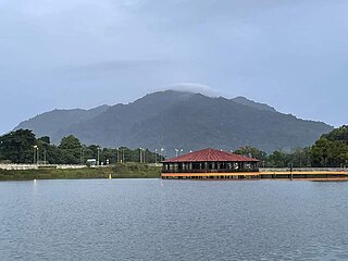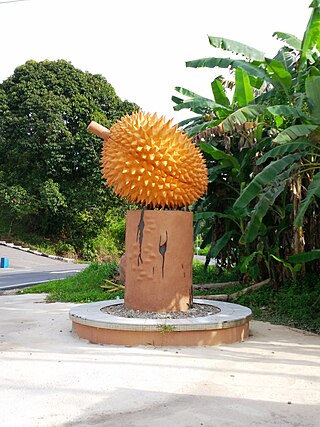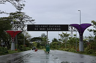
Limbang is a border town and the capital of Limbang District in the Limbang Division of northern Sarawak, East Malaysia, on the island of Borneo. This district area is 3,978.10 square kilometres, and population was 56,900. It is located on the banks of the Limbang River, between the two halves of Brunei.

Serian is a town, and the capital of the Serian separated on 11 April 2015 from Samarahan Division, Sarawak, Malaysia. It is located about 40 miles (64 km) from Kuching. Sub-district headquarters towns are Balai Ringin and Tebedu.

Simanggang is a town and the capital of Sri Aman District and Sri Aman Division in Sarawak, east Malaysia. Located on the Lupar River, it is 193 kilometres (120 mi), a three-hour drive, from Kuching, the capital of Sarawak. It is a trade center for the timber, oil palm, rubber, and pepper of its mostly agricultural district.

Lawas is a small town and the capital of Lawas District, Limbang Division, Sarawak, Malaysia. This district area is 3,811.90 square kilometres, and population was 46,200. It is 1,200 km from the state capital, Kuching and 200 km from the capital city of Sabah, Kota Kinabalu.

The Rajang River is a river in Sarawak, northwest Borneo, Malaysia. The river originates in the Iran Mountains, flows through Kapit, and then towards the South China Sea. At approximately 565 km long (351 mi), the river is the seventh-longest in Borneo and the longest in Malaysia.

Kapit is a town and the capital of Kapit District in Kapit Division, Sarawak, Malaysia on the south bank of the Rajang River. The district comprises 15,595.6 square kilometres and as of 2020, it has a population of 65,800.
Tatau is a town, and the capital of the Tatau District in Bintulu Division, Sarawak, Malaysia. The district's reported total population for Tatau was 30,383. Tatau became a district in 1987. Before that it was a Sub District under Bintulu District. The main spoken languages are Iban, Kenyah, Beketan and Punan.

Song is a town, and the capital of the Song District in Kapit Division, Sarawak, Malaysia. The district population was 20,046 according to the 2010 census. Song is situated by the banks of the Katibas River, a tributary of the Rajang River. It is an important stopover for river traffic going up the Rajang River.

Julau is a town, and the capital of the Julau District in Sarikei Division, Sarawak, Malaysia. The district population is 15, 333. The population is dominated by Iban as well as Chinese especially the Fuzhou.

Bukitan are the indigenous people native to the Nanga Palin in Embaloh Hilir of Kapuas Hulu Regency, Indonesia. Nowadays, the Bukitan diaspora can be found in the neighbouring Nanga Palin as well; including the district of Bintulu in Sarawak.

Lundu is a town and a district located in the northwest of Kuching Division of Sarawak, Malaysia, and borders the Indonesian Province of West Kalimantan.

Limbang Division is one of the twelve administrative divisions of Sarawak, Malaysia. It has a total area of 7,788.50 square kilometres, and is the fourth largest division after Kapit Division, Miri Division and Bintulu Division. Limbang Division consists of two districts which are Limbang District and Lawas District, which in turn are divided as sub-districts in Limbang and two sub-districts in Lawas. Long Semadoh and Ba’kelalan are rural settlements in the southern part of Lawas district. Two major towns in Limbang are Limbang and Lawas. There are also few smaller towns such as Sundar, Trusan, Merapok and Tedungan.

Ba'kelalan is a group of nine villages at Maligan Highlands of Limbang Division, Sarawak, Malaysia about 3,000 feet (910 m) above sea level and 4 km from the border with Indonesian Kalimantan and 150 km from the nearest town of Lawas. There are nine villages in Ba'kelalan. The villagers here belong to the Lun Bawang tribe.

Pakan is a small town in Pakan District, Sarikei Division, Sarawak, Malaysia. The district population estimates was 17,600.

Sungai Tujoh, is the westernmost point of Brunei. It is located in the Belait district.
The local government in Malaysia is the lowest tier of government in Malaysia administered under the states and federal territories which in turn are beneath the federal tier. Local governments are generally under the exclusive purview of the state governments as provided in the Constitution of Malaysia, except for local governments in the federal territories. The federal Ministry of Local Government Development plays a role in co-ordinating and standardising the practices of local governments across the country.

The Limbang District is one of the two districts of Limbang Division, Malaysia. It has a total area of 3,978.10 square kilometres. The major town is Limbang. It has one sub-district, which is Nanga Medamit Sub-District. It borders Brunei Darussalam to the west and east, Lawas District to the southeast and Miri District at the south and southwest. Due to being squeezed in between Brunei at its north and coastal areas, Limbang is accessible by road only by going through immigration posts.
Biawak is a settlement in Lundu District, Sarawak, Malaysia. It lies approximately 70.6 kilometres (44 mi) west of the state capital Kuching, very close to the border with Indonesian Kalimantan.
Batang Ai is a state constituency in Sarawak, Malaysia, that has been represented in the Sarawak State Legislative Assembly since 1979.

Entikong is a subdistrict (kecamatan) and also an administrative village (desa) within that subdistrict in Sanggau Regency of West Kalimantan Province, Indonesia. It is the location of the main border crossing between the West Kalimantan and the Malaysian state of Sarawak. The checkpoint on the Malaysian side of the border is called the Tebedu immigration, customs, quarantine and security checkpoint.


