Lucas Valley-Marinwood, California

Last updated

Lucas Valley-Marinwood, California
Lucas Valley, California.JPG
Lucas Valley
Marin County California Incorporated and Unincorporated areas Lucas Valley-Marinwood Highlighted.svg
Location in Marin County and the state of California
Coordinates: 38°1′41″N122°33′46″W / 38.02806°N 122.56278°W / 38.02806; -122.56278
Country United States
State California
County Marin
Government
   County Board District 1
Damon Connolly
   State Senator Mike McGuire (D) [1]
   CA Assembly Stephanie Nguyen (D) [1]
   U. S. Rep. Jared Huffman (D) [2]
Area
[3]
  Total5.731 sq mi (14.84 km2)
  Land5.731 sq mi (14.84 km2)
  Water0 sq mi (0 km2)  0%
Elevation
[4]
620 ft (189 m)
Population
 (2020) [5]
  Total6,259
  Density1,100/sq mi (420/km2)
Time zone UTC-8 (PST)
  Summer (DST) UTC-7 (PDT)
ZIP code
94903 (San Rafael)
Area codes 415/628
FIPS code 06-44399
GNIS feature ID 2408149

Lucas Valley-Marinwood is a census-designated place (CDP) in Marin County, California, United States. It includes the neighborhoods of Lucas Valley and Marinwood. As of the 2020 census, the population was 6,259. [5]

Contents

History

Marinwood Community Center Marinwood Community Center.jpg
Marinwood Community Center

James Miller, of Irish descent, came overland to California in 1844 with the Stephens–Townsend–Murphy Party and in April 1845 arrived in San Rafael. [6] In 1846 he purchased 680 acres (2.8 km2) of land from Timothy Murphy, grantee of Rancho San Pedro, Santa Margarita y Las Gallinas. The land encompassed present-day Marinwood and a creek which was later named Miller Creek. He rebuilt an old adobe on a hill where the Miller Creek condominiums are located and called it Miller Hall. By 1862 Miller had 10 children, and in 1864 he donated a 34-acre site next to Miller Creek to have the Dixie School built upon it. The building still stands but has been relocated in front of Miller Creek Middle school on Las Gallinas Avenue. It is on the National Register of Historic Places.

James Miller died in 1890. The 1,084-acre (4.39 km2) ranch he owned at the time was eventually sold to the Sequeira family in 1935. The family tore down Miller Hall later that year. A portion of the Miller land was sold to Anthony Faustine (A.F.) Silveira, who had leased the property from 1900 to 1935. Silveira built his own home and dairy facility in 1935 on the east side of what is now the 101 Highway. Silveira, the founding president of Marin Dairymen's Milk Co. Ltd. aka Marin-Dell, died in a ranch accident in 1937. His family continued the ranching operation, which still exists.

Lucas Valley was named after John Lucas, a 19th-century rancher and nephew of Timothy Murphy (not related to George Lucas). [7]

In the 1950s and 1960s, suburbia came to Marinwood. It was brought partly on the shoulders of modernist builder/developer Joseph Eichler. His highly recognizable and stylish homes can be found throughout Lucas Valley and Eastern Marinwood. The Lucas Valley community center and pool were also constructed by Eichler as a centerpiece of the neighborhood.

The original subdivision of Marinwood consisted of streets to the north of Miller Creek Road and featured a blend of suburban single story ranch-style homes and two-story Cape Cod-inspired homes. The streets were named so that all the names ended in "-stone". In alphabetical order, they are Adobestone, Blackstone, Cobblestone, Deepstone, Emerystone, Flagstone, Heatherstone, Johnstone, Millstone, Opalstone, Peachstone, Rhinestone, Unionstone, and Windstone.

The second subdivision was smaller, built to the south of Miller Creek Road, featuring the same mix of ranch- and Cape Cod-style homes. The streets were named with "-wood" as their suffix. They are Pinewood and Quietwood.

A later development was the area that became known as Lower Lucas Valley. This development featured the Eichler-style homes, as opposed to the Marinwood mix. The streets of lower Lucas Valley were named so their names all ended in berry. The streets are, in alphabetical order: Appleberry, Blackberry, Cedarberry, Danberry, Elderberry, Flaxberry, Greenberry, Huckleberry, Idylberry, Juniperberry, Kernberry, Loganberry, Mulberry, Newberry.

The final development was the area up the valley to the west, known as Upper Lucas Valley, and also featured Eichler-style homes. The streets of this area are all named for famous mountains, such as Mt. Shasta, Mt. Rainier, Mt. Whitney, etc.

In 1977, George Lucas purchased 1,267 acres (5.13 km2) west of Marinwood, which he subsequently refashioned into Skywalker Ranch. Geographically, Skywalker Ranch is located on the western side of the Big Rock Ridge and is not part of the Lucas Valley–Marinwood CDP.

Geography

According to the United States Census Bureau, the CDP has a total area of 5.7 square miles (15 km2), all of it land. [3] It is bordered to the north by Novato and to the south by San Rafael. The U.S. Route 101 freeway forms the eastern limit of the CDP, and Lucas Valley Road is the southern border. The CDP extends west up Lucas Valley road to the height of land at Big Rock.

Demographics

2010

The 2010 United States Census [8] reported that Lucas Valley-Marinwood had a population of 6,094. The population density was 1,064.2 inhabitants per square mile (410.9/km2). The racial makeup of Lucas Valley-Marinwood was 5,225 (85.7%) White, 68 (1.1%) African American, 18 (0.3%) Native American, 424 (7.0%) Asian, 5 (0.1%) Pacific Islander, 117 (1.9%) from other races, and 237 (3.9%) from two or more races. Hispanic or Latino of any race were 444 persons (7.3%).

The Census reported that 6,011 people (98.6% of the population) lived in households, 54 (0.9%) lived in non-institutionalized group quarters, and 29 (0.5%) were institutionalized.

There were 2,348 households, out of which 809 (34.5%) had children under the age of 18 living in them, 1,395 (59.4%) were opposite-sex married couples living together, 222 (9.5%) had a female householder with no husband present, 84 (3.6%) had a male householder with no wife present. There were 84 (3.6%) unmarried opposite-sex partnerships, and 35 (1.5%) same-sex married couples or partnerships. 521 households (22.2%) were made up of individuals, and 311 (13.2%) had someone living alone who was 65 years of age or older. The average household size was 2.56. There were 1,701 families (72.4% of all households); the average family size was 2.97.

The population was spread out, with 1,455 people (23.9%) under the age of 18, 309 people (5.1%) aged 18 to 24, 1,055 people (17.3%) aged 25 to 44, 2,052 people (33.7%) aged 45 to 64, and 1,223 people (20.1%) who were 65 years of age or older. The median age was 47.3 years. For every 100 females, there were 89.6 males. For every 100 females age 18 and over, there were 85.2 males.

There were 2,407 housing units at an average density of 420.3 per square mile (162.3/km2), of which 2,002 (85.3%) were owner-occupied, and 346 (14.7%) were occupied by renters. The homeowner vacancy rate was 0.7%; the rental vacancy rate was 4.9%. 5,121 people (84.0% of the population) lived in owner-occupied housing units and 890 people (14.6%) lived in rental housing units.

2000

As of the census [9] of 2000, there were 6,357 people, 2,369 households, and 1,764 families, residing in the CDP. The population density was 1,134.3 inhabitants per square mile (438.0/km2). There were 2,392 housing units at an average density of 426.8 per square mile (164.8/km2). The racial makeup of the CDP in 2010 was 81.0% non-Hispanic White, 1.1% non-Hispanic African American, 0.1% Native American, 6.9% Asian, 0.1% Pacific Islander, 0.3% from other races, and 3.2% from two or more races. Hispanic or Latino of any race were 7.3% of the population.

There were 2,369 households, out of which 37.4% had children under the age of 18 living with them, 61.5% were married couples living together, 10.1% had a female householder with no husband present, and 25.5% were non-families. 19.9% of all households were made up of individuals, and 10.4% had someone living alone who was 65 years of age or older. The average household size was 2.64 and the average family size was 3.03.

In the CDP, the population was spread out, with 26.6% under the age of 18, 3.6% from 18 to 24, 23.8% from 25 to 44, 30.2% from 45 to 64, and 15.8% who were 65 years of age or older. The median age was 43 years. For every 100 females, there were 91.1 males. For every 100 females age 18 and over, there were 84.4 males.

The median income for a household in the CDP was $85,444, and the median income for a family was $95,852. Males had a median income of $65,583 versus $51,132 for females. The per capita income for the CDP was $38,423. About 2.0% of families and 3.7% of the population were below the poverty line, including 2.2% of those under age 18 and 6.3% of those age 65 or over.

Education

The school districts covering the area of the CDP are the Miller Creek Elementary School District (formerly the Dixie School District) and the San Rafael City High School District. [10]

It includes three elementary schools- Lucas Valley Elementary School, and Mary E. Silveira Elementary School. There is also one middle school-Miller Creek Middle School Panthers, a California Distinguished School.

Residents may choose either San Rafael High School or Terra Linda High School. [11]

Related Research Articles

<span class="mw-page-title-main">Kentfield, California</span> Census-designated place in California, United States

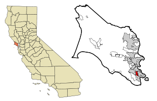
Kentfield is a census-designated place (CDP) in Marin County, California, United States, just north of San Francisco. Kentfield is located 2 miles (3 km) southwest of downtown San Rafael, at an elevation of 115 feet. The population was 6,808 at the 2020 census. The ZIP codes are 94904 for street addresses, and 94914 for PO boxes, and are shared with the neighboring community of Greenbrae.

<span class="mw-page-title-main">Lagunitas-Forest Knolls, California</span> Census-designated place in California, United States

Lagunitas-Forest Knolls is a census-designated place, composed of two unincorporated areas in the western half of the San Geronimo Valley in Marin County, California. It is located to the west of San Geronimo and Woodacre. The population was 1,924 at the 2020 census.

<span class="mw-page-title-main">Muir Beach, California</span> Census designated place in California, United States

Muir Beach is a census designated place (CDP), unincorporated community, and beach on the Pacific Ocean. The community is located 16.5 miles (26.6 km) northwest of San Francisco in western Marin County, California, United States. Unlike many other entities in the area, it is not named directly in honor of conservationist John Muir; instead, it was named after Muir Woods National Monument to capitalize on the latter's popularity. The population was 304 at the 2020 census. The community itself flanks the northwest side of the beach.

<span class="mw-page-title-main">San Rafael, California</span> City in California, United States

San Rafael is a city and the county seat of Marin County, California, United States. The city is located in the North Bay region of the San Francisco Bay Area. As of the 2020 U.S. census, the city's population was 61,271, up from 57,713 in 2010.

<span class="mw-page-title-main">Santa Venetia, California</span> Census-designated place in California, United States

Santa Venetia is a census-designated place (CDP) in Marin County, California, United States. It is located 1.5 miles (2.4 km) north of downtown San Rafael, at an elevation of 56 feet (17 m). The population was 4,289 at the 2020 census.

<span class="mw-page-title-main">Strawberry, Marin County, California</span> Census-designated place in California, United States

Strawberry is a census-designated place (CDP) and an unincorporated district of Marin County, California, United States. It shares a ZIP code (94941) with Mill Valley and falls within its school districts; however, it is considered within the sphere of influence of the town of Tiburon. It is separated from Mill Valley by U.S. Route 101. Its population was 5,447 at the 2020 census.

<span class="mw-page-title-main">Tamalpais-Homestead Valley, California</span> Census-designated place in California, United States

Tamalpais-Homestead Valley is a census-designated place (CDP) in Marin County, California, United States. The population was 11,492 at the 2020 census.

<span class="mw-page-title-main">Woodacre, California</span> Census-designated place in California, United States

Woodacre is an unincorporated town and census-designated place (CDP) in Marin County, California, United States. The population was 1,410 at the 2020 census.

<span class="mw-page-title-main">Palm City, Florida</span> Census-designated place in Florida, United States

Palm City is an unincorporated area and census-designated place (CDP) in Martin County, Florida, United States. The population was 25,883 at the 2020 census. It is part of the Port St. Lucie Metropolitan Statistical Area.

<span class="mw-page-title-main">Martinez, Georgia</span> Census-designated place in Georgia, United States

Martinez is a census-designated place (CDP) in Columbia County, Georgia, United States. It is a northwestern suburb of Augusta and is part of the Augusta, Georgia metropolitan area. The population was 34,535 at the 2020 census.

<span class="mw-page-title-main">Lemont, Pennsylvania</span> Census-designated place in Pennsylvania, United States

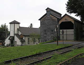
Lemont is an unincorporated community and census-designated place (CDP) in Centre County, Pennsylvania, United States, and is the location of the only remaining granary in Pennsylvania. It is part of the State College, Pennsylvania Metropolitan Statistical Area. The population was 2,270 at the 2010 census.

Glenburn is a census-designated place (CDP) in Glenburn Township, Lackawanna County, Pennsylvania, United States. The population was 953 at the 2010 census. It is approximately 10 miles (16 km) north of downtown Scranton, in the growing suburban area known as the "Abingtons". Glenburn is located north of Clarks Summit and south of Dalton.

<span class="mw-page-title-main">Wyldwood, Texas</span> CDP in Texas, United States

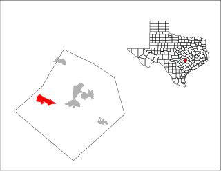
Wyldwood is a census-designated place (CDP) in Bastrop County, Texas, United States. The population was 3,694 at the 2020 census.

<span class="mw-page-title-main">Brushy Creek, Williamson County, Texas</span> CDP in Texas, United States

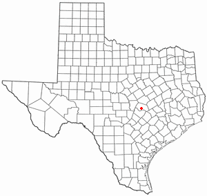
Brushy Creek is a census-designated place (CDP) in Williamson County, Texas, United States. The population was 22,519 at the 2020 census.

<span class="mw-page-title-main">Montezuma Creek, Utah</span> Census-designated place in Utah, United States

Montezuma Creek is a census-designated place (CDP) in San Juan County, Utah, United States. The population was 335 at the 2010 census, a decrease from the 2000 figure of 507.

<span class="mw-page-title-main">West Springfield, Virginia</span> Census-designated place in Virginia, United States

West Springfield is a census-designated place (CDP) in Fairfax County, Virginia, United States. The population was 23,369 at the 2020 census.

<span class="mw-page-title-main">Lance Creek, Wyoming</span> CDP in Wyoming, United States

Lance Creek is a census-designated place (CDP) in Niobrara County, Wyoming, United States. The population was 43 at the 2010 census. Lance Creek is the namesake of the Lance Formation, a rock formation from the Late Cretaceous that has yielded fossils from a diverse number of species.

<span class="mw-page-title-main">Nicasio, California</span> Census-designated place in California, United States

Nicasio is an unincorporated community and census-designated place in Marin County, California, United States. It is located 8 miles (13 km) west-southwest of Novato, at an elevation of 194 feet (59 m). As of the 2020 census the CDP population was 81, while population estimates for the surrounding area range from about 600 to about 900 people.

Sleepy Hollow is a census-designated place in Marin County, California, United States. It is located 7 miles (11 km) south of downtown Novato at an elevation of 177 feet (54 m). Its population as of the 2020 census was 2,401.

<span class="mw-page-title-main">Miller Creek Elementary School District</span> School district in California

The Miller Creek Elementary School District, formerly the Dixie School District, is a school district located in San Rafael, California that operates four schools in the northern portion of the city: Mary E. Silveira Elementary School in the Marinwood area, Vallecito Elementary School in the Terra Linda area, Lucas Valley Elementary School, and Miller Creek Middle School in the Marinwood area. All four are California Distinguished Schools.

References

  1. 1 2 "Statewide Database". UC Regents. Archived from the original on February 1, 2015. Retrieved December 5, 2014.
  2. "California's 2nd Congressional District - Representatives & District Map". Civic Impulse, LLC. Retrieved March 8, 2013.
  3. 1 2 "2021 U.S. Gazetteer Files: California". United States Census Bureau. Retrieved July 7, 2022.
  4. "Lucas Valley-Marinwood Census Designated Place". Geographic Names Information System . United States Geological Survey, United States Department of the Interior . Retrieved December 31, 2014.
  5. 1 2 "P1. Race – Lucas Valley-Marinwood CDP, California: 2020 DEC Redistricting Data (PL 94-171)". U.S. Census Bureau. Retrieved July 7, 2022.
  6. Michael C. O'Laughlin, 2004,Irish Families on the California Trail, Irish Genealogical Fou–ndation, ISBN   978-0-940134-61-4
  7. Strickler, Jeff (November 16, 2007). "Skywalker Ranch: George Lucas creates a magic world in real life". Minneapolis-St. Paul Star Tribune. Archived from the original on May 17, 2015.
  8. "2010 Census Interactive Population Search: CA - Lucas Valley-Marinwood CDP". U.S. Census Bureau. Archived from the original on July 15, 2014. Retrieved July 12, 2014.
  9. "U.S. Census website". United States Census Bureau . Retrieved January 31, 2008.
  10. "2020 CENSUS - SCHOOL DISTRICT REFERENCE MAP: Marin County, CA" (PDF). U.S. Census Bureau . Retrieved April 28, 2023. - Text list - The Miller Creek Elementary School District is listed as the "Dixie Elementary School District."
  11. "School Attendance Boundary Information". San Rafael City Schools . Retrieved April 29, 2023. What about High School?[...]

See also