Foster City, California

Last updated

Foster City, California
City of Foster City
Foster City aerial view, February 2018.JPG
Aerial view of Foster City and the San Mateo Bridge
Flag of Foster City, California.gif
Seal of Foster City, California.svg
San Mateo County California Incorporated and Unincorporated areas Foster City Highlighted 0625338.svg
Location of Foster City in San Mateo County, California
Location Map San Francisco Bay Area.png
Red pog.svg
Foster City
Location in the United States
Relief map of Northern California.png
Red pog.svg
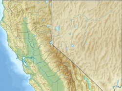
Foster City
Foster City (Northern California)
Relief map of California.png
Red pog.svg
Foster City
Foster City (California)
Usa edcp relief location map.png
Red pog.svg
Foster City
Foster City (the United States)
Coordinates: 37°33′5″N122°15′59″W / 37.55139°N 122.26639°W / 37.55139; -122.26639
Country United States
State California
County San Mateo
Incorporated April 27, 1971 [1]
Named for T. Jack Foster, Foster Enterprises
Government
   Mayor Patrick Sullivan [2]
   City Manager Stefan Chatwin [3]
Area
[4]
  Total19.83 sq mi (51.37 km2)
  Land3.79 sq mi (9.81 km2)
  Water16.05 sq mi (41.56 km2)  81.07%
Elevation
[5]
7 ft (2 m)
Population
 (2020) [6]
  Total33,805
  Density8,947.22/sq mi (3,454.27/km2)
Time zone UTC-8 (Pacific)
  Summer (DST) UTC-7 (PDT)
ZIP code
94404
Area code 650
FIPS code 06-25338
GNIS feature IDs 1659723, 2410534
Website www.fostercity.org
An aerial photograph of Foster City in 2013 Aerial view of Silicon Valley.jpg
An aerial photograph of Foster City in 2013

Foster City is a master-planned [7] city located in San Mateo County, California, United States. Foster City is sometimes considered to be part of Silicon Valley for its local industry and its proximity to Silicon Valley cities. [8] [9] There are many notable companies headquartered in Foster City like Gilead Sciences, Zoox, and Sledgehammer Games. Visa used to be headquartered in Foster City.

Contents

The 2020 census put the population at 33,805, [6] an increase of more than 10% over the 2010 census figure of 30,567.

Foster City is one of the United States’ safest cities, [10] with an average of one murder per decade. [11]

History

Foster City was founded in the 1960s, built on the existing Brewer Island in the marshes of the San Francisco Bay on the east edge of San Mateo, enlarged with engineered landfill. The city was named after T. Jack Foster, a real estate magnate who owned much of the land comprising the city and who was instrumental in its initial design. His firm, Foster Enterprises, now run by his descendants, relocated to San Mateo in 2000 [12] and is still active in real estate affairs throughout the San Francisco Bay Area.

In the early 1960s, the first homes built in Foster City were sold for under $18,000. By the late 1960s, the average home price was just under $30,000. [13] United States census data shows the median household income for Foster City residents in 1970 was $30,000 and in 1980 was $60,000. [14] As of 2020, the median household income for Foster City was $161,000. [15] In 2024, the average home value was $1,926,381. [16]

Geography

According to the United States Census Bureau, the city has a total area of 19.8 square miles (51 km2), of which 3.8 square miles (9.8 km2) is land and 16.1 square miles (42 km2) is water. The total area is 81.07% water. Foster City has ongoing issues with water intrusion from the San Francisco Bay and is potentially subject to permanent inundation as the sea level rises. A project to improve the existing levee with a steel-reinforced wall has been underway since FEMA designated the entire area as a floodplain making residents subject to much higher flood insurance rates. [17]

Climate

Foster City, like most of the peninsula, has a mild warm-summer Mediterranean climate, with warm, dry summers and cool, wet winters. The warmest month of the year is September, with an average daytime temperature of 77.8 °F (25.4 °C) and an average nighttime temperature of 53.8 °F (12.1 °C), while the coldest month of the year is January, with an average daytime temperature of 58 °F (14 °C) and an average nighttime temperature of 41.5 °F (5.3 °C). [18]

Climate data for Foster City, California
MonthJanFebMarAprMayJunJulAugSepOctNovDecYear
Record high °F (°C)78
(26)
80
(27)
88
(31)
89
(32)
98
(37)
109
(43)
108
(42)
103
(39)
107
(42)
96
(36)
89
(32)
78
(26)
109
(43)
Mean daily maximum °F (°C)58.0
(14.4)
61.5
(16.4)
63.9
(17.7)
67.0
(19.4)
70.5
(21.4)
74.4
(23.6)
76.7
(24.8)
76.6
(24.8)
77.8
(25.4)
73.0
(22.8)
65.4
(18.6)
59.0
(15.0)
68.7
(20.4)
Daily mean °F (°C)49.7
(9.8)
52.7
(11.5)
54.5
(12.5)
57.0
(13.9)
60.2
(15.7)
63.5
(17.5)
65.2
(18.4)
65.4
(18.6)
65.8
(18.8)
62.1
(16.7)
55.7
(13.2)
50.8
(10.4)
58.5
(14.7)
Mean daily minimum °F (°C)41.5
(5.3)
43.9
(6.6)
45.3
(7.4)
46.9
(8.3)
49.9
(9.9)
52.7
(11.5)
53.8
(12.1)
54.2
(12.3)
53.8
(12.1)
51.2
(10.7)
46.2
(7.9)
42.6
(5.9)
48.5
(9.2)
Record low °F (°C)23
(−5)
29
(−2)
31
(−1)
31
(−1)
36
(2)
40
(4)
42
(6)
46
(8)
40
(4)
36
(2)
29
(−2)
25
(−4)
23
(−5)
Average precipitation inches (mm)4.6
(120)
3.2
(81)
2.8
(71)
1.3
(33)
0.5
(13)
0.1
(2.5)
0
(0)
0
(0)
0.2
(5.1)
0.9
(23)
2.1
(53)
3.4
(86)
19.1
(490)
Average precipitation days11109531001371060
Source: [18]

Demographics

Historical population
CensusPop.Note
1970 9,327
1980 23,287149.7%
1990 28,17621.0%
2000 28,8032.2%
2010 30,5676.1%
2020 33,80510.6%
U.S. Decennial Census [19]

2020

The 2020 United States Census reported that Foster City had a population of 33,056 with 12,243 households. The 2020 median home price in Foster City was $1,439,375. [20] The population density was 8,947.22/sq mi (3,454.27/km2). The racial makeup of Foster City was 13,171 (39.8%) White, 818 (2.5%) African American, 39 (0.1%) Native American, 16,715(50.6%) Asian, 30 (0.1%) Pacific Islander, 394 (1.2%) from other races, and 1,889 (5.7%) from two or more races. Hispanic or Latino of any race were 2,605 persons (7.9%). 52% of the population was born in the United States, and 22% of the population are naturalized citizens. [21]

The Census reported that the median household income was $163,322, [22] 3.2% of the population was below the poverty line, out of the total population 2.5% of those under the age of 18 and 5.1% of those 65 and older were living below the poverty line.

For those over the age of 25, 96% had a high school diploma or higher, 71% had a bachelor's degree, and 36.6% had a graduate degree or professional degree.

2010

The 2010 United States Census [23] reported that Foster City had a population of 30,567. The 2009 median home price in Foster City was $1,025,000. The population density was 8,138.2 inhabitants per square mile (3,142.2/km2). The racial makeup of Foster City was 13,912 (45.5%) White, 576 (1.9%) African American, 29 (0.1%) Native American, 13,746 (45.0%) Asian, 189 (0.6%) Pacific Islander, 575 (1.9%) from other races, and 1,540 (5.0%) from two or more races. Hispanic or Latino of any race were 1,995 persons (6.5%).

The Census reported that 30,458 people (99.6% of the population) lived in households, 52 (0.2%) lived in non-institutionalized group quarters, and 57 (0.2%) were institutionalized.

There were 12,016 households, out of which 4,256 (35.4%) had children under the age of 18 living in them, 7,127 (59.3%) were opposite-sex married couples living together, 963 (8.0%) had a female householder with no husband present, 316 (2.6%) had a male householder with no wife present. There were 531 (4.4%) unmarried opposite-sex partnerships, and 75 (0.6%) same-sex married couples or partnerships. 2,807 households (23.4%) were made up of individuals, and 860 (7.2%) had someone living alone who was 65 years of age or older. The average household size was 2.53. There were 8,406 families (70.0% of all households); the average family size was 3.04.

The population was spread out, with 6,913 people (22.6%) under the age of 18, 1,526 people (5.0%) aged 18 to 24, 9,801 people (32.1%) aged 25 to 44, 8,223 people (26.9%) aged 45 to 64, and 4,104 people (13.4%) who were 65 years of age or older. The median age was 39.3 years. For every 100 females, there were 93.5 males. For every 100 females age 18 and over, there were 91.0 males.

There were 12,458 housing units at an average density of 3,316.8 per square mile (1,280.6/km2), of which 6,958 (57.9%) were owner-occupied, and 5,058 (42.1%) were occupied by renters. The homeowner vacancy rate was 0.8%; the rental vacancy rate was 3.5%. 18,423 people (60.3% of the population) lived in owner-occupied housing units and 12,035 people (39.4%) lived in rental housing units.

Demographic profile [24] 2010
Total population30,567 (100.0%)
One race29,027 (95.0%)
Not Hispanic28,572 (93.5%)
White alone12,829 (42.0%)
Black or African American alone545 (1.8%)
American Indian and Alaska Native alone17 (0.1%)
Asian alone13,691 (44.8%)
Native Hawaiian and Other Pacific Islander alone182 (0.6%)
Some other race alone102 (0.3%)
Two or more races alone1,206 (3.9%)
Hispanic or Latino (of any race)1,995 (6.5%)

2000

As of the census [25] of 2000, there were 28,803 people, 11,613 households, and 7,931 families residing in the city. The population density was 7,668.5 inhabitants per square mile (2,960.8/km2). There were 12,458 housing units at an average density of 3,316.8 per square mile (1,280.6/km2). There were 11,613 households, out of which 30.5% had children under the age of 18 living with them, 57.7% were married couples living together, 7.7% had a female householder with no husband present, and 31.7% were non-families. 23.6% of all households were made up of individuals, and 5.0% had someone living alone who was 65 years of age or older. The average household size was 2.47 and the average family size was 2.97.

In the city, the population was spread out, with 21.2% under the age of 18, 5.9% from 18 to 24, 35.3% from 25 to 44, 27.6% from 45 to 64, and 10.1% who were 65 years of age or older. The median age was 38 years. For every 100 females, there were 96.8 males. For every 100 females age 18 and over, there were 93.9 males.

According to Money magazine, the median income for a household in Foster City was $135,470. [9] The median income for a family was $118,231. [26] Males had a median income of $77,916 versus $51,157 for females. The per capita income for the city was $45,754. 2.9% of the population and 1.7% of families were below the poverty line. Out of the total population, 1.6% of those under the age of 18 and 5.6% of those 65 and older were living below the poverty line.

Economy

Metro Center, one of Foster City's largest retail/office complexes Foster City CA Metro Center.jpg
Metro Center, one of Foster City's largest retail/office complexes

Headquarters

Around 1993Visa Inc. began consolidating various scattered offices in San Mateo, California to a location in Foster City. [27] Visa's headquarters were in Foster City, and Visa became Foster City's largest employer. Visa owns four buildings at the intersection of Metro Center Boulevard and Vintage Park Drive. As of 2009 it employed about 3,000 people at the complex. During that year Visa signed a 10-year lease agreement for the top three floors of 595 Market Street in San Francisco and moved its top executives there. Visa continued to keep employees at the Foster City offices. [28] As of 2009, after the headquarters move, the Foster City facilities remained the company's center of employment, and those buildings housed 2,400 employees as of 2009. [29]

Other companies with headquarters in Foster City:

Top employers

According to the city's 2023 Top Ten Employers, [30] the top ten employers in the city are:

#Employer# of Employees% of Total City Employment
1 Gilead Sciences 6,71433.15%
2 Visa 2,87914.22%
3 Zoox 14016.92%
4 Inovant LLC (Visa Technology and Operations LLC)1,0545.20%
5 CyberSource 4272.11%
6 Peninsula Jewish Community Center 4172.06%
7 Sledgehammer Games 3211.58%
8 Costco Wholesale2901.43%
9 Qualys 2831.40%
10 MinPen Housing Corporation 2701.33%

Arts and culture

Parks and recreation

Boating is a popular activity in the city's lagoons. Foster City February 2013 002.jpg
Boating is a popular activity in the city's lagoons.
Shells Dirt Jumps at the Beach Park NorCal2018 060c Shells Dirt Jumps at the Beach Park, Foster City S0174019.jpg
Shells Dirt Jumps at the Beach Park

Foster City has 24 parks occupying more than 200 acres (0.8 km2), including many public tennis courts, baseball and soccer fields, basketball courts, and rollerblading/biking trails along the San Francisco Bay.

Foster City also has:

In addition, Foster City maintains an extensive 218-acre (0.9 km2), [33] man-made enclosed lagoon system. The lagoons were initially designed as a drainage system required in order to efficiently drain the lowland city.

Government

City Hall of Foster City City Hall Foster City May 2011.jpg
City Hall of Foster City

In the California State Legislature, Foster City is in the 13th Senate District , represented by Democrat Josh Becker, and in the 21st Assembly District , represented by Democrat Diane Papan. [34]

In the United States House of Representatives, Foster City is in California's 15th congressional district , represented by Democrat Kevin Mullin. [35]

As of December 2021, Foster City's Mayor is Richa Awasthi. Other councilmembers include Sam Hindi, Jon Froomin, and Patrick Sullivan. Froomin was elected to office after former councilmember Herb Perez was recalled by a majority of Foster City voters. Perez was the first city councilperson to be recalled since 1977.

Former Mayor Sam Hindi was the first Palestinian-American Mayor in the history of California. Councilmember Sanjay Gehani was the first Mayor for Foster City of Indian descent. Current (2022) Mayor Richa Awashi is the first female minority Mayor and first woman Immigrant to be Foster City's Mayor. [36] [37]

According to the California Secretary of State, as of February 10, 2019, Foster City has 16,568 registered voters. Of those, 7,336 (44.3%) are registered Democrats, 2,756 (16.6%) are registered Republicans, and 5,977 (36.1%) have declined to state a political party. [38]

Education

Foster City is home to five public schools in the San Mateo–Foster City Elementary School District. Foster City Elementary School (which has recently been remodeled), Brewer Island Elementary School, Audubon Elementary School, and newly-built Beach Park Elementary School serve kindergarten through fifth grades. Nathaniel Bowditch Middle School serves 6th through 8th grades. There are several private preschools and elementary schools. There is a separate High School District: San Mateo Union High School District. There is no high school located east of Highway 101 so Foster City high school students attend the public schools in the San Mateo Union High School District and other private high schools in the San Francisco Bay Area.

Four public schools in Foster City (Audubon School, Brewer Island School, Foster City School, and Bowditch Middle School) have won California Distinguished School awards. In 1993, Bowditch was recognized with the U.S. Department of Education Blue Ribbon. In 2005, Bowditch became a California Distinguished School for the second time. A third recognition was given in 2013.

Foster City has one private Jewish day school: Ronald C. Wornick Jewish Day School is a kindergarten – eighth grade school. It was rated the number one Jewish day school in the South Bay/Peninsula. [39]

Foster City also has one private elementary school: Kids Connection is a kindergarten – fifth grade school.

Items of interest

Foster City's Werder Pier is a remainder of the original expanse of the San Mateo–Hayward Bridge. It is also one of the longest and oldest piers in California. Unfortunately, due to much needed repair, the once popular fishing pier is no longer in operation[ when? ].

A number of San Francisco professional athletes have called Foster City home. Former San Francisco Giants players Kevin Mitchell and Jeff Kent won the National League Most Valuable Player award while they were residents of Foster City.[ citation needed ]

Peter Thiel, founder of PayPal, was raised in Foster City.

Norman Hsu, the Hong Kong-born convicted criminal (Ponzi scheme scam artist) and political activist, is a former resident of Foster City.

The movie Over the Edge is based on events[ clarification needed ] occurring in Foster City and chronicled in a 1973 article titled "Mousepacks: Kids on a Crime Spree" in the San Francisco Examiner .

Foster City TV broadcasts a variety of programs related to the operation of and life in Foster City. Foster City TV provides programming through a dedicated government-access television (GATV) channel.

See also

Related Research Articles

<span class="mw-page-title-main">San Mateo County, California</span> County in California, United States

San Mateo County, officially the County of San Mateo, is a county located in the U.S. state of California. As of the 2020 census, the population was 764,442. Redwood City is the county seat, and the third most populated city following Daly City and San Mateo. San Mateo County is included in the San Francisco–Oakland–Berkeley, CA MSA, Silicon Valley, and is part of the San Francisco Bay Area, the nine counties bordering San Francisco Bay. It covers most of the San Francisco Peninsula. San Francisco International Airport is located in the northeastern area of the county and is approximately 7 miles (11 km) south of the city and county limits of San Francisco, even though the airport itself is assigned a San Francisco postal address. The county's built-up areas are mostly suburban, and are home to many corporate campuses.

<span class="mw-page-title-main">Menlo Park, California</span> City in California, United States

Menlo Park is a city at the eastern edge of San Mateo County within the San Francisco Bay Area of California, United States. It is bordered by San Francisco Bay on the north and east; East Palo Alto, Palo Alto, and Stanford to the south; and Atherton, North Fair Oaks, and Redwood City to the west. It had 33,780 residents at the 2020 United States census. It is home to the corporate headquarters of Meta, and is where Google, Roblox Corporation and Round Table Pizza were founded. The train station holds the record as the oldest continually operating train station in California. It is one of the most educated cities in California and the United States; nearly 70% of residents over 25 have earned a bachelor's degree or higher.

<span class="mw-page-title-main">Newark, California</span> City in California, United States

Newark is a city in Alameda County, California, United States. It was incorporated as a city in September 1955. Newark is an enclave, surrounded by the city of Fremont. The three cities of Newark, Fremont, and Union City make up the Tri-City Area. Newark's population was 47,529 at the 2020 census making it the third largest city in the US named Newark after Newark, New Jersey, and Newark, Ohio.

<span class="mw-page-title-main">San Pablo, California</span> City in California, United States

San Pablo is an enclave city in Contra Costa County, California, United States. The city of Richmond surrounds nearly the whole city. The population was 32,127 at the 2020 census. The current Mayor is Abel Pineda. Currently, the City Council consists of Abel Pineda, Patricia Ponce, Arturo Cruz, Elizabeth Pabon-Alvarado, and Rita Xavier. Ponce is the Vice Mayor, and Cruz, Pabon-Alvarado, and Xavier are Council Members. Dorothy Gantt is the city Clerk. Viviana Toledo is the city Treasurer.

<span class="mw-page-title-main">Kentfield, California</span> Census-designated place in California, United States

Kentfield is a census-designated place (CDP) in Marin County, California, United States, just north of San Francisco. Kentfield is located 2 miles (3 km) southwest of downtown San Rafael, at an elevation of 115 feet. The population was 6,808 at the 2020 census. The ZIP codes are 94904 for street addresses, and 94914 for PO boxes, and are shared with the neighboring community of Greenbrae.

<span class="mw-page-title-main">Belmont, California</span> City in the US state of California

Belmont is a city in San Mateo County in the U.S. state of California. It is in the San Francisco Bay Area, on the San Francisco Peninsula about halfway between San Francisco and San Jose. Known for its wooded hills, views of the San Francisco Bay and stretches of open space, Belmont is a quiet residential community in the midst of the culturally and technologically rich Bay Area. It was originally part of Rancho de las Pulgas, for which one of its main roads, the Alameda de las Pulgas, is named. The city was incorporated in 1926. Its population was 28,335 at the 2020 census.

<span class="mw-page-title-main">Brisbane, California</span> City in California, United States

Brisbane is a small city in San Mateo County, California, located on the lower slopes of the San Bruno Mountain. The city is on the northeastern edge of San Mateo County, located immediately south of the San Francisco city limits on the San Francisco Bay. The population was 4,851 as of the 2020 census.

<span class="mw-page-title-main">Burlingame, California</span> City in California, United States

Burlingame is a city in San Mateo County, California, United States. It is located on the San Francisco Peninsula and has a significant shoreline on San Francisco Bay. The city is named after diplomat Anson Burlingame and is known for its numerous eucalyptus groves, walkable downtown area, and public school system. As of the 2020 census, the city population was 31,386.

<span class="mw-page-title-main">Colma, California</span> Town in San Mateo County, California

Colma is a small incorporated town in San Mateo County, California, United States, on the San Francisco Peninsula in the San Francisco Bay Area. The population was 1,507 at the 2020 census. The town was founded as a necropolis in 1924.

<span class="mw-page-title-main">Daly City, California</span> City in California, United States

Daly City is the second most populous city in San Mateo County, California, United States. The population was 104,901 at the 2020 census. Located in the San Francisco Bay Area, and immediately south of San Francisco, it is named for businessman and landowner John Donald Daly.

<span class="mw-page-title-main">Half Moon Bay, California</span> City in California, United States

Half Moon Bay is a coastal city in San Mateo County, California, United States, approximately 25 miles south of San Francisco. Its population was 11,795 as of the 2020 census. Immediately north of Half Moon Bay is Pillar Point Harbor and the unincorporated community of Princeton-by-the-Sea. Half Moon Bay is known for Mavericks, a big-wave surf location. It is called Half Moon Bay because of its crescent shape.

<span class="mw-page-title-main">Hillsborough, California</span> City in California, United States

Hillsborough is an incorporated town in San Mateo County, California, United States, in the San Francisco Bay Area. It is located 17 miles (27 km) south of San Francisco on the San Francisco Peninsula, bordered by Burlingame to the north, San Mateo to the east, Highlands-Baywood Park to the south, and Interstate 280 to the west. The population was 11,387 at the 2020 census.

<span class="mw-page-title-main">Millbrae, California</span> City in California, United States

Millbrae is a city located in northern San Mateo County, California, United States. To the northeast is San Francisco International Airport; San Bruno is to the northwest, and Burlingame is to the southeast. It is bordered by San Andreas Lake to the southwest. The population was 23,216 at the 2020 census.

<span class="mw-page-title-main">North Fair Oaks, California</span> Census-designated place in California, United States

North Fair Oaks is a census-designated place and an unincorporated area located in San Mateo County, California adjacent to Redwood City, Atherton, and Menlo Park. As of the 2020 census the area had a total population of 14,027. Because of the large number of residents from one Mexican state the area is also known as Little Michoacán. The larger area including North Fair Oaks and adjacent parts of Redwood City has a large Latino population and is known locally as Little Mexico. The neighborhood is distinctive, as it is one out of only three communities in San Mateo County that have a majority Hispanic population.

<span class="mw-page-title-main">Pacifica, California</span> City in San Mateo County, California, US

Pacifica is a city in San Mateo County, California, on the coast of the Pacific Ocean between San Francisco and Half Moon Bay.

<span class="mw-page-title-main">Portola Valley, California</span> City in California, United States

Portola Valley is a town in San Mateo County, California, United States. Located on the San Francisco Peninsula in the Bay Area, Portola Valley is a small, wealthy community nestled on the eastern slopes of the Santa Cruz Mountains.

<span class="mw-page-title-main">Redwood City, California</span> City in the United States

Redwood City is a city on the San Francisco Peninsula in Northern California's Bay Area, approximately 27 miles (43 km) south of San Francisco, and 24 miles (39 km) northwest of San Jose. Redwood City's history spans its earliest inhabitation by the Ohlone people to being a port for lumber and other goods. The county seat of San Mateo County in the heart of Silicon Valley, Redwood City is home to several global technology companies including Oracle, Electronic Arts, Evernote, Box, and Informatica. The city's population was 84,292 according to the 2020 census. The Port of Redwood City is the only deepwater port on San Francisco Bay south of San Francisco.

<span class="mw-page-title-main">San Bruno, California</span> City in California, United States

San Bruno is a city in San Mateo County, California, United States, incorporated in 1914. The population was 43,908 at the 2020 United States Census. The city is between South San Francisco and Millbrae, adjacent to San Francisco International Airport and Golden Gate National Cemetery; it is approximately 12 miles (19 km) south of Downtown San Francisco.

<span class="mw-page-title-main">San Carlos, California</span> City in California, United States

San Carlos is a city in San Mateo County, California, United States. The population is 30,722 per the 2020 census.

<span class="mw-page-title-main">San Mateo, California</span> City in California, United States

San Mateo is a city in San Mateo County, California, United States, on the San Francisco Peninsula. About 20 miles (32 km) south of San Francisco, the city borders Burlingame to the north, Hillsborough to the west, San Francisco Bay and Foster City to the east and Belmont to the south. The population was 105,661 at the 2020 census.

References

  1. "California Cities by Incorporation Date". California Association of Local Agency Formation Commissions. Archived from the original (Word) on November 3, 2014. Retrieved August 25, 2014.
  2. "City Council". City of Foster City. Archived from the original on February 11, 2015. Retrieved December 14, 2021.
  3. "City Manager | Foster City California". City of Foster City. Archived from the original on July 19, 2023. Retrieved August 23, 2023.
  4. "2019 U.S. Gazetteer Files". United States Census Bureau. Retrieved July 1, 2020.
  5. "Foster City". Geographic Names Information System . United States Geological Survey, United States Department of the Interior . Retrieved April 15, 2015.
  6. 1 2 "Foster City (city) QuickFacts". United States Census Bureau.
  7. "Living in Foster City | Golden Gate Sotheby's International Realty". www.goldengatesir.com. Retrieved April 1, 2024.
  8. Woolsey, Matt. "In Depth: America's Top 25 Towns To Live Well". Forbes.
  9. 1 2 "Best places to live 2008". CNN.
  10. FBI Crime Reports (2015), reported in Patch
  11. Foster City, California (CA 94404) profile: population, maps, real estate, averages, homes, statistics, relocation, travel, jobs, hospitals, schools, crime, moving, houses, news. City-data.com. Retrieved on 2013-07-21.
  12. Simon, Mark (January 21, 2000). "Foster City Loses Namesake Enterprise". SFGATE. Retrieved May 20, 2021.
  13. DiFruscio, Ray (November 1, 1979). This is Foster City. Foster City Chamber of Commerce. p. 21.
  14. "City of Foster City Census". BayAreaCensus.org. Retrieved April 16, 2024.
  15. "Foster City Community Development" (PDF). FosterCity.org. Retrieved April 16, 2024.
  16. "Foster City CA Home Prices & Home Values". Zillow. Retrieved April 25, 2024.
  17. "Can Foster City's new massive steel wall keep sea level rise at bay?". The San Francisco Chronicle.
  18. 1 2 "Foster City, California". Weatherbase. Retrieved May 3, 2022.
  19. "Census of Population and Housing". Census.gov. Retrieved June 4, 2015.
  20. "Foster City, CA Real Estate Market, Home Prices & Sales Trends". www.propertyshark.com.
  21. "Explore Census Data". data.census.gov.
  22. "Explore Census Data". data.census.gov.
  23. "2010 Census Interactive Population Search: CA - Foster City city". U.S. Census Bureau. Archived from the original on July 15, 2014. Retrieved July 12, 2014.
  24. "Demographic Profile Bay Area Census". Archived from the original on December 27, 1996.
  25. "U.S. Census website". United States Census Bureau . Retrieved 2008-01-31.
  26. "U.S. Census Bureau: Foster City". Archived from the original on February 10, 2020. Retrieved April 3, 2020.
  27. "Visa Finds a Passport to the Future San Mateo Company Bets on 'Smart' Cards That Will Exchange Information, Not Just Money." San Jose Mercury News . Monday August 7, 1995. 1F Business. Retrieved on February 2, 2011. "Then, two years ago, it began consolidating scattered sites throughout San Mateo in nearby Foster City with[...]"
  28. "Week in review." The Daily Journal . January 3, 2009. Retrieved on February 2, 2011.
  29. "Visa joins The Chronicle 200 at No. 20." San Francisco Chronicle . April 19, 2009. Retrieved on February 2, 2011.
  30. "Top Ten Employers | Foster City California". www.fostercity.org.
  31. Water Activities, City of Foster City
  32. "Building a Better VIBE". San Mateo Times Article
  33. Built to Withstand a "100 Year Flood" Archived August 14, 2009, at the Wayback Machine . City of Foster City.
  34. "Statewide Database". UC Regents. Archived from the original on February 1, 2015. Retrieved December 29, 2014.
  35. "California's 15th Congressional District - Representatives & District Map". Civic Impulse, LLC. Retrieved March 12, 2013.
  36. "Foster City Appoints 1st Minority Woman Mayor in 50-Year History". December 9, 2021.
  37. "City Council Member Bios | Foster City California".
  38. "CA Secretary of State – Report of Registration – February 10, 2019" (PDF). ca.gov. Retrieved March 12, 2019.
  39. Teach the Children | j. the Jewish news weekly of Northern California. Jewishsf.com (2006-08-08). Retrieved on 2013-07-21.