| Middle Harbor Shoreline Park | |
|---|---|
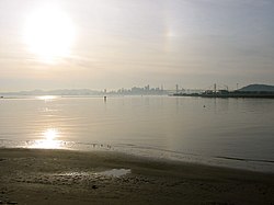
 Middle Harbor Shoreline Park in the Port of Oakland | |
 Interactive map of Middle Harbor Shoreline Park | |
| Location | Oakland Bay/Alameda County, California |
| Nearest city | Oakland, California |
| Area | 38 acres (15 ha) [1] |
| Created | 2004 |
| Operated by | Port of Oakland [1] |
| Open | Monday - Friday |
Middle Harbor Shoreline Park (MHSP) is located on San Francisco Bay and the Oakland Seaport entrance channel, west of downtown Oakland, California. [2] It is owned and operated by the Port of Oakland. The park entrance is at the intersection of 7th Street and Middle Harbor Road. It is open seven days a week from 8 a.m. to dusk. [1]