Related Research Articles

Williams County is located on the western border of the U.S. state of North Dakota, next to Montana. As of the 2020 census, the population was 40,950. making it the fifth-most populous county in North Dakota. Its county seat is Williston.

Ward County is a county in the U.S. state of North Dakota. As of the 2020 census, the population was 69,919, making it the fourth-most populous county in North Dakota. Its county seat is Minot. Ward County is part of the Minot, ND Micropolitan Statistical Area.

Mountrail County is a county in the northwestern part of North Dakota, United States. As of the 2020 census, the population was 9,809. Its county seat is Stanley. The county was originally created in 1873, then removed in 1892, annexed by Ward County. It was re-created and organized in 1909.

McLean County is a county in the U.S. state of North Dakota. As of the 2020 census, the population was 9,771. Its county seat is Washburn.

Dunn County is a county in the U.S. state of North Dakota. As of the 2020 census, the population was 4,095. Its county seat is Manning.

Burke County is a county on the north edge of the U.S. state of North Dakota, adjacent to the south line of Canada. As of the 2020 census, the population was 2,201. The county seat is Bowbells. The county is named after John Burke, the tenth Governor of North Dakota.
The White Earth River is a tributary of the Missouri River, approximately 50 mi (80 km) long, in northwestern North Dakota in the United States. It rises in the plains of southeastern Divide County, approximately 10 mi (16 km) east of Wildrose. It flows east and south, through Mountrail County and joins the Missouri in Lake Sakakawea.
The Denbigh Experimental Forest 636 acres (2.6 km²) is an arboretum and experimental forest operated by the Forest Service of the U.S. Department of Agriculture. It is located 15 miles (24 km) west of Towner, North Dakota.
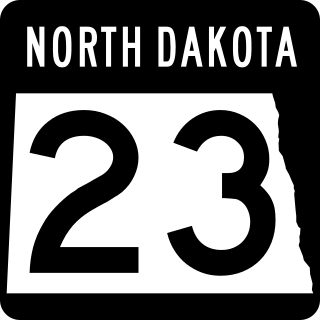
North Dakota Highway 23 is a 122.581-mile-long (197.275 km) east–west highway in northwestern North Dakota. ND 23's eastern terminus is at ND 41 near Velva, and its western terminus at U.S. Route 85 in Watford City.

The Fort Berthold Indian Reservation is a U.S. Indian reservation in western North Dakota that is home for the federally recognized Mandan, Hidatsa, and Arikara Nation, also known as the Three Affiliated Tribes. The reservation includes lands on both sides of the Missouri River. The tribal headquarters is in New Town, the 18th largest city in North Dakota.
Sikes Township is a civil township in Mountrail County, North Dakota, United States.
Verendrye National Monument was a federally protected area in the U.S. state of North Dakota from 1917 to 1956. In the latter year it was withdrawn as a national monument. It is located in southwestern Mountrail County, west of the city of New Town. It lies within the Fort Berthold Indian Reservation.
North Dakota's 3rd congressional district is an obsolete congressional district in the state of North Dakota that was created by reapportionments in 1913, and eliminated by the reapportionments of the 1930 census in 1933. The district consisted of the western part of the state, and was made up of following counties: Divide, Burke, Renville, Ward, Mountrail, Williams, McKenzie, McLean, Dunn, Mercer, Oliver, Billings, Stark, Morton, Hettinger, Bowman and Adams.

Tagus is a ghost town in Mountrail County, North Dakota, United States. The town was founded in 1900, approximately forty miles west of Minot and along the Great Northern Railway's transcontinental route. It incorporated in 1908 and reached a peak population of 140 in 1940. It was originally named Wallace, but was later renamed Tagus to avoid confusion with the town of Wallace, Idaho.
Belden is a ghost town located in Sikes Township in Mountrail County, North Dakota, United States. It is located along North Dakota Highway 8 between Stanley and the former town of Van Hook. The village was founded in 1904, and was reportedly named for W. L. Belden, North Dakota's Indian agent at-large who was stationed at Fort Berthold Indian Reservation at the time.
The Parshall Oil Field is an oil field producing from the Bakken Formation and Three Forks Formation near the town of Parshall, in Mountrail County, North Dakota. The field is in the Williston Basin. The field was discovered in 2006 by Michael Johnson and sold the play to EOG Resources, which drilled, and now operates, most of the wells. It was the discovery of the Parshall Field that was largely responsible for the North Dakota oil boom. Parshall's break-even price is at US$38/barrel, which is the lowest on the Bakken Formation; overall, Bakken's break-even point is of US$62/barrel.
Snake Creek is a stream in the U.S. state of South Dakota. It is a tributary of South Fork Grand River.
Cedar Butte Township is a township in Pennington County, in the U.S. state of South Dakota. Its population was 42 as of the 2010 census.
Battleview is a township and settlement in Burke County, North Dakota, United States. The population was 79 as of the 2010 census, and 86 as of the 2000 census. The total area of the township is 35.79 square miles, of which 35.48 square miles, or 99.4%, is land and 0.31 square miles, or 0.6%, is water.

Van Hook State Wildlife Management Area is a Wildlife Management Area on the Van Hook Arm of Lake Sakakawea in Mountrail County, North Dakota. The Van Hook Arm of Lake Sakakawea is managed by a different county than the Garrison Dam which formed it. The closest town to the WMA is New Town, North Dakota and the Soo Line Railroad runs through it on its way to Parshall, North Dakota.
References
- ↑ U.S. Geological Survey Geographic Names Information System: Manitou, North Dakota
- ↑ Federal Writers' Project (1938). North Dakota, a Guide to the Northern Prairie State. WPA. p. 257. ISBN 978-1-62376-033-5.
- ↑ "Mountrail County". Jim Forte Postal History. Retrieved October 22, 2015.
Municipalities and communities of Mountrail County, North Dakota, United States | ||
|---|---|---|
| Cities |  | |
| Townships |
| |
| Unorganized territories | ||
| Unincorporated communities | ||
| Ghost town | ||
| Indian reservation | ||
| Footnotes | ‡This populated place also has portions in an adjacent county or counties | |
48°19′52″N102°38′12″W / 48.33111°N 102.63667°W
| | This North Dakota location article is a stub. You can help Wikipedia by expanding it. |