White Earth, North Dakota

Last updated

White Earth, North Dakota
White Earth, North Dakota 10-18-2008.jpg
Street in White Earth
ND Mountrail County White Earth.svg
Location of White Earth, North Dakota
Coordinates: 48°22′48″N102°46′18″W / 48.38000°N 102.77167°W / 48.38000; -102.77167
CountryUnited States
State North Dakota
County Mountrail
Founded1887
Area
[1]
  Total1.50 sq mi (3.88 km2)
  Land1.50 sq mi (3.88 km2)
  Water0.00 sq mi (0.00 km2)
Elevation
[2]
2,093 ft (638 m)
Population
 (2020) [3]
  Total100
  Estimate 
(2022) [4]
93
  Density66.76/sq mi (25.78/km2)
Time zone UTC-6 (Central (CST))
  Summer (DST) UTC-5 (CDT)
ZIP code
58794
Area code 701
FIPS code 38-85540
GNIS feature ID1036333 [2]

White Earth is a small incorporated rural village in Montrail County, North Dakota, United States. It is one of the oldest communities in Mountrail County, having been founded in 1887. The population was 100 at the 2020 census. [3] There is a City Hall at White Earth (which is considered a "city" under North Dakota law), community center, two churches and a granary; and no other businesses or services.

Contents

The community's recent growth due to the North Dakota oil boom is the subject of an Academy Award–nominated short documentary film, White Earth . [5]

Geography

According to the United States Census Bureau, the city has a total area of 1.50 square miles (3.88 km2), all land. [6]

Demographics

Historical population
CensusPop.Note
1910 264
1920 247−6.4%
1930 240−2.8%
1940 27213.3%
1950 218−19.9%
1960 208−4.6%
1970 128−38.5%
1980 98−23.4%
1990 73−25.5%
2000 63−13.7%
2010 8027.0%
2020 10025.0%
2022 (est.)93 [4] −7.0%
U.S. Decennial Census [7]
2020 Census [3]

2020 census

As of the census of 2020, there were 100 people and 23 households in the city.

2010 census

As of the census of 2010, there were 80 people, 26 households, and 20 families residing in the city. The population density was 53.3 inhabitants per square mile (20.6/km2). There were 37 housing units at an average density of 24.7 per square mile (9.5/km2). The racial makeup of the city was 97.5% White and 2.5% African American. Hispanic or Latino of any race were 5.0% of the population.

There were 26 households, of which 42.3% had children under the age of 18 living with them, 61.5% were married couples living together, 3.8% had a female householder with no husband present, 11.5% had a male householder with no wife present, and 23.1% were non-families. Of all households 23.1% were made up of individuals. The average household size was 3.08 and the average family size was 3.70.

The median age in the city was 31.7 years. 40% of residents were under the age of 18; 2.6% were between the ages of 18 and 24; 27.6% were from 25 to 44; 26.3% were from 45 to 64; and 3.8% were 65 years of age or older. The gender makeup of the city was 57.5% male and 42.5% female.

2000 census

As of the census of 2000, there were 63 people, 24 households, and 16 families residing in the city. The population density was 42.1 inhabitants per square mile (16.3/km2). There were 27 housing units at an average density of 18.0 per square mile (6.9/km2). The racial makeup of the city was 93.65% White, and 6.35% from two or more races.

There were 24 households, out of which 45.8% had children under the age of 18 living with them, 58.3% were married couples living together, 4.2% had a female householder with no husband present, and 33.3% were non-families. Of all households 29.2% were made up of individuals, and 20.8% had someone living alone who was 65 years of age or older. The average household size was 2.63 and the average family size was 3.31.

In the city, the population was spread out, with 33.3% under the age of 18, 6.3% from 18 to 24, 25.4% from 25 to 44, 25.4% from 45 to 64, and 9.5% who were 65 years of age or older. The median age was 31 years. For every 100 females, there were 90.9 males. For every 100 females age 18 and over, there were 90.9 males.

The median income for a household in the city was $26,250, and the median income for a family was $30,000. Males had a median income of $28,750 versus $18,750 for females. The per capita income for the city was $11,671. There were 10.0% of families and 22.2% of the population living below the poverty line, including 60.0% of under eighteens and none of those over 64.

Transportation

Amtrak's Empire Builder, which operates between Seattle/Portland and Chicago, passes through the town on BNSF tracks, but makes no stop. The nearest station is located in Stanley, 22 miles (35 km) to the east.

Education

White Earth is serviced by the Tioga School District. [8]

Climate

This climatic region is typified by large seasonal temperature differences, with warm to hot (and often humid) summers and cold (sometimes severely cold) winters. According to the Köppen Climate Classification system, White Earth has a humid continental climate, abbreviated "Dfb" on climate maps. [9]

Related Research Articles

<span class="mw-page-title-main">Kathryn, North Dakota</span> City in North Dakota, United States

Kathryn is a city in Barnes County, North Dakota, United States. The population was 66 at the 2020 census. Kathryn was founded in 1900. It was named after the daughter of a railroad man.

<span class="mw-page-title-main">North River, North Dakota</span> City in North Dakota, United States

North River is a city in Cass County, North Dakota, United States. The population was 55 at the 2020 census. North River was founded in 1973. It is a suburb/bedroom community directly adjacent to the city of Fargo.

<span class="mw-page-title-main">Inkster, North Dakota</span> City in North Dakota, United States

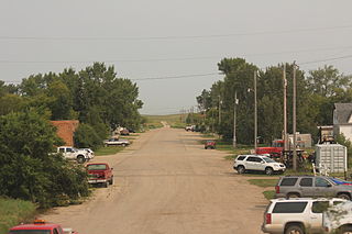
Inkster is a small village in Grand Forks County, North Dakota, United States, with a population of 38 as of the 2020 census. Inkster was founded in 1884, in an area that had been settled by George T. Inkster in 1878.

<span class="mw-page-title-main">Elgin, North Dakota</span> City in North Dakota, United States

Elgin is a city in Grant County, North Dakota, United States. The population was 543 at the 2020 census.

<span class="mw-page-title-main">Gackle, North Dakota</span> City in North Dakota, United States

Gackle is a town in Logan County, North Dakota, United States. The population was 281 at the 2020 census.

<span class="mw-page-title-main">New Town, North Dakota</span> City in North Dakota, United States

New Town is a city in Mountrail County, North Dakota. The population was 2,764 at the time of the 2020 census, making it the 18th largest city in North Dakota. New Town was platted in 1950 as a replacement site for the residents of Sanish and Van Hook, as these towns were scheduled to be flooded by the creation of Lake Sakakawea, a reservoir to provide water for irrigation.

<span class="mw-page-title-main">Palermo, North Dakota</span> City in Mountrail County, North Dakota, United States

Palermo is a city in Mountrail County, North Dakota, United States. The population was 125 at the 2020 census.

<span class="mw-page-title-main">Parshall, North Dakota</span> City in North Dakota, United States

Parshall is a city lying within the jurisdictional boundaries of the Mandan, Hidatsa, and Arikara Nation. It is located on the Fort Berthold Indian Reservation in Mountrail County, North Dakota, United States. The population was 949 at the 2020 census. Parshall was founded in 1914 by George Parshall, and is the home of the Paul Broste Rock Museum.

<span class="mw-page-title-main">Plaza, North Dakota</span> City in North Dakota, United States

Plaza is a city in Mountrail County, North Dakota, United States. The population was 211 at the 2020 census. Plaza was founded in 1906. The business district is built around a central town square, city park or "plaza". A key feature of the plaza is a recently completed large covered gazebo.

<span class="mw-page-title-main">Ross, North Dakota</span> City in North Dakota, United States

Ross is a city in Mountrail County, North Dakota, United States. The population was 95 at the 2020 census.

<span class="mw-page-title-main">Stanley, North Dakota</span> City in North Dakota, United States

Stanley is a city in Mountrail County, North Dakota, United States. It is the county seat of Mountrail County. The population was 2,321 at the 2020 census, making it the 22nd largest city in North Dakota. Stanley was founded in 1902. The town's economy is heavily connected to the nearby oil-rich Bakken Formation.

<span class="mw-page-title-main">Hankinson, North Dakota</span> City in North Dakota, United States

Hankinson is a city in Richland County, North Dakota, United States. The population was 921 at the 2020 census. Hankinson was founded in 1886. It is part of the Wahpeton, ND–MN Micropolitan Statistical Area.

<span class="mw-page-title-main">Alamo, North Dakota</span> City in North Dakota, United States

Alamo is a city in Williams County, North Dakota, United States. The population was 53 at the 2020 census. Alamo was founded in 1916.

<span class="mw-page-title-main">White, South Dakota</span> City in South Dakota, United States

White is a city in Brookings County, South Dakota, United States. The population was 537 at the 2020 census.

<span class="mw-page-title-main">Chamberlain, South Dakota</span> City in South Dakota, United States

Chamberlain is a city in Brule County, South Dakota, United States. It is located on the east bank of the Missouri River, at the dammed section of the Lake Francis Case, close to where it is crossed by Interstate 90.

<span class="mw-page-title-main">Wagner, South Dakota</span> City in South Dakota, United States

Wagner is a city in Charles Mix County, South Dakota, United States. The population was 1,490 at the 2020 census. The city is served by Wagner Municipal Airport as well as YST Transit buses.

<span class="mw-page-title-main">Parkston, South Dakota</span> City in South Dakota, United States

Parkston is a city in Hutchinson County, South Dakota, United States. The population was 1,567 at the 2020 census.

<span class="mw-page-title-main">Crooks, South Dakota</span> City in South Dakota, United States

Crooks is a city in Minnehaha County, South Dakota, United States and is a suburb of Sioux Falls. The population was 1,362 at the 2020 census. Crooks was named New Hope until 1904. The town's present name honors W. A. Crooks, a local politician.

<span class="mw-page-title-main">Hartford, South Dakota</span> City in South Dakota, United States

Hartford is a suburban American city in Minnehaha County, South Dakota, a few miles northwest of Sioux Falls. Its population was 3,354 at the 2020 census.

<span class="mw-page-title-main">North Mankato, Minnesota</span> City in Minnesota, United States

North Mankato is a city in Nicollet and Blue Earth counties in the State of Minnesota. The population was 14,275 at the 2020 census.

References

  1. "ArcGIS REST Services Directory". United States Census Bureau. Retrieved September 20, 2022.
  2. 1 2 U.S. Geological Survey Geographic Names Information System: White Earth, North Dakota
  3. 1 2 3 "Explore Census Data". United States Census Bureau . Retrieved December 22, 2023.
  4. 1 2 "City and Town Population Totals: 2020-2022". United States Census Bureau. December 22, 2023. Retrieved December 22, 2023.
  5. Skirble, Rosanne (February 19, 2015). "Oscar-Nominee 'White Earth' Depicts N. Dakota Oil Boom Through Children's Eyes". Voice of America. Retrieved February 24, 2015.
  6. "US Gazetteer files 2010". United States Census Bureau. Archived from the original on February 20, 2011. Retrieved June 14, 2012.
  7. United States Census Bureau. "Census of Population and Housing" . Retrieved July 29, 2013.
  8. "2020 CENSUS - SCHOOL DISTRICT REFERENCE MAP: Mountrail County, ND" (PDF). United States Census Bureau . Retrieved August 22, 2021.
  9. Climate Summary for White Earth, North Dakota