Metroway

Last updated

Metroway
Metroway logo.svg
WMATA Metroway New Flyer XN40.jpg
A Metroway New Flyer XN40 bus at 27th & Crystal station.
Overview
System Metrobus
Operator Washington Metropolitan Area Transit Authority
GarageFour Mile Run
Vehicle New Flyer Xcelsior XN40
LiveryMetroway
StatusIn service
Began serviceAugust 24, 2014 (2014-08-24)
Predecessors Metrobus 9S [1]
Routes
Routes1
LocaleCity of Alexandria and Arlington County, Virginia, U.S.
Start Pentagon City
End Braddock Road
Length6.8 mi (11 km)
Stations17
Service
LevelDaily
Frequency12-20 minutes
Weekend frequency20 minutes
Journey time24 minutes
Operates5:30 am – 10 pm (weekdays)
6:30 am - 10:30 pm (Saturdays)
7:30 am - 10:00 pm (Sundays)
Daily ridership2,431 (March 2019) [1]
Increase2.svg 12.34%
Ridership51,043 (March 2019) [1]
Increase2.svg 7.2%
Timetable Metroway timetable
Map Metroway map
Route map
Metroway Metroway highlighted in blue
BSicon utCONTg.svg
WMATA Blue.svg WMATA Yellow.svg toward Pentagon
BSicon utBHF.svg
BSicon BLaq.svg
BSicon KBHFa.svg
BSicon BLeq.svg
Pentagon City
BSicon utSTR.svg
BSicon LSTR.svg
Transitway extension
BSicon utSTR.svg
BSicon eHST grey.svg
12th & Elm Street
BSicon utSTR.svg
BSicon eHST grey.svg
12th & Clark Street
BSicon utBHF.svg
BSicon BLaq.svg
BSicon BHF grey.svg
BSicon BLeq.svg
Crystal City
BSicon utSTRl.svg
BSicon STR grey.svg
BSicon mKRZt.svg
BSicon utLSTR2+r.svg
WMATA Blue.svg WMATA Yellow.svg via National Airport
BSicon ABZgl grey.svg
BSicon STR+r grey.svg
BSicon STRf grey.svg
BSicon BHF(L)g grey.svg
18th & Crystal Virginia Railway Express.svg
Crystal
City
BSicon BHF(R)f grey.svg
BSicon BHF(L)g grey.svg
23rd & Clark | 23rd & Crystal
BSicon BHF(R)f grey.svg
BSicon STRg grey.svg
26th & Clark
BSicon STRl grey.svg
BSicon ABZg+r grey.svg
BSicon HST grey.svg
27th & Crystal
BSicon HST grey.svg
33rd & Crystal
BSicon BHF grey.svg
South Glebe
BSicon WASSERq.svg
BSicon WBRUCKE1.svg
BSicon HST.svg
Reed – Potomac Yard
BSicon lHST~L.svg
BSicon STR+l.svg
BSicon lHST~R.svg
BSicon STRr.svg
East Glebe and Potomac
BSicon HST grey.svg
East Glebe
BSicon HST grey.svg
Swann
BSicon HST grey.svg
Custis
BSicon KHSTe grey.svg
BSicon STR.svg
Potomac
BSicon uSTR+l.svg
BSicon STR.svg
BSicon utSTRa@gq.svg
BSicon utLSTRr+1.svg
BSicon uhSTRa.svg
BSicon HST.svg
Fayette
BSicon uhBHF.svg
BSicon BLaq.svg
BSicon KBHFe.svg
BSicon BLeq.svg
Braddock Road
BSicon uhCONTf.svg
WMATA Blue.svg WMATA Yellow.svg toward King Street
Key
Street section
BSicon STRq.svg
BSicon STRq grey.svg
Transitway
 {{{previous_line}}} {{{system_nav}}} {{{next_line}}} 

Metroway is a bus rapid transit (BRT) line operated by the Washington Metropolitan Area Transit Authority (WMATA) as part of their Metrobus system. It consists of a single line operating in Arlington and Alexandria, Virginia. It opened on August 24, 2014. It was the first bus rapid transit line to open in Virginia and in the Washington metropolitan area. [2]

Contents

Route

The service runs from its northern end at the Pentagon City south through Crystal City and Potomac Yard before ending at the Braddock Road Metrorail station. The service runs along a bus-only roadway along Richmond Highway (U.S. Route 1) in Alexandria between Potomac and East Glebe stations, as well as a busway in Arlington. The remainder of the service runs on mixed-traffic roadways. [3]

Stations

There are 17 stations on the route. Twelve of the stations offer two-way service; three of the stations, 18th & Crystal, 23rd & Crystal, and Fayette, are northbound-only; and two other stations, 26th & Clark, 23rd & Clark, are southbound-only. [3]

The Metroway stations vary depending on location and jurisdiction, though all stations consist of side platforms and sidewalk-level bus stops.

Service

Bus 8009, one of the 13 2014 NABI 42 BRT diesel-electric hybrid buses that were originally in the Metroway scheme until December 18, 2016. WMATA Metroway scheme.jpg
Bus 8009, one of the 13 2014 NABI 42 BRT diesel-electric hybrid buses that were originally in the Metroway scheme until December 18, 2016.

Metroway operates seven days a week with longer hours and more frequent service during weekdays. All runs take place on board the New Flyer Xcelsior XN40 CNG buses with Metroway livery, which replaced the original NABI 42 BRT Hybrid buses on December 18, 2016.[ citation needed ]

Connections

As a WMATA Metrobus service, Metroway is integrated within the regional transit network, and is subject to the same fares and transfer rules as any other local Metrobus service. The Braddock Road, Potomac Yard, Crystal City, and Pentagon City stations offer service for the Metrorail Yellow and Blue lines. [3] As it parallels the Yellow and Blue lines between Pentagon City and Braddock Road, it can be used as an alternative to Metrorail during service outages on Metrorail. [4]

The Crystal City VRE station is a short distance (0.1 mile; 160 meters) away from the 18th & Crystal station.

Metroway provides connections to the Mount Vernon Trail at the 18th & Crystal station, and the Four Mile Run Trail at the South Glebe station. Capital Bikeshare stations exist at or near several Metroway stations. [3]

Expansions

Metroway has been expanded since its opening in 2014, both in number of stations and length of route. Two new stations opened in Arlington, both in April 2016. Fayette station in Alexandria opened in 2017. [5]

On April 17, 2016, the 33rd & Crystal and Pentagon City stations opened, bringing the total number of operating stations to 15. At the same time, a dedicated transit lane and a peak period transit lane opened in Arlington. [5] [6] While the Fayette and 33rd & Crystal stations are infill stations along the existing route, the addition of the Pentagon City station extended the route north, which changed the northern terminus from Crystal City to Pentagon City. The 33rd & Crystal stop offers two-way service, while Pentagon City, the new northern terminus, is southbound-only.

The National Capital Region Transportation Planning Board wants to extend the dedicated transitway in Crystal City North to the Pentagon City Metro station. [7]

Beginning May 25, 2019, as a result of the Blue and Yellow Lines being shut down south of National Airport for the summer, new stops were added on Potomac Avenue at East Glebe Road near the Kaiser Permanente and the National Institute for the Blind (NIB) Headquarters. [8]

As part of the Amazon HQ2 project, plans were made in 2019 to extend the dedicated transitway to the section between Crystal City and Pentagon City, and add new stops at 12th & Clark Street, 12th & Elm Street, 12th & Hayes Street, and Army-Navy Drive. [9] Construction began in April 2022, with completion expected in April 2023. [10]

See also

Related Research Articles

<span class="mw-page-title-main">Yellow Line (Washington Metro)</span> Washington Metro rapid transit line

The Yellow Line is a rapid transit line of the Washington Metro system that runs between Huntington in Virginia and Mount Vernon Square in Washington, D.C. It consists of 13 stations in Fairfax County, the city of Alexandria, and Arlington County in Virginia, and Washington, D.C. It is the shortest line in the system, and since its truncation to Mount Vernon Square, it is the only line that does not enter Maryland.

<span class="mw-page-title-main">Crystal City station (Washington Metro)</span> Washington Metro station

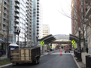
Crystal City station is an underground Washington Metro station in the Crystal City neighborhood of Arlington County, Virginia. The station opened on July 1, 1977, and serves the Blue Line and Yellow Line services, with a Metroway bus rapid transit stop on the surface.

<span class="mw-page-title-main">Braddock Road station</span> Washington Metro station

Braddock Road station is an island-platformed Washington Metro station in Alexandria, Virginia, United States. The station was opened on December 17, 1983, and is operated by the Washington Metropolitan Area Transit Authority (WMATA). Providing service for both the Blue and Yellow Lines, the station is located at Braddock Road and West Street.

<span class="mw-page-title-main">Potomac Yard</span> Neighborhood in Northern Virginia

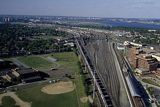
Potomac Yard is a neighborhood in Northern Virginia that straddles southeastern Arlington County and northeastern Alexandria, Virginia, located principally in the area between U.S. Route 1 and the Washington Metro Blue Line /Yellow Line tracks, or the George Washington Memorial Parkway, depending on the definition usedF. The area was home to what was once one of the busiest rail yards on the Eastern Seaboard of the United States. The "Potomac Yard" name is also used to refer to several developments in the area, especially the Potomac Yard Center power center and a Washington Metro station.

<span class="mw-page-title-main">Metrobus (Washington, D.C.)</span> Bus transit service in the US federal district

Metrobus is a bus service operated by the Washington Metropolitan Area Transit Authority (WMATA). Its fleet consists of 1,595 buses covering an area of 1,500 square miles (3,900 km2) in Washington, D.C., Maryland, and Virginia. There are 269 bus routes serving 11,129 stops, including 2,554 bus shelters. In 2023, the system had a ridership of 103,438,600, or about 366,500 per weekday as of the fourth quarter of 2023.

<span class="mw-page-title-main">Arlington Transit</span>

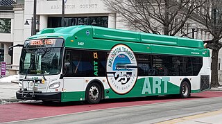
Arlington Transit (ART) is a bus transit system that operates in Arlington County, Virginia, and is managed by the county government. The bus system provides service within Arlington County, and connects to Metrobus, nearby Metrorail stations, Virginia Railway Express, and other local bus systems. Most ART routes serve to connect county neighborhoods to local Metrorail stations, as well as the Shirlington Bus Station. It includes part of the Pike Ride service along Columbia Pike, which is shared with WMATA. In 2023, the system had a ridership of 2,258,200, or about 8,100 per weekday as of the fourth quarter of 2023.

<span class="mw-page-title-main">South Glebe station</span>

South Glebe is a bus rapid transit station in Arlington County, Virginia, located near the intersection of South Glebe Road and South Clark Place. It is a stop along the dedicated bus-only highway portion of the Metroway bus rapid transit line, providing two-way service along the route to southern Crystal City.

<span class="mw-page-title-main">33rd & Crystal station</span>

33rd Street is a bus rapid transit station in Arlington, Virginia. It is located near the intersection of 33rd Street South and Potomac Avenue, along the dedicated bus-only highway portion of the Metroway bus rapid transit line, providing two-way service along the route.

<span class="mw-page-title-main">27th & Crystal station</span>

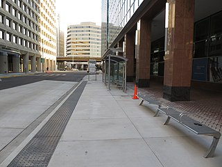
27th & Crystal is a bus rapid transit station in Arlington County, Virginia, located near the intersection of 27th Street South and Crystal Drive. The stop is along the Metroway bus rapid transit line, in a portion of the dedicated bus-only highway. It provides two-way service to southern Crystal City.

<span class="mw-page-title-main">26th & Clark station</span>

26th & Clark is a bus rapid transit station in Arlington County, Virginia, located near the intersection of 23rd Street South and South Clark Street. The stop is on a mixed-traffic segment of the Metroway that is restricted to buses during certain hours. It provides southbound service to central Crystal City.

<span class="mw-page-title-main">23rd & Crystal station</span>

23rd & Crystal is a northbound-only bus rapid transit station in Arlington County, Virginia, located near the intersection of 23rd Street South and Crystal Drive. The stop is on a mixed-traffic segment of the Metroway that is restricted to buses during certain hours. It provides northbound service to central Crystal City.

<span class="mw-page-title-main">18th & Crystal station</span>

18th & Crystal is a northbound-only bus rapid transit station in Arlington County, Virginia, located near the intersection of 18th Street South and Crystal Drive. The stop is on a mixed-traffic segment of the Metroway that is restricted to buses during certain hours. It provides service along the route to northern Crystal City.

<span class="mw-page-title-main">23rd & Clark station</span>

23rd & Clark is a bus rapid transit station in Arlington County, Virginia, located near the intersection of 23rd Street South and South Clark Street. The stop is on a mixed-traffic segment of the Metroway that is restricted to buses during certain hours. It provides southbound service to central Crystal City.

<span class="mw-page-title-main">National Landing</span> Area in Northern Virginia

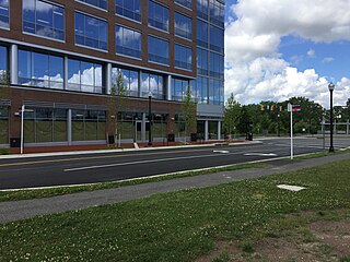
National Landing is an area in Northern Virginia encompassing parts of the Crystal City and Pentagon City neighborhoods of Arlington County and the Potomac Yard neighborhood in the city of Alexandria. It is the location of the Amazon HQ2 headquarters.

<span class="mw-page-title-main">East Glebe & Potomac station</span>

East Glebe & Potomac, is a temporary bus rapid transit station in Alexandria, Virginia, located on Potomac Avenue and East Glebe Road. It was a stop on the portion of the mixed-traffic segment of the Metroway bus rapid transit line, providing two-way service along the route. The station provided service to the central Potomac Yard and Potomac communities in Alexandria.

<span class="mw-page-title-main">Barcroft–South Fairlington Line</span>

The Barcroft–South Fairlington Line, designated as Route 22A, Route 22C, or Route 22F, is a daily bus route operated by the Washington Metropolitan Area Transit Authority between Ballston–MU station of the Orange and Silver lines of the Washington Metro or Skyline City (22F) and Pentagon station of the Yellow and Blue lines of the Washington Metro. The 22 Line trips are roughly 20 minutes during peak hours, 30 minutes during off peak, and 60 minutes on weekends. This line provides service to Ballston or Skyline City and the Pentagon Transit Center from the neighborhoods of Arlington County, Fairfax County and Alexandria.

<span class="mw-page-title-main">Columbia Pike–Pentagon City Line</span> Bus routes in the Washington Metropolitan Area

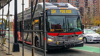
The Columbia Pike–Pentagon City Line, designated as Routes 16G & 16H, were daily bus routes that was operated by the Washington Metropolitan Area Transit Authority between the neighborhoods of Arlington Mill (16G) or Skyline City (16H) and Pentagon City station of the Yellow and Blue lines of the Washington Metro. This line is part of the Pike Ride service, which runs through Columbia Pike. This line provides service through the neighborhoods of Fairfax County and Arlington County to Pentagon City. Unlike the Columbia Pike Line, the Columbia Pike–Pentagon City Line does not serve Columbia Pike past the Arlington County line.

The Alexandria–Pentagon Line, designated as Routes 10A, 10E & 10N, is a daily bus route operated by the Washington Metropolitan Area Transit Authority between Huntington station of the Yellow Line of the Washington Metro (10A), Hunting Point (10E), or Ronald Reagan Washington National Airport station of the Yellow and Blue lines of the Washington Metro and Pentagon station of the Yellow and Blue lines of the Washington Metro. This line provides service within the neighborhoods in Fairfax County, Alexandria, and Arlington County. Alongside the neighborhoods, it also brings service through the marketplace, businesses, and offices within the counties.

The Hunting Point–Ballston Line, designated as Route 10B, is a daily bus route operated by the Washington Metropolitan Area Transit Authority between Hunting Point and Ballston–MU station of the Orange and Silver lines of the Washington Metro. This line provides service within the neighborhoods in Fairfax County, Alexandria, and Arlington County. Alongside the neighborhoods, it also brings service through the marketplace, businesses, and offices within the counties.

<span class="mw-page-title-main">Columbia Pike–National Landing Line</span> Bus route

The Columbia Pike–National Landing Line, designated as Route 16M, is a daily bus route operated by the Washington Metropolitan Area Transit Authority between Skyline City and Crystal City station of the Yellow and Blue lines of the Washington Metro. This line is part of the Pike Ride service, which runs through Columbia Pike. This line provides service through the neighborhoods of Fairfax County and Arlington County to Crystal City. Unlike the Columbia Pike Line, the Columbia Pike–National Landing Line does not serve Columbia Pike past the Arlington County line.

References

  1. 1 2 3 "Crystal City-Potomac Yard Transitway Project". City of Alexandria. Archived from the original on May 12, 2019. Retrieved December 28, 2019.
  2. Lazo, Luz (August 23, 2014). "Metroway, the region's first bus rapid transit, to debut in Northern Virginia". The Washington Post . Archived from the original on December 18, 2014. Retrieved December 18, 2014.
  3. 1 2 3 4 "Route | Metroway". Metroway. MetrowayVA.com. Archived from the original on December 18, 2014. Retrieved December 18, 2014.
  4. Siddiqui, Faiz (March 4, 2017). "For Metro riders in Virginia, one last dance with SafeTrack — if all goes to plan". Washington Post. Archived from the original on March 21, 2017. Retrieved March 21, 2017.
  5. 1 2 Smith, Max (April 17, 2016). "New bus-only lanes open along Jefferson Davis Highway". WTOP.com. WTOP. Archived from the original on July 16, 2016. Retrieved April 18, 2016.
  6. "Crystal City Potomac Yard Transitway - Projects & Planning". Arlington County Government. Archived from the original on April 14, 2016. Retrieved April 16, 2016.
  7. "Trains, buses, new lanes for cars and bikes—highlights from the 2016 CLRP Amendment". National Capital Region Transportation Planning Board. October 18, 2016. Archived from the original on October 19, 2016. Retrieved October 19, 2016.
  8. "Metrobus Service Changes Beginning Saturday, May 25 and Sunday, June 23, 2019". Washington Metropolitan Area Transit Authority. Archived from the original on May 14, 2019. Retrieved May 14, 2019.
  9. Chaffin, Gordon (December 12, 2018). "Bus Rapid Transit Expanding in NOVA Thanks to Amazon". DC Commute Times. Retrieved June 14, 2019.
  10. Blitz, Matt (April 6, 2022). "Construction starting on the Transitway extension to Pentagon City". ARLNow. Archived from the original on April 6, 2022. Retrieved April 7, 2022.