Montalvin Manor, California

Last updated
Montalvin Manor
Montalvin
USA California location map.svg
Red pog.svg
Montalvin Manor
Location in California
Coordinates: 37°59′44″N122°19′58″W / 37.99556°N 122.33278°W / 37.99556; -122.33278 Coordinates: 37°59′44″N122°19′58″W / 37.99556°N 122.33278°W / 37.99556; -122.33278
Country Flag of the United States.svg  United States
State Flag of California.svg  California
County Contra Costa County
Government
   County Board District 1:
John Gioia
Area
[1]
  Total0.341 sq mi (0.884 km2)
  Land0.341 sq mi (0.884 km2)
  Water0 sq mi (0 km2)  0%
Elevation
[2]
69 ft (21 m)
Population
 (2010)
  Total2,876
  Density8,400/sq mi (3,300/km2)
Time zone UTC-8 (Pacific (PST))
  Summer (DST) UTC-7 (PDT)
GNIS feature IDs1701553; 2583085
U.S. Geological Survey Geographic Names Information System: Montalvin Manor, California; U.S. Geological Survey Geographic Names Information System: Montalvin Manor, California

Montalvin Manor[ pronunciation? ] (formerly, Montalvin) is a census-designated place [3] (CDP) in Contra Costa County, California. [2] It lies at an elevation of 69 feet (21 m). [2] For census purposes, it formed part of Bayview-Montalvin, California until 2010, when it became a separate CDP with a population of 2,876. The other half of the old CDP became Bayview.

Contents

Despite its location outside San Pablo city limits, Montalvin Manor uses San Pablo mailing addresses.

Demographics

At the 2010 census Montalvin Manor had a population of 2,876. The population density was 8,426.4 inhabitants per square mile (3,253.5/km2). The racial makeup of Montalvin Manor was 1,295 (45.0%) White, 222 (7.7%) African American, 36 (1.3%) Native American, 306 (10.6%) Asian, 27 (0.9%) Pacific Islander, 855 (29.7%) from other races, and 135 (4.7%) from two or more races. Hispanic or Latino of any race were 1,800 persons (62.6%). [4]

The census reported that 2,869 people (99.8% of the population) lived in households, 7 (0.2%) lived in non-institutionalized group quarters, and no one was institutionalized.

There were 818 households, 337 (41.2%) had children under the age of 18 living in them, 411 (50.2%) were opposite-sex married couples living together, 122 (14.9%) had a female householder with no husband present, 60 (7.3%) had a male householder with no wife present. There were 50 (6.1%) unmarried opposite-sex partnerships, and 11 (1.3%) same-sex married couples or partnerships. 186 households (22.7%) were one person and 109 (13.3%) had someone living alone who was 65 or older. The average household size was 3.51. There were 593 families (72.5% of households); the average family size was 4.11.

The age distribution was 738 people (25.7%) under the age of 18, 319 people (11.1%) aged 18 to 24, 742 people (25.8%) aged 25 to 44, 712 people (24.8%) aged 45 to 64, and 365 people (12.7%) who were 65 or older. The median age was 35.2 years. For every 100 females, there were 93.1 males. For every 100 females age 18 and over, there were 92.3 males.

There were 895 housing units at an average density of 2,622.3 per square mile (1,012.5/km2),of which 818 were occupied, 621 (75.9%) by the owners and 197 (24.1%) by renters. The homeowner vacancy rate was 5.3%; the rental vacancy rate was 8.4%. 2,000 people (69.5% of the population) lived in owner-occupied housing units and 869 people (30.2%) lived in rental housing units.

Education

It is in the West Contra Costa Unified School District. [5]

Related Research Articles

<span class="mw-page-title-main">Diablo, California</span> Census-designated place in California, United States

Diablo is a census-designated place (CDP) in Contra Costa County, California, United States. The population was 1,158 at the 2010 census. It is located 2.5 miles (4.0 km) east-northeast of Danville.

<span class="mw-page-title-main">Mountain View, Contra Costa County, California</span> Census designated place in California, United States

Mountain View is a census designated place (CDP) in Contra Costa County, California, United States. The population was 2,372 at the 2010 census.

<span class="mw-page-title-main">Pacheco, California</span> Census-designated place in California, United States

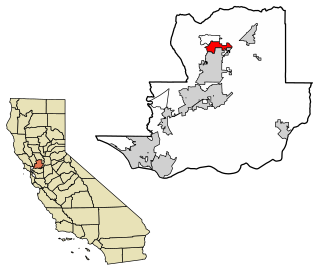
Pacheco is a census-designated place (CDP) in Contra Costa County, California. The population was 3,685 at the 2010 census. It is bounded by Martinez to the north and west, respectively; it is bounded by Concord to the east, and Pleasant Hill to the south.

<span class="mw-page-title-main">Rodeo, California</span> Census-designated place in California, United States

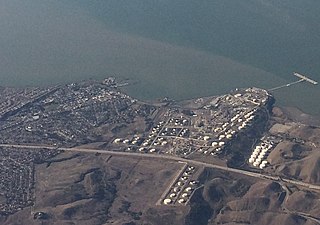
Rodeo is a census-designated place (CDP) located in Contra Costa County, California, in the East Bay sub-region of the San Francisco Bay Area, on the eastern shore of San Pablo Bay, 25 miles northeast of San Francisco. The population was 8,679 at the 2010 census. The town is named for the rodeos common in the late 19th century. Cattle from the surrounding hills were regularly driven down through the old town to a loading dock on the shoreline of San Pablo Bay for shipment to slaughterhouses, a practice which continued through the early 20th century. The town of Rodeo is served by the Interstate 80 freeway and State Route 4. The Southern Pacific Railroad main line passes through Rodeo. Rodeo has not been a stop on the railroad since the 1950s.

<span class="mw-page-title-main">Tara Hills, California</span> Census-designated place in California, United States

Tara Hills is a census-designated place (CDP) in Contra Costa County, California, United States. The population was 5,126 at the 2010 census.

<span class="mw-page-title-main">Vine Hill, California</span> Census-designated place in California, United States

Vine Hill is a census-designated place (CDP) in Contra Costa County, California, United States. The population was 3,761 at the 2010 census. It is located 2.25 miles (3.6 km) east of downtown Martinez.

<span class="mw-page-title-main">Bayview, Humboldt County, California</span> Census-designated place in California, United States

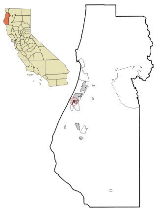
Bayview is a census-designated place (CDP) located adjacent to the City of Eureka in Humboldt County, California, United States. Its population is 2,619 as of the 2020 census, up from 2,510 from the 2010 census. Many locals consider this area as part of "Pine Hill."

<span class="mw-page-title-main">East Hemet, California</span> Census-designated place in California, United States

East Hemet is a census-designated place (CDP) in Riverside County, California, United States, located east of Hemet. East Hemet is in an unincorporated area outside the city limits of Hemet. The population was 17,418 at the 2010 census, up from 14,823 at the 2000 census.

<span class="mw-page-title-main">London, California</span> Census designated place in California, United States

London is a census designated place (CDP) in Tulare County, California, United States. The population was 1,869 at the 2010 census, up from 1,848 at the 2000 census.

<span class="mw-page-title-main">China Lake Acres, California</span> Census-designated place in California, United States

China Lake Acres is a census-designated place (CDP) in Kern County, California, United States. The population was 1,876 at the 2010 census, up from 1,761 at the 2000 census.

Saranap is a residential census-designated place (CDP) within central Contra Costa County, California. Lying at an elevation of 180 feet, it is bounded on the south and east by portions of Walnut Creek and on the north and west by Lafayette. Saranap's ZIP code is 94595, but is addressed "Walnut Creek, CA" for delivery purposes as this is the postal designated city name used by residents. The community is in telephone area code 925. Saranap's population as of the 2010 census was 5,202.

Bayview is a census-designated place in Contra Costa County, California. Bayview sits at an elevation of 36 feet. The 2010 United States census reported Bayview's population was 1,754. Prior to 2010, Bayview was part of the Bayview-Montalvin CDP and then separated into the two individual communities of Bayview and Montalvin Manor for the census.

Camino Tassajara is a census-designated place in Contra Costa County, California. Camino Tassajara sits at an elevation of 814 feet (248 m). The 2010 United States census reported Camino Tassajara's population was 2,197.

Castle Hill is a census-designated place in Contra Costa County, California. Castle Hill sits at an elevation of 302 feet (92 m). The 2010 United States census reported Castle Hill's population was 1,299.

<span class="mw-page-title-main">Contra Costa Centre, California</span> Census-designated place in California, United States

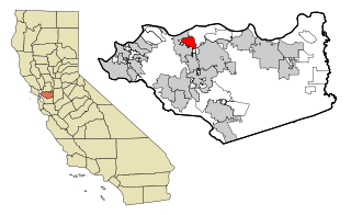
Contra Costa Centre is an unincorporated census-designated place in Contra Costa County, California. Contra Costa Centre sits at an elevation of 92 feet. The 2010 United States census reported Contra Costa Centre's population was 5,364. Contra Costa Centre is served by the Pleasant Hill / Contra Costa Centre BART station.

North Gate is a census-designated place in Contra Costa County, California. North Gate sits at an elevation of 253 feet (77 m). The 2010 United States census reported North Gate's population was 679.

San Miguel is a census-designated place in Contra Costa County, California. San Miguel sits at an elevation of 249 feet (76 m). The 2010 United States census reported San Miguel's population was 3,392.

<span class="mw-page-title-main">Desert Edge, California</span> Census-designated place in California, United States

Desert Edge is a census-designated place in Riverside County, California, United States. Desert Edge sits at an elevation of 994 feet (303 m). The 2010 United States census reported Desert Edge's population was 3,822.

<span class="mw-page-title-main">Good Hope, California</span> Census-designated place in California, United States

Good Hope is a census-designated place in Riverside County, California. Good Hope sits at an elevation of 1,624 feet (495 m). The 2010 United States census reported Good Hope's population was 9,192.

<span class="mw-page-title-main">Hartley, California</span> Census-designated place in California, United States

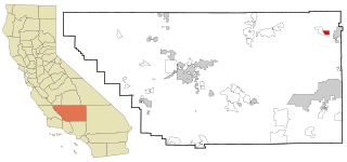
Hartley is a census-designated place (CDP) in Solano County, California. Hartley sits at an elevation of 131 feet (40 m). The 2010 United States census reported Hartley's population was 2,510.

References

  1. "2010 Census U.S. Gazetteer Files – Places – California". United States Census Bureau.
  2. 1 2 3 U.S. Geological Survey Geographic Names Information System: Montalvin Manor, California
  3. U.S. Geological Survey Geographic Names Information System: Montalvin Manor, California
  4. "2010 Census Interactive Population Search: CA - Montalvin Manor CDP". U.S. Census Bureau. Archived from the original on July 15, 2014. Retrieved July 12, 2014.
  5. "2020 CENSUS - SCHOOL DISTRICT REFERENCE MAP: Contra Costa County, CA" (PDF). U.S. Census Bureau . Retrieved 2022-12-25.