Mount Archer, Queensland (Somerset Region)

Last updated

Mount Archer
Queensland
Doyles Road Mount Archer Queensland.jpg
Doyles Road, 2015
Australia Queensland location map.svg
Red pog.svg
Mount Archer
Coordinates 26°59′S152°39′E / 26.983°S 152.650°E / -26.983; 152.650 Coordinates: 26°59′S152°39′E / 26.983°S 152.650°E / -26.983; 152.650
Population449 (2011) [1]
Postcode(s) 4514
LGA(s) Somerset Region
State electorate(s) Nanango
Federal Division(s) Blair
Suburbs around Mount Archer:
Villeneuve Neurum Neurum
Glenfern
Westvale
Mount Archer Mount Delaney
Westvale Mount Byron Mount Mee

Mount Archer is a mountain and locality in the Somerset Region of Queensland, Australia. [2] [3] The population of Mount Archer is very low, so it is included in the population statistics for the adjoining locality of Villeneuve, which recorded a population of 449 at the 2011 Australian Census. [1]

Contents

Geography

Mount Archer and Somerset Dam as seen from Villeneuve, 2015 Mount Archer and Somset Dam 2 Queensland.jpg
Mount Archer and Somerset Dam as seen from Villeneuve, 2015

Part of the northern boundary to the east is aligned with Neurum Creek, while in the west it roughly follows the Stanley River. [4]

In the northwest of Mount Archer is a section of Somerset Dam. The north-eastern part has some rural residential and farming properties. The south of the locality is mountainous and heavily vegetated with parts protected within D'Aguilar National Park. [4] This includes the peak of Mount Archer which marks the northern extent of the D'Aguilar Range.

Sketch of Durundur Station by Charles Archer, 1843 Sketch of Durundur Station by Charles Archer, 31 July 1843.jpg
Sketch of Durundur Station by Charles Archer, 1843

History

Mount Archer takes its name from the mountain Mount Archer which in turn is named after three of the pioneer Archer brothers (John, David, and Thomas) who established the Durundur Station in the area. [3]

At the 2011 census Villeneuve had a population of 449 people. [1]

Related Research Articles

Mount Nebo (Queensland) Suburb of Moreton Bay Region, Queensland, Australia

Mount Nebo is a rural locality in the Moreton Bay Region, Queensland, Australia. In the 2016 census, Mount Nebo had a population of 424 people.

Mount Pleasant, Queensland (Moreton Bay Region) Suburb of Moreton Bay Region, Queensland, Australia

Mount Pleasant is a rural locality in the Moreton Bay Region, Queensland, Australia. In the 2016 census, Mount Pleasant had a population of 332 people. Mount Pleasant is also a mountain in the north-east of the locality which is part of the D'Aguilar Range.

Mount Glorious Suburb of Moreton Bay Region, Queensland, Australia

Mount Glorious is a rural locality in the Moreton Bay Region, Queensland, Australia. In the 2016 census, Mount Glorious had a population of 296 people.

Lake Manchester is both a lake in the City of Brisbane and the surrounding locality which is split between the City of Brisbane and Somerset Region in Queensland, Australia. It is 30 kilometres (19 mi) west of the CBD. At the 2016 Australian Census, the locality had a population of 23.

DAguilar, Queensland Suburb of Moreton Bay Region, Queensland, Australia

D'Aguilar is a rural township and locality in the Moreton Bay Region, Queensland, Australia. It is located northwest of the larger centre of Caboolture. In the 2011 census, the locality recorded a population of 830 persons, living in 255 inhabited dwellings, all of which were detached houses.

Bryden, Queensland Suburb of Somerset Region, Queensland, Australia

Bryden is a small rural locality in the Somerset Region, Queensland, Australia.

Villeneuve, Queensland Suburb of Somerset Region, Queensland, Australia

Villeneuve is a rural town and locality in the Somerset Region, Queensland, Australia. In the 2016 census, Villeneuve had a population of 179 people.

Colinton, Queensland Suburb of Somerset Region, Queensland, Australia

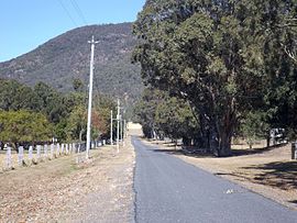
Colinton is a locality of the Somerset Region, Queensland, Australia.

Dundas, Queensland Suburb of Somerset Region, Queensland, Australia

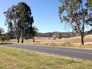
Dundas is a rural locality in the Somerset Region, Queensland, Australia. In the 2011 census, Dundas was counted within the larger area of Crossdale which had a population of 190 people.

Crossdale, Queensland Suburb of Somerset Region, Queensland, Australia

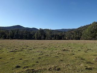
Crossdale is a rural locality in the Somerset Region, Queensland, Australia.

Mount Byron, Queensland Suburb of Somerset Region, Queensland, Australia

Mount Byron is a rural locality and a mountain in the Somerset Region, Queensland, Australia.

Mount Delaney Suburb of Moreton Bay Region, Queensland, Australia

Mount Delaney is a locality of the Moreton Bay Region in Queensland, Australia.

Glenfern, Queensland Suburb of Somerset Region, Queensland, Australia

Glenfern is a locality in the Somerset Region of Queensland, Australia. The population of Glenfern is very low so it is included in the population statistics for the adjoining locality of Velleneuve, which recorded a population of 449 at the 2011 Australian Census.

Royston, Queensland Suburb of Somerset Region, Queensland, Australia

Royston is a rural locality in the Somerset Region, Queensland, Australia. In the 2016 census, Royston had a population of 336 people.

Mount Kilcoy, Queensland Suburb of Somerset Region, Queensland, Australia

Mount Kilcoy is a rural locality in the Somerset Region, Queensland, Australia. In the 2016 census, Mount Kilcoy had a population of 261 people.

Winya, Queensland Suburb of Somerset Region, Queensland, Australia

Winya is a rural locality in the Somerset Region, Queensland, Australia. In the 2016 census, Winya had a population of 72 people.

Sheep Station Creek, Queensland Suburb of Somerset Region, Queensland, Australia

Sheep Station Creek is a rural locality in the Somerset Region, Queensland, Australia. In the 2016 census, Sheep Station Creek had a population of 108 people.

Mount Elliot, Queensland Suburb of City of Townsville, Queensland, Australia

Mount Elliot is a locality in the City of Townsville, Queensland, Australia. It contains the mountain of the same name. In the 2016 census, Mount Elliot had a population of 8 people.

Westvale, Queensland Suburb of Somerset Region, Queensland, Australia

Westvale is a locality in the Somerset Region, Queensland, Australia. In the 2016 census, Westvale had a population of 0 people.

Mount Hallen, Queensland Suburb of Somerset Region, Queensland, Australia

Mount Hallen is a rural locality in the Somerset Region, Queensland, Australia. In the 2016 census, Mount Hallen had a population of 458 people.

References

  1. 1 2 3 Australian Bureau of Statistics (31 October 2012). "Villeneuve (State Suburb)". 2011 Census QuickStats. Retrieved 8 August 2015. OOjs UI icon edit-ltr-progressive.svg
  2. "Mount Archer (entry 768)". Queensland Place Names. Queensland Government . Retrieved 8 August 2015.
  3. 1 2 "Mount Archer (entry 44898)". Queensland Place Names. Queensland Government . Retrieved 8 August 2015.
  4. 1 2 "Queensland Globe". State of Queensland . Retrieved 8 August 2015.

Commons-logo.svg Media related to Mount Archer, Queensland at Wikimedia Commons