Mount Mee, Queensland

Last updated

Map all coordinates using: OpenStreetMap  
Mount Mee
Queensland
Mt mee lookout panorama.jpg
Panorama from Mount Mee lookout
Australia Queensland location map.svg
Red pog.svg
Mount Mee
Coordinates 27°03′32″S152°46′00″E / 27.0588°S 152.7666°E / -27.0588; 152.7666 (Mount Mee (town centre))
Population519 (2021 census) [1]
 • Density6.697/km2 (17.345/sq mi)
Established1873
Postcode(s) 4521
Elevation501 m (1,644 ft)
Area77.5 km2 (29.9 sq mi)
Time zone AEST (UTC+10:00)
Location
LGA(s) Moreton Bay Region
State electorate(s) Glass House
Federal division(s) Longman
Localities around Mount Mee:
Mount Delaney Delaneys Creek Wamuran Basin
Mount Archer Mount Mee Campbells Pocket
Mount Byron Mount Pleasant Ocean View

Mount Mee is a rural town and locality in the Moreton Bay Region, Queensland, Australia. [2] [3] In the 2021 census, Mount Mee had a population of 519 people. [1]

Geography

Aerial panorama from Mount Mee lookout. June 2023. Aerial panorama from Mount Mee lookout. June 2023.jpg
Aerial panorama from Mount Mee lookout. June 2023.
Mount Mee and surrounds from above. June 2023. Mount Mee and surrounds from above. June 2023.jpg
Mount Mee and surrounds from above. June 2023.

Mount Mee (also known as Bonnie Knob) is a mountain, located north of the town of Dayboro, in the D'Aguilar Range( 27°04′47″S152°46′53″E / 27.0797°S 152.7814°E / -27.0797; 152.7814 (Mount Mee (Bonnie Knob)) ), rising 498 metres (1,634 ft) above sea level. [4] [5] [6]

Brisbane–Woodford Road (Mount Mee Road) runs through from south to north. [7]

History

The area around Mount Mee was known to the indigenous inhabitants of the area as Dahmongah, a word meaning "flying squirrel" or glider. [8] The English name Mount Mee is possibly derived from another local word mia-mia, meaning a view or lookout, but this name was not formalised until the establishment of the school in 1899. [2] [9]

Settlers began arriving in the area around Mount Mee in 1873, many being timber-getters attracted by the red cedar timber that was readily available in the area. [8] Initially, timber cut down in the area was exported to the nearby towns of Caboolture, D'Aguilar and Woodford, but a sawmill was eventually built in the fledgling town. A number of larger mills were operated on various parts of the mountain until the last closed in 1982. [8]

Dahmongah Provisional School opened on 20 February 1884. In 1900, it was renamed Mount Mee Provisional School. It closed in 1904 due to low student numbers but opened again in 1909. On 1 October 1909, it became Mount Mee State School. [10]

Mount Mee Methodist Church was consecrated on 16 December 1922, where it operated as a community church which could be used for any Christian purpose. [11] [12] [13] As of July 2023 it has closed operations and is currently for sale. [14] .

Mount Mee Public Hall opened in 1933. [15]

A special tractor called the Linn tractor was used to haul logs instead of bullock teams in the early 1930s. [8] Over time, agriculture became important to the economy of the area, with dairy farms and banana plantations being particularly important. [8] [9]

Mount Mee Banana Settlement State School opened on 4 April 1934 and closed circa 1939. [10]

Mount Mee was initially governed as a part of the Caboolture Divisional Board, later the Shire of Caboolture. In 2008, the shire was amalgamated with Pine Rivers Shire and Redcliffe City to form the Moreton Bay Region. [16]

In the 2021 census, Mount Mee had a population of 519 people. [1] The median age of the Mount Mee population was 52 years, 14 years above the national and state median of 38. 77.5% of people living in Mount Mee were born in Australia. The other top responses for country of birth were England at 4.4%, New Zealand at 1.9%, Scotland at 1% and South Africa at 0.8%. 87.5% of people spoke only English at home; the next most common languages were German and Spanish at 1%, though these households only numbered in the single digits. 43.9% of the population listed their ancestry as English, and 36.2% said their ancestry was Australian. The next highest responses were Scottish, Irish and German. 1.3% of the population were Aboriginal Australians or Torres Strait Islanders, below the Queensland average of 4.6%.

State Forest and Forest Reserve

Mount Mee State Forest and Forest Reserve is a nature preserve located in Mount Mee. It features eucalyptus forests, small sections of rainforest, and plantations of Hoop Pine. [17] They adjoin the Brisbane Forest Park. The park features six different walking tracks, two picnic grounds, a camping ground, and numerous tracks for offroad driving. [18]

Education

Mount Mee State School is a government primary (Prep-6) school for boys and girls at 1368 Mt Mee Road ( 27°04′50″S152°46′16″E / 27.0806°S 152.7711°E / -27.0806; 152.7711 (Mount Mee State School) ). [19] [20] In 2017, the school had an enrolment of 72 students with 9 teachers (5 full-time equivalent) and 5 non-teaching staff (3 full-time equivalent). [21] In 2018, the school had an enrolment of 70 students with 9 teachers (4 full-time equivalent) and 5 non-teaching staff (3 full-time equivalent). [22] In 2021, this number declined to 53 students and 8 teachers (3.9 full-time equivalent) and 7 non-teaching staff (3.6 full-time equivalent). [23]

There are no secondary schools in Mount Mee. The nearest government secondary school is Woodford State School (to Year 10) in Woodford to the north. For secondary education to Year 12, the options are Tullawong State High School in Caboolture to the east, Kilcoy State High School in Kilcoy to the north-west, and Bray Park State High School in Bray Park to the south-east. [24]

Amenities

Mount Mee Public Hall, 2010 Mt Mee Public Hall.JPG
Mount Mee Public Hall, 2010
Mount Mee Community Church, 2010 Mt Mee Community Church, 2010.jpg
Mount Mee Community Church, 2010

The Moreton Bay Regional Council operates a mobile library service which visits near the Mount Mee Public Hall at 1352 Mount Mee Road ( 27°04′50″S152°46′19″E / 27.0806°S 152.7719°E / -27.0806; 152.7719 (Mount Mee Public Hall) ). [25] The council also operates the hall with the assistance of local volunteers. [15]

The historic Mount Mee Community Church, which ceased operations in 2023 and is currently for sale, can be seen at 1345 Mount Mee Road ( 27°04′50″S152°46′22″E / 27.0806°S 152.7727°E / -27.0806; 152.7727 (Mount Mee Community Church) ) across the road from the Community Hall. It has views from the mountain. [13] [26] [14] .

Mount Mee Cemetery is at 1 Cemetery Road, off Settlement Road ( 27°03′31″S152°45′21″E / 27.0586°S 152.7559°E / -27.0586; 152.7559 (Mount Mee Cemetery) ). [27]

Attractions

The Pitstop Cafe has excellent views, a large range of automotive and racing memorabilia and food. [28]

Lookouts at Mount Mee in D'Aguilar National Park include:

both of which are accessed from the Falls Lookout Track which commences from Neurem Road. [30]

Related Research Articles

<span class="mw-page-title-main">Petrie, Queensland</span> Suburb of Moreton Bay, Queensland, Australia

Petrie is a suburb in the Moreton Bay Region, Queensland, Australia. In the 2016 census, Petrie had a population of 8,674 people.

<span class="mw-page-title-main">Caboolture, Queensland</span> Suburb of Moreton Bay Region, Queensland, Australia

Caboolture is a town and suburb in Moreton Bay Region, Queensland, Australia. In the 2021 census, the suburb of Caboolture had a population of 29,534 people. It is located on the northern side of the Caboolture River.
<span class="mw-page-title-main">Mount Pleasant, Queensland (Moreton Bay Region)</span> Suburb of Moreton Bay Region, Queensland, Australia

Mount Pleasant is a rural locality in the Moreton Bay Region, Queensland, Australia. In the 2016 census, Mount Pleasant had a population of 332 people.
<span class="mw-page-title-main">D'Aguilar Range</span>

The D'Aguilar Range is a mountain range near Brisbane, Queensland, Australia. The town of Dayboro is situated on the lower foothills midway along the range and the Sunshine Coast Hinterland town of Mooloolah lies at the northernmost point of the range. Many residential areas line its eastern slopes including the town of Samford and the suburb of Ferny Hills. In the west, numerous ridges and gullies are heavily forested and designated as state forest or national park.

<span class="mw-page-title-main">Mount Glorious</span> Suburb of Moreton Bay Region, Queensland, Australia

Mount Glorious is a rural locality in the Moreton Bay Region, Queensland, Australia. In the 2016 census, Mount Glorious had a population of 296 people.

<span class="mw-page-title-main">Dayboro, Queensland</span> Town in Queensland, Australia

Dayboro is a rural town and locality in the Moreton Bay Region, Queensland, Australia. In the 2016 census, the locality of Dayboro had a population of 2,119 people.
<span class="mw-page-title-main">Samford, Queensland</span> Town in Queensland, Australia

Samford is a town in Moreton Bay Region, South East Queensland, Australia. It consists of two localities, Samford Village and Samford Valley.
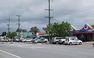
<span class="mw-page-title-main">Woodford, Queensland</span> Town in Queensland, Australia

Woodford is a rural town and locality in the Moreton Bay Region, Queensland, Australia. In the 2016 census, the locality of Woodford had a population of 3,458 people.
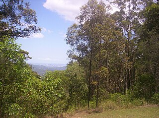
<span class="mw-page-title-main">Camp Mountain, Queensland</span> Suburb of Moreton Bay Region, Queensland, Australia

Camp Mountain is a rural locality in the Moreton Bay Region, Queensland, Australia. In the 2016 census, Camp Mountain had a population of 1,416 people.

<span class="mw-page-title-main">Moreton Bay Region</span> Local government area in Queensland, Australia

The Moreton Bay Region is a local government area in the north of the Brisbane metropolitan city in South East Queensland, Australia. Established in 2008, it replaced three established local government areas, the City of Redcliffe and the Shires of Pine Rivers and Caboolture.

<span class="mw-page-title-main">Mount Samson, Queensland</span> Suburb of Moreton Bay Region, Queensland, Australia

Mount Samson is a rural locality in the Moreton Bay Region, Queensland, Australia. In the 2016 census, Mount Samson had a population of 594 people.

Ocean View is a rural locality in the Moreton Bay Region, Queensland, Australia. In the 2016 census, Ocean View had a population of 936 people.

<span class="mw-page-title-main">D'Aguilar, Queensland</span> Suburb of Moreton Bay Region, Queensland, Australia

D'Aguilar is a rural town and locality in the Moreton Bay Region, Queensland, Australia. In the 2016 census, the locality of D'Aguilar had a population of 1,207 people.

<span class="mw-page-title-main">Delaneys Creek, Queensland</span> Suburb of Moreton Bay Region, Queensland, Australia

Delaneys Creek is a rural locality in the Moreton Bay Region, Queensland, Australia. In the 2016 census, Delaneys Creek had a population of 1,061 people.

King Scrub is a rural locality in the Moreton Bay Region, Queensland, Australia. In the 2016 census, King Scrub had a population of 348 people. It is located on the northern outskirts of Dayboro.

<span class="mw-page-title-main">Wamuran, Queensland</span> Town in Queensland, Australia

Wamuran is a rural town and locality in the Moreton Bay Region, Queensland, Australia. In the 2016 census, the locality of Wamuran had a population of 3,196 people.

<span class="mw-page-title-main">Rocksberg</span> Suburb of Moreton Bay Region, Queensland, Australia

Rocksberg is a rural locality in the Moreton Bay Region, Queensland, Australia. In the 2016 census, Rocksberg had a population of 300 people.

Dundas is a rural locality in the Somerset Region, Queensland, Australia. In the 2016 census Dundas had a population of 77 people.

<span class="mw-page-title-main">Mount Delaney</span> Suburb of Moreton Bay Region, Queensland, Australia

Mount Delaney is a rural locality in the Moreton Bay Region, Queensland, Australia. In the 2016 census Mount Delaney had a population of 85 people.

Brisbane–Woodford Road is the official name for a continuous 60.5-kilometre (37.6 mi) road route in the Moreton Bay local government area of Queensland, Australia. It is designated as part of State Route 58. It is a state-controlled road part regional and part district, rated as a local road of regional significance (LRRS).

References

  1. 1 2 3 Australian Bureau of Statistics (28 June 2022). "Mount Mee (SSC)". 2021 Census QuickStats. Retrieved 19 July 2023. OOjs UI icon edit-ltr-progressive.svg
  2. 1 2 "Mount Mee – town in Moreton Bay Region (entry 23091)". Queensland Place Names. Queensland Government . Retrieved 16 November 2019.
  3. "Mount Mee – locality in Moreton Bay Region (entry 45489)". Queensland Place Names. Queensland Government . Retrieved 16 November 2019.
  4. "Mountain peaks and capes - Queensland". Queensland Open Data. Queensland Government. 12 November 2020. Archived from the original on 25 November 2020. Retrieved 25 November 2020.
  5. "Mount Mee – mountain in Moreton Bay Region (entry 21501)". Queensland Place Names. Queensland Government . Retrieved 25 November 2020.
  6. "Mountain ranges beaches and sea passages - Queensland". Queensland Open Data. Queensland Government. 12 November 2020. Archived from the original on 25 November 2020. Retrieved 25 November 2020.
  7. Google (17 January 2023). "Mount Mee" (Map). Google Maps . Google. Retrieved 17 January 2023.
  8. 1 2 3 4 5 Horton, Helen (1988). Brisbane's Back Door: The story of the D'Aguilar Range. Bowen Hills, Queensland: Boolarong Publications. pp. 64–71. ISBN   0-86439-036-X.
  9. 1 2 "Caboolture Town History". Archived from the original on 28 May 2008. Retrieved 6 May 2008.
  10. 1 2 Queensland Family History Society (2010), Queensland schools past and present (Version 1.01 ed.), Queensland Family History Society, ISBN   978-1-921171-26-0
  11. "NEWS FROM THE COUNTRY". The Daily Mail . Queensland, Australia. 23 December 1922. p. 13. Archived from the original on 22 May 2022. Retrieved 6 June 2020 via Trove.
  12. "Mt. Mee Methodist Church". The Brisbane Courier . Queensland, Australia. 11 January 1923. p. 15. Archived from the original on 22 May 2022. Retrieved 6 June 2020 via Trove.
  13. 1 2 "Mount Mee Church". Mount Mee. Archived from the original on 6 June 2020. Retrieved 6 June 2020.
  14. 1 2 "1345 Mount Mee Road, Mount Mee, Qld 4521" . Retrieved 19 July 2023.
  15. 1 2 "Mount Mee Public Hall". Mount Mee. Archived from the original on 6 June 2020. Retrieved 6 June 2020.
  16. "Amalgamations to cut half Qld's local councils". ABC News. 27 July 2007. Archived from the original on 12 June 2008. Retrieved 6 May 2008.
  17. "Mount Mee State Forest and Forest Reserve". Archived from the original on 29 February 2008. Retrieved 6 May 2008.
  18. "Mount Mee State Forest and Forest Reserve". Archived from the original on 11 April 2008. Retrieved 6 May 2008.
  19. "State and non-state school details". Queensland Government. 9 July 2018. Archived from the original on 21 November 2018. Retrieved 21 November 2018.
  20. "Mount Mee State School" . Retrieved 21 November 2018.
  21. "ACARA School Profile 2017". Archived from the original on 22 November 2018. Retrieved 22 November 2018.
  22. "ACARA School Profile 2018". Australian Curriculum, Assessment and Reporting Authority . Retrieved 28 January 2020.
  23. "Mount Mee State School, Mount Mee, QLD". ACARA School Profile 2021. My School, ACARA. 2021. Retrieved 20 October 2022.
  24. "Queensland Globe". State of Queensland . Retrieved 3 November 2022.
  25. "Mobile Library". Moreton Bay Regional Council . Archived from the original on 30 January 2018. Retrieved 30 January 2018.
  26. "Mt Mee - Dayboro". Ecumenical Relationships Committee, Mt Mee – Dayboro. Archived from the original on 6 June 2020. Retrieved 6 June 2020.
  27. "Cemetery Areas - Queensland". Queensland Open Data. Queensland Government. 12 November 2020. Archived from the original on 15 November 2020. Retrieved 12 November 2020.
  28. "The Pitstop Cafe, Mount Mee". MustDoBrisbane. Archived from the original on 28 March 2017. Retrieved 28 March 2017.
  29. 1 2 "Tourist points - Queensland". Queensland Open Data. Queensland Government. 18 November 2020. Archived from the original on 24 November 2020. Retrieved 24 November 2020.
  30. "Falls lookout track | D'Aguilar National Park". Parks and forests. Queensland Government. 21 April 2017. Retrieved 3 November 2022.