Mount Samson, Queensland

Last updated

Mount Samson
Queensland
Mt.Samson at sunrise.jpg
Australia Queensland location map.svg
Red pog.svg
Mount Samson
Mount Samson, Queensland
Coordinates 27°18′02″S152°50′26″E / 27.3005°S 152.8405°E / -27.3005; 152.8405 (Mount Samson (centre of locality))
Population594 (2016 census) [1]
 • Density32.28/km2 (83.61/sq mi)
Postcode(s) 4520
Area18.4 km2 (7.1 sq mi)
Time zone AEST (UTC+10:00)
Location
LGA(s) City of Moreton Bay
State electorate(s) Pine Rivers
Federal division(s) Dickson
Suburbs around Mount Samson:
Samsonvale Samsonvale Cashmere
Mount Glorious Mount Samson Clear Mountain
Cedar Creek Cedar Creek Closeburn

Mount Samson is a rural locality in the City of Moreton Bay, Queensland, Australia. [2] In the 2016 census, Mount Samson had a population of 594 people. [1]

Contents

Geography

Mount Samson is about halfway between Samford and Dayboro located in South East Queensland. It is roughly 34 kilometres (21 mi) north west of Brisbane.[ citation needed ]

Mount Samson is a mix of acreage properties and small farms. The area was most recently dominated by agriculture such as dairy farming. Access to Mount Samson from Brisbane is along Samford Road and Mount Samson Road.[ citation needed ]

History

Mt Samson was occupied by the indigenous people who named it Buran (Boorun), which means wind. [3]

The suburb takes its name from the reasonably dominant Mount Samson which is part of the D'Aguilar Range.[ citation needed ]

Samson Creek Provisional School opened on 9 August 1880. On 1 October 1909, it became Samson Creek State School. In 1925, the school was moved and renamed Mount Samson State School. [4]

Mount Samson was connected to Brisbane by a train service from 1919 to 1955. The station was sited on land adjoining the current location of Samsonvale Hall.[ citation needed ]

An annual music festival, Red Deer Festival, was held in Mount Samson from 2009 to 2017. [5] [6]

In the 2011 census, Mount Samson recorded a population of 566 people, 49.8% female and 50.2% male. [7] The median age of the Mount Samson population was 38 years, 1 year above the national median of 37. 77.5% of people living in Mount Samson were born in Australia. The other top responses for country of birth were England 9.8%, New Zealand 3%, Germany 0.5%, Canada 0.5%, Ireland 0.5%. 95.8% of people spoke only English at home; the next most common languages were 0.9% Greek, 0.7% Mandarin, 0% Welsh, 0% Irish, 0% Gaelic (Scotland). [7]

In the 2016 census, Mount Samson had a population of 594 people. [1]

Climate

Mount Samson has a sub-tropical climate with very hot humid summers and mild, dry, sunny winters. Most rain falls during the height of summer, between November and February. Whilst summer maximum average temperatures generally linger around 30C, the summer months, like most of South East Queensland have some extremely hot days, sometimes as high as 40C.[ citation needed ]

Facilities

Samsonvale Hall is located on Winn Road on the opposite side from the primary school.[ citation needed ]

The Moreton Bay City Council operates a mobile library service which visits the Mount Samson State School on Winn Road. [8]

Education

Mount Samson State School is a government primary (Prep-6) school for boys and girls at 1060 Winn Road ( 27°17′39″S152°51′04″E / 27.2943°S 152.8512°E / -27.2943; 152.8512 (Mount Samson State School) ). [9] [10] In 2017, the school had an enrolment of 313 students with 26 teachers (20 full-time equivalent) and 16 non-teaching staff (9 full-time equivalent). [11] It includes a special education program. [9]

The school has been described as a 'school without a town' due to the fact that it serves residents of nearby areas but indeed has no township. Despite this - or perhaps because of it - the school community is very close knit and supportive.[ citation needed ]

Directly in front of Mount Samson State School sits Sparrow Early Learning, a long day care centre catering for children birth to school age, and Songbirds, a small music learning centre.[ citation needed ]

Related Research Articles

<span class="mw-page-title-main">Petrie, Queensland</span> Suburb of Moreton Bay, Queensland, Australia

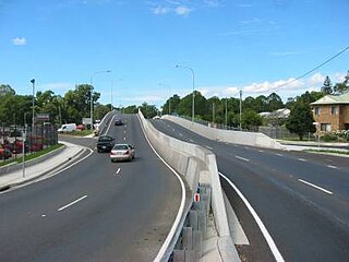
Petrie is a suburb in the City of Moreton Bay, Queensland, Australia. In the 2016 census, Petrie had a population of 8,674 people.

<span class="mw-page-title-main">Mount Nebo (Queensland)</span> Suburb of City of Moreton Bay, Queensland, Australia

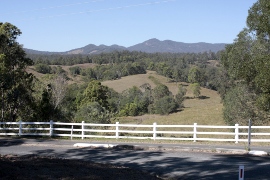
Mount Nebo is a rural locality in the City of Moreton Bay, Queensland, Australia. In the 2016 census, Mount Nebo had a population of 424 people.

<span class="mw-page-title-main">Mount Pleasant, Queensland (Moreton Bay)</span> Suburb of City of Moreton Bay, Queensland, Australia

Mount Pleasant is a rural locality in the City of Moreton Bay, Queensland, Australia. In the 2016 census, Mount Pleasant had a population of 332 people.

<span class="mw-page-title-main">Mount Glorious</span> Suburb of City of Moreton Bay, Queensland, Australia

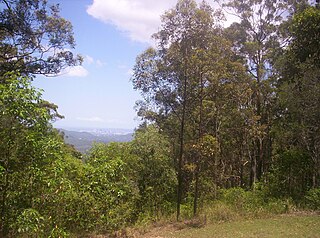
Mount Glorious is a rural locality in the City of Moreton Bay, Queensland, Australia. In the 2016 census, Mount Glorious had a population of 296 people.

<span class="mw-page-title-main">Warner, Queensland</span> Suburb of City of Moreton Bay, Queensland, Australia

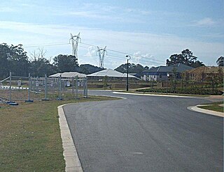
Warner is a suburb in the City of Moreton Bay, Queensland, Australia. In the 2016 census, Warner had a population of 11,411 people.

<span class="mw-page-title-main">Dayboro, Queensland</span> Town in Queensland, Australia

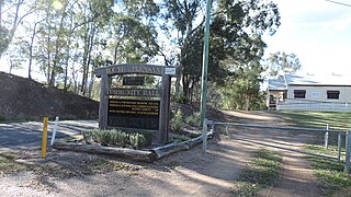
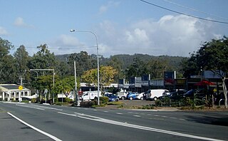
Dayboro is a rural town and locality in the City of Moreton Bay, Queensland, Australia. In the 2016 census, the locality of Dayboro had a population of 2,119 people.

<span class="mw-page-title-main">Samford, Queensland</span> Town in Queensland, Australia

Samford is a town in the City of Moreton Bay, South East Queensland, Australia. It consists of two localities, Samford Village and Samford Valley.

Bunya is a suburb in the City of Moreton Bay, Queensland, Australia. In the 2016 census, Bunya had a population of 1,916 people.

<span class="mw-page-title-main">Ferny Hills, Queensland</span> Suburb of Moreton Bay, Queensland, Australia

Ferny Hills is a suburb in the City of Moreton Bay, Queensland, Australia. In the 2016 census, Ferny Hills had a population of 8,739 people.

<span class="mw-page-title-main">Camp Mountain, Queensland</span> Suburb of City of Moreton Bay, Queensland, Australia

Camp Mountain is a rural locality in the City of Moreton Bay, Queensland, Australia. In the 2016 census, Camp Mountain had a population of 1,416 people.

<span class="mw-page-title-main">Lawnton, Queensland</span> Suburb of Moreton Bay, Queensland, Australia

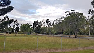
Lawnton is a suburb in the City of Moreton Bay, Queensland, Australia. In the 2016 census, Lawnton had a population of 5,658 people.

<span class="mw-page-title-main">Closeburn, Queensland</span> Suburb of City of Moreton Bay, Queensland, Australia

Closeburn is a rural locality in the City of Moreton Bay, Queensland, Australia. In the 2016 census, Closeburn had a population of 594 people.

King Scrub is a rural locality in the City of Moreton Bay, Queensland, Australia. In the 2016 census, King Scrub had a population of 348 people. It is located on the northern outskirts of Dayboro.

<span class="mw-page-title-main">Kobble Creek</span> Suburb of City of Moreton Bay, Queensland, Australia

Kobble Creek is a rural locality in the City of Moreton Bay, Queensland, Australia. In the 2016 census, Kobble Creek had a population of 632 people.

<span class="mw-page-title-main">Samsonvale, Queensland</span> Suburb of City of Moreton Bay, Queensland, Australia

Samsonvale is a rural locality in the City of Moreton Bay, Queensland, Australia. In the 2016 census, Samsonvale had a population of 590 people.

<span class="mw-page-title-main">Clear Mountain, Queensland</span> Suburb of Moreton Bay, Queensland, Australia

Clear Mountain is a rural locality in the City of Moreton Bay, Queensland, Australia. In the 2016 census, Clear Mountain had a population of 730 people.

<span class="mw-page-title-main">Highvale, Queensland</span> Suburb of Moreton Bay City, Queensland, Australia

Highvale is a rural residential locality in the City of Moreton Bay, Queensland, Australia. In the 2016 census, Highvale had a population of 1,766 people.

<span class="mw-page-title-main">Wights Mountain, Queensland</span> Suburb of City of Moreton Bay, Queensland, Australia

Wights Mountain is a rural locality in the City of Moreton Bay, Queensland, Australia. In the 2016 census, Wights Mountain had a population of 793 people.

<span class="mw-page-title-main">Yugar, Queensland</span> Suburb of City of Moreton Bay, Queensland, Australia

Yugar is a rural locality in the City of Moreton Bay, Queensland, Australia. In the 2021 census, Yugar had a population of 406 people.

<span class="mw-page-title-main">Rush Creek, Queensland</span> Suburb of City of Moreton Bay, Queensland, Australia

Rush Creek is a rural locality in the City of Moreton Bay, Queensland, Australia. In the 2016 census, Rush Creek had a population of 157 people.

References

  1. 1 2 3 Australian Bureau of Statistics (27 June 2017). "Mount Samson (SSC)". 2016 Census QuickStats. Retrieved 20 October 2018. OOjs UI icon edit-ltr-progressive.svg
  2. "Mount Samson – locality in Moreton Bay Region (entry 45456)". Queensland Place Names. Queensland Government . Retrieved 7 March 2022.
  3. Petrie, Constance Campbell; Petrie, Tom, 1831–1910 (1992), Tom Petrie's reminiscences of early Queensland (4th ed.), University of Queensland Press, p. 317, ISBN   978-0-7022-2383-9 {{citation}}: CS1 maint: multiple names: authors list (link) CS1 maint: numeric names: authors list (link)
  4. Queensland Family History Society (2010), Queensland schools past and present (Version 1.01 ed.), Queensland Family History Society, ISBN   978-1-921171-26-0
  5. "StackPath". amnplify.com.au. 4 October 2017. Archived from the original on 22 December 2020. Retrieved 22 December 2020.
  6. "Organisers of Red Deer Music and Arts Festival at Mt Samson have pulled plug on event". The Courier-Mail . 17 October 2017. Archived from the original on 19 April 2019. Retrieved 22 December 2020.
  7. 1 2 Australian Bureau of Statistics (31 October 2012). "Mount Samson (Pine Rivers Shire) (State Suburb)". 2011 Census QuickStats. Retrieved 24 February 2008. OOjs UI icon edit-ltr-progressive.svg
  8. "Mobile Library". Moreton Bay Regional Council . Archived from the original on 30 January 2018. Retrieved 30 January 2018.
  9. 1 2 "State and non-state school details". Queensland Government. 9 July 2018. Archived from the original on 21 November 2018. Retrieved 21 November 2018.
  10. "Mount Samson State School". Archived from the original on 27 February 2014. Retrieved 21 November 2018.
  11. "ACARA School Profile 2017". Archived from the original on 22 November 2018. Retrieved 22 November 2018.