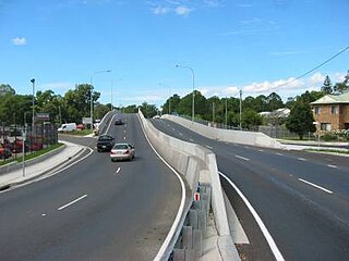
Petrie is a suburb in the City of Moreton Bay, Queensland, Australia. In the 2021 census, Petrie had a population of 8,722 people.
Ningi is a town and locality in the City of Moreton Bay, Queensland, Australia. In the 2016 census, the locality of Ningi had a population of 4,675 people. It is near Caboolture.
Warner is a suburb in the City of Moreton Bay, Queensland, Australia. In the 2016 census, Warner had a population of 11,411 people.

Kallangur is a suburb in the City of Moreton Bay, Queensland, Australia. In the 2016 census, Kallangur had a population of 20,405 people.
Rosemount is a rural locality in the Sunshine Coast Region, Queensland, Australia. In the 2021 census, Rosemount had a population of 1,851 people.
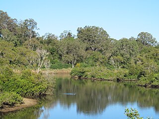
The North Pine River is a river in South East Queensland, Australia.
Dakabin is a locality in the City of Moreton Bay, Queensland, Australia. In the 2021 census, Dakabin had a population of 5,275 people.

Narangba is a town and suburb of the City of Moreton Bay, Queensland, Australia. It is located 34 kilometres (21 mi) north of Brisbane CBD. This suburb has rural origins, but is being redeveloped as a residential suburb on the outskirts of the greater Brisbane metropolitan area. In the 2021 census, Narangba had a population of 20,910 people.
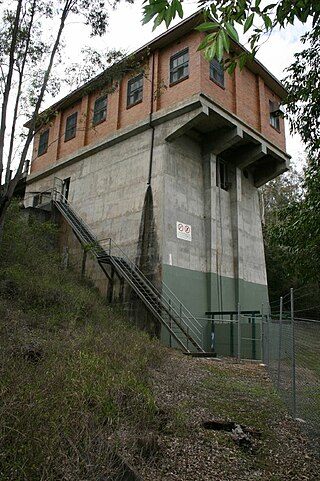
The Sideling Creek Dam is an earth-fill embankment dam with an un-gated spillway across the Sideling Creek in Kurwongbah, City of Moreton Bay, Queensland, Australia. The main purposes of the dam are for potable water supply of the City of Moreton Bay and for recreation. The impounded reservoir is called Lake Kurwongbah.

Delaneys Creek is a rural locality in the City of Moreton Bay, Queensland, Australia. In the 2021 census, Delaneys Creek had a population of 1,366 people.
Kobble Creek is a rural locality in the City of Moreton Bay, Queensland, Australia. In the 2021 census, Kobble Creek had a population of 654 people.

Clear Mountain is a rural locality in the City of Moreton Bay, Queensland, Australia. In the 2021 census, Clear Mountain had a population of 807 people.

Draper is a rural residential locality in the City of Moreton Bay, Queensland, Australia. In the 2021 census, Draper had a population of 695 people.
Laceys Creek is a rural locality in the City of Moreton Bay, Queensland, Australia. In the 2021 census, Laceys Creek had a population of 280 people.
Stony Creek is a rural locality in the City of Moreton Bay in Queensland, Australia. In the 2016 census Stony Creek had a population of 262 people.
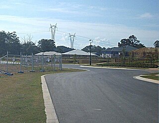
Whiteside is a suburb in the City of Moreton Bay, Queensland, Australia. In the 2016 census, Whiteside had a population of 753 people.

Cedar Creek is a rural locality in the City of Moreton Bay, Queensland, Australia. In the 2021 census, Cedar Creek had a population of 831 people.

Mount Delaney is a rural locality in the City of Moreton Bay, Queensland, Australia. In the 2016 census Mount Delaney had a population of 85 people.

Rush Creek is a rural locality in the City of Moreton Bay, Queensland, Australia. In the 2016 census, Rush Creek had a population of 157 people.
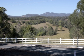
Gregors Creek is a rural locality in the Somerset Region, Queensland, Australia. In the 2021 census, Gregors Creek had a population of 87 people.

