Camp Mountain, Queensland

Last updated

Camp Mountain
Queensland
View-of-Brisbane-city-from-Camp-Mountain.jpg
View of Brisbane city from Camp Mountain
Australia Queensland location map.svg
Red pog.svg
Camp Mountain
Camp Mountain, Queensland
Coordinates 27°23′52″S152°52′32″E / 27.3977°S 152.8755°E / -27.3977; 152.8755 (Camp Mountain (centre of locality))
Population1,416 (2016 census) [1]
 • Density87.41/km2 (226.4/sq mi)
Postcode(s) 4520
Area16.2 km2 (6.3 sq mi)
Time zone AEST (UTC+10:00)
Location
LGA(s) City of Moreton Bay
State electorate(s) Pine Rivers
Federal division(s) Dickson
Suburbs around Camp Mountain:
Samford Valley Samford Village Samford Valley
Wights Mountain Camp Mountain Ferny Hills
Jollys Lookout Enoggera Reservoir Upper Kedron

Camp Mountain is a rural locality in the City of Moreton Bay, Queensland, Australia. [2] In the 2016 census, Camp Mountain had a population of 1,416 people. [1]

Contents

Geography

Camp Mountain is near Samford, 20 kilometres (12 mi) north-west of the Brisbane central business district.[ citation needed ]

The south-east of the locality is within D'Aguilar National Park and a lookout and recreation area are accessible off Mount Nebo Road. [3] [4]

The locality takes its name from the mountain Camp Mountain ( 27°24′42″S152°52′38″E / 27.4118°S 152.8772°E / -27.4118; 152.8772 (Camp Mountain (mountain)) ) which rises 414 metres (1,358 ft) above sea level. [5] [6]

History

There was gold mining in the area in the 1860s. The miners referred to the area as their "mountain camp" and that is the origin of the name of the mountain and the locality. [2] In the late 1800s the mountain was known as Mount Daniel. [6]

By 1908, banana growing in the Samford district had become one of the area's most important industries, and in 1926 and 1927, more bananas were sent from Samford railway station, just down from Camp Mountain, to Sydney and Melbourne than any other station in Queensland. [7] This successful industry existed until the banana bunchy top virus wiped out the crops [8] in the early 1930s. [9] Dairy farming and timber were other industries in the district and out to the end of the line at Dayboro, as well as the quarrying of granite at Camp Mountain, used in the foundations of Brisbane City Hall. [8]

Rescuers inspect the wreckage of the Camp Mountain train disaster. StateLibQld 2 102560 Rescuers inspect the wreckage of the Camp Mountain train disaster, 1947.jpg
Rescuers inspect the wreckage of the Camp Mountain train disaster.

Camp Mountain railway station ( 27°23′41″S152°53′31″E / 27.3947°S 152.8919°E / -27.3947; 152.8919 (Camp Mountain railway station (former)) ) opened in 1918, [10] and until 1955 the train line to Dayboro traversed the area.[ citation needed ]

Camp Mountain State School opened on circa 1929 and closed circa 1955. [11] It was on Upper Camp Mountain Road (approx 27°24′05″S152°51′51″E / 27.4014°S 152.8643°E / -27.4014; 152.8643 (Camp Mountain State School (approx)) ). [12]

On 5 May 1947, the Camp Mountain rail accident occurred at approximately 9:48 am when a crowded picnic train derailed on a sharp left-hand curve between Ferny Grove and Camp Mountain stations ( 27°23′50″S152°53′45″E / 27.39713°S 152.89577°E / -27.39713; 152.89577 (Camp Mountain rail accident) ). With 16 fatalities and 38 injured, the accident was (and remains) the largest loss of life in a rail accident on the Queensland railway network. [13] [14]

In the 2011 census, Camp Mountain recorded a population of 1,258 people, 51% female and 49% male. [15] The median age of the Camp Mountain population was 41 years, 4 years above the national median of 37. 81.7% of people living in Camp Mountain were born in Australia. The other top responses for country of birth were England 6.4%, New Zealand 1.8%, Netherlands 1%, Italy 0.9%, South Africa 0.6%. 92.1% of people spoke only English at home; the next most common languages were 1% German, 0.6% Dutch, 0.6% Cantonese, 0.6% Italian, 0.3% Hungarian. [15]

In the 2016 census Camp Mountain had a population of 1,416 people. [1]

Heritage listings

Selector's Hut, 2007 Selector's Hut (former) (2007).jpg
Selector's Hut, 2007

Camp Mountain has a number of heritage-listed sites, including:

Education

There are no schools is Camp Mountain. The nearest government primary schools are Samford State School in neighbouring Samford Village to the north, Patrick Road State School in neighbouring Ferny Hills to the east, and Ferny Grove State School in Ferny Grove to the east. The nearest government secondary school is Ferny Grove State High School in Ferny Grove to the east. [4]

The Samford Ecological Research Facility is a 51-hectare (130-acre) parcel of land bequeathed by Elizabeth Nesta Marks to the Queensland University of Technology as a teaching and research facility for biodiversity and conservation, urban development, and agriculture. [17] It is at 148 Camp Mountain Road ( 27°23′17″S152°52′42″E / 27.3880°S 152.8784°E / -27.3880; 152.8784 (Samford Ecological Research Facility) ). [17]

Amenities

There are a number of parks in the locality, including:

Attractions

Camp Mountain -- looking towards the Glass House Mountains Looking-towards-Glass-House-Mountains-from-Camp-Mountain.jpg
Camp Mountain looking towards the Glass House Mountains

Camp Mountain Lookout is at the end of Camp Mountain Road within the D'Aguilar National Park ( 27°24′37″S152°52′44″E / 27.4102°S 152.8790°E / -27.4102; 152.8790 (Camp Mountain Lookout) ). [19] Part of the historic Enoggera goldfields, the lookout provides views of Moreton Bay, the Brisbane skyline and the Glass House Mountains. [20]

Related Research Articles

<span class="mw-page-title-main">Mount Pleasant, Queensland (Moreton Bay)</span> Suburb of City of Moreton Bay, Queensland, Australia

Mount Pleasant is a rural locality in the City of Moreton Bay, Queensland, Australia. In the 2016 census, Mount Pleasant had a population of 332 people.

<span class="mw-page-title-main">D'Aguilar Range</span> Mountain range in Australia

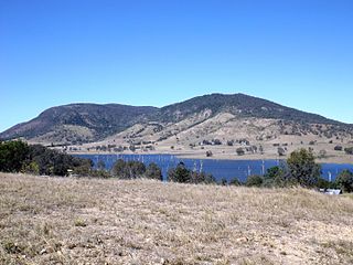
The D'Aguilar Range is a mountain range near Brisbane, Queensland, Australia. The town of Dayboro is situated on the lower foothills midway along the range and the Sunshine Coast Hinterland town of Mooloolah lies at the northernmost point of the range. Many residential areas line its eastern slopes including the town of Samford and the suburb of Ferny Hills. In the west, numerous ridges and gullies are heavily forested and designated as state forest or national park.

<span class="mw-page-title-main">Mount Glorious</span> Suburb of City of Moreton Bay, Queensland, Australia

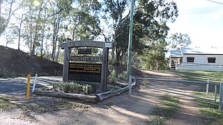
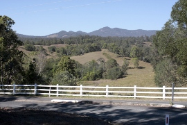
Mount Glorious is a rural locality in the City of Moreton Bay, Queensland, Australia. In the 2016 census, Mount Glorious had a population of 296 people.

<span class="mw-page-title-main">Dayboro, Queensland</span> Town in Queensland, Australia

Dayboro is a rural town and locality in the City of Moreton Bay, Queensland, Australia. In the 2016 census, the locality of Dayboro had a population of 2,119 people.

<span class="mw-page-title-main">Samford, Queensland</span> Town in Queensland, Australia

Samford is a town in the City of Moreton Bay, South East Queensland, Australia. It consists of two localities, Samford Village and Samford Valley.

<span class="mw-page-title-main">Arana Hills, Queensland</span> Suburb of Moreton Bay, Queensland, Australia

Arana Hills is a suburb in Division 10 of the City of Moreton Bay, Queensland, Australia. In the 2016 census, Arana Hills had a population of 6,810 people.

Bunya is a suburb in the City of Moreton Bay, Queensland, Australia. In the 2016 census, Bunya had a population of 1,916 people.

<span class="mw-page-title-main">Ferny Hills, Queensland</span> Suburb of Moreton Bay, Queensland, Australia

Ferny Hills is a suburb in the City of Moreton Bay, Queensland, Australia. In the 2016 census, Ferny Hills had a population of 8,739 people.

<span class="mw-page-title-main">Samford Valley, Queensland</span> Suburb of City of Moreton Bay, Queensland, Australia

Samford Valley is a rural locality in the City of Moreton Bay, Queensland, Australia. It is one of two localities in the town of Samford, the other being Samford Village. In the 2016 census, Samford Valley had a population of 3,068 people.

<span class="mw-page-title-main">Samford Village, Queensland</span> Suburb of City of Moreton Bay, Queensland, Australia

Samford Village is a rural locality in the City of Moreton Bay, Queensland, Australia. It is one of two localities in the town of Samford, the other being Samford Valley. The town's urban area occupies much of the land of the locality. In the 2016 census, Samford Village had a population of 796 people.

<span class="mw-page-title-main">Closeburn, Queensland</span> Suburb of City of Moreton Bay, Queensland, Australia

Closeburn is a rural locality in the City of Moreton Bay, Queensland, Australia. In the 2016 census, Closeburn had a population of 594 people.

<span class="mw-page-title-main">Mount Mee, Queensland</span> Town in Queensland, Australia

Mount Mee is a rural town and locality in the City of Moreton Bay, Queensland, Australia. In the 2021 census, Mount Mee had a population of 519 people.

<span class="mw-page-title-main">Kobble Creek</span> Suburb of City of Moreton Bay, Queensland, Australia

Kobble Creek is a rural locality in the City of Moreton Bay, Queensland, Australia. In the 2016 census, Kobble Creek had a population of 632 people.

<span class="mw-page-title-main">Draper, Queensland</span> Suburb of City of Moreton Bay, Queensland, Australia

Draper is a rural residential locality in the City of Moreton Bay, Queensland, Australia. In the 2016 census, Draper had a population of 676 people.

<span class="mw-page-title-main">Highvale, Queensland</span> Suburb of Moreton Bay City, Queensland, Australia

Highvale is a rural residential locality in the City of Moreton Bay, Queensland, Australia. In the 2016 census, Highvale had a population of 1,766 people.

<span class="mw-page-title-main">Rocksberg</span> Suburb of City of Moreton Bay, Queensland, Australia

Rocksberg is a rural locality in the City of Moreton Bay, Queensland, Australia. In the 2016 census, Rocksberg had a population of 300 people.

<span class="mw-page-title-main">Wights Mountain, Queensland</span> Suburb of City of Moreton Bay, Queensland, Australia

Wights Mountain is a rural locality in the City of Moreton Bay, Queensland, Australia. In the 2016 census, Wights Mountain had a population of 793 people.

<span class="mw-page-title-main">Yugar, Queensland</span> Suburb of City of Moreton Bay, Queensland, Australia

Yugar is a rural locality in the City of Moreton Bay, Queensland, Australia. In the 2021 census, Yugar had a population of 406 people.

<span class="mw-page-title-main">Cedar Creek, Queensland (Moreton Bay)</span> Suburb of City of Moreton Bay, Queensland, Australia

Cedar Creek is a rural locality in the City of Moreton Bay, Queensland, Australia. In the 2016 census, Cedar Creek had a population of 745 people.

<span class="mw-page-title-main">Dundas, Queensland</span> Suburb of Somerset Region, Queensland, Australia

Dundas is a rural locality in the Somerset Region, Queensland, Australia. In the 2016 census Dundas had a population of 77 people.

References

  1. 1 2 3 Australian Bureau of Statistics (27 June 2017). "Camp Mountain (SSC)". 2016 Census QuickStats. Retrieved 20 October 2018. OOjs UI icon edit-ltr-progressive.svg
  2. 1 2 "Camp Mountain – locality in Moreton Bay Region (entry 50017)". Queensland Place Names. Queensland Government . Retrieved 28 December 2020.
  3. "D'Aguilar National Park". Parks and forests. Queensland Government. 20 October 2009. Archived from the original on 11 April 2021. Retrieved 23 April 2021.
  4. 1 2 "Queensland Globe". State of Queensland . Retrieved 23 April 2021.
  5. "Mountain peaks and capes - Queensland". Queensland Open Data. Queensland Government. 12 November 2020. Archived from the original on 25 November 2020. Retrieved 25 November 2020.
  6. 1 2 "Camp Mountain – mountain in Moreton Bay Region (entry 5947)". Queensland Place Names. Queensland Government . Retrieved 25 November 2020.
  7. "Samford". Moreton Bay Regional Council. Archived from the original on 2 October 2009.
  8. 1 2 "Harcourts Samford – About". Harcourts Group. Archived from the original on 19 July 2008. Retrieved 20 March 2008.
  9. "A brief history of the Samford Valley". Moreton Bay Regional Council. 22 March 2007. Archived from the original on 28 August 2008. Retrieved 22 March 2008.
  10. Australia. Army. Royal Australian Survey Corps; Australia. Royal Australian Air Force. Squadron, 87 (1958), Samford, Queensland (Second ed.), Royal Australian Survey Corps, archived from the original on 23 April 2021, retrieved 20 September 2020{{citation}}: CS1 maint: numeric names: authors list (link)
  11. Queensland Family History Society (2010), Queensland schools past and present (Version 1.01 ed.), Queensland Family History Society, ISBN   978-1-921171-26-0
  12. "Samford" (Map). Queensland Government. 1958. Archived from the original on 23 April 2021. Retrieved 23 April 2021.
  13. Purtell, Meg (26 December 2021). "Crash survivor remembers Queensland's worst rail disaster at Camp Mountain 75 years on". ABC News. Retrieved 25 March 2024.
  14. "Camp Mountain Train Crash". Monument Australia. Retrieved 25 March 2024.
  15. 1 2 Australian Bureau of Statistics (31 October 2012). "Camp Mountain (State Suburb)". 2011 Census QuickStats. Retrieved 16 February 2014. OOjs UI icon edit-ltr-progressive.svg
  16. "Selector's Hut (former) (entry 602654)". Queensland Heritage Register . Queensland Heritage Council. Retrieved 11 July 2013.
  17. 1 2 Technology (QUT), Queensland University of. "About SERF". QUT. Archived from the original on 17 January 2021. Retrieved 23 April 2021.
  18. 1 2 3 4 "Land for public recreation - Queensland". Queensland Open Data. Queensland Government. 20 November 2020. Archived from the original on 22 November 2020. Retrieved 22 November 2020.
  19. "Tourist points - Queensland". Queensland Open Data. Queensland Government. 18 November 2020. Archived from the original on 24 November 2020. Retrieved 24 November 2020.
  20. "Camp Mountain lookout | D'Aguilar National Park". Parks and forests. Queensland Government. 21 April 2017. Archived from the original on 8 March 2021. Retrieved 23 April 2021.

Further reading